


fratermus
-
Posts
1207 -
Joined
-
Last visited
Posts posted by fratermus
-
-
Just curious what the group thinks the best GPS is for caching? I have been before but with a friend. I am looking at buying my own GPS and need some help deciding. Thanks in advance!!
What, other than geocaching, do you intend to do with the GPS? How do you intend to use it for geocaching?
-
Well, you won't cry if you drop the eTrex in the mud.
-
Has anyone geocached with a Garmin Foretrex 101? If so, please tell me your opinion.
They work fine.
The 101/201 share the interface with the Geko line, which is to say they are very simple. Think of the ForeTrex like an original yellow eTrex in a tiny case, strapped to your arm. Like the eTrex they have a normal (not high-sensitivity) chipset and may lose signal under heavy cover or in urban canyons.
You can also get a handlebar mount from Garmin for <$20 and mount it on your bike. Coolio. I bet you could get a used 101 or 201 off eBay for $50 delivered if you are patient.
-
Set the GPS to prompt for navigation type each calculation.
Then do as WK says.
1. nav to the cache on-road (answer "on-road" when prompted)
2. when you get as far as you can on the road, recalc and answer "off-road"
Please to enjoy.
-
Thanks for the quick reply. I tried to save them as POI's and it worked, but is there any way to change them to geocaches or normal waypoints so I can view them in the geocaches folder?
Only waypoints with the specified geocache icon will show up in the GPS as caches, and POI != waypoints.
-
Is there a way to either turn off certain POI's or the ability to edit the mpa directly and remove all of them.
...
Any ideas?
I think the easiest workaround is to keep the caches in a seperat POI sourcefile so they show up as a category, then do your POI search by category. Won't help with the map but it will tell you the nearest cache without seeing the other POI. I suppose you could also set a proximity alarm on them, though I haven't done this.
-
I've been told at a sales counter that it is junk but it does have a great preloaded map package.
I wouldn't believe a word a salescritter uttered, ever, whether positive or negative.
-
Are you saying that all uploaded Geocache Waypoints should be loaded into the Geocache "folder" on my GPS????
I am saying this;
* The gps has a setting that says which icons are to be recognized as caches (by default, the treasure chest).
*The uploaded waypoints have an icon (by default, the treasure chest).
* When the two icon types match (the uploaded waypoint icon matches the gps cache icon setting, in this case both are treasure chest) then the waypoint appears as a geocache in the GPS.
Normally in a case like this the user has wandered into the GPS settings and changes the default geocache icon. Traditionally the thread ends with "I changed the geocache icon back to the treasure chest and it works again".
Should both Find and Found caches be listed under Geocache on my GPSr
It's the same issue from another perspective.
Normally the found (open treasure chest) and unfound cache icons (treasure chest) are intentionally different, and are changed by the GPSr when you mark it as found. Since the waypoint now has a Found Geocache icon it no longer matches the geocache icon and is no longer visible as a geocache to the gps. It is possible to set the found/unfound icons to be identical, but then you lose the biggest feature of the Geocaching mode, namely being able to find the nearest unfound cache.
-
A couple of clarifications:
* There are no folders in the GPSr itself in any normal sense. There are special views of things like waypoints, and geocaches
* all geocaches loaded into the GPSr are waypoints, but not all waypoints are caches.
* the GPSr knows what waypoints are geocaches because it matches the waypoint icon with the icon it associates with geocaches.
Almost always, the problem is that the new cacher has either changed the geocache icon in the GPSr or in the software they are using to transfer the waypoints to the GPSr.
-
The GPS pointed in the right direction, but when I got close to the target, the arrow started pointing the opposite direction and telling me I was 20 feet off.
GoTo is fine. When you get that close to the cache it is time to stop looking at the GPS and start looking for the likely hiding spots.
-
While Topo 2008 certainly will not route along roads, it should accurately show your position relative to a road. The poster said he was at a road junction. If so, the position marker and that junction should coincide on the map. If not, either the maps are wrong or the GPS is showing the wrong position, most likely the maps.
This is an incorrect assumption. Even road nav maps will not show you on the road in most cases unless the GPSr is set to "lock on road" (or does it automatically).
Look for the endless variety of threads entitled things like "why does [fill in the blank] show me driving BESIDE the road!?!?!?!?!?!".
-
I tried to use Topo 2008 in Hawaii,last fall for road navigation,forget it ! get to a road junction and it would show me way off in the boonies somewhere.
Topo 2008 is not intended for road navigation.
-
I love my ol' etrex but the paper thing has got to go. Is there a Garmin GPSr that costs less that $300 that will load cache mate or hold hints and cache names?
If hints and cache names are what you are looking for then any GPSr with a caching mode will do it, assuming that you send the hints to the GPSr in the comment field with EasyGPS, GSAK, or similar.
-
Hello,
I am ready to upgrade from my base map on my vista hcx. I mostly use my gps for hiking, mountain biking, and geocaching. I am just wondering if it would be worth my time and money to create custom maps or just dump the 80 bucks into garmin's topo map? I understand that the accuracy of garmin's topo isn't the best and you can't set it to stay on the road. Do those problems occur when you create your own maps using 3rd party software? Any input or suggestions would be greatly appreciated.
The topo series is not designed to be used as a road map (TOPO Canada notwithstanding), so I wouldn't worry about that bit. Doesn't fit into your hiking/biking/caching model anyhow.
If it were me I'd:
* get an older, Garmin TOPO off eBay now that the newer TOPO is released. They are not locked. If you are patient and pay attention you should be able to get it for about $40 shipped.
* augment with route/track/waypoint files created by gps users in your recreation area, and post new ones that you make.
Making maps is a non-trivial undertaking and would almost certainly take significantly more than $80 of your time to do. Unless it's fun for you, in which case "welcome to your new hobby". :-)
-
My question is this - I would like to add the city navigator map to my GPSr for the times we travel. Would it be best to invest in the micro SD card version or should I buy the DVD version? Can I copy the DVD version onto a purchased blank SDcard?
I have not followed the Mac threads, but maps on SD are generally a bad deal if you are able to load maps from DVD. With the preloaded map-on-card scenario you are limited to that card, no backups, no map maniupulation, etc.
When you upload a map onto an x-series Garmin handheld the map goes onto the blank sd card automagically; you could in theory have a bunch of them with different mapsets on them if you wanted.
-
Hi, I am finally going to start geocaching after years and years of talking about it. I am looking for a basic unit, no frills, that I can use internationally.
All GPS can be used anywhere (local laws notwithstanding).
I've been searching around Amazon and the Garmin site and getting topo maps outside of the U.S is a challenge when buying a basic unit, unless I am missing something.
Nitpick, hopefully helpful: the use of the terms "Mapping" and "basic unit" indicate that you are looking for more than a basic unit. At the least it should be capable of using maps. Many basic units do not use maps at all.
I am currently living in Germany, but at the end of the year I will be moving to the U.S or Australia. I really would like to buy a worldwide map or at least get a GPS with a european map included, and buy maps later.
Worldmaps are minimal, but detailed maps (or maps of any kind) are not required for geocaching. Maps are generally useful, autorouting maps are useful for driving places, and topo maps are useful for seeing how terrain is laid out. But none are necessary for caching.
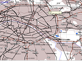
Consider this view of Paris in a worldmap:
As others have noted, there are many free mapsets out there. You will want to play with them to see what works for you. I do think that a 60cx or 60csx would be a rugged go-to mapping unit. There are people reporting getting the cx for <$170 off Amazon, which I think is a great price.
-
It is normal to have to hold it up to the window to get any kind of signal. Even then that's a tiny view of the sky.
-
Store them to the card as Custom POI.
-
IMO the easiest way to do this is with freeware EasyGPS.
Edit > Preferences > Geocaching > Comment > Geocaching Hint (Decrypted).
This will make the hint visible when you look at the geocache comment in the GPSr.
-
that show up in the ????-wpts file when I unzip the emailed results?
When I searched the forum I got results that indicated they are other waypoints related to the caches. And also one that suggested that file got emailed with this kind of language:
...-wpts.gpx: This additional GPX file contains supporting waypoints for your Pocket Query. -
When useing the map to guide you(it does the same thing on the compass too) when you zoom in there is a ring around the triangle(that you are).
It's probably the accuracy indicator. If so, it is not a forcefield keeping you away from the cache, and he is too close to the cache to be looking at the GPS.
-
What maps did you buy?
-
Both would likely do equally well in the challenging "urban canyon" NYC environment.
I am not familiar with the 40, but it appears it may come bundled with "Topo USA" that includes routable roads. If that's the case the 40 may be better out of the box. Having said that, I bought my 60cx refurb for a little over $200 and have loved it.
I would be surprised if you couldn't find ready-made waypoint/POI lists that you could alter for your wife's use.
-
The main problem is that car nav GPSr are $$$, delicate, and not waterproof. This is a bad combination stomping around in mud and briars.
I'd pick up a cheap used etrex (yellow, legend, whatever) with the cable so you can use that for bolting out of the car and snagging caches.


60Csx does not follow roads route from MapSource
in GPS technology and devices
Posted
This is correct, although I don't know whether the GPS is dropping the other waypoints when loading or if mapsource isn't sending them; I suspect the latter. Note that if you use metroguide to make the route all the points make it into the GPSr. I think mapsource believes that sense metroguide (normally) does not autoroute that it needs to send all the waypoints.