


Ladybug Kids
-
Posts
1481 -
Joined
-
Last visited
Posts posted by Ladybug Kids
-
-
I'm currently running a 9% DNF/Total Hunt ratio. Historically, it's run closer to 10%, but I've had a bit more luck lately. On average, more about half subsequently get replaced/disabled/archived and the other half I apparently just missed. In either case, my DNF log was a part of the cache's history.
-
Anyone.Out of curiosity, who do you think should be allowed to use the NM feature?
DNF: Looked for cache, did not find it.
NM: Found cache (or remains of cache) and cache owner attention is needed. If the log is signable or the cacher provides a replacement log, it's not uncommon for a cacher to log "found it" and NM, separately. One cannot determine if maintenance is needed if they didn't find the cache nor is NM a substitute for DNF.
NA: Issues requiring reviewer intervention such as caches on private property, railroad rights of way, land manager requests for removal, etc. This is the only log in this group that results in a local reviewer notification.
-
Not my caches personally, but I once found a cache that had been used as a latrine in Illinois and one of our local cachers had that happen to his as well.
-
GeocacheAlaska! events routinely feature a GPS "accuracy" contest. The game organizer averages coordinates for a spot for hours before the event and marks it in a way (sometimes using two ropes stretched from trees and then recoiled) that isn't identifiable to the game players. Players are each given a survey flag to initial and they place the flag where they think GZ is. It's interesting to see the spread of answers, though the same people usually finish with the top three to five placements regardless of the brand/model of GPS they are using. They are the cachers who know how to hold their GPS (vertical or horizonal), know how to let the GPS settle, and know how to be patient.an experiment where a lot of people place various brand consumer GPS units on a particular immovable spot and write down the coordinates, just to see how far off they are from each other. Come to think of it, I am going to a EVENT this evening. Maybe I will try to get some people to try it.
Another way to check one's GPS is to find a benchmark with adjusted coordinates.
The commercial grade equipment pictured can achieve accuracy to within a couple of centimeters under the right conditions, whereas our handhelds are having a good day with they get within a couple of meters.
-
This thread has additional information and links to bookmark lists on the GeocacheAlaska! website.
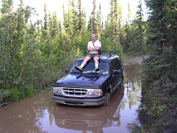
I highly recommend having topo maps on your GPS for Alaska because the terrain is so extreme in many areas that a cache only .25 mile away could also be 1000' feet above you. On the other hand, if you intend to stay in the cities and towns, a basic street map will do.
-
No good reason at all. A "Needs Maintenance" log is an innocuous way of telling a Cache Owner their cache has been found, but it has a problem. It sets the "Needs Maintenance" attributeThanks so much for the feedback. Would someone please explain why a CO might be upset by a NM? I'm not understanding that at all.
 on the cache page and on the larger cache lists one can view when searching for caches by location or when viewing a cacher's profile.
Now, what understandably could bother a cache owner is when someone inappropriately uses the "Needs Maintenance" log when a "Did Not Find" log would have been more appropriate. A cacher can't possibly know whether or not a cache needs maintenance if they haven't seen it and touched it.
Long strings of "Did Not Find" logs on a cache that used to be regularly found can be a sign to the cache owner and the local reviewer that something may have gone awary. That's why it's so important for cachers to document their "did not finds." I have posted over 420 "did not find" logs out there, and I'm proud of it. (Note: posting "did not find" logs is the source of much angst in other threads, so I won't go into more detail here.)
As the owner of more than 120 active caches, I appreciate having the ability to click through a half dozen pages and see at a glance which caches require a maintenance visit. When preparing to travel, I filter out caches with the "Needs Maintenance" attribute set (as well as those with recent multiple "Did Not Finds" so I don't spend my vacation time hunting for caches that have problems.
No worries there. The forums are supposed to be a friendly place where folks can get answers to their questions. The only bad question is the question that is not asked.(If this is all explained somewhere, I won't be offended if someone would share the link. I have literally spent hours reading through the FAQ's and the forums and am frustrated that I can't find info on this stuff.) -
Ouch! Guaranteed, that cache owner would never see another log of any sort from me if s/he reacted that way to a politely worded, matter of fact, "Needs Maintenance" log. The examples given by Bamboozle are perfect situations for when the "Needs Maintenance" log should be applied.2. If you find it and the containers broken or log wet etc log a NM. ( we never do it for a wet log, we simply add a new one )
If you do that, you can expect to get flamed by the CO for not telling him privately.
-
Log your find.
Nowhere in the gecaching.com guidelines, the Knowledge Books, or the EarthCaching guidelines does it state that a cacher must wait for a confirmation from the Cache Owner before logging their find. An EarthCache finder should log their find, send their answer(s) to the Cache Owner, and move on. It's then up to the Cache Owner to contact the EarthCache finder if there is a problem.
-
Did you read GeoawareUSA4's post? Please tell us how not having land owner permission, not providing one's answers in a Reviewer Note, and not annotating one's sources of information on the cache page as clearly required in the guidelines is anyone but the cache developer's issue. The reviewer even provided tmitchh with the land manager's contact information to make obtaining permission as easy as possible.I have pulled my submission. No longer watching this topic either. Good luck to everyone.
Hey out there to any whom may care. Well, was it worth it to lose another earthcacher?


-
I don't think it's possible to develop objective criteria for what "makes" a logging task educational. There is certainly a subjective "feeling," though. Isn't there?
Borrowing from a recent favorite in these forums, Glacial Erratics:
1. Report the date carved in the side of the erratic.
2. Measure the height/width/depth of the erractic, calculate its volume, and then estimate its weight.
3. Study the surface of the erratic and report on whether it has striations (grooves). Are the striations the result of the erratic having been plucked from the bedrock by the glacier or was the erratic conveyed on the surface of the glacier.
4. Compare the appearance of the erratic with the appearance of the surrounding bedrock. What are the similarities and differences? What evidence is presented that the rock came from somewhere else?
5. Observe the bedrock (if exposed) for evidence of glacial action and determine the direction of glacial movement at this location.
6. Observe the plantlife in the immediate area. Assuming that species A of tree will begin growing about forty years after the glacier recedes (assuming proper soil conditions) and then adds 2 mm in trunk diameter per year, how many years ago was the glacier at this location?
Another topic, a Copper Mine:
1. What is the title on interpretive panel #5?
2. How many people lived in the nearby ghost town?
3. During which years did the mine operate?
4. Who discovered the ore deposit?
5. How many tonnes of copper was processed here?
6. Name the process used to extract the copper from the ore.
7. Observe the rocks in the area. What color are they and describe any crystals you might see. Using information found on the interpretive panels, what kind of ore is it and why is it blue (or green or black)?
Earthquake Fault:
1. What year did the last "big" earthquake occur here?
2. How far did the fault slip?
3. Describe the scarp (height, weathering, etc.) that you see here.
4. Assuming the fault slipped the same distance here as at a much wetter location 20km to the west, why can you see the scarp here, but not there?
5. Assuming that the the return interval of large earthquakes along this fault is 700 years (+/- 100 years) and that the fault has moved 50 meters since the last glacier retreat 14,000 years ago, what is the average movement of the fault per major event?
6. There is evidence that the last large earthquake on this fault was 650 years ago. Would you build a new home nearby? Why/why not?
A Ravine:
1. Who was the first person to successfully run a boat down the ravine and in what year?
2. What is the water flow rate through the ravine?
3. Determine the depth of the ravine using your GPS by walking along Trail X.
4. Observe the rock layers as you descend into the ravine. What is the thickness of each layer? (Assume the cache developer provided a description of the local geology on the cache page). Which layer is the oldest? Which is the youngest? How do you know?
5. Assuming the river began carving this ravine 7 million years ago, what is the average rate of erosion? Do you think erosion is still occuring? Why do you think so?
Which logging tasks in the above list are Earth Science/geological educational/unique logging tasks and what are not?
-
I don't think this list is being shortened at all. By encouraging cachers to focus on what is unique about the feature they are highlighting, the review team is helping the total EarthCache knowledge base to continues to grow rather than stagnating with cookie-cutter, "what type of waterfall is this, what is the flow rate of the spring, how many letters are on the sign" logging tasks.Those were the days before each and every Earthcache had to be a "unique feature" that provided an "exceptional" science lesson. They were also the days when we were branching out and widening our scope to find more things to write about. Today we're pulling back and shortening the list, rather than lengthening it.
It's the EarthCache developer who won't do location specific research to help the visitor learn about why a spring or a waterfall is the way it is at that location that is, in my opinion, limiting the learning opportunities.
-
What is the geocaching policy in Tongass National Forest? The GeocacheAlaska! website has information about caches in Chugach National Forest, but not Tongass National Forest.I have always found it ridiculous that an earthcache needs permission from the park service and POC information must be provided, but I can put a film canister at the same spot and have no issues.
It's my understanding that EarthCaches about erratics, waterfalls, watersheds, etc., will still be published if the cache owner ties the feature into the local geology and makes their cache page unique. I think the context of the moratorium pertains to cut and paste type cache pages that don't relate to the local geology/earth science.
For example, many grandfathered erratic EarthCaches ask the cacher to measure the rock and estimate its mass. However, the real lessons learned can be about from which direction the erratic came, whether the erratic was plucked from the ground by a glacier sliding over it or was conveyed from its origin on top of the glacier, comparing the erratic rock to rocks where it is resting, the grooves carved into the erratic, the "age" of the erratic, etc.
I believe a little extra effort by the EarthCache submitter can still result in an exceptional published EarthCache.
-
My bit of nuance to logging TBs while traveling or picking up bugs in highly traveled areas is:
1. If I pick up a traveller (TB, tag, geocoin, etc.), it goes into one bag for logging when I return home. That usually gives the person who dropped the traveller several days to do their drop. If the bug has not been dropped by then, it gets put on top of my printer to nag me for a few more days until a) the original dropper eventually drops the bug or b') I'm heading out on a caching trip that will afford the opportunity to drop the travellers I've accumulated and I need to get said traveller into my inventory.
2. When travelling, I oftentimes don't have time to log all my finds, but if I drop a traveller(s), I'll do the drop with a Note Log to keep the cache's inventory current. Later, I'll change the note to a "Found It" as I log my finds in order. Sometimes, the traveller(s) I drop are picked up and logged before I get to internet access and are whisked away. That's the way it goes, especially with the busier Hotels near major airports. Many times, the cache who beats me to logging will do a dip to keep the mileage current, but sometimes they don't. Either way, the TB is moving which is what I'm certain most TB owners would like to see.
I personally don't think Mike&Jess did anything "wrong." I'd much rather see one of my bugs logged and moved along rather than indefinitely hung up somewhere.
-
We do that, too.I respond to every email I get about the few EC I look after.....I think its good etiquette!
-
United States
Alaska
California
Kansas
Oklahoma
Texas
Florida
Maryland
Maine
Minnesota
Colorado
Washington
Missouri
New Jersey
Europe
Switzerland
Italy
France
Netherlands
Luxembourg
Portugal
United Kingdom
Canada
Alberta
Ontario
-
-
Gosh, Nick...so close, yet so far...too bad your schedule doesn't permit a hop up to Anchorage. We'd love to have you up here for the June 4 flash mob event so you could model (not flash
 ) your kaching kilt.
 -
Hello ScarletdragonflyAK:
Welcome to Alaska!
One great way to meet fellow Alaska cachers is through the statewide GeocacheAlaska! organization.
The website is located at http://www.geocachealaska.org.
Local forums are hosted at http://geocachealaska.proboards.com/
Upcoming local events include the WWFM 8 - Anchorage AK - Town Square Flash Mob 2 on June 4, and Euroschmaching: Twelve Countries in Twelve Days, on June 16.
Look forward to meeting you at one of the events or on the trails!
-
The special promotion is winding down...
2010 Bronze SOLD OUT!
2010 Silver 10
2010 Gold Relief 1
2010 Bronze Pin 81
2010 Silver Pin 74
2009 Bronze 28
-
-
Below are the remaining quantities of Alaska geobling. Orders are still being taken online with a special promotion here.
2010 Bronze SOLD OUT!
2010 Silver 20
2010 Gold Relief 3
2010 Bronze Pin 88
2010 Silver Pin 80
2009 Bronze 31
We're noodling on some unique 2011 ideas and will post them in a new thread as they come together.
-
A quick screening tool I use is GoogleEarth with the Geocaching Google Earth Viewer. It allows me to quickly pan an area, zooming in on caches/features of interest. I can click on the cache icon, get a high level summary of T/D, and then click the cache title to open the cache page in the GoogleEarth window. To make it easier to find the ECs in the sea of other caches, I turn off the other cache icons....I run a PQ for ECs in an area...the researching of the right place is a bit tedious.

-
-
Below are the remaining quantities of geobling. Orders are still being taken online here.
2010 Bronze 15
2010 Silver 22
2010 Gold Relief 8
2010 Bronze Pin 94
2010 Silver Pin 87
2009 Bronze 40

Legality or common sense?
in General geocaching topics
Posted