

PFF
-
Posts
1197 -
Joined
-
Last visited
Everything posted by PFF
-
Interesting question to ponder. As you mentioned, AF8050 is in North Carolina. It was set in 1983, and thus it appears in the geocaching.com data base. I have logged it. Our state also has the AH series, with AH5027 being monumented in 1985 and AH4744 in 1990. I've seen an AE series set in 1994, and AI (Alpha India) set in 1999. A lot of marks are added every year, and the newest series begins with the letter "D". A mark with DE was assigned a PID in the year 2000 or afterward and is not likely to be in our data base, but DD might be included. Of course, the PID reflects the year when the identification was assigned, and not the year monumented. Sometimes, there is a delay--such as the unusual case of DD0055, which was first described by NCGS in 1963. The Year Monumented is "Unknown", although there is evidence (such as references in the "Annual Report to the Superintendent") that it was monumented in 1898, and this date is inscribed on the stone. But I can see the point. The person writing the description wasn't THERE in person....so why stick your neck out? You know, if that one took 50 years to be uploaded, perhaps the current delay of two to four months isn't so bad! -Paul-
-
Even with that being the case, our group closed out 2010 just one report shy of 6,400 recoveries, and our total since starting the program is over 54,000. Congratulations to AZcachemeister, shorbird, and kayakbird for finishing the year in the top three slots. Benchmark Blasterz also had a great year, with 764 recovery reports. ALL reports are valuable. So, whether you're among the thirty folks who reported 40 or more, or if you did only a few, thanks for taking time to prepare and upload your reports. With the Power Squadron having moved onto other projects, GEOCAC is the largest (and possibly only) volunteer group actively reporting the condition of benchmarks and updating their descriptions. With the budget crunch at Federal and state levels, I'm confident that reports from government agencies are down--making our services even more valuable than in the past. Thanks to having another year of experience under our belts, plus valuable assistance from the professional surveyors and NGS personnel in the Forum, our reports continue to be high quality. Keep up the great work in 2011! -Paul-
-
Good point about the search, Mike. I always click "Include Destroyed Marks", and then I call each one up, individually. (Even though this is time-consuming, I sometimes hit Pay Dirt.) I appreciate the comments of everyone in this thread. My feeling remains that we should submit destruction reports with caution, and only when there is a clear benefit in doing so. To borrow a phrase from the Medical profession: "Do no harm."; and from the business world, "Never let the value of an action be exceeded by the cost of accomplishing it." Thanks to Tosborn and Rotareng for the reminder that Deb does not want reports of any kind for aerial intersection stations--whether recoveries, or destruction notices. -Paul-
-
I agree about being able to get the destroyed mark's datasheet--IF you know to look for it. But I'm curious to find out if some of you have a resource I have not discovered. Specifically, my problem is that I don't understand how I could know that a DESTROYED mark's datasheet referenced the target object. What is the secret to knowing that there is a potentially useful datasheet buried in the archive, and how would I know the PID? The references to old monuments often are slipped into the descriptive text of stations, with no other indication being present. See DG7593 (in the NGS database) as an example. If that datasheet were to be marked DESTROYED, how would anyone in the future know that NC-VA Marker Number 28.5 ever existed? -Paul-
-
Actually, if you use a metal detector, it is not so rare to find a displaced disk--if you are alert to the possibility that it still is in the vicinity. Mowing equipment can throw a chunk of brass a considerable distance. I've found one at 10 feet out, and two were about 20 feet from the monument. Interestingly, in these three cases, a DESTROYED status was not justified because the stems were still in the monuments and had the potential to be used by surveyors. If you are a long-time reader of this Forum, you can tune out now, because what follows is a soap box I've been on numerous times in the past. Processing a DESTROYED report is a very labor-intensive exercise for NGS, where resources already are stretched. In most cases, there is no value in getting a mark "off of the active map", and there can be harmful consequences. I've pointed out before that finding 100-year-old markers along state lines involves reading data sheets for conventional markers, which often contain the only clues to the location of a granite monument. I have a dozen cases which I've published in the forum in the past five years--including several examples where a well-meaning geocaching.com individual submitted destruction reports simply to "clean up the data base". It has been argued that the "destroyed" data sheets still can be viewed. That is true, but ONLY IF YOU KNOW TO LOOK FOR IT. If the mark is "off the active map" and does not show up in the "results" of a geographical search, how would one know that the data sheet existed? Be very cautious before asking Deb to mark a station as DESTROYED--especially if the data sheet contains references to any other marks. Monday morning, I was in Virginia, looking for MOTLEY 2 (FY0800) and its reference marks. The most recent NGS update was in 1983, and I suspected the description might need updating. The box score in the NGS data sheet lists two reference marks and an azimuth mark. There are bearings, but no distances. However, I noticed that the original station was referenced, also. Knowing of its existence, I was able to find and print the data sheet for MOTLEY (FY0799), which contained bearings and distances for all but the newest reference mark. The old values were no longer valid for searching, because the station has been reset in a new location. However, I was able to use the NGS FORWARD program to calculate the coordinates of the reference marks, based upon the info in the original data sheet. I also learned from the original data sheet that one of the reference marks had been destroyed by grading. Having the old data in hand made the task a lot easier! Later that morning, I ran across yet another example of a conventional triangulation station which includs a granite meridian marker in its description. In this case, the meridian has been assigned a PID and its data sheet is published. That's how we hope the old stones are identified. But it often is not the case. Summary: It is okay to mark a station as DESTROYED on geocaching.com. However, don't send destruction reports to NGS for YOUR convenience or satisfaction. Always report with the real audience in mind--the professional surveyors, for whom this is NOT a hobby. Best regards, -Paul-
-
Click here for story. Attempts to re-establish the boundary between North and South Carolina have been going on for nearly ten years. Apparently, it is not newsworthy until the line gets "fuzzy" as it passes through a residential subdivision in one of the South's largest cities. [Grin.] Nevertheless, the article is interesting. Longtime readers of this Forum will recognize some of the names, such as Gary Thompson (North Carolina) and Alan Jon Zupan (South Carolina). The article mentions an old marker which was taken to a museum (and later restored to its original location). GEOCAC know this marker by its PID: FB3773. While the original line was marked axe-blazes, the eastern section of the NC-SC boundary was marked in 1905, using granite monuments. On the western end, modern surveyors have found stones and other markings created by surveyors nearly 200 years ago. -Paul-
-
Just a "heads up". The NGS database will be unavailable Sunday, January 2 from 12:00 Noon - 4:00pm EST for quarterly patching and security updates.
-
"Never let the value of information be exceeded by the cost of obtaining it." The short answer is, "No. Entries stand as submitted." Technically, is it possible? Of course. Unfortunately, the only way to modify an existing entry is for a NGS employee to do it manually. The person(s) who would do this do not have time to make corrections. They barely have time to transfer our uploads into the data base. (You've noticed that transfers take place at invervals of 30 days, sixty days, or even longer. This is a reflection of the limited resources available for the task.) Have there been times when a correction was made? Yes. However, it was to fix an error which was pretty serious. If you had an error which was technical in nature, you could submit another report with the first line indicating it was a corrected report. But this should be a rare occurance. And you would not do this to change "casual wording". You've asked an excellent question, and it provides an opportunity to insert the oft-repeated suggestion that those new to the hobby refrain from submitting updates to NGS until they have a good feel for the terms and sentence structure used in reporting. And the regulars in this Forum will be glad to preview anyone's recovery reports, prior to sending them to NGS. The good news is that almost nobody reading a NGS data sheet will know your identify--so you can take that silly bag off of your head. [big grin.] Heck, most of them don't know who GEOCAC is! Bottom line: Let the early reports stay as they are. I assure you that most of us have a few of our own that we wish we could retract, so you are not alone. -Paul-
-
Great work, Jim. Always appreciated! I finally wiped off one of those annoying white squares on the North Carolina map, as well as picking up a new county in Virginia. VagabondsWV slipped through the state on a rainy day in September, without letting me buy him a cup of coffee. [Grin.] But he picked up some good finds while doing so. It looks like he followed foxtrot_xray's 2006 route through the mountains. Congratulations to RobinMohawk [RW] for doing a great job on his first NGS submission as GEOCAC. -Paul-
-
IDENTIFYING STATE LINE MARKERS ON TOPO MAPS Granite monuments sometimes appear on topo maps as small squares along the state boundary. [Click here for example.] Give this a try. I hope you are rewarded with success. In 2005, the North Carolina Geodetic Survey was embarking on a project to find some of the "missing" markers set in the late 1800s at 5-mile intervals along the NC-VA state line. Using online topo maps, I "flew" along the line, looking for squares. As I found them, I zoomed in very close in GoogleEarth and used the cursor to determine the approximate coordinates. I provided NCGS with the coordinates, plus aerial photos, for every marker that appeared on the maps. When the expedition returned, NCGS staffers showed me photos of their finds. They said my information was very accurate and extremely helpful. In several cases, knowing the location in advance allowed them to contact one US Government facility and several property owners to get pre-trip permission to hunt. GEOCAC tracked down the last "missing" marker a few weeks later, but in this case, LUCK played a big part, as I admit in my log. -Paul-
-
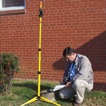
Re: "Triangulation Station on Chimney of Permanent Building." Great posts, Kurt! The next time someone asks why I did not choose "Surveyor" as an occupation, I'll reach in my wallet and pull out this photo. -Paul-
-
Very interesting! Christmas and my birthday are fast approaching. I'll drop some hints to the family.
-
AI8550 STATION RECOVERY (2010) AI8550 AI8550 RECOVERY NOTE BY SOUTH CAROLINA GEODETIC SURVEY 2010 (RPM) AI8550 RECOVERY OF THE GEODETIC CONTROL WAS ATTEMPTED USING A DUAL AI8550 FREQUENCY GLOBAL NAVIGATION SYSTEM (GNSS) RECEIVER. THE RECEIVER AI8550 WAS CONNECTED TO THE SCGS VIRTUAL REFERENCE NETWORK. THE RECEIVER WAS AI8550 USED TO NAVIGATE TO THE COORDINATES OF THE CONTROL MONUMENT. AI8550 WHEN CONNECTED TO THE VIRTUAL REFERENCE NETWORK, THE GNSS RECEIVER AI8550 IS CAPABLE OF CALCULATING COORDINATES WITH HORIZONTAL ACCURACIES AI8550 OF APPROXIMATELY 0.015 METER, VRS LED TO A BROKEN CONCRETE POST, AI8550 PRESUMED DESTROYED. The SCGS staff tells me that they take continuous observations to determine correction factors, and they broadcast these in real time. Surveyors can make use of them in the field, instead of having to apply the corrections when they get back to their offices. -Paul-
-
[Duplicate post deleted]
-
Hi Gene, While logging the benchmarks you've found, you may have picked up on the fact that benchmark hunting contains an element of public service. While we enjoy the challenge of looking for marks, our reports are useful to surveyors. Since 2005, our members have submitted 53,000 updated reports to the national data base. Eighty members have submitted over 100 reports, and 200 members have submitted at least 12. Thirteen have submitted over 1,000 reports. Even a casual find without NGS reporting has value. Meanwhile, some benchmark hunters have assisted state agencies by searching for very old survey markers along state lines, or by tracking down monuments of historic interest. A Geocacher likes the challenge of the hunt and enjoys tracking his/her number of finds, Oddly, on the benchmark side of the hobby, there is not much emphasis on numbers. That's probably a good thing. We have folks who will spend hours looking for a single benchmark. (Actually, if it were not for one of our dedicated members who compiles the statistics, we would probably would never look at the totals.) That's not to imply that one aspect of the hobby is "better" or "more important" than another. I just wanted to pass along a perspective which might explain the excitement about the proposed opportunity for service. Finding boundary markers and renewing trail markers is a good "fit" for the mindset already present. -Paul-
-
On a related topic, the NGS server is erratic this week due to planned outages. Electrical work is being performed by the power company. -Paul-
-
It's difficult to say about Virginia, Mike. That northwestern county in red might have been either of us. I made a run down the Blue Ridge Parkway from I-64 south to US-501, back in September, and I picked up some benchmarks along the way. I made another excursion along the Parkway in mid-October (after these maps were compiled), starting at I-77 and ending up in Roanoke. Watch for some southern VA counties to fill in, next time, as well as putting color into a conspicious hole called Stokes County, NC. (I finally grew weary of seeing the white spot, so I drove up there last Friday to report on thirteen stations.) In the current statistics, North Carolina saw recovery reports coming from TFC, KPE, PFF, J-I-J, RCP, plus a new (and as yet unidentified) GEOCAC submitter using the initials DRD. Keep up the great work, fellow Tar Heels. There are only 100 counties, and GEOCAC has been in most of them! -Paul-
-
And at the time, that was an appropriate report. However, eighteen months later, GEOCAC received a request from NGS that we discontinue submission of recovery reports for "intersection" stations, such as water tanks, church spires, radio towers, etc. New technology has rendered them obsolete. It is not a wise use of NGS resources to process recovery reports which have no value. Because new people constantly are joining the hobby, you will see this reminder from time to time. Of course, it's still okay to log intersection stations on geocaching.com. But we no longer send them to NGS. -Paul-
-
Hi Anthony, Perhaps a look at this topo map will clarify things. The approximate center of the tower is shown with a balloon and the PID. The USGS marker (in the parking lot) is identified in the red text box, and the actual location is indicated by an "X" just outside the upper right corner of the box. This disk has no PID, which is not that uncommon. Many benchmarks never make it into the NGS database, often because they were not surveyed according to NGS standards. The Devil's Tower is a natural geologic object which was created when everything else eroded away, leaving a "tower" rising about 1,000 feet above average terrain. [Try Google for a description of how, why, and when this occurred.] The description in the NGS data sheet gives the dimensions. I hope this is helpful. -Paul-
-
Wow! You're talking some serious distance! I've got the DLR130 (the 130-foot version of the Bosch laser measuring device). When I purchased it six months ago, it was selling for $139 at surveyor supply stores; $99 at Lowes Home Improvement. It's a wonderful tool. In fact, as a real estate agent, I could not get along without it. However, I have trouble finding the laser beam at 75 feet and greater, outdoors. They could improve the sighting notches, which are nearly useless. I use the device frequently when benchmark hunting. It works well when I aim at the wall of a building, and it's easier than pulling a tape across a roadway. When I need a stand-alone target, I use a blank, white sign board. I have not tried a true reflective surface. The company sells eye glasses which make it easier to spot the laser dot, outdoors. Anybody tried them? Or does anyone know what color would enhance this? -Paul-
-
These are good. My only suggestion has to do with keeping the wording similar to other station descriptions in your area. For instance: MS0003. Recovered in good condition. Delete telephone building, which no longer exists. HH2 GPS coordinates _____________________. Note the substitution of "no longer exists", for "is no longer extant". Grammer rules aside (see below), the phrases "no longer exists", "have been removed", or "not observed" seem to be 'NGS Speak" for "I didn't see the thing while I was at the site". [Grin.] -Paul- Grammer observation: I agree that"extant" means "existing". However, it is an adjective, which should modify a noun. We can speak of extant railroad structures in Henry County, where "extant" and "railroad" describe 'structures". The opposite of "extant" is "non-extant", but again, it must modify a noun. "No longer exists" is the better way to describe a state of being.
-
Hi kayakbird, PANARIMO is easy to use and probably would be ideal for what you are doing. Personally speaking, I upload selected photos taken while Benchmarking or Waymarking, and I enjoy being being able to send family and friends a link. Another benefit is that you will begin to hear from others who have an interest in what you've posted. In the case of Carroll Trail, I predict you will get inquires from people who are curious about your local project or who are considering doing similar projects elsewhere. At one time, it took up to six weeks for a photo to migrate onto GoogleEarth, but this has been fixed and they now appear very quickly. By the way, you indicated that the on-line photo application would be for one project, only. However, I know from years of browsing the Geocaching photo gallery that you have some good scenic shots residing on your hard drive. Perhaps it's time to share them with the world. -Paul-
-
LOL! Good point about using a mapping program to catch typo's. -Paul-
-
[sorry....Duplicate post due to a server hang-up.]
-
Adding a note to what Patty wrote: (and duplicatingt ArtMan's post, where he hit SEND before I did) 1. When submitting coordinates to NGS, use the Degrees/Minutes/Seconds format. This is different from the Degrees/Minutes format used on Geocaching.com. There are online programs which will do the conversion for you. 2. Don't report coordinates to NGS if the data sheet indicates that the horizontal coordinates are ADJUSTED. The ADJUSTED coordinates are far more accurate than we can achieve with our handheld GPS units. However, if the horizontal coordinates are listed as SCALED, this indicates that they are estimates which were calculated from a map. For these benchmarks, it is okay to send in the reading you obtained with your GPS receiver. NOTE: Don't confuse horizontal coordinates with vertical position. Both appear on the data sheet, and benchmarks with SCALED horizontal coordinates often have ADJUSTED vertical positioning. (Hint: SCALED coordinates have no decimal point in the Seconds field), A sample submission to NGS might go like this: HH2 coordinates N35 58 37.5, W078 59 03.2 Sending photos to NGS is an entire topic by itself. For the moment, concentrate on the written description and condition. When that is correct, it is better than a photo. However, NGS sometimes picks up photos from geogaching.com and converts them to its photo standard. So take a good close-up of the disk, an area view, and a distant (vicinity) view and post these in your geocaching.com log. You may discover, someday, that your pictures have migrated over to the NGS database someday--especially in those cases where a picture "is worth 1,000 words". Seriously consider Patty's suggestion about posting your proposed NGS upload in this Forum. In addition to our members who are experienced with NGS reporting, we have the several professional surveyors who are willing to pass along advice, as well as actual NGS employees who monitor the Forum and contribute their valuable time to assist us in understanding reporting standards and policies. -Paul- [Corrected typo]