


McMurdo1
-
Posts
62 -
Joined
-
Last visited
Posts posted by McMurdo1
-
-
From the Groundspeak terms of use:
"All comments, articles, tutorials, screenshots, pictures, graphics, tools, downloads, and all other materials submitted to Groundspeak in connection with the Site or available through the Site (collectively, “Submissions”) remain the property and copyright of the original author."
That means no one has the right to extract and republish any content from the site without the permission of the original poster. Groundspeak reserved the right to reuse or sell the content, so it may be possible to negotiate the use of photos from them.
It would probably be permissable to link to the content, but not to display the content itself. Linking to the content violates no copyright, and doesn't even violate the GC terms of use.
Just because this has been discussed in here before, I have kept a seperate file of photos of my finds named in the format that Deb asked for. If needed I can ftp it to a site or an ftp server.
-
Good question -- A judgement call.
We do NOT want the mark to accumulate water which can frost-jack, so definitely NO non-porous soil or clay. Dry sand would be a slight annoyance to the surveyor but not too problematic; balance that annoyance against whatever danger the "open manhole" presents.
You can also affect a makeshift cover with a conspicuous rock or handy piece of trash.
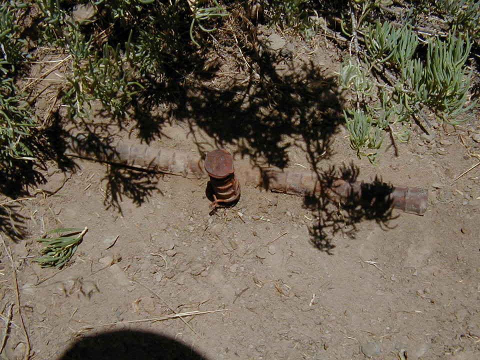
Well I couldn't come up with anything that would really protedt JM0354 being as it is now in the middle of a parking area. I found an old rag to put over the rod and filled the hole with the asphault grindings the rest of the area is covered in. I also buried what is left of the witness post across the top of the marker.
-
I just tried to back up a page in the "Cheers?" thread in OT, and it told me the page wasn't found.
I refreshed the page I had been on and suddenly THAT page wasn't found.
I tried going out to the main forums page and the FORUMS disappeared - all that I got was a list of names of people that were logged on. The "path" that I usually have been seeing in a forum / thread is
Groundspeak Forums > {forum section} > {sub-forum} > Thread: for example:
Groundspeak Forums > General Geocaching Discussions > Geocaching.com Web Site > Forum Problems?
Now it says Groundspeak Forums > > Geocaching.com Web Site.
The forum section seems to be missing.
I only got to this subforum by selecting "view all new posts", clicking on one I *knew* was in the Web Site section, and then clicking on the "Geocaching.com Web Site" link.
What's going on? Is it a forum thing or is my browser freaking out?
Edit to add: and at the top of each page I get this error message:
IPB WARNING [2] Invalid argument supplied for foreach() (Line: 610 of \sources\classes\class_forums.php)
Did Cheers? break the forums again??

-
I use a PPC and just use the export to HTML feature of GSAK. By re-naming the file created before I send it to the iPaq I can use the same function to send my cache pages too.
Try GPXSonar, or Cachemate (now for PPC)... both should allow you to take notes for remember what you found or didn't find when you get home.
The advantage of the iPAQ
I just push the button on the side and take audio notes.
My hand writing is so bad the recognition program can't do it's thing and I don't have to hunt and peck the virtual keyboard.
-
Absolutely. I use my Palm III and hunt both caches and benchmarks.
Here's what you do. For a Palm, get Cachemate, it's 8 bucks and worth it by a long shot. Next, go to http://www.parkrrrr.com/ and download BMGPX.
Get yourself a copy of GSAK, and experiment with how to use it to send data to your Palm. Use the "Export to Cachemate" option on the File->Export menu.
After you've set up Cachemate and can sync GPX files you get from Geocaching.com, go to the NGS website and get the ZIP file for your county or the area you're looking for. Extract it and drag it onto the BMGPX program you downloaded, and it generates a GPX. Import that into GSAK, export to your Palm and off you go.
I personally keep two GSAK databases- one for caches and one for benchmarks. Prior to going out, I'll clear my GPS of all waypoints and send the contents of both to the GPS. I then use GSAK and export a copy of both databases to my Palm and sync it. Then when I start Cachemate, it pulls in all the waypoints and organizes the data. (My Palm III has limited memory, so I usually delete all the records in it before I try to import from my PC).
When I'm out caching, after finding a cache, I'll usually head back to the car, find the cache in Cachemate, and tell it to find nearest using that cache as the centerpoint. Then I look for nearby benchmarks. If any are interesting, I'll go hit them up, otherwise I go after a cache. Lather, rinse, repeat.
I carry my GPS and my Palm with me when caching. That and my digital camera is all I need.

Feel free to ask if you have any specific questions about how to set up your paperless caching experience.

I use a PPC and just use the export to HTML feature of GSAK. By re-naming the file created before I send it to the iPaq I can use the same function to send my cache pages too.
-
I use SA 2004 handheld although with a PPC.
One of my big gripes was that there is no way to import the waypoints generated in GSAK to the maps. In order to import the waypoints you need either Street Atlas or DeLorme Topo. With the handheld module installed there will be a tab at the bottom of either of these map windows to export data to the handheld. With that you can transfer waypoints, routes and maps. The nice thing with the topo program is that you can transfer very small bits of the map around the caches to the HH and increase the resolution. I don't use my handheld to navigate to the caches anymore, the garmin has taken over those duties. The handheld still goes along with the cache pages generated in HTML from GSAK so if I need the hint or the garmin's helical antenna is not acting very nice I can switch to the patch antenna on my Compact Flash GPSr for the handheld.
There is the answer to your other question. Some handhelds use a Bluetooth GPSr or if you have a CF or SD slot you can buy a GPSr for them.
I did write DeLorme a nasty gram after I found out I needed to buy another package to use the program the way I wanted. I don't know if 2006 release rectified any of those problems or not.
Look for a tab on the PC part of the program marked DRAW. If they have added that it will import the .txt file that GSAK makes. Then you can export the points to your handheld.
-
While not technically closed in winter..
Cone_Z at 12000 feet would probably be rated about a 10/10 to get in the winter

The sun has just risen on it again this week, we'll see if anybody visits it again between October and February

-
Did not find this one yet but it is reported to be indoors.
-
The best comedy show in town:
CSP Ch 1
CSP Ch 2
CSP Ch 3
NLEEC
GJPD
MCSO
GJFD “A”
EMS
GJFD “B”
Med 8
Med 7
MRA
SARC
TAC
GJPD “DATA”
GJPD TAC
CNM
BLM
CDOT
ELT
DOW / Parks
Plateau Valley VFD
Lower Valley FPD
Clifton Fire
Palisade FD
FERN
CBI
CBI
CBI
CBI
Approach & depart
Walker field ground
Walker Field FSS
Westar
Unicom
St Mary’s helipad?
Walker Field Tower
Denver Center
Denver Center
ELT
DELTA
MONTROSE CSP 1
MONTROSE
However I have found that laughing out loud while walking down the trail will often get funny looks in return (I use an earphone)
-
-
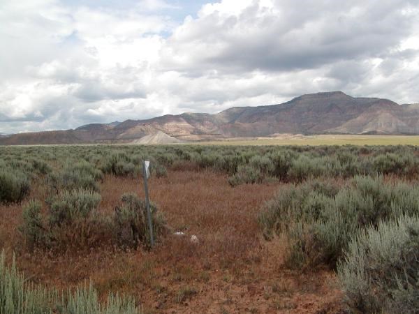
Some strange things are used for "Bench Marks"
A witness post caught my eye as I was traveling along Colorado hiway 65.
Being the curious sort I stopped to check it out. I knew it was not in either the NGS or GC database, I have the marks in my laptop running on the passenger seat and nothing was showing in the area.
 ???????_C
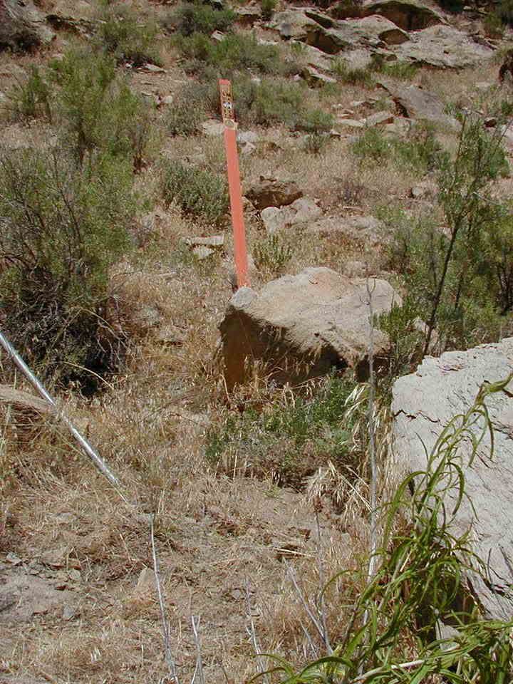 ???????_A Can I log it???
 -
Well they are not in the GC database but do
DF5501
DF5502
DF5503
and DF5504 qualify?
I don't think that a GPSr is going to do much good on these.
They are all inside the Eisenhower tunnels on I-70.
edit sloppy typing
-
*Dress for the job. Torn jeans and a tee-shirt will make folks wonder if they should even SPEAK to you--not to mention letting you on their land. I prefer white or kakhi slacks (especially during tick season) and a "dress" shirt with collar and pocket. I have been known to wear a tie, when working in urban areas.
-Paul-
hmm that might work in your part of the country
Out here if you show up in a shirt and tie, you are either pounding a bible, selling insurance, or "Hi I'm from the Government and I'm here to help you"
Most of which will get you shown the gate pretty quickly.
My disguise is an older, somewhat beat up Toyota 4runner with antennas and a yellow "kojak". An aluminum folding clip board and a faded traffic vest.
It really doesn't matter if I am in jeans, workboots and a t-shirt or the same ensemble with Carhart shorts. It looks like I am just another working stiff with a sometimes boring outdoor job.
I have had law enforcement drive by and see the car in the ditch, slow down and wave before driving away. Ranchers see me inside the fence line at the orange post and wave.
I don't think the slacks and ties would do too well with barbed wire! Last expedition I probably crossed 6 or 8 fences.
-
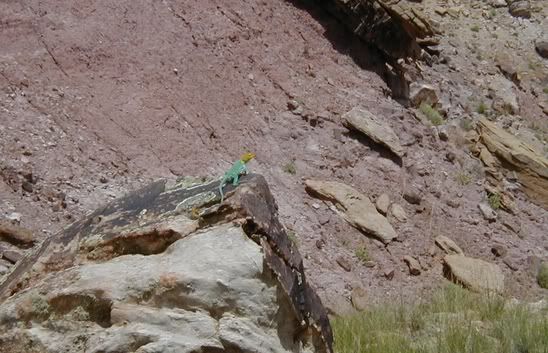
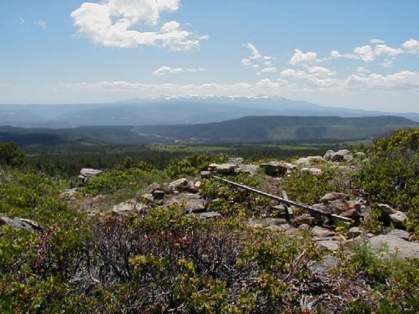
Met this guy on the way back down from here
-
-
I like the DeLorme products. I have S&T but use the DeLorme on a daily basis. Here in Colorado it is important to have the topo maps on some caches and trips. With Delorme's topo program the computer will share routes and waypoints between the programs. I just discovered that the Topo will also export a map to my iPaq (it is a memory hog but if you are trying to decide which trail to take to get to a waypoint it is invaluable).
I spend way tooooooo much money on map programs.
I also have the National Geographic series for Colorado. It is terrible to use with the GPS but great to locate Bench Marks and some of the more remote trails to the caches.
Don't let it become an addiction...
I promise I won't buy the next update...
until it comes out.
-
-
-
-
For most of my benchmarks and caches I use a compaq iPAQ. It has internet explorer built in. If it is a fairly easy mark (Colorado Dept of Transportation etc) the html output of GSAK is all I need. If it is one that I need the original data sheet I just save the page from NGS as an html and transfer it into the hand-held.
I can keep the descriptions of several hundred BMs in the memory so if I have a few minutes I can check things out and see if I can do a recovery.
The other real handy thing about the iPAQ is the voice recording feature for taking a quick note.
I also purchased a waterproof case with lanyard for it. The back of the "bag" is closed cell foam so it will theoretically float.
I also have a Compact Flash GPSr module for it and have the hand-held version of National Geographic Topo maps. The GPSr module will monitor the DGPS signals and WAAS. In most areas locally my resolution is less than a meter all the time.
-
Yes, they work. I used one for a long time before we got our installed units. Just like in a car, you have to put it in the windshield, or someplace that it can see the sky. The roof, being aluminum in many cases, will block the signals, but the rotors don't. I used to keep mine in a holder the sheet metal repairman made, just like many of our pilots did (and many still do, even with an aviation GPS installed, just in case), which attached to the glareshield, right in front of me. Back then I had a Magellan Pioneer, rather primitive by today's standards, but it worked much better than the LORAN receivers we had installed, which quit working every time a thunderstorm appeared in the gulf, which was just about every day it seemed. The low-frequency signals were severely affected by lightning. GPS, when it appeared, was a wonderful thing, even though we had to use different coordinates than what we used for LORAN. The LORAN coordinates were up to a few miles off from the actual surveyed coordinates, but the GPS coordinates agreed exactly.
Um...... There is no fiberglass in a B212. It's all aluminum alloy, including the blades. That's 1950s technology, and fiberglass wasn't used for much of anything back then. Those old 212s used in Antarctica are the last ones we have - we got rid of the rest long ago. You may be getting GPS signals through the windows, which are pretty big, and if you're in a window seat you can get a decent sky view. And if you're seeing 170mph, either you have a poor signal or a very, very strong tailwind. 100mph in a 212 is closer to average, which is one reason they're obsolete.
BTW, tell Jack Hawkins I said hello.
I was going to ask if you knew Jack.
You may see him before I do though! He should be back and flying the gulf as we speak.
I guess the 212 is aluminum. Oh well I had no trouble with the GPS in either of the 212s.
And yes a 50Kt+ tail wind is not too unusual between Black Island and McMurdo...
-
I know from personal experience that the fiberglass bodies of A-Star and Bell 212 helicopters are invisible to the radio waves from the satellites.
It is impressive to see my GPSr registering 170MPH!
-
This one in Christchurch is something like that.
and seems to be real popular.
Not really trailheads though..
-
I love my DeLorme Street Atlas on my handheld, The problem is without having the full version of street atlas too, you can not import the draw points (waypoint) file generated by GSAK.
You can still enter the waypoints by hand but that is a real pain.


Benchmark Picture Contest 2006 - Part 1
in Benchmarking
Posted
The best way seems to be a closeup that gets the numbers and markings on the mark plus an area shot that would help another hunter to find the mark. If the area shot also happens to be scenic all the better.
Labeling the pictures for the logs is also important especially if NGS ever gets photo logs on their site.
The format asked for by NGS is
PID_YYYYMMDD_AorC.jpg
example
KM0443_20050508_A.JPG
It works for me by letting me know the exact date I took the picture and I can look up the PID on my GSAK database, I also link back to the picture from GSAK.
PS thanks for including me in the "contest" BDT I really wasn't too impressed with the scenery on that shot. That scene is as common for my area as an overpass is for the urbanites