


Black Dog Trackers
-
Posts
2675 -
Joined
-
Last visited
Posts posted by Black Dog Trackers
-
-
I agree about the aluminum bronze. Most of it tarnishes in some way and looks like junk, well actually they look about like the Primore disk in your second to last picture. Most of the gold ones though have a surprising shine to them that just seems unreal. I doubt the people who set those would imagine how bright they look after a hundred years out in the weather. As you say though, alloys seem to have a million combinations, sometimes with surprising results, like Wood's metal and those new super-powerful magnets they're selling these days.
-
I still think it's Aluminum Bronze.
These disks are old but the Berntsen company might happen to know.
By the way, I just noticed their cool benchmark disk catalog here. Be sure to click on their Design Groups dropdown menu!
-
Welllll, actually some people create a waymark and then log it right away.
-
Hi Normand99 -
Well there's 2 basic issues here. One is that the benchmark logging database is from the year 2000 and does not get any updates. The other is that there are thousands of benchmarks that are not included in the NGS database where the year 2000 data came from.
If you like you can read about hunting benchmarks in the Benchmark FAQ and in particular you can read about marks not in the database and how you can log them.
-
-
I have done this same thing in excel with 2 columns; one for linking to NGS and the other for linking to GCBenchmarking.
-
Hi TillaMurphs,
That disk is really interesting! It looks like some kind of cover for some gadget, but there it is in the NGS database, so it's a geodetic disk.
Anyway, the Gnomonclature website belongs to BuckBrooke, not me. He gives his email at the bottom of the introductory paragraphs on that page so that he can be sent new disk type information.
-
TillaMurphs -
In starting to log at the NGS, I suggest logging only the ones you found, not the ones you didn't find, at least at first.
If you want to see how it will look before you submit, copy all the existing history and add your log in all-caps at the end of it. Perhaps something about your intended report will appear to you to fix in that context.
Try to use NGS database 'survey-speak' when writing logs for the NGS, as Bill93 suggests.
Before logging write a list of stuff to remember, while logging, like:
change all measurements to feet-and-tenths
enter your coordinates for all bench marks
put information in the correct order - general-area to close-by
-
Ya, OK, I'll bite

ruffytiger - You can log them at Groundspeak's Waymarking site for U.S. benchmarks.
-
I see no advantage for any further separation of benchmarking from geocaching.
The programming of benchmark logging, searching for benchmarks, and listing of benchmarks is already sufficiently independent of the programming of the analogous geocaching functions and works is fine as is.
Any ideas like doing a better import of benchmark data (like including the box score), getting annual NGS updates pasted somehow onto the GC benchmarks database, or any other such improvements is therefore a different matter, independent of whether or not there is some kind of 'offshoot' separation from geocaching.
-
Yes, it is still the same format.
It just looked really strange in Notepad when I looked at it earlier today.
I agree; nothing needs to be done except change the extension from .txt to .dat if you're still using BMGPX.
-
NightKnight -
Oh, I see what you mean. NGS apparently changed the format of these archives from the regular .dat file format to some new format. I wonder if there's a description of this new format anywhere on the NGS site.
-
Also here at the NGS site.
-
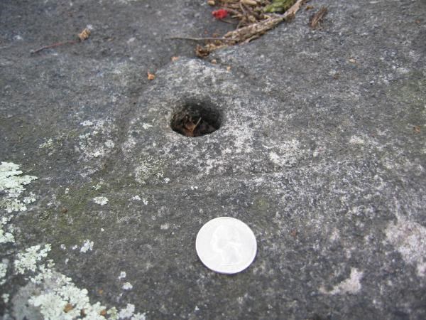
KELLER 1884 - a drill hole surrounded by a chiseled triangle. In the picture is a quarter for scale.
-
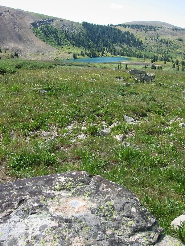
and some more!
2105 by Wader123
FAIRVIEW by TillaMurphs
BLACK CROSS by southpawaz
GORDA 3 RM 1 by esquimaux
845 4538 C by king.hubi
by Baron88
COLO KII by jkselby
W M SOUTH by CallawayMT
N 20 by kayakbird
O 14 by tbarhunt
-
-
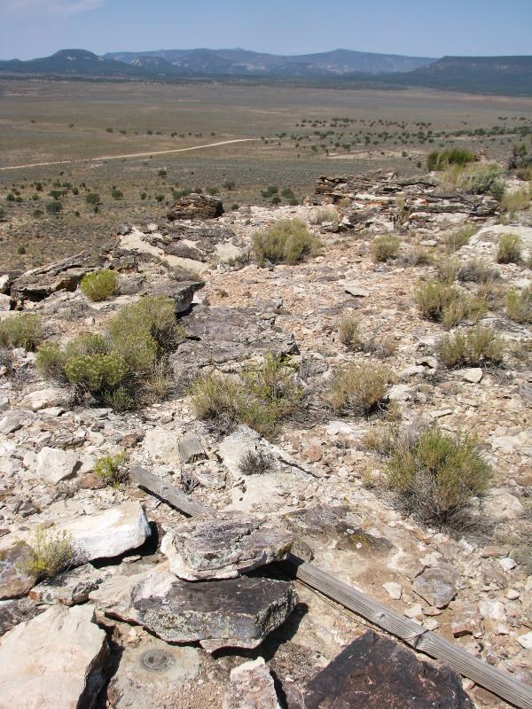
1. should avoid the "scaled" BMs, as they may need a lot of effort to find them
2. should not bother to transform NAD to WGS
Concerning #1, I would have the opposite point of view. The "adjusted" benchmarks are often on private property, which requires obtaining permission, and are often not near a road. Neither of these are a big problem but are things that add to time spent. The "scaled" benchmarks are often on a bridge or very near a road or railroad. Don't bother using a GPS receiver to find them; use a tape measure instead. The use of a tape measure is not in itself a significant difference - looking for "adjusted" stations often requires tape measuring too. The main thing is to read the description to see how easy or difficult a mark will be. It could be either an "adjusted" or a "scaled" one that is easier.
Concerning #2, that is certainly true. There used to be some NAD27 (1927) but not any more, so for a handheld GPS receiver being used in benchmark search mode, you can consider NAD=WGS.
-
Schuhhirsch,
In addition to the above excellent answers, I want to point out:
1) Bench Mark (with a space) is the term the surveying community uses for vertical control stations.
2) Benchmark (with no space) is the term we hobbyists use for both vertical control stations and horizontal control stations.
3) Perhaps in Europe there is no analog of a vertical (vertical-only) control station?
-
Another question. I understand that RESET markers (e.g., MR0489) were placed to be able to reposition the actual marker if it were lost or moved. If so, how come the descriptions never indicate the direct relationship between the two. I'd expect "89 degrees and 42 feet" or some other description of relationship. Or is this enscribed directly on the RESET only?
RESETs are generally set if there is no hope of using the original, either because it is gone or because it is encumbered by something. What you're saying relates to REFERENCE marks, not RESET marks. REFERENCE marks are to help re-locate (find) stations (almost always horizontal control stations) or sometimes to re-establish them (at a lower order of stated accuracy, by requirement). So, the accurate distance and bearing from a RESET to the originial station is generally of no real interest to surveyors.
-
monkeykat, m&h,
Here is the place where those graphs are. I did them a few years ago, so they are out of date. I had to move from my former site because the server there quit hosting web pages.
-
Hi buzzy_cacher -
I recommend entering your own zip code "Postal Code" in the benchmark search and FAQ web page. Then choose a mark that someone else amongst us has already found and go looking for it. That will give you experience in seeing how they look in the field. At the same time, pick some to look for that have not been found if there are any.
There are many important things to learn about benchmark searching but probably the main one is to learn the difference between "scaled" and "adjusted" marks. It's explained in the FAQ page.
I suggest reading the entire benchmark search and FAQ page, especially starting here.
-
-
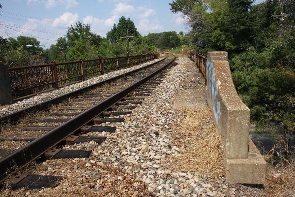
In my experience, the compass directions along roads and from roads and buildings are very approximate. Even roads that are locally NE will be called either North or East, depending on the more general direction of the road.
In other words, there are driving directions like route 22 going East out of town (it may not be exactly East so don't leave the road while you travel ~East), and then there are walking directions with the same level of generality, and then there are the directions to local landmarks (a 12-inch maple tree) and those won't be exact directions either (but they will have distances with 1/10 foot precision), and then there are bearings to reference mark disks and that last category will have bearings that are both True, not Magnetic, and very precise.
Bearing that in mind (pun intended), I agree with your approach of doing the measurements in order; first the 50 feet (generally going) East along the tracks from the road's centerline, and then measuring 32.6 feet exactly perpendicular (and more or less South) from the (generally Southernmost) track rail.
I think the main problem with this mark is that it is 3 feet lower than the track. With a gradient, there is probably fill over the mark. I agree with pgrig and Bill93 that a metal detector is probably going to have to be used to find this one. I agree with southpawaz about not worrying much about slope distance versus horizontal distance for this small gradient from the tracks. If you don't have a metal detector, then probing is your best alternative. As southpawaz says, you're likely really looking for a +- 12 inch diameter cement post with the disk in it.
A trick before going is to paste 39 53 24 -083 31 44 in Google Maps or Google Earth and you can see a picture of the area to help you plan your find. Google Earth is a bit nicer because you can use its mouse ruler to make lines.
-
I think we need an instructional video contest here!
Video with the most items of information in the least time, or some such idea.
Points for categories like: technical and procedural information, presentation, interest level, landowner relations, and respect of the markers.


Nad 83 - Wgs 84
in Benchmarking
Posted