

rtyrie
-
Posts
149 -
Joined
-
Last visited
Everything posted by rtyrie
-
See they use small calibre stuff as well x2... maybe that was for small slides... I hope that was actually something else and just looks like bullet holes! Maybe the sign was recycled from outside the park.. or IS outside the park. Doug 7rxc In case you are interested, the exact location of this sign is the Balu Pass parking area, right off the Trans-Canada highway, not far from Rogers Pass.
-
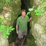
This is not a funny sign, but it is an interesting sign that I had not seen before. Picture was taken this past summer while in Glacier National Park in British Columbia, Canada.
-
When I was looking for colours for my maps, I used this site: Colorbrewer I ended up using a modified green colour scheme that was inspired from that site.
-
I noticed that there is some artwork for Canadian provinces and territories that can be seen in this video: The artwork is visible at 3:13 in the video. So it looks like Canadian souvenirs should be coming soon.
-
I enjoyed GC1TKMW Rideau Canal EarthCache when I was in Ottawa this past summer. It is also in a convenient location if you are staying downtown.
-
Geocaching.com site update Dec 21st 2010
rtyrie replied to OpinioNate's topic in Geocaching HQ communications
Some further clarification...I am able to edit the bookmark from the "edit" link in the list of bookmarks. The problem occurs on this page: The "edit" link on the above page points to this url: http://www.geocaching.com/bookmarks/edit.aspx?ListID=-1 I believe the -1 is invalid. -
Geocaching.com site update Dec 21st 2010
rtyrie replied to OpinioNate's topic in Geocaching HQ communications
I'm not sure if this bug is related to this update, but I've not seen it before today, so I will post here: If I create a new bookmark list, I am unable to edit it. I receive the following message when I click on the "Edit" hyperlink: Error Occurred You do not have permissions to edit this bookmark list. This only occurs for new bookmark lists that I create. I am able to edit bookmark lists that I created in the past. For the devs, I created a list called "New List" as an example list that I am unable to edit. -
Geocaching.com site update Dec 21st 2010
rtyrie replied to OpinioNate's topic in Geocaching HQ communications
Great update, really enjoying the new features - especially the favorites. I did notice one minor bug that I don't think has been reported. If you click on "View who favorited this cache", when a cache has not been favorited, you see: Total Records 1 - 0 of 0 Also, any chance of localizing the word "favorite" to "favourite", for those of us around the world who spell differently? I'm a software developer myself, and I know that my english speaking users really appreciated it when I localized my software to account for different english spellings of various words. -
Great quiz - I'm enjoying all of the images! I will likely be offline for the next couple days but here is the next cache:
-
The eastern-most cache is GC1F557 - Scatarie Island, Eastern Head.
-
Correct!
-
Okay, here is the next cache:
-
For previous posters who are looking for tips regarding how to find these caches, I will share my solution for the last puzzle: I found this cache entirely with Google Search. The bend in the railway is the most obvious feature in the image. I figured that such bends would be quite rare. I first googled "hairpin turn". The results of that search taught me that these bends in railways are called "horseshoe curves". I then googled for "horseshoe curves" in Canada. This led me to a railroad forum that provided map links to 2 such curves in Canada. One of these links looked promising, so I then entered the given coordinates into the geocaching map - bingo! Now I will look for a new cache to add for the next puzzle.
-
GC12KGK - "Tools of the trade"
-
I read about the ice box, but we didn't go on that trail, so I don't know if there was snow. We spent most of the time on the Miller Lake and Lake Eva trails.
-
Thanks everyone for the suggestions. I am now back from my trip. There were some slight changes to our itinerary and I ended up not finding any caches in Kelowna, but found a few in Vernon., my favourite being GC1QWA6. However, my favourite cache of the entire trip was the Mt. Revelstoke virtual - GC9BCD. We ended up hiking the backcountry trails that began there, and spent the entire day hiking on the mountain - great times, but sore knees!
-
Thanks once again for the suggestions. I'm flying out tomorrow. I'm not sure how much time I will have for caching, but I'm hoping to find at least a couple good ones. Narcissa - Your cache looks interesting, but I'm not confident that I will get to it due to time limitations in the Kelowna part of my trip. I was once thinking of creating a similar cache in my town. Circles are my favourite shape .
-
I'll second the suggestion for the Niagara gorge caches. They are amongst my favourites. I had no idea you could even go down into the gorge before I started caching! I don't know if they are accessible by public transit though. I saw some sort of bus running along the gorge when we were there. Not sure of its route or hours. They may scale it back in September. That bus is operated by the Niagara Parks Comission. Also on your way to the falls there is GC2B4 (deer Bait) the oldest cache in ontario. Yes, it looks like you would need to take the bus operated by Niagara Parks rather than the Niagara Falls shuttle. The Niagara Falls shuttle route ends before reaching the caches in the gorge, such as the Niagara Glen caches. The Niagara parks bus goes all the way to Queenston Heights. There is a nice virtual cache at Queenston Heights that marks one end of the Bruce trail. Niagara Parks Bus
-
Thanks for the suggestions. We will be flying into Kelowna, then driving to Revelstoke where we will stay for several days. We will then drive back to Kelowna and stay there for a couple days before flying back to Ontario.
-
Next week I will be traveling to BC for about a week, dividing my time between Kelowna and Revelstoke. Does anyone have any recommendations for good caches in this area? I will not find many caches, so I'm trying to locate the more interesting ones. Currently, the Mt Revelstoke virtual looks interesting (I love interesting virtuals and earthcaches), as well as the traditional caches on hikes in Glacier National Park. I've just started looking at the Kelowna area, but the number of caches there is overwhelming, so any advice is appreciated! I mostly enjoy caches in natural areas rather than urban caches. Thanks for any suggestions.
-
I'll second the suggestion for the Niagara gorge caches. They are amongst my favourites. I had no idea you could even go down into the gorge before I started caching! I don't know if they are accessible by public transit though.
-
I didn't see it in the release notes, but I noticed that the colour banding issue in the Additional Waypoints table on the cache page has been fixed. Thanks!
-
This is strange. I opened the page today, and the problem no longer exists. I'm not sure what happened. I will let you know if it happens again.
-
I'm not sure if this is a new bug or I just didn't notice it before: If you go to a trackable page, the distances in the logs are listed in km. This is correct since this is what I chose in my profile settings. However, if I click on "View Map", the distances are now listed in miles.
-
Since the update, the side bar on the home page does not render correctly on the Opera browser after moving the mouse over it.