

Rubberhead
-
Posts
776 -
Joined
-
Last visited
Everything posted by Rubberhead
-
I put it on one of my Vista computers and I hate it.
-
Will Garmin UK Topo maps work on a Nuvi 700 series?
Rubberhead replied to sexybaldyguy's topic in GPS technology and devices
I have a US NUVI 650 that takes US Topo 2008 maps when I use Mapsource to install them on an SD card. -
I have hung onto my GPSmap 60CS because I use the alarm clock feature all the time. It has been discontinued for a long time but I found that they recently updated the firmware. Unfortunately it doesn't look like they fixed the DST issue: Changes made from version 4.10 to 4.20: Improved support for Macintosh USB. Corrected support for certain carpool/toll roads types in Austria and Switzerland. http://www8.garmin.com/support/download_details.jsp?id=549
-
The 60CS has an alarm clock and the 60CSx does not. I would really miss the alarm clock if I had to go with the 60CSx.
-
I don't think you need to load Trip & Waypoint manager. These functions are already in all other Mapsource products.
-
Can I Remove Bluechart From My 76s & Put It On My Cx
Rubberhead replied to LOANSHARKY's topic in GPS technology and devices
No but you can use your second unlock code to unlock the bluecharts for the Cx in addition to the GPSmap 76s. -
The original intent was for the unit to provide altitude even when the unit isn't receiving a signal.
-
Best Mapping Software For 60csx For Geocaching?
Rubberhead replied to aspTrader's topic in GPS technology and devices
Metroguide 3.00 does Autoroute on my GPSmap 60CS. This software was orginally designed for the GPS V and is unlocked. Later versions of Metroguide do not autoroute on the unit. -
I use the barometer when I'm saltwater fishing. Elevation is near constant (only changing elevation about 6 feet every 6 hours), but it does a good job of predicting whether or not a "pop-up" thunder cell is going to hit or miss my boat. I also used it to track if my migranes are pressure related. Other than that it hasn't been much use. The compass on the other hand has been very useful.
-
60csx Vs Rino 530 (and Maps Question For Both!)
Rubberhead replied to chetwynd's topic in GPS technology and devices
Try sending Mr. and Mrs. Parrothead a PM and asking them. She has the Rino 530 and he has the GPSmap 60csx. I remember her telling me how fast her husband's 60csx was compared to anything they've had including the 530. If it were me, I'd go for the 60csx. -
Inventory Time> What GPS Units Do You Own ?
Rubberhead replied to GOT GPS?'s topic in GPS technology and devices
Next: Color Fixed mount something like the Garmin 172C I might also have to get a StreetPilot i3 for the Mrs. since she just started calling my autorouting GPSmap 60CS "her little friend" after taking it on a trip. Current: Garmin GPSmap 60CS Garmin GPSmap 162 (fixed mount) Garmin eTrex Vista Garmin eTrex Camo Garmin eTrex Mariner Previously: Garmin GPS 38 Garmin eTrex Mariner (different from the one above) Garmin GPS 128 (fixed mount) Garmin eTrex Legend -
Here's a picture of my console. Yeap, I'm a Garmin guy. I take my family including two kids offshore in a 20 foot walkaround so I have to trust my equipment.
-
Ford Coke Garmin "Well, I ain't never been to Nacogdoches." "dadgum it Mister, I believe you."
-
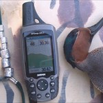
This is a split screen shot of tidal predictions on a GPSmap 60CS.
-
The Etrex C/ Cx / Vista C Compatability Problems
Rubberhead replied to TeamBalls's topic in GPS technology and devices
NMEA protocol are RS232 based 4800 BUAD serial interfaces design to transfer water temperature and water depth readings to a GPS and location based information from the GPS. NMEA can be used to connect a GPS to a VHF radio with DSC capabilities (for transmitting location information during a "May Day"), or a GPS to a fishfinder (for sharing water depth & temp and location). The biggest reason the color eTrex units can not speak NMEA protocol is because they don't have a serial port. -
Whichever one you pick, you will at some point in the future you will wish you had picked the other. It always happens when you compromise. I say, save an extra $40 and get both (Vista Cx)- you will be much happier.
-
Isn't It Unethical To Overprice Used Gps?
Rubberhead replied to vfrpilot's topic in GPS technology and devices
It's the buyer's obligation to do their research. If someone sells a $300 unit for $400 and the buyer willing paid $400 what's the big deal? -
NMEA is a serial (RS-232) protocol that is not used for loading maps but transmitting and receiving real-time data such as water depth, water temperature, and coordinates. It is used to connect a GPS to a Fishfinder or other marine device. I've connected my 60CS to my Garmin fishfinder that my GPS displays water depth and tempteratue. I can also highlight structure on my fish finder and hit the "mark" button and create a waypoint on my GPS. When these devices are connected, marking a waypoint on the GPS also fills out the depth parameter for that waypoint, otherwise depth is marked as unknown. This connection uses the round, 4-pronged connector on the back of the Garmin 76/60 series. This is the same interface as the serial map loading interface so I have to set up the port for either Garmin protocol if I were to ever need to transfer map data or to NMEA when connected to my fishfinder.
-
Garmin Rhino 110,120,130 Opinions
Rubberhead replied to gobblerhuntr's topic in GPS technology and devices
Autorouting uses road maps to give you door-to-door driving directions like Yahoo driving maps only real-time and location based. I'll tell you again that the 520/530 are light-years ahead of the 130. Believe me 3 minutes of loading time is nothing for a RINO 530. Waiting an hour to load a map set into a RINO 130 is crazy in this day and age. If you are going to get the RINO 130 you must also realize that the barometer functions of the 520/530 are much more advanced than the 130. In addition, I don't know if it's important to you but the RINO 520/530 also have tidal predictions. -
Garmin Rhino 110,120,130 Opinions
Rubberhead replied to gobblerhuntr's topic in GPS technology and devices
If it were me, I'd seriously consider getting the 520 or 530. The major reason is that since it has a USB interface rather than a serial interface, you'll load maps and tracks in about 2 minutes versus about 20 for the 120 and 50 minutes for the 130. Also, most computers don't have serial interfaces anymore so you need to purchase (and carry) a serial to USB adaptor. Besides the color screen are much easier to read in all light conditions. -
Version 7 won't install unless you've got version 6 installed. And, if it's anything like Bluecharts, the old version will still be installed. So if you need room on your harddrive you will need to erase the old version. I would rename the subdirectory for Version 6 to something different and make sure that version 7 still works before totally deleting version 6.
-
The 60CS also takes 12VDC straight without the USB power plug. The long and short of that is that you can get 2 or 3 power cords for the 60CS for what it'll cost for 1 for the Vista C. I also like the buttons on the 60CS better than the click-sticks on the eTrex units.
-
Bass pro shops has the Legend C for $199.99. I know that's more than double your initial price of $80, but it's way more than double the GPS. 1) 24 MB of memory vs. 8 for the old Legend 2) Better battery life 3) Color screen vs. 4-level gray (color looks great in direct sunlight, LCD screens cast shadows making the display hard to read) 4) The "C" uses a standard mini USB cable (included), the Legend uses a DB9 serial which new computers don't have anyway 5) The Legend C autoroutes, the old Legend doesn't 6) The Legend C has tidal predictions, the old Legend doesn't 7) The Legend C has beeps for warnings including an alarm clock and proxmity alarms, the old Legend doesn't 8) The Legend C has a geocaching mode, the old Legend doesn't ... You get the point... Good luck.
-
Turn the compass on my pressing and holding the "Page" button. Once the compass is on the "Sight-N-Go" will be hilighted.
-
I got a Bass Pro Shops catalog today that is advertising the Legend C for $199.99.