

_Shaddow_
-
Posts
413 -
Joined
-
Last visited
Posts posted by _Shaddow_
-
-
I am unable to download my automatically run Pocket Queries, they show zero caches and zero file size
I've had the same settings for years and never had a problem

-
Holey cow. Not only the ET but many offshoots. So the trails are there.
I'm still a strong skeptic of the 2000+ finders. I'd be willing to concede that it's possible that at least one on that list has truly done it, however the incentive to fudge numbers here is too great while the risk of being caught is extremely low.
Personally, I would need to see a GPS track to believe any claims.
-
Project-GC.com is a great source for statistics. You can slice and dice worldwide, by country, by province/state/region -- even by county!
The site tells me that, as of today, Alamogul has the most total finds with 161,363, and the most finds in one day were recorded by hans415, with 5,578. There are now 41 geocachers who have logged more than 2,000 finds for a single day!
Wow! That's one find every 15 seconds for a 24 hour day! I'm astonished, astounded, and unbelieving. 2,000 finds is one every 7.2 minutes. for 24 hours. Even that is astounding!
That's what I'm saying. Physically those kinds of number are impossible. I would have to think they went caching for a whole week or more and dated everything for the same day so they could claim those kinds of numbers. Either that or like what was mentioned above with people re logging previously found caches under a different account.
Careful what you call impossible. 7.2 minutes per cache is pretty slow for a power trail. I've seen one video that shows less than a minute per find - that's working as a team in a van. I, myself, do find the 5,578 in a day hard to fathom...
Yeah, I want a math check:
24 hours x 60 minutes = 1440 minutes in a full day (even at one per min, 2k is out of the question)
Large claim:
5,578 caches is 3.9 caches per minute which is very close to 4/min (roughly one every 15 sec)
Spacing of caches are a minimum of 528 ft which is 0.4 miles per minute x 60 minutes = 24 miles per hour average speed over a 24 hour span
Also 5,578 caches x 0.1 miles = 558 miles traveled at the absolute minimum cache spacing
So I guess you could argue that it's technically possible
Of course there a lot of assumptions which include:
- that there is a power trail with 5,578 caches spaced 0.1 miles apart
- the vehicle maintains this average speed over 24 hours (no stopping only slowing of the vehicle to grab / replace caches - caches are tossed to the rig while still moving?)
- no fuel stop
- no bathroom stops
- no food stops
- probably a large support team so the cacher only quickly signs the logsheet and does little else
Smaller Claim:
2,000 caches is 1.4 caches per minute (one every 43 sec)
Spacing of caches are a minimum of 528 ft which is .14 miles per minute x 60 minutes = 8.4 miles per hour average speed over a 24 hour span
Also 2,000 caches x 0.1 miles = 200 miles traveled at the absolute minimum cache spacing
Assumptions include:
- that there is a power trail with 2,000 caches spaced 0.1 miles apart
- the vehicle maintains this average speed over 24 hours
- no food stops
- bathroom stops are made up with higher vehicle top speed between caches (time at 0 speed quickly drags down the average)
- any slowing of vehicle below 8.4 mph to grab/replace is made up with higher vehicle top speed between caches
- that the vehicle is able to accelerate to required top speed in less than 264 ft
My 2 cents: anything close to 2k in a day would be very momentous achievement. Are there even any 2k+ cache power trails yet?
Heck, I'd be impressed by someone signing their caching name on a piece of paper 2000 times straight
-
Here on the wet side, a few years ago we (many difference local cachers) were able to track down an absent CO, the owner of some very cool multi caches and others, and he adopted them out. Ironically, one of those cachers was hydnsek who posted above. I say, if you find them interesting and think worth saving, do it!
Community care works well for the physical cache, there are still issues that come up on the page which requires access, those issues can be archive worthy so know that even the best community care will still not prevent the cache from being archived in the long run.
My best suggestion is to try and figure out who the CO used to cache with and see if you can contact them for more information about the CO, or if they might be able to directly contact the CO. Researching the CO's old found logs on their profile page is a great place to start. Often the logs will mention who the found the cache with, or it can be deduced by a pattern of logs on the same day.
Good luck
-
I REALLY hope this cache is not archived due to the (overdue) determination regarding new rules for challenge caches. I qualified for the final with over 51k accumulated back in Oct of `14 but due to medical issues I was out of action for almost a year, then moved out of state. This summer I will be returning for a few months and hope to go for the final. It would be a big disappointment if the new rules prevented me from claiming this challenge I had worked so long and hard for.
Yes, overdue after more than a year. They did post an update in the forums on 4/21/16 but it all it really says they are going to take more time. http://forums.Groundspeak.com/GC/index.php?showtopic=338633 It's a long read at 16 pages right now but I can summarize quickly. In the post the only new requirement they mention is that future challenge caches will need an online checker. But it's very clear that they haven't thought through any finer details of how it will work. The rest of the 16 pages of post are basically one of two things, catchers unhappy that GS appears to not have made any meaningful progress or about the problems / issues / details around the online checkers. For example that checker process would be through an uncompensated third party site and how it would work for a site of volunteers to take this work load.
Back to your concern, I'm hopeful they will grandfather in existing challenge caches. Even if they don't, we can find a way for you to complete the challenge and log a find. I have some ideas we can discuss if it becomes a need
-
Some more changes to the rules and description:
In addition to the changes to rule 3 noted in my previous post, I've removed the wording "generally within" and specifically required that trips be completed on a road or trail in NW Topos. In a new bullet item located below the rule, I've noted that I'll accept most trips on roads and trails not yet in NW Topos with the understanding that tracks will be submitted to Switchbacks
Since we use NW Topos as the official map for elevations and it now differs in extent from NW Trails I've gone through the cache description and made minor changes to make this more clear by removing most references to NW Trails. This effectively just clarifies the boundaries since NW Topos now covers a smaller area than NW Trails.
I've updated my coordinate format request to remove the comma between the latitude and longitude, it is now
NXX XX.XXX WXXX XX.XXX
This helps ease my check effort as I can cut and paste quickly, MapSource is very picky and won't accept the comma.
Significantly changed the text at the bullet under 'Additional Information; For each elevation, use NW Topos Maps or another topo map and round to the nearest 10'' to be more friendly and explain that some updates to posted trip elevations may be because of the differences between maps, and showing those differences improves our navigation skills which is a key goal for this challenge.
Corrected spelling errors throughout the page.
Additional Note:
Up until now I've used the names NW Trails and NW Topos somewhat interchangeably since NW Topos was simply NW Trails data combined with a topo map and otherwise they had the same data. Now using the terms interchangeably creates confusion. Even in my recent log I used the wording "NW Topos (Trails) mapset" as if they are the essentially same which might have cause some confusion. From now on, I'll be referencing NW Topos separately from NW Trails.
-
And good news that the newest mapset does have some areas of Alberta in it, per the Switchbacks page under the title General Information:
The mapset is dynamic and continually growing and improving. As of this release, it covers all of the State of Washington along with North Idaho, Western Montana, much of northern and western Oregon, the areas around Victoria and Vancouver in British Columbia, and Calgary, Alberta:I am not sure where in Alberta you are located, but perhaps you can do the hikes in the areas covered by the mapset
I live in Calgary.
And this was my point. The map sets clearly included portions of Alberta, but the cache page excluded Alberta from rule 3. From this, I drew the assumption that you were drawing the line at the Continental Divide. Based on your response, I will now assume that the Alberta mountains W and SW of Calgary, which are included in the maps, are valid hikes.
This all raises another point. I regularly record my tracks. If we contribute a track log to the project that is not part of the current mapset, can we then count that track toward this challenge? It would certainly encourage contributions.
Nothing in rule 3 was meant to exclude Alberta, it only restricts to within the boundaries of NW Topos mapset. The bulleted info underneath, which is what I think you're referencing, clarified what areas are included in the mapset. At the time of the writing NW Topos didn't include any of Alberta so it wasn't included in that text.
I've updated the bulleted item to make it current (pulled from the website) and also added some wording to indicate that it may change:
"Currently includes Washington, North Idaho, western Montana, much of northern and western Oregon, the areas around Victoria and Vancouver in British Columbia, and Calgary, Alberta"
In addition, in reviewing the Switchbacks pages on NW Trails and NW Topos, it looks like the NW Trails now includes all of Alberta as well as British Columbia and Alaska. And that area is much larger than the area covered in NW Topos. Because of that I've changed the rule wording from "NW Trails" to "NW Topos" to clarify we use the NW Topos mapset not the NW Trails mapset. It should have said Topos anyway, but now there is more of a need to make it clearer. These changes will their way to the page at the next trip update.
I'm am not sure why the Topo mapset is smaller than the Trails mapset, though I'm sure it's a good reason. Could have to do with time and effort involved for a voluntary project, or the overall file size (currently at 1.25 GB). I'm also not sure about his desire to increase the size of NW Topos.
So here's my thoughts: I am keeping the boundaries of the challenge within those areas covered by NW Topos. The boundary has to be drawn somewhere, and it has to affect some people. I'm sorry that affects you and I'd like you in the challenge. One option you can pursue is to get in touch with Jon at Switchbacks and see if he will extend the Topo Mapset into the your areas.
-
A copying of my response on the cache page:
behmSquad, log,Thanks for taking time to read (and post) in the forum.
While I have been allowing trips on trails not in the NW Topos (Trails) mapset, these have been within the greater bounder of the mapset. The reason I've allowed them is to encourage improvement and maintenance of the mapset. Data Submission Upload page.
For now I would like to keep it as is with the boundaries determined by the extent of the mapset and trips on unmapped trails within the boundaries are accepted with the understanding that the tracks will be submitted to the NW Topo (Trails) project.
-
Here's some ideas I'm thinking about:
Eliminate rule #3.
I'd love to see #3 eliminated or at least add Alberta to your list. It's clearly part of the NW unless you're disqualifying it as being over the Continental Divide (as is most of MT and WY). I would have qualified just over the last year if Alberta were part of the challenge.
First, thank you for reading this forum first before asking your question
I think that the name of the mapset we're using is causing some misunderstanding, while it does have Northwest in the map title, I have not so much directly related this challenge to the NW. For example, if the mapset were to be updated to include more area outside of the NW, or renamed to something such as Western Trails, I would more than likely still use it.
And good news that the newest mapset does have some areas of Alberta in it, per the Switchbacks page under the title General Information:
The mapset is dynamic and continually growing and improving. As of this release, it covers all of the State of Washington along with North Idaho, Western Montana, much of northern and western Oregon, the areas around Victoria and Vancouver in British Columbia, and Calgary, Alberta:I am not sure where in Alberta you are located, but perhaps you can do the hikes in the areas covered by the mapset
-
Just tried it again and it's now working. I saw in the edit box what you mentioned with the content missing above the "<!-- data is inserted ending here -->" however that is -not- what I believe that pasted onto the edit page and was verified when I pasted the same info to my HTML viewer and had a correct display of the info. I posted the same info back into my cache page now and all is well.
To double check, I took the html that on the cache page with the "<!-- data is inserted ending here -->" and it did -not- display correctly on my HTML viewer, it displayed the same as the cache page.
It is possible that I had an error in my process, but I am unable to find it. My feeling is that the page changed what I posted to the edit box on the cache page to what you found and what was being displayed. If I am the only one reporting this issue then clearly it must be at my end. Though I wonder how many caches are as complicated as my page and where also edited shortly after the update, the chance that anyone would report an issue is relatively small.
In any case, it's fixed now. I'll keep an eye on my process to see if I might find an issue with it
-
There was an update this morning and now my cache GC24K9Z won't display the pictures or finisher's tables. I have not made a change at my end that would affect these items and have double checked my HTML code with another online tool.
Did the update break something or has there been changes made that affects HTML?
-
NM - found it......or not. I'm going to need the thread link.
That's cos we're all commenting on the Facebook thread.This intrigues me. I'm surprised nobody is commenting. If you haven't received enough volunteers, keep me in mind. I'm not in the same shape I was in during the HOTMs but I'll be happy to volunteer. I'm intrigued, too!
The Facebook post she is speaking of is in the Cachers Of Puget Sound group: https://www.facebook.com/groups/317549528315995/permalink/773864149351195/
I posted nearly the exact same post in a couple of other groups as well (NW Hikers and Seattle Mountain Running Group)
-
This intrigues me. I'm surprised nobody is commenting. If you haven't received enough volunteers, keep me in mind. I'm not in the same shape I was in during the HOTMs but I'll be happy to volunteer.
I have a nice easy scenario if you want it...
-
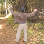
Hi everyone, I’m excited to present to you an opportunity to participate in a search and rescue (SAR) training event that I’m planning for the weekend of March 7th and 8th. I have a need for 8-12 mock subjects who act as the lost or injured people that the trainees spend the weekend searching for and treating. Normally we use SAR personnel for this role and I've decided to extend this opportunity to you so that you can have a chance to see what it is that we do and to give our members a more realistic training experience since they will not recognize you as they would a fellow SAR member.
Who we are:
King County Explorer Search and Rescue (KCESAR, or ESAR for short) kcesar.org
What we are doing:
This is a Course III, the sixth training course for new trainees which occurs over about 7 months, it’s the fourth overnight weekend for trainees. At this point the trainees have learned all their skills and this course gives them a chance to bring their newly learned skills into bigger picture action. Other participants are also doing advanced training including some of the leadership.
What you would be doing:
Your part will be to act a role based on the scenario, most often that will simply be as a lost person but possibly with a basic injury as a non-bleeding arm or leg injury (dislocated shoulder, broken arm or leg, twisted ankle, etc.) Based on the scenario you may be splinted and walked out or in case of an nonambulatory injury, packed out where we place you into a litter and carry you out (this is very comfortable, people sometimes even fall asleep.)
You will never be alone, you will have at least one well-trained veteran SAR member as a shadow, this person will be the team leader providing navigation, safety oversight, communications and other needs including providing a temporary shelter if holding for a while as well as generally keeping an eye on you. This person will hide during when the teams find you and watch the interaction.
Location:
This training will occur somewhere in King County but the location not is being publicly disclosed yet to maintain realism, the ‘solution’ side will only be informed the evening before, and many of my Facebook and some of my geocaching friends are SAR members.
Date and Times:
Early morning Saturday March 7th to about noon on Sunday March 8th. You can participate either a full or nearly full day on Saturday or Sunday morning with possibly an overnight opportunity based on interesting and planning issues yet to be worked out.
Requirements:
Be at least 14 years of age and fit enough and comfortable with traveling about 0.5 to 2 miles round trip off trail, mostly open forest, some minor bush whacking, log hopping and minor stream crossings, no technical terrain. Depending on the scenario, you will be in the field for a few hours to all day, or even overnight (I will work together to match you with a preferred time frame). You will weather specific clothing to maintain warmth and dryness for many hours in possible poor weather (rain, cold, possibly snow).
Pass a free basic background check completed by King County Sheriff’s Office (KCSO) to get a temporary Department of Emergency Management (DEM) card (provides insurance coverage). This is not overly strict, both the severity and the length of time since any items may be considered.
Need to provide proof of auto insurance or get a ride from someone that has it. DEM insurance covers travel to and from the site and they have this requirement.
Other Details:
I’ll hold at least one planning meeting in Bellevue about one to two weeks before to go over details, get to know each other, etc. While the meeting is not absolutely mandatory, it is highly recommended to attend. If you can’t make it, we will try to work around it.
The application deadline is Feb 20th to allow time to run the background checks.
If you are interested or have questions then please post here or contact me via private message or email me (not posting here to avoid spam).
Cheers,
Kurt
-
Here's another one that I'm posting for a friend:
This is a oldie (05/12/2001) located over in Burien: Slippery Root Cache GC931
It's been recently archived but the reviewer stated on the page that they are open to unarchiving it if it will be maintained. If you're interested please contact me and I'll arrange the adoption with the CO (who is very busy at the moment...)
Myself and at least one other person that I know of have made inquires to adopt this cache but have not heard anything back.
I responded to the two inquires that I received. I did make a mistake about my email address on my log to the cache page that has since been fixed, if you used that email, that could be the reason that I didn't receive it.
Please reach out to me again if needed
Shaddow.geo gmail.com
-
Here's another one that I'm posting for a friend:
This is a oldie (05/12/2001) located over in Burien: Slippery Root Cache GC931
It's been recently archived but the reviewer stated on the page that they are open to unarchiving it if it will be maintained. If you're interested please contact me and I'll arrange the adoption with the CO (who is very busy at the moment...)
-
I have an lahontan cache The Dust Upon Which You Now Stand GCP95X on the PCT near Snoqualmie Pass that needs maintenance that I have not been able to find the time to complete.
It's under a reviewer archive warning so the maintenance would need to be completed at the first opportunity though snowfall recently covered it for the season. A note to the reviewer may extend the window until spring.
If you're interested please post here or contact me at shaddow.geo at g mail dot com.
-
Still hoping the oldie cache is replaced (was it today by someone else with permission, I can't tell yet, a little confused) and maybe can find time to go up there. I'd have gone via the old trail but my knees will appreciate the newer one. Don't see any new caches yet but am sure that won't be the case for too long.
What cache are you referring to lam? I thought that all the caches up there are enabled and in place.
-
Go ahead Make my day!
My Earth Caches are Earth Caches in every sense of the word. I put my physical cache in the bottom of Crack in the Ground in a place where GPS signals don't reach so that people that are doing the Earth Cache will know that they are at the correct place to answer the questions. Several people have not found the peanut butter jar but have correctly answered the Earth Cache questions.
For my second Earth Cache I was the second finder of Mel Tuppers nice ammocan cache in Twin Crack. My Earth Cache long description is a full geology lesson with two simple questions from me and you have to answer one of the geology professor's questions.
The BLM developed the trail from the parking area out to Crack in the Ground. At least 5 times as many "ordinary folks" visit Crack in the Ground as geocachers to log the Earth Cache.
Whether you walk out to lift a rock to find a geocache or walk out and lift a rock to answer a question about the geology of an area, you are doing the same amount of damage to the environment which is negligible IMO.
When I was walking out to Crack in the ground with my peanut butter jar to develop the questions for the Earth Cache I met a cow coming out. She was leaving a lot more than footprints behind her. Mr. Bishop of the Lakeview BLM district had no problem with me hiding the peanut butter jar to aid with getting to the proper spot.
What are the gc codes?
-
I created a new cache on the Mailbox Peak summit (my close-by trainer of choice): http://coord.info/GC4M6PK. Originally I wanted to adopt the one that was there but the CO never got back to me. In fact, I believe _Shaddow_ is familiar with the situation.I was wondering if this could count for logging elevation gained. I know it's my own, but it was intended to be an adoption and still denotes my elevation gained (in fact, I'm doing this hike today and exchanging a trackable if the cache is accessible since there's still quite a bit of snow up there).I'll be sure to log the 3/4 way cache for at least that much gain, but I'm really hoping the summit cache can count. I'd consider packing my snowshoes up and taking the crest over to Dirtybox Peak to log that cache, but the final approach to that cache, IIRC, would be fairly dangerous when covered in snow and ice - at least going solo.Also, can we log a find on a cache we already found? I've done most of the peaks through the I-90 corridor with only a few left to do until about exit 47. I do visit the North Cascades on occasion and plan a summit bid for Rainier last this summer/fall, but the I-90 corridor is so close to home!
Turns out it was still buried by several feet of snow, so the 3/4 way up cache (didn't feel like going for the one slightly higher for little extra gain) will have to do anyway if we can log a cache we already found.I was wondering if this could count for logging elevation gained. I know it's my own, but it was intended to be an adoption and still denotes my elevation gained (in fact, I'm doing this hike today and exchanging a trackable if the cache is accessible since there's still quite a bit of snow up there).Welcome to the 50,000 Feet Challenge.
A qualifying trip includes finding a cache the traditional manner. Re-visiting a cache or checking on an owned one does not qualify.
The good news is that you'll visit areas and find caches that you haven't been to or found before.
Quoted from the cache page:
A lot of the hardcore ele junkies have already gotten most of the nearby caches so this challenge will be equally hard for them just in a different way as they will find it necessary to drive further and hike farther then they have beforeShaddow
-
I'm still looking for the virtuals that the BLM says are in there. Tell me again how walking to a virtual (and back) makes any less of a "geotrail".
The BLM established trails within the Badlands long before geocaching was invented.
I do have two Earth Caches on BLM land (Lakeview District) that I got permission from the BLM to publish. Each of my Earth caches has a physical cache associated with it.
Neither I nor Mel Tupper had to get permission to put in a physical cache in the Lakeview District.
I fully support the seasonal closure of Dry Canyon to protect the nesting birds.
I suggest that anyone that wants to try to stop this abuse of power call Mike Haske (or Doc Shepard) in the Portland office of the BLM.
No. Tell me how virtuals have the same impact.
Your Earth caches obviously aren't virtuals but physical caches. If they're in the area of concern the they should be removed. They may not have asked you to remove them for a very reasonable reason, that they didn't know that there are physical elements to what is almost always a virtual cache.
It seems to me that they are attempting to do their job of protecting sensitive areas. I don't see any abuse of power but rather a normal and healthy use of it. I understand that they've made a not unreasonable decision based on their charter that has directly impacted you and you don't like it. Instead what I see is a person who is angry that they can't put their personal agenda in front of the greater good.
Should I still call them? I can tell them that I think they are doing a good job with OUR land and make them aware of the physical caches that you're being sneaky about?
-
Here is a thread from 9 years ago which says they were banning them at that time. Are they now being banned a second time? Or has it taken them 9 years to figure something out?

I'm sure that you've never revisited any of your decisions
-
but now has 2 new female bosses.
Not sure why you bring that up and I'm afraid to ask
From the article:
The Bureau of Land Management’s Prineville District Office last week announced it is working with geocachers to have geocaches removed from the Badlands, Spring Basin and Lower White River wilderness areas, as well as land on nearby Horse Ridge and other lands deemed environmentally sensitive. Along with wilderness areas the lands have titles like “research natural areas” and “areas of critical environmental concern.” The removal follows nationwide BLM policy, banning geocache containers from wilderness areas.“Geocaching is absolutely a legitimate use of public land, but it’s inappropriate in wilderness areas,” Carol Benkosky, Prineville BLM district manager, said in the press release announcing the removal of the geocaches.
Seems very reasonable.
In all, the BLM plans to permanently remove 47 geocaches in Central Oregon and seasonally close 37 geocaches, meaning a total of 84 will be affected by the changes.Not very many caches, really. Though I understand that if you're the CO of one of the caches then it's much different and feels very personal.
Hopefully you can work something out with them
-
For many years we had an agreement with the Prineville BLM that there would be 13 geocaches within the Badlands RNA. This includes a long standing moving cache called Badlands Post Office. This was fine as long as Gavin (GovBigDog) was in charge of the Prineville BLM. Now the BLM under Molly's direction, wants to get rid of 84 caches.
There are a couple of well established trails developed by the BLM including the Flat Iron Trail that have caches close to them.
I asked for and got permission from the Lakeview BLM office to establish my Crack in the Ground Earth Cache and my Twin Crack Earth Cache. I did not need their permission to put a physical cache in the bottom of Crack in the Ground. I established the Twin Crack Earth Cache after finding a nice ammocan cache deep in the crack.
The last time I talked to Gavin it was to tell him that the gate on the road to my Stalag 13 Revisited cache parking spot had been ripped out by vandals. The BlM chose to leave to road open and not replace the gate.
I know at least 2 geocachers in the Bend area that are more angry than I am about this change in BLM policy.
The USFS has been our friend since the start of geocaching-the BLM not so much.
The only difference appears to be in the personalities between Gavin and Molly. Your issue is with Molly at the BLM, not the BLM.
Can you still reach GovBigDog? Maybe he can help you figure out how to deal with this new person. You may need to go above her head to her supervisor.
We had a very similar issue a few years ago in Bellevue where a young new hire was trying to make a name for herself etc and caused all kinds of issues. After getting her supervisor involved then things calmed down and eventually returned to normal. In the end, things were a bit different, but for the better.
A pain to be sure. But deal with it is the way to go, rather than taking one's ball and going home

 I'm intrigued, too!
Pocket Queries empty: bug or user issue?
in Website
Posted
Thank you!