


TmdAndGG
-
Posts
407 -
Joined
-
Last visited
Posts posted by TmdAndGG
-
-
42 minutes ago, kunarion said:
One day I might just stick one inside a sealed "bird house" stage, where there's no evidence that finders must scan the outside walls of the bird house with their phone. Don't tempt me.

Ooh, that's a good one


Where's the evil scheming frog when you need him?

-
 2
2
-
-
On 2/11/2021 at 10:42 PM, kilroy18 said:
Hello all. I want to create a wireless beacon Cache but I’m having trouble finding a Garmin chirp beacon. Can they still be found? If so, where?
https://buy.garmin.com/en-AU/AU/p/74811
Some of the other ideas are pretty good too, but just in case you want to use it, here's where you can buy a chirp beacon.
-
On 2/12/2021 at 3:17 PM, Viajero Perdido said:
But... try it without the mysteries-only filter.
I'm pretty sure I meant to say that
 On 2/12/2021 at 3:17 PM, Viajero Perdido said:
You don't want to miss the occasional masterpiece built with traditionals.
Wow, that's pretty impressive!
-
.png) 1
1
-
-
Here's a list of some good ones.
https://www.geocaching.com/plan/lists/BM311KC?sort=name&sortOrder=asc&skip=0&take=100
-
53 minutes ago, 2quigs said:
Just curious of what the advantages are in creating "Pocket Queries" as opposed to "Lists". Maybe it's in the filters. Lists can be created immediately; whereas pocket queries have to submitted. I've used both and I can't see where the advantage is.
We're phone cachers, but I'm pretty sure Pocket Queries are better suited to be uploaded onto a GPS. And like you said, you can filter for caches with Pocket queries, but Lists you would have to filter separately and add the caches to your list. Here are the help center links so you can try to spot some more differences.
-
Welcome to the game!
To answer your questions...
9 minutes ago, spokexx said:I love the hunt and find, but I'm curious, does it boil down to being honest if you've actually found the cache or not?
Technically the owner is supposed to check the log to see if all of the online logs match up with the logs in the cache, so you can verify (Most of the time) if they were actually there.
11 minutes ago, spokexx said:Could one just merely sit at their phone for an hour and mark as many caches 'found" if they felt like it?
Yes, but would that really fun?
12 minutes ago, spokexx said:Is it possible to create a cache where the hunter/cacher must take a photo of a QR code or enter a numerical code(posted at the cache) for the cache to be officially found?
No, that would be consider a ALR ( https://www.geocaching.com/help/index.php?pg=kb.chapter&id=107&pgid=823), and is not allowed.
Have fun!
-
2
-
-
On 2/1/2021 at 11:03 AM, HHL said:
Thanks, I was on the wrong track with solving it
On 1/31/2021 at 8:44 PM, GrateBear said:The cache is GCYF01. At least he gave a hint! If you can tell me what it is, I would appreciate it.
So basically what you would have to do is program it for every move to spell out the coordinates.
RT 90 FD 30 RT 90 FD 90 RT 90 FD 30 PU RT 90 FD 45 RT 90 PD FD 30
This code for a really simple number 3. Basically, this is giving the turtle super specific instructions on how to move the right ways to draw the number 3.
Turn RighT 90 Degrees, Go ForwarDs 30 steps, RighT 90 Degrees, etc.
What I'm trying to say, is that you can't really have an Encoder for it (I'm sure there's one out there somewhere, but I'd think the chances of finding it are pretty slim) , you have to act as the encoder yourself.
-
1
-
-
We run a Antivirus software and trust geocachers (Well, most of them), so I'd be willing to do it. I've done multiple puzzle caches that link you to a different website to get the coords. They tend to be pretty fun, mostly because you can do things you couldn't do directly on geocaching.com.
-
11 hours ago, GrateBear said:
As for ciphers, I'm still trying to find a way to encode using Turtle. There's a local cache that used that, and I found a decoder. Can't find one to go the other way.
I'm still not exactly sure what you mean by Turtle. My best guess is the Python Turtle.
Could you please tell me if the code looked something like this?
import turtle
pendown()
turtle.forward(50)
turtle.right(90)
turtle.left(50)
turtle.backwards(90)
penup()
goto(50,50)
stamp()
Or used any of those lines of code?
-
The ones that make me most suspicious? The ones where they admit they didn't sign the log
-
Just now, terratin said:
Do check that an iPhone 6s is still supported though.
It should be, it works fine on my IPhone5s
")
-
.png) 1
1
-
-
According to this blog post:
QuoteFor reasons unknown, this is often referred to as the flipping of the “Big Blue Switch”.
I was honestly hoping for something more exciting.

-
1
-
.png) 1
1
-
-
28 minutes ago, black_cat1 said:
This is a related question, so I'm not going to start a new thread- for your first cache(s), and your caches in general, do you tend to do a higher or lower D/T rating?
I would start with something lower (But please not a 1/1!), but it's totally up to you. I think our first hide was originally a 1.5/1.5, But then we ended up changing it to a 2.5/1.5.
Unless you're talking about our finds. I honestly prefer a higher D/T rating. Our first find was a 2/2 (Although I'm pretty sure it deserved a higher T rating). I believe the most common DT in general is 1.5/1.5.
-
1
-
-
They released the souvenir dates!
https://www.geocaching.com/blog/?p=83338/?newsletter=PM
Well, some of them
")
-
All I know is that there was never an actual blue switch.
I did a couple of searches, and came up with nothing non-related to geocaching.
But now I am wondering the story behind it!
-
2
-
-
We tend to leave un-activated TBs. We put them in small plastic baggies with a sheet of paper that says: Congrats FTF!
If the cache will fit one, we'll leave one. The TBs we put are usually just whatever we can get cheapest on Shop Geocaching
Sometimes the FTF takes it, sometimes they don't. We don't really care.
-
1
-
-
I like to go to the browse map, filter for only mysteries, zoom out, and look for clumps.
There are a lot of geo-arts in Florida (In my opinion). I'll get you started.
Here is the first cache (Or a random one
) of each geo-art. Just go to the map and look in the surrounding area for the rest.
https://www.geocaching.com/geocache/GC6517Y_rs-1-you-cant-always-get-what-you-want
https://www.geocaching.com/geocache/GC68GBT_1-anchors-away-uss-enterprise-cvn-65
https://www.geocaching.com/geocache/GC5F4N1_thurman-munson-new-york-yankees
https://www.geocaching.com/geocache/GC5P2EW_bobby-doerr-red-sox-1
https://www.geocaching.com/geocache/GC7VYBT_house-of-mouse-1-mickey
https://www.geocaching.com/geocache/GC70YFH_01-giraffe
https://www.geocaching.com/geocache/GC7HTED_banded-peacock-butterfly-1
https://www.geocaching.com/geocache/GC7GDC3_largemouth-bass-geoart-series-01
https://www.geocaching.com/geocache/GC6FM4B_perdido-river-wmd-fl-sunshine-state-geoart-1
https://www.geocaching.com/geocache/GC6AZRA_apoxee-gator-run-1-alligator-facts
https://www.geocaching.com/geocache/GC7234A_airplane-1
https://www.geocaching.com/geocache/GC7N5V0_beccas-cats-series-1
https://www.geocaching.com/geocache/GC4ZQJC_yellow-submarine-rubber-soul
Have fun solving!
-
1
-
-
Have you changed something? It appears to be looking fine on the Android GC app.
It's possible it's just a IPhone problem. I'll have to check it out on mine.
-
59 minutes ago, thebruce0 said:
I use it all the time. Yes, even in deep forests where satellite imagery is uniformly green with no landmarks. It's not the imagery I'm referring to, but the approach to locating a waypoint from a birds eye view vs 1st person. It's like digital vs analog. In birds eye, your waypoints are pinpointed at mapped locations, like anchors. Sure, your personal location may waver as it settles by gps, but it's like you're bearing down on an unmoving object, gz. In compass/first-person mode, you only use your wavering location combined with the uncertainty of compass direction, and your destination gz wavers with both location and bearing; no anchor.
I just find birds eye SO much more reliable, especially if gps reception is poor. Personal preference after 12 years geocaching with the smartphone
Yup, I %100 agree. I rarely ever use the compass.
I especially like it for finding trails, so I don't have to hope the trail that I choose is the right one.
-
6 hours ago, rustynails. said:
Never ever trust a computer.
OT, but I trust computers more than people.
-
1
-
2
-
1
-
-
6 hours ago, Ragnemalm said:
In what context? When, why? After how long?
(Sighs...) There's a whole
argumentdiscussion on it, which is what I assume SwineFlew is mentioning... -
11 hours ago, SamLowrey said:
I use an iPhone 6 and it seems to work fine. I use the Geocaching app.
I have an IPhone 5s, and it works perfectly fine for caching. I've been using Cachly.

-
1
-
-
After looking for what I consider way too long, I finally found it!

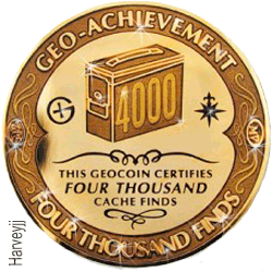
I love it when the forums drag me into finding stuff that I'll never use for myself
Here's the 5000 one too.

-
1
-
-
10 hours ago, thebruce0 said:
Granted it's kind of a sky-is-falling perspective, but you could also say if they really wanted newbie input, they could filter who they send the surveys to for those under say 1000 finds. ...but then that leaves out the 1000+ geocachers! Well, so do the questions (as they feel).
Maybe they should make 2 surveys, one for people with <100 finds and one for people with >100 finds? Then the questions could match the find count a little better.
I just thought of this right now, and honestly that sounds like the best solution to me.


.png)
.png)

.png)


Certitude: How to get the coordinates for a station shown to the user.
in How do I...?
Posted · Edited by TmdAndGG
A lizard sneezed in a faraway country, making me forget to add information.
I'm a little unclear about the first part of what you're saying, but I believe this is what you want.
To get there, go to certitudes.org, sign in, enter your GC code into the banner towards the top, and click the "Create my certifiable solution" button.