


Triple Crown
-
Posts
520 -
Joined
-
Last visited
Posts posted by Triple Crown
-
-
I don't know if I'm doing something wrong, but still have not received an email telling me the queries are ready.
Once you have submitted your query, you need to check the box for the current day of the week to tell it to run. The box should stay checked until it runs, then the time/date it ran will appear in the right column on the 'Your Pocket Queries' page.
-
ok, i was wondering why you would want a new pocket querie weekly like they have an option for but now i see that its for the logs. Im having trouble recieving pocket quries, I did it on the site and it said it was succesful, but its not sending to my email. How long does it normally take to get one?
Pocket queries with less than 500 results get emailed to you, with more than that they email a notification that they are ready to download and you have to go to the 'Pocket Queries Ready for Download' tab on the Pocket Query page.
Usually PQ's are generated in less than 5 minutes, but occasionally they take longer (like until just before midnight)
-
So lets say i go to the shore, i find 50 caches, i can just re-load that same file and the filter on gsak will re-load all those caches, but will remove the 50 that i just found off the device?
There are a couple of different ways to go about this.
GSAK allows you to have multiple databases, so I keep 1 for my home area, another for my finds and others for when I'm planning a trip. Your Oregon can hold up to 5000 caches in up to 200 files plus an unlimited number of POI's.
I run several different Pocket Queries (I exclude found caches) and load them all into my unfound caches database. Then after I go caching I mark the ones I found in GSAK and then move those to my 'My Finds' database then I re-run those Pocket Queries and add them to my unfound database so that I'm always updating the unfound caches with new logs.
There is a fantastic macro called GarminExportBeta that allows you to export not only the caches in your database, but all of your finds and hides (as POI's so there's no limit)
-
Having an Oregon 450 which includes a 3-axis compass, I'd say it depends on the type of the compass and how well it works. The one in the Oregon is totally worth it: reliable and accurate. I'm not so sure if the same is true with the 2-axis compass that the Vista has, but I'm only guessing here as I've never used a unit with a 2-axis compass.
The altimeter I find pretty useless. It's nice to have a steady elevation reading, but I don't care much about elevation, so I wouldn't need it.
The 3-axis compass in the newer high end units works quite well even when standing still. The older units require that the unit be held level (not convenient for viewing) and the electronic compass just doesn't work very well.
-
I am shopping for my first gpsr and have been looking at the Vista HCx and the Legend HCx. Is the magnetic compass and altimeter in the Vista worth the extra 50 bucks? Also what maps would I benefit from, preferably free. Where do I get free maps?
In my opinion the extra cost for the electronic compass & altimeter is not worth it. You can get excellent free topo maps from GPS File Depot and you can get free routable street maps from OpenStreetMap but I do really like the Garmin City Navigator NT (DVD version so you can put it AND topo maps on your own 4GB microSD card together)
-
 Cool tools! I really like it!
-
I had a similar experience. Just to be sure I checked my geocache_visits.txt file with notepad and verified no dupes there. Next I deleted all my field notes and uploaded them again and the second time I got the right number and no dupes. Weird.
-
So we upgraded to an Oregon 450 a couple months ago from our eTrex Legend HCx very excited for our new toy. However, there are some issues that we are having that mostly derives from two things. I have checked the wiki page for the Oregon 450 and tried to find an answer in the forums here (although, I didn't scroll through all 40 pages that have 450 somewhere in them)
1) the eTrex used to keep a list of finds on the calender day. The 450 doesn't seem to, in fact the calender just seems to...you know...tell the date. Is this an option that I can enable and I just haven't figured out how to do it?
2)Our geocache finds seem to organize by proximity not by recent find date, how do I switch this around?
3) And since I got you reading already, i seem to have issues getting all the caches to load in properly. I used EasyGPS yesterday and it didn't load all the files I sent to it and even then, some of the files were stripped of their information (description etc...). I didn't go over the limit for the 450 (there were only 74 files loaded) as I know that if you reach the max it will randomly not load some with no rhyme or reason.
Thanks much
Jason
The Oregons are a little different from the eTrex and 60 series...
The text file geocache_visits.txt will show all your finds with time & date & field notes. (viewable only on a computer)
The only way to view your finds on the unit is by proximity.
There is definitely a quirk when loading GPX files. For consistency, I always first delete the old GPX files, then disconnect and reboot, then re-connect and load the new GPX files. Works every time. If I just delete the old files and add the new files in 1 step I frequently find that lots of the caches are missing.
-
Doesn't the Garmin 24K Topo INCLUDE all of the streets?
You should be able to install all of that one plus the City Navigator NT tiles from the areas not covered by the topo maps.
On my 60Csx I had all of the CN plus 1:24k GPSFileDepot topos of California and 1:100k for most of the Southwest all on my card.
Definitely use a card reader/writer, it's significantly faster than writing to the card while in the unit.
-
-
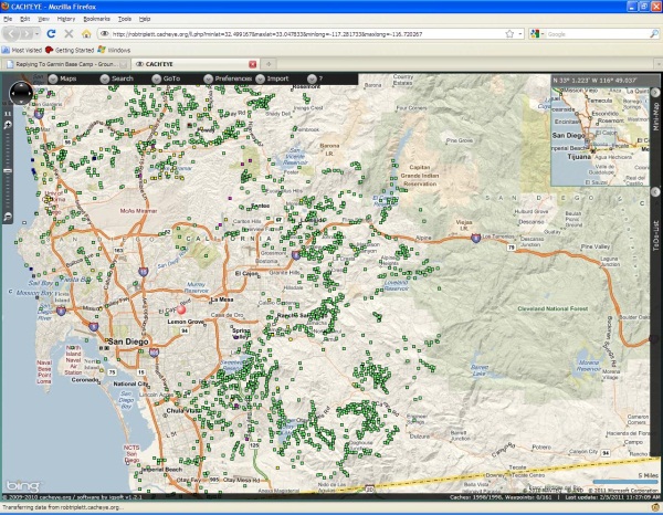
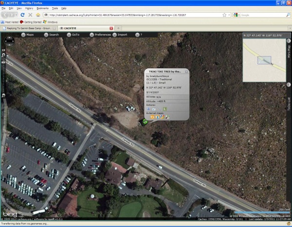
I use GSAK to filter caches then view them all on a map with Cache'Eye. There is even a GSAK macro (myCacheEye.gsk) that automatically exports your caches. The resolution of the aerial images is fantastic too!
Here are some screenshots...
-
You can visit Kill Bill's Church GC1BWC1 in Lancaster.
-
Hi,
I have the skills, I work with electronics =) The big problem is to get a LCD to replace it :S
If i could get one i would replace it.
I thought Garmin would fix any problem for $99.
-
I am looking to buy my first GPSr. I have been caching with my phone for about 4 months, and have had pretty good luck. I am looking for something a little more solid, with some battery life and not quite so fragile as my Blackberry. After lots of review, I am down to either the Oregon(300, 400 or 450), The dakota 20 or the Delorme Earthmate PN40. I am looking for a little advice from the community about which you think I would be happiest with. I am looking for mostly geocaching with a little biking as well. Thanks!
Patandkat
Well I'd narrow it further to the Oregon 450 since the 300 & 400 are discontinued. The Dakota 20 is slightly smaller overall but I like the bigger screen on the Oregon. I tried the PN-40 and it's a very good unit and the PN-60 is even better, but in the end I went with the (now discontinued) Oregon 300. Familiarity with Garmin products was a factor for me, but the clunkiness of the DeLorme settings and that I hated their mapping program finally swayed me.
You might also consider the Garmin 62s which has all the paperless features and the screen is a little easier to read (non-touchscreen) if you're doing a lot of biking, since it's hard to adjust the screen angle once on the bike mount.
-
Next question - is it possible, when using the compass screen, to have the screen tell me what waypoint I am searching for? It is helpful to have your destination listed.
one of the possible settings for the data fields is "waypoint at dest", which may be what you're looking for. the "small data fields" dashboard is probably your best bet.
Yes, you can touch each of the data fields and select what information you want them to display. The most useful are Waypoint at Destination and Distance to Destination, for the other fields I have Time of Day and Bearing to Destination.
-
I'm having some difficulty understanding the "Compass" command on my Oregon. when I am searching for a waypoint, not a geocache.
I begin by selecting "Where to?" and I select a waypoint. Then I select "Go". Then I return to "Compass" but the waypoint I just selected is not shown on the "Compass" screen. Instead, a geocache that I had been looking for days ago appears. How can I have the "Compass" show the same location as my "Where to?" selection? In other words how can I tell my Oregon's compass to search for a waypoint, not a geocache?
The easiest way is when on the compass page, press the small dashboard button in the lower right corner and then select large or small data fields instead of one of the geocaching dashboards. Then the arrow will point to the waypoint you're navigating to. Don't forget to switch back when you want to navigate to a cache again.
As an alternative, you can set up a separate 'Waypoints' profile so you don't have to change settings within a profile, just change profiles.
-
I'm an experienced cacher (209 finds and hides of my own), but have been using a garmin nuvi. My boyfriend would get frustrated with it's lack of accuracy and decided to buy me a GPSMAP 60CX for Christmas. I've read the reviews and people seem to love it and claim it's so easy yet I'm completely lost! I have figured out how to load caches onto the device, but do I need to download/buy additional maps to get street level views? I live in Baltimore so having the street maps make all the difference. I also have a MAC which isn't helping the process since garmin does not have mac capabilities from what I can tell. I have tried loading the "trip and waypoint manager" but it wasn't recognized on my mac so I loaded it onto a friends PC, but still couldn't figure things out. I am so used to a normal car GPS that this type of GPS has set me back to novice level. Thanks in advance!
Unfortunately the Garmin hiking units don't come with street maps other than major freeways. You can purchase street maps for the US & Canada (City Navigator) for around $70 online or you can get free ones at www.openstreetmap.org and free topo maps at www.GPSfiledepot.com
-
I do a little treasure hunting and while in the field of interest I record via GPS, markers, treasure signs, etc. and also write them down in notebook.
I would like to be able to go home and put these markers on Topo map or older Plat map and then be able to draw lines from
one marker to the next.
Can NE 1 here recommend a GPS Mapping Program that would allow me to import Topo maps and then be able to mark points
and draw lines on those maps in the program?
Thanks in advance
Garmin MapSource or BaseCamp should work. You can probably do it in Google Earth too.
-
The next generation of your GPSr is the Garmin 62s, same form factor but with all of the paperless features and you can load it with GSAK. It has the same features as the Oregons (except the touchscreen) but some people find the screen easier to read in bright light.
I had the 60CSx and loved it, then got the DeLorme Pn-40 but traded it in for an Oregon 300 (now discontinued)
My next unit will be an Oregon 450 since I really like the touchscreen.
-
why has no one replied or even looked at this? 0 reply's 0 views ........ impossible
You might look at c:geo but using it might violate Groundspeak's Terms Of Use.
-
For those not on FB......
It's with a sad heart that I have to say that we lost another Geocaching Pet and family member....the Flagman family had to say goodbye to Max yesterday. Our hearts go out to Tom and his family......
Another sad lose of a dear pet.
Doubly hard to come at this time
of year I'm sure.
Heartfelt condolences,
Harmon & Sandy,
SD Rowdies
Thanks, you guys... For all of my friends who aren't on FB, here's a link to a photo tribute of Max's wonderful life. We will miss him terribly...
 :( Max (the dog) So sorry to hear about Max. That's a very nice photo tribute.
"A good dog never dies. He always stays. He walks besides you on crisp autumn days when frost is on the fields and winter's drawing near. His head is within our hand in his old way." -Mary Carolyn Davies
-
I have just received an oregon 450 and have used gsak to upload waypoints to it but I am not getting the hint sent to the gps, but the full description and logs are there. I am hoping to not have to load them with poi loader as I have plenty of room for all the local caches with the available memory. I tried using different macros but then the caches are loaded like poi. There is no option in the gps setup that lets me add the hint like I would like to.
Thanks for any suggestions,
John
You can't see the hint until you are navigating to the cache. Select a cache, then 'GO' then when you press the Geocache Icon you should see the 'Show Hint' button.
-
Just ordered the Zagg- can't agree more, better safe than sorry! Used the 50% off coupon as well.
Thanks for all the help- is applying the Zagg a hassle? Many bad reviews I've seen are generally from those who either didn't read the instructions or some sort, but it seems relatively simple.
It's pretty easy, just make sure you have good light & clean hands and use lots and lots of the spray!
-
Just got my Oregon 450 from Gpscity for only 239! Great deal, replaced my old triton 2000.
I've heard that the new firmware isn't doing so well- what is the safest version to upload to it, straight out of the box?
Also, what screen protector, if any, do you reccommend?
Any batteries you reccommend?
Thanks for all the help!
Run the WebUpdater to get the latest non-beta software.
Get the Zagg screen protector. It makes your screen almost impervious to scratches. Well worth it!
Need help with GSAK and 450
in GPS technology and devices
Posted
GSAK is going to take some practice but the help forums are terrific and the moderators are very responsive.
For your current filter question, choose a cache near the center of the shore and right click on it to open the menu, then select 'Set this cache as the centre point' GSAK will then re-order the database for you.
Next click on the Set Filter button at the top (magnifying glass icon) and in the Distance field change it to 'Less than or equal to' then enter 30 miles. GSAK will then display all caches within 30 miles of your center point cache (which will be diplayed in the top margin of the Set Filter dialog box)
Finally, send the caches to your GPS or export them as a GPX file which you can share with your friends so you all have the same caches loaded.