Triple Crown
-
Posts
520 -
Joined
-
Last visited
Posts posted by Triple Crown
-
-
I have a new 450t I've added a PNY 4GB microSD to. I am a little surprised that when I connect to my PC I don't see this extra memory for the mounted GPS and only the base memory that the 450t has. So I wonder if maybe Garman hides this extra memory from Windows viewing or if some other problem I might have... Thanks.
The memory card will show up as a separate drive.
-
Garmin wants people to buy chirps instead of playing free Wherigo games.
IMHO the Wherigo is going nowhere. The user interface to make a cartridge is clunky & difficult to use, which means there are very few Wherigo caches out there and (it seems) very little demand for them. Also you can get a Wherigo player on your Android phone, so there's no urgency or exclusivity for Garmin to add it to the new units.
-
Hi all
I have done 100 caches using an IPhone 3GS
I have now bought a Garmin Oregon550 and on first inspection wonder if I've done the right thing so I'm asking the forum if I'm missing something
On the iPhone I pretty much relied on the satellite view not only when near the cache but to see paths etc and cannot see this option on the unless I need to purchase add on maps?
Someone please show me where I'm going wrong
Mike
You'll need to get maps. You can also get the aerial imagery Garmin BirdsEye if you want. You can get great free topo maps at GPS File Depot I like Garmin's City Navigator maps, but you can also get free street maps from Open Street Map
-
Expect more price drops on all of the handhelds...the new Garmin Montana arrives in a few weeks.
-
Hi There,
I live in Ontario Canada and am wondering which unit you would recommend?
Thanks!
The PN-60 is the top of the line DeLorme while the Dakota 10 is the bottom of the line Garmin, so I would choose the PN-60 of those two, however for me personally I would prefer the Garmin Oregon 450.
-
Oregon software version 4.18 Beta
http://www8.garmin.com/support/download_details.jsp?id=4741
Changes made from version 4.17 to 4.18:
Fixed issues relating to WAAS performance.
Fixed issue where the device would not regain a GPS signal after losing the GPS signal in a tunnel.
Fixed an issue where the enabled/disabled option for custom maps could not be changed when two or more BirdsEye™ Satellite Imagery providers were on the device.
Problems with the software may be reported to OregonBeta@garmin.com
Yay! Thanks for posting!
-
I've been having a fair amount of difficulty migrating from a 60csx to a Oregon 450t.
I haven't figured out how to display all my loaded caches and waypoints onto a map. In other words, when I am caching I want to visually see all my loaded caches and waypoints when I open my map. I am able to display a single GC when I open that particular GC. But sometimes I want to see all of the preloaded GC's on a map when I am hunting.
What am I missing?
You should be able to see them all if you zoom out far enough AND you have your profile setup to display user waypoints at a reasonable zoom level. Setup/Map/Advanced Map Setup/Zoom Levels/User Waypoints -- I have mine set to .5 miles. Just experiment to see what works best for you.
-
If you want the 24K maps preinstalled, you can find an Oregon 450T in the UK for less than £320 on Amazon over there.
I think the Oregon 450T has 1:100K topos pre-installed.
-
The Oregon 450 is now down to $189! Linky
-
The OP did exactly the right thing, and offering to return the cache to the niece by mail is very gracious. Worst case, the cache is out of service for a week or two...you posted a note explaining what happened, no harm, no foul.
I've been asked to remove caches by police, neighbors and employees and have always complied. Better to remove it and return it to the owner than to get into an unnecessary confrontation. You did the right thing for the right reasons. Carry on!
-
Thank you very much for the feedback. It's good to have a heads up about the learning curve. I'd rather be aware of it now than once I get the GPS home.
Having never worked with or used a GPS in person, I have a few naive questions...Would not all units have a compass(not just high end ones)? That seems like it would be a pretty basic feature. Also, should i be purchasing any additions to go with the GPS? Maps? Memory cards? I've been reading about people needing to buy maps. Does it depend on which GPS you buy?
All units will have a compass rose, so the arrow will point accurately when you are moving. A step up is the 2-axis electronic compass which can still point if you are standing still, but you need to hold it in a level attitude, the latest & greatest is the 3-axis electronic compass which works all the time in any attitude---definitely a big improvement.
Most hiking GPSr's come with very basic maps...major freeways and bodies of water. You will need to get better maps, you can either purchase them (easiest but most expensive) or you can get them for free at places like GPS File Depot or Open Street Map
Also you will probably want to get a memory card, but those are cheap for ones that hold 4GB or so.
-
Slipped up" huh? Why I oughta ...
Absolutely, thanks for checking in with a good critique.
Put it all down to cheap labor and my marriage to an
ex-nun, you know; domestic chores-wise.

Here's the official thumbs-up from the driver after his victory spin.
Note: A young guy would have celebrated from the rooftop and
then back-flipped to the trophy presentation.
Isn't that how he got hopelessly wedged into the window opening? That and having an 'over the wall' beer guy?
Anyway it's not like it's mixing Judy Garland and Shirley Temple.. oh my!
How do you like my version... Can't complain without offering a fix, I always say..

I need some more practice... let's just say I know a little about working with images and video... but I'm far from gifted if you know what I mean... this was also quick and dirty work...
Nice to see you again... get a chuckle out of watching your graphic attempts to get lynched by friends... I don't have any so I don't care much... The guys that play over in the Where in Canada quiz (Canada forum) seem to think I'm a whiz at that... I don't mind much, but I've only not found 4 or five out of hundreds... often first (more than I claim for sure, but the hider knows)
mostly using only the pic and Google Earth... fun game... I just put up an offering this morning... got to go get lunch... first in days.
Doug 7rxc 73
Aha! another Forum Photoshop guy, how good is that?
Do stop by now and then, I need all the help I can
get to shield me from the slings and arrows of my
fabulous Geocaching pals.

Hey John, how's this for a pit crew? Imagine a pit crew
like this with a combined Geocaching find-count of about
150,000 smileys! One thing for sure, that bunch of ol'
gals always make me smile.
Note to Self: Hmm, does that car make his butt look big?
 Now THERE'S a pit crew that will make your motor run!
 -
I would disagree with that. I have a CN card in my Oregon and was able to write to the Garmin/GPX folder when I had the Oregon hooked up to my computer. Strangely enough it didn't read the gpx file. I haven't gotten around to testing it again and I don't speak for all cards but mine is writeable.
Also remember that these cards can be updated (for a fee of course) so if they are not writable then how does that occur.
I would suggest the next time you hook up use the explorer to look at it and try writing a gpx file to /garmin/gpx and see what happens.
You were able to write to the Garmin/GPX folder on the CN microSD card? (the same folder is also on the unit itself)
Interesting. Were you able to see the GPX files on the card? (Trying to figure out why it could be written to but not read)
From the Garmin site: Reduced price map updates are not available for these cards. If you want to update the maps, you must purchase a new card that includes the latest map data.
-
I am just wondering, if you use a pre-loaded SD card for your maps (Oregon 450t), can you still save the GPX files to the memory card?
No. The pre-loaded cards are read only.
-
Hook your Garmin up to the computer and use My Computer to look on your unit and delete the gpx file as StarBrand suggested. You will not see the caches, just the gpx file.
It worked, thanks. Am I the only one who finds this clumsy?
Yes. Now turn and face Olathe, KS for the required kowtowing before they release another bug, I mean feature.

-
For OSM, is there a way to easily download all of the US or just the 48? Or do you have to select each tile for the country?
Use the pulldown menu at the top to select an entire country. It's much easier than selecting all the tiles.
When I select the United States, nothing gets selected. When I select a state, that state gets selected.
Hmmm, not sure why it does that, but it did that for me too. When I select European countries it worked as advertised...unfortunately I'm number 1020 in the queue to get my maps and they're saying 4.3 days. Might have to do it a state at a time I guess.
-
At the risk of posing a stupid question - anyone know how I reset the elevation plot and odometer on the Oregon 450? I found the Reset option in the Setup but that only resets the trip data.
You need to clear the current track memory to reset it. Go to Setup/Reset/Clear Current Track Memory.
-
Another question please.
I understand there is something called birdseye view.
But I think there is another way to do it by photcapturing pics from google earth satelite pics.
1. Can I do this and add sat-pics on areas that I drive in a lot?
2. Has anyone had a great degree of success or failure doing this?
3. Does it make the unit run slower?
4. Did they fix the bug with the firmware update whereby the peeps lost the
streetnames?
5. Can I place such maps on the unit itself, or do they have to be on the SDdisk?
Newb questions i'm sure. sorry.

The Garmin BirdsEye Imagery is an easy to use method of getting pretty good satellite imagery onto your GPSr but it cost $29/year for all you can download, and once you download it you own it forever. The alternate method is a lot more work, but it is free. Discussion here.
Maps are maps, and they shouldn't make the unit run slower, but most people store them on the microSD cards because they do take up a lot of space.
-
For OSM, is there a way to easily download all of the US or just the 48? Or do you have to select each tile for the country?
Use the pulldown menu at the top to select an entire country. It's much easier than selecting all the tiles.
-
Ok. I'm very impressed. So.. there's really no need for the 'garmen brand' maps I take it. Will my oregon 450 be able to hold a significant amount of maps? or will it be limited? I truly have no understanding of how this works.
Also check out Open Street Maps for routable street maps.
For hiking & caching you'll want 1:24K topo maps to get enough detail. A 4GB microSD card should hold all the street maps you need and a good chunk of the country in topo.
-
After installing the Beta 4.16, my Oregon 300 did power off by itself lots of times, when starting to navigate or going into the waypoint manager.
That has never happend to me with any version before.
Reinstalled the Beta 4.12.
Having the same problem. Working with geocaches is fine, but selecting 'Waypoints' causes an immediate shutdown. Message sent to Garmin.
-
Very sad news to report....

GRUBERT, CARL ERNEST 1942 to 2011 Born in Illinois. Family moved to San Diego in 1949 where Carl remained until his death. He married Stella Elena in 1964. Two children were born of their union. Carl served proudly in the military. He worked over 33 years for Pac Bell, never missing a day of work due to illness, and completed his college education during that time. Carl started at Pac Bell as a linesman and worked his way up to engineer, while going to school and raising a family. Carl was a fitness fanatic before a "healthy life style" became popular. He was known for his incredible endurance in running, biking, hiking, fishing, and geocaching, etc. Anything that involved physical activity. Carl just finished his last marathon, crossing the finish line in Heaven. Carl is survived by his beloved wife, Stella; son, Carl (Ashley); daughter, Laura (Jim); sister, Carleen (George), and two grandchildren, Joseph Street and Ariel Grubert, and large extended family. Memorial services will be held on March 26, 2011 at Del Cerro Baptist Church, 5512 Pennsylvania Lane, La Mesa, California, beginning at 3:00 p.m. In lieu of floral arrangements, please send donations to the American Cancer Society or the American Diabetes Association .
RIP General. You will be missed...
I never got to meet the General but he was always helpful by email and always game for a new cache in his neighborhood. Sad to lose one of the good guys.
-
New to geocaching. Have found 2. Need some advice on downloading to my GPS. I have Garmin Oregon 450. Have gone to the Hide and seek cache page and by using parameters found about 1050 caches to download. Problem for which I am seeking help is that I have to do it page by page with only about 30 per page. Will take forever. Would like to load larger area so I can hunt when traveling. Also, hints don't seem to be loading. I see them on my computer, but when I push the hint button near the cache I am always told no hint.
Help with either issue would be greatly appreciated.
Since you are a premium member, you can use Pocket Queries which will allow you to download up to 1000 caches at a time complete with full description, hints and logs. You can run 5 of these each day!
-
This should read as.... modified the way .jnx files are handled to make the current firmware patcher inoperable.
At the risk of sounding incredibly ill-informed, what are .JNX files and what have I been missing?
BirdsEye aerial images are stored as .JNX files


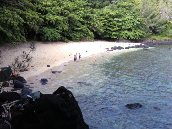
Maui & Kauai
in West and Southwest
Posted · Edited by Triple Crown
On Kauai I really liked Queen's Bath (GCTHC0) and Sea Lodge Beach Cache(GCHNA0)(pictured)