

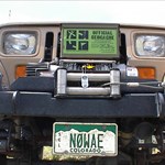
n0wae
-
Posts
292 -
Joined
-
Last visited
Posts posted by n0wae
-
-
I think C.A.C.H.E. has become like a virtual cache and gone locationless. But what does one expect when any of the PTB"s of C.A.C.H.E. never show up at any of the events in this state other than the big one in the Springs or their own events.
There are small enclaves of dedicated cachers in this state that don't like the crackdowns on virtuals and other subjective and unclear guidelines so they will continue to do their thing and cache on in their own way. And have their own version of WOW, even though others think its mundane.
One might even wonder why no one other that this old controversial, opionated and stubborn cacher is the only one to post to this topic to date. Because as we say in Gaelic, a language that the clergy doesn't understand.
Tha Mi Fo Churam.

Sounds to me like you took this thread to post your own aggenda!
So anything that isn't politically correct is an agenda? I don't think so. Tahosa probably speaks for many that just prefer to stay in the background. Most cachers choose to stay out of politics to ovoid the usual criticisms when they dare express their views. The bottom line is that when something is done right it usually works. No one including myself likes to fight city hall. I'd rather go my own way and do my own thing. I'd guess that the majority of cachers (lurkers) feel the same way.
-
Guys you have it exactly backwards.
All the virtual cache becomes is a waypoint on the way to the micro at Wal-Mart. It does take away from the virtual.
Virtuals are not my favorite cache. I'd rather find a box. But if it's not appropriate to have one then why ruin it with a crappy multi?
I know I'm not going to convince either of you, but trust me that making a cache a multi doesn't magically make it better, and if you change the focus of the cache you change the experience. The cache experience is the owners prerogative. This site lists caches, or it doesn’t. It should end there. Not with suggestions that do nothing for the cache experience. Of course the bias against virtuals and the subjective nature of them make that virtually impossible.
I know what you're trying to get across here RK. When I'm trying to enjoy a meal at a restaurant I don't want an employee running a vacuum cleaner. To me the intended atmosphere without distractions is important. To me the multi and vacuum cleaner would detract from the theme of the desired atmosphere. I guess others including the vacuum operator think otherwise. Oh well, such is life.
-
Hey Sax,
You guys are having way too much fun. Mrs n0wae and I have reserved site #37 and plan on attending this Smurf event. We understand you have ordered Smurfy weather but we will be bringing a pop up trailer with heater just in case. (Some rumor about frozen cachers last year or something.
 )
) -
This cacher has over 600 finds. I wonder how many are like this one:
 Spent 2 nights up there, and a lot of time out on the viewpoint. Think I know exactly where it was. Even went down on the saddle and climbed around in the rocks and boulders looking for any remnants that a human or animal might have thrown down there. Nothing. I'm going to log it anyway, and then recommend that it be archived
 -
I had a rather detailed dream about caching last night and was wondering if that was weird...but after doing a thread search I see I'm in good company!
In my dream I was with a large group of cachers broken down into two man teams doing a multi. My team was crawling in a cave with helmets and headlamps ahead of another group. The cave exited into a motel room. This made sense in the dream somehow. (Must have been a Vader cache and he wanted everyone to have a convenient place to clean up!
 )
) Anyhoo my team was doing a bearing & distance to find the next container and we were having a problem. In frustration my team tried a back azimuth which led us to a bush where we found a green cardboard box with the next clue. (must not rain here) We quickly put it back because we could hear the team behind us getting closer. .. Then we realized neither one of us wrote down the info so we had to retrieve the little cardboard box again. (In a panic now!
)Then the dream switched to a train switch yard with lots of trains and workers. I had a clipboard and was making a chart of the rail switch indicators. In the dream the colored indicators were very tall and they could be seen above the power lines.
I charted 3 of the four banks of indicators but it was getting too dark to see. I then approached a train yard worker and asked for his help. He was enthusiastic and was even double checking my work so far. Then I woke up.
Wow! Have I been caching to much lately or was it my nightly nightcap of wine?

-
I hope it doesn't put the OP off from posting in the future.
Something that a lot of you should think about. Your right of course but using that as an excuse to be negative doesn't do the sport any good. There *is* a reason why we have a lot of lurkers out there that won't post anything... Such a shame.
-
VHF & UHF can be heard 60 miles or more away but there are many variables like antennas, power, and terrain. I've talked to my son-in-law 50 miles away with a HT running 5W but I was on the top of one of Colorado's 14K foot mountains with no obstructions. While hunting in dense woods the same radio was only good for 8 miles.
If you upgrade your license to General you can use most of the HF bands. These frequencies are good for thousands of miles if conditions are good. It's a lot of fun to talk to Hams that live in other countries.
-
I've got 8 four wheel drive caches here in Colorado and will be adding more to the 4x4 series this summer. My first is the hardest of the series and is GCG8E0. All of my four wheel cache names start with "4x4" but for some reason the keyword search doesn't find them. I've also added the 4x4 attribute but not sure if you can search for that either. Come to Colorado and we'll go wheeling!
-
What a great story and heart warming response. Makes me proud to be a member of such a great group of people.

-
Imajika,
Sorry to hear about your medical problems. I wouldn't worry about your caches unless you are notified about a problem. Cachers are pretty Good about giving the cache owner a heads up about any cache problem. If you get such an e-mail let me know and I will do my best to take care of the problem for you. (Your humble volunteer.) Get well! - Eric
-
I don't think I've got a LTF yet but I figure that's just blind luck due to the many "fish bowl" caches I've done. I wouldn't feel guilty if I had been LTF on these type of caches. The cache owner has to understand that if he places a cache in plain view of say a large apartment complex that sooner or later a muggle is going to be looking out a window and observe caching activity. It doesn't matter how careful the cachers are with these "high risk" cache locations. It's just a matter of time before the cache disappears.
Now on the other hand if I was careless... Didn't scan my surroundings for muggles (that I could see) or didn't properly re-hide the cache then I *should* feel guilty if the cache went missing.
-
Welcome to Geocaching! Some of us frogs never grow all the way up.

-
Hello from Longmont, CO. We're active cachers that like to camp and 4-wheel drive in the summer months. We're in the process of putting in a new V8 engine in the jeep now so the rig will be ready for the 05 jeeping season.
Ooh. What kinna Jeep and what are you putting in it?
I'm from Pueblo and have a CJ5 with a 289 in it. I have a set of FSJ Dana 44's to go under at some point as well. Yum.
Yep, JPN is a fun way to go caching in Colorado. We can enjoy two hobbies at the same time. I don't want to de-rail the thread so I'll send you a PM with the scoop on my Jeep project.
-
Hello from Longmont, CO. We're active cachers that like to camp and 4-wheel drive in the summer months. We're in the process of putting in a new V8 engine in the jeep now so the rig will be ready for the 05 jeeping season.
-
I like history and virtuals. I would much rather do your virtual than the many lame lamppost micros that get approved with ease. The bottom line is that we don't make the rules so we need to adapt. Instead of a multi you could always make the sights that you want them to see as optional for "extra points". The people who care will earn the points and those that don't care won't. (No need to force them)
-
If all you are trying to do is find your way back to the same fishing spot than datum doesn't matter. Mark a WP in a datum and return to the same spot in the same datum. If however you want to go to a map feature that is on the map with the best accuracy (so that your GPS location matches the map features exactly then use the map datum.
-
What Poindexter said.
-
Usually a purchased USB adapter comes with its own drivers. Are you sure you have the proper driver? If yes then on to whatever software you're trying to use. Check the settings menus for "GPS" or "ports" for a setting of "COM1", COM2" etc. You might have to experiment with different ports until you find the right one. My software has a interface "dot" that is either green, yellow or red which lets me know at a glance if it is receiving the GPS data.
Is your GPS sending data to your laptop? Check in the setup screen of your GPS to make sure the Interface serial data format is set to "NMEA" (mine is set to 4800 baud)
-
The only way to get a real average is to do it for a long period of time over several days.
I've had the same experience. I took readings of one of my caches over several days. Most of the readings repeated themselves fairly closely but one of the days my readings were off 20 feet from the other days. Perhaps the satellite conditions were bad that day. Who knows. If I had averaged that day only then I would have been averaging a bad days readings.
-
The Geocaching site uses WGS84 datum so use that datum when you type in the cache way points. You will find the cache just fine even if using NAD27 maps. The shift between WGS84 and NAD27 is only about 120 feet or so. If you want to plot a road on a map so that it matches *exactly* to the map like surveyors do then you might be concerned about datums. For caching leave it at WGS84. I use laptop navigation with 7.5 Topo maps with NAD27 datum and the moving icon (my Jeep) matches close enough to map features using WGS84 datum. I use to switch back and forth until I forgot to switch back and posted one of my caches in the wrong datum.
A 120 foot error when your driving is no big deal but finding a cache with that same error is indeed a problem. Set your equipment to WGS84 and leave it there. -
If you want Topographical information you might like Garmin's MapSource - US Topo. It features digital Topo maps of the US, Alaska & Hawaii comparable to the USGS 1:100,000 scale paper maps.
-
Interesting thread! Change is a certainty in language and methods... The word "let" use to mean hinder in the 1600's... the term "variation" is also evolving into other terminology. I have an old pathfinding book by Robert S. Owendoff (does the name ring a bell?) and an old Orienteering handbook that use the term "Variance". I can also remember using it in a ROTC map course in the late 1960's. I've got an Army FM 21-26 "Map Reading and Land Navigation" manual dated 1987 in front of me and the term "variance" is not used. They use declination, Grid Convergence, Conversion, True North, Magnetic North, and Grid North for terms. It Looks like the horseless carriage is here to stay and we will just have to use the current terminology that is taking over.
Another point I'd like to bring up is that a lot of manuals ovoid complicated detail and simplify navigation methods and terms. For example it's an erroneous idea that a compass needle points to the North Magnetic Pole. If it did our Isogonic Charts would be vastly simplified. The needle responds to the earth's magnetic lines of force in the immediate area. It doesn't point to any particular place and is never more than 13 degrees off from the direction of the N. Magnetic Pole. "local disturbances" due to magnetic material in the earth's crust can also affect the magnetic lines of force in varying amounts and are not shown on the isogonic charts. It's usually less than a quarter of a degree here in the US unless you live in Arkansas or Colorado where it can be more. Ok, getting back to my point... todays manuals for the layman may not be politically correct but use the KISS method of instruction that works just fine for Joe cacher on his one mile hike in the woods.
-
My hardest 4x4 cache is this one. You will need a very capable Jeep to make it. A few hard core hikers have done the cache. My hat is off to them.
-
I would suggest skipping the purchased paper maps. Instead go straight to the software products that you can buy. You can then superimpose the cache waypoints right on the map, so that you can see exactly where you need to go.
Then you print that out and use it as your paper map. You can get whatever detail you like by zooming in or out.
The above is a small cropped screen section from DeLome Street Atlas (Microsoft Streets and Trips can do this as well but lacks features that DeLorme has). The sample illustrates one of the major reasons why I use maps: I hate ending up on the wrong side of a river or creek. With maps you can generally tell which side you need to appoach from.
Yes, This is the ticket!... I do the same thing on my laptop in my car real time with Topo maps or Streets USA maps using Fagawi software. I can zoom in and out at will and use different icons for different types of caches, and lots more.
This might work in urban areas, but it's always a good idea to have a paper map showing the trails in the aera you're caching. Your batteries may run out on you and you'll have to rely on memory to get back to your car. Better safe than sorry.
I thought I made it clear in my previous posts that paper maps have their place in deep woods situations as backups. I don't carry my laptop in the woods. It stays in my car or jeep and does a fantastic job of keeping track of hundreds of caches and getting me to the best parking area. I use a hand held GPS with 100K scale Topo maps on board to navigate to the cache with excellent detail of creeks etc. I would guess that only 1% of the caches that I've done would have been in a remote area where backup paper maps would have been useful if my GPS died. I'm always well prepared depending on the situation. Backup paper maps and compass just wouldn't be needed for the majority of caches that I seek if my GPS died. When I'm in the city or doing a park cache I don't carry paper maps. If I'm doing a 5 mile hike in the woods I carry paper maps and a whole lot of other things too. That's just being safe and smart and has nothing to do with the idea of taking advantage of the technology that is available for caching today.
 )
) Spent 2 nights up there, and a lot of time out on the viewpoint. Think I know exactly where it was. Even went down on the saddle and climbed around in the rocks and boulders looking for any remnants that a human or animal might have thrown down there. Nothing. I'm going to log it anyway, and then recommend that it be archived
 )
) 


The Rebirth Of C.a.c.h.e.
in West and Southwest
Posted
So true Sax. One has to admire the dedication and work that was done. It will be some big shoes to fill. I hope Michael finds someone to carry the torch. Working with land managers as diverse as the ones we have here on the front range can't be an easy job.