


riotwarrior
-
Posts
22 -
Joined
-
Last visited
Posts posted by riotwarrior
-
-
OP seems to be the only one that insists UTM be an accepted format, and refuses to take the few moments necessary to switch formats in a GPS, note the coords in the format needed for Groundspeak, and switch his unit back over.
Guess my question is, why should everyone else go to the trouble of converting to UTM just so one individual doesn't have to go to any effort? Guess the world can do without his participation!
IT is not about making everyone else convert...it's about adding in the option of UTM for those that prefer that methodology......simple
-
My suggestion would be to go through the proper channels to try to make UTM an alternative method of posting coordinates. While doing this, I do not think that it would hurt to conform to the accepted method (acceptable to geocaching.com that is) of posting coordinates. It's like everyone in the room is speaking English and one person decides to speak only French (even though he does understand English).
A feature request has been submitted. The OP has indicate a total unwillingness to bend on the use of UTM. Since I don't expect the request to be implemented, we are left with an impasse. Nuff said.
There was NEVER a total unwillingness....just a preference...READ what I wrote...it is clear!
-
Cache is listed....funny thing...they listit with UTM as well....HOLY BAT CRAP...what a strange idea...list them but don't allow them to be input....kinda like eating soup with a fork....does not work well...but can be done!
All yer talk still does not resolve the issue...Groundspeak allows IIRC 3 different long lat formats and no UTM...I was just wanting the addition of UTM for those of us who use it....
I can and do use long lats, I prefer and most of the SAR groups in the area as stated previously use UTM unless we have to switch.
My Delorme PN60 takes but a few seconds to switch....simple nuff
AS for map use I learned back in the late 70's how to use a compass and map thanks to my father who had numerours topos from the Forestry Servive, he was a boss in forestry suppression crew and knowing I went out on the trail bike made me learn map compass and how to navigate.
Please don't assume anything about me. I have a couple of years in SAR and some basic training, I can handle the map and compass far better than GPS, just like I prefer pencil and paper to typing...LOL
-
Seems like a subject of very minimal interest. (One user has expressed interest in this.) Probably an easy fix, but there are sites available for this conversion. Many requests have a lot of support from other users. Those would probably be a higher priority.
Ya know...it's funny...just cause someone does something different...they get a bunch of flack for wanting to do things that way, I know that in millions of people that do geocaching I cannot be the ONLY one who would prefer to use UTM, for logical reasons of their own of course. They are just less likely to try to push the envelope, cause that's what I do best!
So...without further addo...I can only hope that this simple easy change is brought to fruition.....
Three kinds of people in the world....
Ones whom wonder what's happened....
Ones whom watch what's happening....
And those ....
Whom MAKE things happen...
Which one are you?
-
A response I recieved VIA email today.....
Hello Al,
Thank you for contacting us and for your patience. I have read both forum strings and wanted to inform you that we do not have this feature. However, FizzyCalc (www.fizzymagic.net/Geocaching/FizzyCalc/) will do this conversion for you. I will be sure to pass this suggestion to add this feature on to our developers.
Please let me know if you have further questions or concerns.
My concerns have been noted and responses have been provided both ways....lets hope this goes somewhere and quickly!
Thanks for listening
-
Anywhoo...
I have a technical question, that I never thought of before this topic came up.
If one has a choice of formats to upload to the cache submission page, what format will be displayed when the cache is published?
Would it not be displayed as HDD(D)° MM.MMM?
B.
I would hope it shows up as UTM and lat long as the caches now do.
-
Do I detect some cynicism?
 This is not constructive at all. We've all seen "less critical" changes implemented (and griped about it). Maybe this will be one of those quick-fixes that will be helpful for some people and won't be any noticeable change for the rest.
Any cynicism would have been directed at Groundspeak only. The OP had stared a previous discussion about UTM. The OP was advised to come here and make a feature request for this preference. I was just giving my opinion that this was extremely unlikely to happen. I did not say I was against it (I'm not). The only harm that could come of it is having a bug introduced to Lat/Long entry by bad code. Quick fix? Seriously? Now who is not being constructive by offering false hope.
I have read the original thread that led to this feature request. Putting the OP's tone from that thread aside, I see no reason to carry the negativity elsewhere. And this thread is not a discussion about Lat/Long vs UTM.
False hope infers that you have absolute knowledge that an addition like this could never happen. I say "maybe" for the very reason I stated above.
Tone nor intention cannot be read from words printed. Understand that? I sure hope so, you cannot read body language or tone or inflection or anything else, just words! Just like now you cannot infer what my tone or frame of mind is. You may think you can when in all reality you can only read words on a page and to think otherwise is just plain ludicrous!
-
Stripping all the "got my back up" reactions away, I think the most relevant answer was given in Post 14:
If you want Groundspeak to change something, you can politely make that request in the "Feature Discussions and Suggestions" forum.
-
Here to say that I prefer UTM and use it almost exclusively and would much prefer seeing the addition of UTM co-ordinates in the submission page.
Seeing as Groundspeak already provides 1/2 of the equation by providing UTM for caches, lets provide an option of submitting them for caches please.
Thanks in advance
-
Ah Ha! I've got it. Buy another GPS. Paint it red so it doesn't look at all like other one you have. Set that one for Lat Long, keep the other for UTM. Go caching with both, and tell everyone you are an ambidextrous cacher. Soon, you will be doing conversions in your head.
lmfao now that's a creative suggestion....lol one thing already ambidextrous to point of being able to write with both hands...ugh...what are we to do...I usually have a radio in one hand a dadgum gps in other...
-
Just put the coords you want converted here and we will ensure you get the correct conversion........

Ya not happening...it's MY cache not yers...LOL but thanks for the offer!
-
Sorry, had to do this.

Don't be sorry...LOVE IT and well put!
-
I think this has gotten way off....
All I wanted to know was if it could be done with UTM....if not...the request is in already to the site...I thought I perhaps missed something in the page to create a cache since the site offers the data for download and posts UTM for caches. IS that understood?
If there is no solution outside of me having to convert, or me having to switch GPS back and forth, then I'll look at other options like pulling the cache which IMHO is a far nicer location as said than several of the ones I collected.
Take for instance beside a swamp that was rather smelly like sewer....Or in the bushes in an area that is used as a toilet with all kinds of well...you get the idea...cannot understand why one was there in first place...no significant view or reason for placement.
Perhaps there are sites that offer the ability to upload UTM data on a cache created and if so I'd love to know about that site.
Am I going to upload lat long don't know perhaps once I get a response back from the site.
One thing a poster did put a link in this thread with regards to someone else using UTM as well. Seems I'm not the only one swimming up stream.
Sometimes a little grit can make change and change can be good. Maybe I'm not the one with the rigid frame of mind. Just cause ya'll use lat longs does not in any way take away my preferences. Also maybe your all so set in your ways and methodology that you are afraid of change? I embrace change and challenge the status quo on just about everything I do, and in so doing am quite good at moving forward with new or different ideas.
As for SARtech, nope, that's not me, those are paid people with mega military training, I'm just a lowly volunteer who likes maps and compass and is embracing GPS.
I do not have a ton of time in SAR though I do know we have a preferred method of doing some things. I like what works well for us, I see how using UTM as a standard is efficient and simple to make work with most of the map scales we use. So easy to input spacing for lines with UTM set lets use for an example 100M apart. Such is the way.
I appreciate everyones desire to make me change and understand this it's not likely gonna happen...mom couldn't do it so I doubt any of you can...
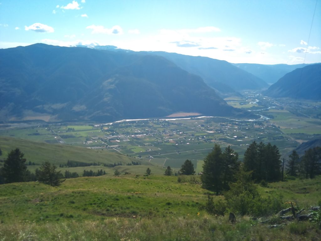
And for this cache....I kind of thought a view like this was worth going to a cache for!
Thanks again for all the suggestions to use tools which I don't wish to use and to change settings and all that.
-
Why is it that some must always swim upstream?
The site has been set the way it is for a fair number of years, well over a million people use it as is, then one comes along and expects it to change for them. All else can be darned (Would have said it otherwise, but the site would have changed it anyway).
Personally, I would never use a "business" unit for recreation. I would use a separate unit -- easy not to 'forget' that way.
Do everyone a favor, and don't pretend to be better than the rest.
upstream got you where you are today or you wouldnt be here would ya! Just some of us keep on swimming up stream!
-
You know what. It is a privately owned website. TPTB can do whatever they feel like. If they decide to change the language to Russian, then they can do it. And I'm calling you out on being a SARtech....You have the idea that it's "My way or the highway" any half decent SARtech knows to, and would adapt to any changes in the way of doing things, because search and rescue is not a textbook do it exactly the same every time. You do what it takes, so I think you sohuld either get off your high horse and quit whining about having to do more then you want, or get off the website....
Since you put that info out there...yes they could change it to russion or what ever or add in UTM too...if they CHOSE too...LOL
First I NEVER SAID I WAS A SAR TECH...I said I was a SAR volunteer! and no it's NOT my way or hiway...it's the way we use our gps in SAR and I am comfortable doing so! as a SAR volunteer...NOT SARTECH which is MILITARY incase you didn't know..not volunteer...
I'm not on a high horse...the site provides the UTM for caches just not to make caches and that does not make sense...not now not ever would that make sense.
I was hoping I may have missed something that was not easy to see to input the data as I wish to, he ll they provide 3 different ways to input long lats...why not just one if that is the "standard" they choose...clearly they are open to differences in ways of doing things...
GOT IT...I"M not military NOT SARTECH...a volunteer and it's how we do it...simple..I can use lat longs...I DON"T USE lat longs....UTM is much more logical and much simpler to utilize!
As for getting off the website...clearly I'm here still
-
Sorry Al
Quote;
People understand this; my changing my GPS to another format is not an acceptable answer....telling me to go to another site to convert...not really what I am hoping for.
The acceptable answer is that YOU should be able to switch back and forth between formats! or use a converter.
What are you going to do when you get a Spot call in Degrees? or Degrees minutes?
Sorry

If you can't call for help in UTM, you don't deserve to be rescued.
I never said that....What I am saying is we primarily USE UTM...the locations and data is passed down from the powers that be...it minimizes error when taking way way points or going to way points if everyone is on the same page.....right? on the rarest of occasions a point is needed in Lat Long...very very rare...for aircraft spotting only. Just seems to be logical when the maps handed out, our compass has the UTM grid in the appropriate scale and so forth are all UTM....just sayin is all...lmfao
-
IT would appear to me that UTM is a "standard" format used...funny how the word standard is open to interpretation. For me, UTM not long lat...we have yet to get a SPOT call and that would likely be converted above my pay grade and passed down accordingly to those that do the leg work.
As UTM is the format we use as a standard and Groundspeak does indeed post that info for caches along with long lats; that invariably would make sense it does so for those that use said standard and should likewise provide same for input of caches...there are IIRC 3 different long lat formats they provide for how difficult would it be to add UTM. If long lat is the standard why not just pick one only?
I could make changes on GPS PN60 easy enough but if I forget and go on call it could cause me issues in the field as mentioned same with if I forgot and lent my GPS to another sar volunteer.
As you can see clearly the site provides one half of the equation, perhaps it's time to provide the other?
-
Hello,
I have watched caching and done a few and enjoy it.
I have placed a cache locally, and took my way point for said cache. I came home went to upload the data and cannot.
This site shows caches to download in Long Lat and UTM, I only use UTM as it's the primary method we use GPS locally within our SAR groups.
I have my cache way point data in UTM and cannot for the life of me figure out HOW to get that into the create a cache section, it only has provisions for long lats.
Why when the site provides both for download can it not take the same for upload? I don't want to mess around converting or anything I just want to add in 11U XXXXXX XXXXXX in the system and create a cache.
Does anyone know how to input UTM into the system??????
The problem with using UTM is that the majority of cachers don't have their gps devices set for that format.
http://support.Groundspeak.com/index.php?pg=kb.page&id=208
11.3. WGS-84 and HDD(D)° MM.MMM Datum and FormatWhy do we use WGS-84 and HDD(D)° MM.MMM Datum and Format?
Most GPS receivers are set coming out of the box with WGS-84 and HDD(D)° MM.MMM Datum and Format. Using this setting will be less likely to confuse new GPS owners.
The conversion to UTM is on cache pages, I assume for the convenience of finders who prefer that format.
I also assume that the cache submission form does not include UTM because it would be confusing to have a cache be published that isn't the "accepted" format.
Here's a thread from 2009, which I found through Google:
http://forums.Groundspeak.com/GC/index.php?showtopic=228162
I don't think you need to do the conversion yourself. You don't mention what gps you are using, but I'm guessing that it will do the conversion if you switch it to the other format.
B.
My GPS will do the conversion...I have it set the exact way I want it...UTM not lat long...on call for sar makes confusing to swap back and forth or hand my gps to another....set it forget it..this is my point....switching is unacceptable and cause for potential error IMHO...
Accepted method is the one I accept....we do all our maps in UTM and gps are set to it so that's an accepted method to me...
I download the data to my GPS from this site and it's set to UTM, funny how I can find caches..thus that data must be there...
People understand this; my changing my GPS to another format is not an acceptable answer....telling me to go to another site to convert...not really what I am hoping for.
What could be accepted is that the site accepts UTM or provides converter for those who do use UTM on the page for inputting data for location of caches created...makes the most sense to me to add it in.
-
Why when the site provides both for download can it not take the same for upload? I don't want to mess around converting or anything I just want to add in 11U XXXXXX XXXXXX in the system and create a cache.
If you are not willing to spend 10 seconds to convert from UTM into Lat/Lon, then perhaps your commitment to placing a good cache is not all that great...
Heck, your GPS will probably do it for you! If not, there are plenty of ways to do it online.
I don't need s***e like this I need an active solution....whom are you to question my commitment to placing a "good cache" It is in an incredibly awesome location in comparison the the 10 caches I have located....especially the last 8...Do not judge my cache when you truly know nothing about it or myself what so ever!
Maybe my GPS will do it....maybe it won't...maybe there are plenty of spots on the net to do the conversion as well...at the very least it would behoove this site to provide the converter at a minimum....we all do not do the same things the same way....
-
Hello,
I have watched caching and done a few and enjoy it.
I have placed a cache locally, and took my way point for said cache. I came home went to upload the data and cannot.
This site shows caches to download in Long Lat and UTM, I only use UTM as it's the primary method we use GPS locally within our SAR groups.
I have my cache way point data in UTM and cannot for the life of me figure out HOW to get that into the create a cache section, it only has provisions for long lats.
Why when the site provides both for download can it not take the same for upload? I don't want to mess around converting or anything I just want to add in 11U XXXXXX XXXXXX in the system and create a cache.
Does anyone know how to input UTM into the system??????
-
Riotwarrior
AKA
Camopants
Al
VE7LAA Cawston BC!
 This is not constructive at all. We've all seen "less critical" changes implemented (and griped about it). Maybe this will be one of those quick-fixes that will be helpful for some people and won't be any noticeable change for the rest.
HOW do I use UTM for setting up a new cache?
in How do I...?
Posted · Edited by Keystone
potty language removed by moderator
[Edited] they are sensitive.....wow...one suggestion / request to add it to the new cache page and it's absolute anarchy that I am creating...God forbid someone has a different idea on how things can/do get done...
It's all about an addition to the new cache page not making it the only option like long lats are currently....would be nice to have BOTH options...I think I have said this enough to have you all understand I don't want to take long lats off the new cache page...just add one more option...MY god I'm not changing the world here....come one people...