+Colorado Papa Posted September 30, 2004 Share Posted September 30, 2004 (edited) In locating 1/2 dozen BMs this past week that were reported as NOT FOUND by NGS made me wonder as to how long GPS has been used for surveying? Out in the boondocks along US Hwy 285 from Antonito, Colorado to Tres Piedras, New Mexico is the very dim outline of what used to be the Denver-Rio Grande narrow gauge railway. A survey crew installed marks along the railway in 1933. In 1984, another crew came along and installed marks along US 285. They used the railway marks where they could find them, but if they didn't find them, the mark was listed as NOT FOUND. Using my GPSr and the scaled coordinates, I was able to walk right up to the missing mark. I was surprised how close the scaled was to the actual location and initially thought the NGS did a poor search job. But then it occurred to me that they had a very poor description, especially since the railway was hard to distinguish in most locations. There were no mile posts or telephone poles, bridges gone, cuts and fill erroded away... They were lucky to find the ones they did! Here's what they had to put up with (GM0500)! Ah, modern inventions. Sheez, GPS would sure have made my Korean flying days a lot easier. I would have known what rice paddy I was blowing up. Edit to add picture. Edited September 30, 2004 by Colorado Papa Quote Link to comment
Z15 Posted September 30, 2004 Share Posted September 30, 2004 (edited) Since the 1980's. I doubt NGS gives their crews hand held GPSr. We had to buy our own early on, supervisors considered them toys and would not approve. Was not until about 2000 that they gave me a credit card and let me purchase what I needed. We did our first GPS project at the DOT back in 1992. Back then we only had 4 Ashtech receivers for the whole state. In 2001 we spent about 1/2 million from FHWA and outfitted all our crews with 3 Leica SR500 RTK rcvr and installed our our CORS system. I have figured out that NGS does not seem to want to find all the marks at times. They ran levels in this area in 1985. Some marks they report as not found are easy to find which makes me wonder if they even looked for the marks. Their survey require them loop to all marks within 1-2 km of the level line. Finding it means more work. Granted this is just conjecture on my part. It could also be that they use temp help and some of these may lack the skill or the desire to look very hard for them. I recall one highway project we had where many of the marks from 1948 were not found by the USGS in the 1980's. We found everyone and they were not that hard. example of one in plain sight.. RL0474 HISTORY - Date Condition Report By RL0474 HISTORY - UNK MONUMENTED MIGS RL0474 HISTORY - 1948 GOOD NGS RL0474 HISTORY - 1985 MARK NOT FOUND NGS RL0474 HISTORY - 20010606 GOOD MIDT RL0474 RL0474 STATION DESCRIPTION RL0474 RL0474'DESCRIBED BY NATIONAL GEODETIC SURVEY 1948 RL0474'IN COVINGTON. RL0474'IN COVINGTON, IN THE SOUTHWEST CORNER OF THE CROSSING OF THE RL0474'DULUTH, SOUTH SHORE AND ATLANTIC RAILWAY AND U.S. HIGHWAY 141, RL0474'131 FEET WEST AND ACROSS THE HIGHWAY FROM THE NORTHWEST CORNER RL0474'OF THE RAILROAD STATION, 50 FEET WEST OF THE CENTER LINE OF THE RL0474'HIGHWAY, 25 FEET SOUTH OF THE SOUTH RAIL, 24 FEET WEST-SOUTHWEST RL0474'OF THE SOUTHWEST CORNER OF THE CONCRETE BASE OF A SIGNAL SWITCH RL0474'BOX, 1 FOOT NORTH OF A WHITE WOODEN WITNESS POST, ABOUT 1 FOOT RL0474'BELOW THE TRACK AND IN THE TOP OF A CONCRETE POST ABOUT FLUSH RL0474'WITH THE GROUND. RL0474 RL0474 STATION RECOVERY (1985) RL0474 RL0474'RECOVERY NOTE BY NATIONAL GEODETIC SURVEY 1985 RL0474'MARK NOT FOUND. RL0474 RL0474 STATION RECOVERY (2001) RL0474 RL0474'RECOVERY NOTE BY MICHIGAN DEPARTMENT OF TRANSPORTATION 2001 (MPR) RL0474'IN COVINGTON, IN THE SW CORNER OF INTERSECTION OF US-141 AND RAILROAD RL0474'TRACKS, 61 FT W OF C/L US-141, 25 FT S OF S RAIL, 24 FT WSW OF SW RL0474'CORNER OF CONCRETE BASE FOR INACTIVE RR SIGNAL, 20 FT NW OF UTILITY RL0474'POLE, 2.7 FT SW OF UTILITY POLE ANCHOR CABLE, 0.9 FT S OF A WITNESS RL0474'POST, FLUSH WITH THE GROUND AND ABOUT 1 FT LOWER THAN HIGHWAY, A RL0474'SURVEY DISK IN SQUARE CONCRETE POST. Edited September 30, 2004 by elcamino Quote Link to comment
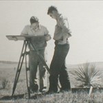
Wild T2 Posted September 30, 2004 Share Posted September 30, 2004 My first GPS project was in the winter of 1983-1984. We set the concrete monuments in November and December. The GPS work was contracted out to a company called GeoHydro. The head of the company was formerly the head of NGS. The antennas were huge things that looked like a metal plane table about 3 foot square with an antenna in the center covered by a clear plastic dome. The rest of the receiver completely filled the back end of a full size station wagon. It drew so much power that you had to keep the vehicle running, which was not a problem since it was February. I think that we got the results around May 1984 so this thing was of no use in navigating to a mark. Since NOAA has commissioned officers in the NOAA Corps they may have had access to military receivers if they existed at the time. Quote Link to comment
Z15 Posted October 1, 2004 Share Posted October 1, 2004 (edited) a photo from that 1992 survey for highway bypass, sorry they are rather large but I don't ahve time to resize them... and the Ashtec receivers (note-the were miltiary grade) and the modern Leica is one small package... Edited October 1, 2004 by elcamino Quote Link to comment
Wild T2 Posted October 1, 2004 Share Posted October 1, 2004 More about the first geodetic GPS receiver from the Smithsonian... http://americanhistory2.si.edu/surveying/o...rdnumber=997498 Same type used in the 1984 survey I mentioned above. Quote Link to comment
+Spoo Posted October 3, 2004 Share Posted October 3, 2004 Colorado Papa: A fellow Pilot !!!!!!! I was an Army Aviator (CWO2, Huey Helicopters) in the early 70's. At that time we had VOR and ADF and some of us even had DME on board. I was hearing rumble of giving us LORAN navigation but never saw it myself. In 1996, I decided to get back into flying and was surprised to find TWO GPS units on board. "These times, they are a-changing" Quote Link to comment

Recommended Posts
Join the conversation
You can post now and register later. If you have an account, sign in now to post with your account.
Note: Your post will require moderator approval before it will be visible.