+Muzikman Posted September 13, 2004 Share Posted September 13, 2004 (edited) Looking at a topo of the area near a friends house I noticed that there were a lot of BM's that were also in the NGS database. When I looked at the Geocaching database I noticed no one had recovered most of them. So we picked a few easy ones (or so they seemed) that were close by and set out yesterday to find them. hunting Benchmarks is something I have done many years ago, whith my only tool being a topo map, and the only BM's I knew about were listed on this map. I never took it seriously. When I found Geocaching a few years ago and then when I saw they added a database of benchmarks, this sparked the intrest again, though due to the lack of time, I never went searching. I would like to make this a semi-serious hobby as some of you have already done. I want to make sure that as I recover a BM, that I am gathering the correct information and this forum has helped me a lot. I expect as I find more my eye for detail gets better. I hope that some point soon, my detail is enough to submit the find to the NGS. Right now, I am just going to log them with the Geocaching database. Now, on to the question. One that I found (MB0362) was on top of a wall on a railroad bridge. I climbed to the top of the wall but could not safely get over to the disk to take a close-up or even read it. From where I was (about 5 ft) I could tell that the disks setting was solid and sound. I laid on the wall and got the GPS as close as I could to the mark (about 3 ft) to mark a waypoint. Now, my question is, should I mark this as a find even though I could not get close enough to the disk to read it. Or should I just note it as I have and leave it at that. Not that I am looking for "find numbers" but if I should run in to this situation again, I just want to make sure I log it correctly. Edited September 13, 2004 by Muzikman Quote Link to comment
+Black Dog Trackers Posted September 13, 2004 Share Posted September 13, 2004 Muzikman - My opinion is: you should not log a find on a disk unless you can read it. Usually, one can be 95% certain that the disk they see from afar is the right one. However, all one needs to do is read the forum for a while, or look at the benchmark gallery and find numerous instances where the disk a person claims a find on is not the right disk at all, even though it is in the "right place", or "the coordinates were right on". I have found some instances myself where I go to the exact right spot, and there's a disk and I think "There it is!", and then get disappointed when I read it. It is almost as if the old disk being missing was such a disappointment for a local agency that they would put one in about the same place to replace the old NGS or C&GS disk that is gone. I was once in the exact position you are. I could see the disk, and it was on some wall, but erosion had created a 15 foot drop along the wall where there had been a hillside at monumentation time. Plus, there was a big sign saying No Trespassing and it was obvious that the main reason the sign was there was the now-dangerous area. I took my best shot with the camera, but couldn't get closer than about 8 feet and didn't log a find, even though the probability of another agency putting a disk in that place is about near to zero as anyone could imagine. Quote Link to comment
evenfall Posted September 13, 2004 Share Posted September 13, 2004 You make a good point Blackdog, and what's even more important as a recovery note, If you cannot physically get close to it, how is a Surveyor? How can the work these Bench Marks are meant to do be performed if one cannot perform an instrument setup over the disc itself? In this instance it would have to be a not recovered disc for Geocaching, and a Found Poor Disturbed report to the NGS database stating that the disc (Station) is in place, but that reaching it is not possible and an instrument set up is not possible either. It is always something that could be kept in mind when performing a recovery. Could the work these are meant to do still be performed? A few days back, I think it was Colorado Papa Found a Station that had been monumented in the top of a Concrete Culvert Bulkhead. That is a good permanent place for a Station, but later when a Fill-and-grade operation raised the ground lever near it, a rockery of sorts was stacked over this bulkhead and covered the Station. We can see the station, but it can no longer be occupied. In this case, the judgment call is Papa got the Find, but too the NGS the Station is Poor. The cool thing about the future is that these Stations are not lost or destroyed, just currently unusable, and a future rehabilitation may effect a change that makes the Station usable again. Like someone said, Certainty is Death, Taxes and Change. Quote Link to comment
2oldfarts (the rockhounders) Posted September 13, 2004 Share Posted September 13, 2004 Muzikman, I would suggest using a good pair of binoculars from a solid position to read the disk. If this is not possible then I would post a note explaining what I could see, as you have already done. Good job, John Quote Link to comment
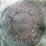
2oldfarts (the rockhounders) Posted September 13, 2004 Share Posted September 13, 2004 (edited) It is always something that could be kept in mind when performing a recovery. Could the work these are meant to do still be performed? A few days back, I think it was Colorado Papa Found a Station that had been monumented in the top of a Concrete Culvert Bulkhead. That is a good permanent place for a Station, but later when a Fill-and-grade operation raised the ground lever near it, a rockery of sorts was stacked over this bulkhead and covered the Station. We can see the station, but it can no longer be occupied. In this case, the judgment call is Papa got the Find, but too the NGS the Station is Poor. evenfall here is the mark you are refering to. I must disagree with the condition you think the mark is in. It is the same as a benchmark under an 8 foot rock cairn. The condition is good. Access is available by moving some of the rocks. Whether or not a surveyor crew would choose to do so is another question altogether. Likewise with the 8 foot cairn, will they choose to "move" it or just use another nearby mark? In both cases though the condition is good. John Edit: Here is the link to the noted benchmark. GP0225 Edited September 13, 2004 by 2oldfarts (the rockhounders) Quote Link to comment
+Muzikman Posted September 13, 2004 Author Share Posted September 13, 2004 Well, in this case, if you had a ladder or even a step ladder, you could get to this. But just being a jump monkey, I could not. With a 25ft ladder, you could get to it from road level and with a 4 step (5ft) ladder you could have gotten down on to the landing next to the wall. I had actually climbed atop the wall, but if I would have jumped down to the landing, I would not have been able to get back up. In short, if they wanted to use this disk, they could, I just could not reach it with what I had on hand. Quote Link to comment
evenfall Posted September 14, 2004 Share Posted September 14, 2004 (edited) Hi John, I just wanted to share with you a Surveyor’s reason for thinking this is poor. I will base my observation from just what I can see in the single picture. I must disagree with the condition you think the mark is in. It is the same as a benchmark under an 8 foot rock cairn. The condition is good. Access is available by moving some of the rocks. Whether or not a surveyor crew would choose to do so is another question altogether. Likewise with the 8 foot cairn, will they choose to "move" it or just use another nearby mark? In both cases though the condition is good. Being a Construction Surveyor, I am pretty savvy on Rockeries... I survey for them and engineer them all the time. (chuckling) Sorry John, but each of those rocks are 250 - 750+ lb boulders, We call them 4-6 man rocks. Some are bigger based on the height of a given rockery. This situation would really limit a Surveyor’s set of choices to be sure. They were placed there with an excavator that has a clamshell bucket, and backfilled with a few scoops of 2-4 inch quarry spalls. It is an engineered fill rockery. Behind that is compacted fill and perhaps a form of matting that helps soil stay where it is put. The fill likely had to be compacted to what we call 95% compaction, which means 95% of all air voids have been compacted out of the soil. The rains have tightened it up further. Nobody will be moving these rocks easily for the purpose of conducting a survey. Though buried under a rockery, and visible from along side it, it may even be as shiny as a brand new penny, making it ultra pretty and readable, in perfect condition as a brass disc, yet in this situation, it has problems that make it a Poor Station, NGS and civil survey wise. This particular station, according to the datasheet is already a low order Station, given a D order for stability, meaning it is not a real high priority high accuracy Station in the first place. It is subject to not being really accurate and we are cautioned that we may find this to be so. Then this culvert has had heavy boulders placed (but in reality sort of dropped and scooted around till they fit well) further enhancing the accuracy of this culvert. An instrument set up over a station requires that the instrument be exactly plumbed to a position exactly over the top of that Bench Marks Cross Hair Mark or Dot in the middle of the triangle. This means if you cannot center a tripod vertically above the Disc and drop a Plumb Bob or an optical plumb site which is built in to most modern instruments, to center the instrument exactly over the mark, Then you cant take accurate readings from this location. An inch off is not accurate. Nor will the Math jibe with previous observations, and any new observations you make and record will be in error. In this Stations situation it is only half visible at all, being fully half buried by a rock at the bottom of the rockery, and the half that is visible is only approachable from a 35 degree angle from the side. Further if I were trying to shoot this Station from another I could not level a Prism pole plumb over this station either. Due to the height of the rockery it would be difficult to find a tripod that would accommodate that last step, which is a doosey... (grins) As a rule in Survey. we have to take our measurements from a point that is truly vertical above the mark. After having tons of rocks piled on it, this Station may not be as accurate as it once was, and we sure can’t get our instruments to it to even verify that. Yes, Access is available by moving some rocks. Since this is not in the scope of a survey crews purview, it is a Poor Station for NGS Survey purposes as it does exist but would be exceedingly difficult to occupy, and quite likely less accurate now that it has been under the weight of a rockery, but a very cool find for Geocaching! Sorry, But that is how I would report it to the Crews who would come after me, and I would not be using it myself. I imagine if you and I were the crew, we would just chuckle and get back in the truck. Lets go hunt another one nearby! Rob Edited September 14, 2004 by evenfall Quote Link to comment
evenfall Posted September 14, 2004 Share Posted September 14, 2004 Muzikman, Thanks for the lowdown on the Ladder. That is good information. In an NGS Recovery report I would write that in my Recovery, " a six foot Ladder will be required to access the Station" and know that you know, you could go back with a step ladder if you like ot try Binoculariing it like John suggested. For the purposes of Surveying from there, all the equipment has to be carted to the Station, somehow... A team trying to use that Station would love knowing what to expect. That is why we can note these things when we recover the Station to the NGS, and for future Geocachers as well. And as always, Be super careful when attempting recoveries on railroad property, it can be very unsafe to do so, and is considered tresspassing, a serious offense by the railroads. Rob Quote Link to comment
2oldfarts (the rockhounders) Posted September 14, 2004 Share Posted September 14, 2004 evenfall, if you care to look again at the picture and at the disk, you will see these rocks are at most 6" X 24" x 5" in size. I doubt if they weigh more than 50 lbs max. John Quote Link to comment
evenfall Posted September 14, 2004 Share Posted September 14, 2004 Hi John, I realize it looks simple enough, but the survey marker is not on NGS property, The rockery and culvert belong to someone though. I, as a Surveyor could not Legally just up and take that rockery apart. I do not have that authorization. As it is, based on what I see in the photo, I could not occupy that Station and conduct survey operations. In the field we get what we get and use what we can. There is no instrument set up for me as it appears in that photo. That is how and why I see it as a poor Station. It would be so much simpler to just leave it be and set a new one (Station) if that was necessary. I sometimes have to make similar calls. That is just how I see it, Just My.02... :-) Rob Quote Link to comment
2oldfarts (the rockhounders) Posted September 14, 2004 Share Posted September 14, 2004 Rob, I'm afraid you are wrong in the condition being poor. The NGS standards for recovery state; The condition is good if the mark is solid and the setting is also undisturbed. There is no mention of ease of access to the mark in their recovery conditions. The mark is considered poor if you can not read the stampings or it appears as though the setting has been compromised. Again, no mention of ease of access. Even though it's position requires special handling it still is a good mark. We have some near here that require special equipment and permits to access, but that does not negate the quality of the setting. I understand your desire to avoid the pictured mark and the extra work it would entail, but when filing a recovery with the NGS we should follow their position as to the condition of the Station. Perhaps I missed that part about ease of access in their description of recovery condition. As for logging on the Geocaching site, a simple "found it" will suffice for most people as this is just a game, hobby, or recreation. John Quote Link to comment
+Black Dog Trackers Posted September 14, 2004 Share Posted September 14, 2004 Just another example of my frustration with the slightly-less-than-comprehensive logging instructions and definition of their terms at the NGS. Quote Link to comment
evenfall Posted September 14, 2004 Share Posted September 14, 2004 Hi John, I was talking this over with some of my fellow coworkers today, and we looked at the picture to see how they would recover the Station and we agree the Station is poor. We see the disc as the representational Center of the station, and the condition of the disc is important as you say, but we all agree that if the station cannot be occupied and this particular one cannot, it is poor. There is no way for an instrument to see the Station Mark from the vertical, As that is where we have to make all out measurements from, and it does not fall within our responsibility to remove the rocks as I said. We can only see half of the disc in the picture and the half we see can only be seen only from a 35 degree angle from the side, max. There is no way for us to use this. We also felt that the weight of the rockery over the Station may have caused settling of the bulkhead in the streambed. It is a low order Station according to the datasheet and this is why we look at it this way. My take is that the NGS would call it poor as well. Up until 5 years ago, nobody but Surveyors ever recovered these and we just did it as a matter of course. It is a civil engineering activity. Part of the Job. It was just something that was understood. We look at all survey the same, pretty much, we evaluate it all just off the top of our head. Can we use it? Is it accurate for our needs? We update the database if we need one, find one or use one. That may be why the Criteria seems vague. Up until that time this was an inside the industry related activity, and how we approched it was just a handed down knowledge. I realize the criteria for station recovery is less than clear. A lot of what a Surveyor does follows a "best practices" method that is developed from experience in the field. It is a calls it as we sees it sort of thing. A lawyer in a courtroom and a framing carpenter both have a special experiential knowledge of their work in a similar way, but it is not covered as well as perhaps it could be in a book somewhere. It truly is a judgment call. Just a Surveyors opinion. The cool thing is, that it is up to the one who recovered it to make the call. Rob Quote Link to comment

Recommended Posts
Join the conversation
You can post now and register later. If you have an account, sign in now to post with your account.
Note: Your post will require moderator approval before it will be visible.