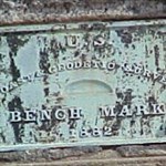
+happycycler Posted March 9, 2004 Share Posted March 9, 2004 I found two interesting disks this past weekend in central Missouri: JC0927 ( TTS 28 B ) and JC0954 ( TTS 34 B ) . Both were dated 1932 and had the elevation stamped on the disk. They were both in great readable condition. Were these some sort of vertical control ( elevation) Traverse? Or is the TT(S) just another letter combination used in the disk designation? Can anyone satisfy my curiosity? Thanks. Quote Link to comment
DaveD Posted March 9, 2004 Share Posted March 9, 2004 TTS = Transit Traverse Station Quote Link to comment
+happycycler Posted March 9, 2004 Author Share Posted March 9, 2004 Thank you Dave for that quick answer! Quote Link to comment
+wvcoalcat Posted March 9, 2004 Share Posted March 9, 2004 Not to be snooty, but I doubt that the TTS on these marks has anything to do with a traverse station. After viewing the original datasheets, I find no horizontal measurement reference. Only vertical. Therefore I believe these are only elevation benchmarks. The TT designation is probably the descriptor of the level loop that established the elevations of these marks. Another possibility is it's in reference to the township that they're located. If the Missouri Land Surveyors have a web site, that would probably be a good place to check. Quote Link to comment
Z15 Posted March 10, 2004 Share Posted March 10, 2004 (edited) TTS means Transit Travserse Survey. You will not find any distance measurements on USGSvertical data sheets. The only reason you find vertical is that you only have the vertical data. There will be another set of data with positions. I know, I have it. This only pertains to USGS data sheets, not the NGS datasheets Here is an example of one. Look at this USGS sheet that came with my data, Notice the words TRANSIT TRAVERSE SURVEY, TTS is short for that. Edited March 10, 2004 by elcamino Quote Link to comment
+happycycler Posted March 10, 2004 Author Share Posted March 10, 2004 GREAT elcamino. I knew that I would learn from my question. This is a super forum and I appreciate all the answers. Quote Link to comment
+GEO*Trailblazer 1 Posted March 10, 2004 Share Posted March 10, 2004 One more along the Same lines. PTS Is it Primary Traverse Station, or Primative Travese Station? Thanks in advance... Quote Link to comment
+wvcoalcat Posted March 10, 2004 Share Posted March 10, 2004 I stand humbly corrected and have learned something myself. I've never run across that designation in this neck of the woods. Thanks for the education elcamino. Quote Link to comment
DaveD Posted March 10, 2004 Share Posted March 10, 2004 The reason the NGS data sheet only shows an accurate elevation and not a horizontal position is that the original data observed by USGS was never submitted to NGS for inclusion in the National Spatial Reference System like so many of their marks. The elevation shown on the NGS data sheet is the result of a leveling survey conducted by USC&GS in 1950 when they included the mark in an independent survey program. USC&GS never determined the horizontal position. Quote Link to comment
+GEO*Trailblazer 1 Posted March 10, 2004 Share Posted March 10, 2004 Well I think I found my answer.Professional Surveyor Glossary PRIMARY Quote Link to comment
+happycycler Posted March 11, 2004 Author Share Posted March 11, 2004 Thanks to ALL who responded! I feel like I am getting a post-grad. education by participating in this forum. And you are all my advisors. BUT I don't want to do a thesis, OK? Quote Link to comment
+GEO*Trailblazer 1 Posted March 11, 2004 Share Posted March 11, 2004 No Thesis required. Have a nice day and, We will see you in 2. Can't wait. Until we meet, Happy...............................................................Geotrails Quote Link to comment

Recommended Posts
Join the conversation
You can post now and register later. If you have an account, sign in now to post with your account.
Note: Your post will require moderator approval before it will be visible.