+Lockjaw Posted June 17, 2002 Share Posted June 17, 2002 Just wondering if anyone has had any experience with GPS modules for Handspring Visors. Let me know, please. Thanks, Lynn lockjaw@attbi.com Quote Link to comment
+Wander Lost Posted June 17, 2002 Share Posted June 17, 2002 Not to sound like a old timer here but do a search of that topic. There have been many, many threads along this line. To sum up my experience using a Visor with a Magellan GPS companion. It's just as accurate as a stand alone unit in that it gets me to the right area and then I have to use my hunting skills to find the actual cache. Just like my husband has to do with his Meridian. If you have a visor and can find a good deal on the springboard gps it's a less expensive way to go than a stand alone GPSr. (by the way Magellan is offering a $50.00 rebate on the companion right now) The downside is they are fragile, not good in rain and chew up batteries pretty fast. If your plan is mostly urban caching it would be fine. Make a habit of hot syncing frequently to make sure your PDA data is always backed up. And look into something to protect the PDA from the enviornment. If ignorance is bliss, why aren't there more happy people?? Quote Link to comment
+Dan_Edwards Posted June 18, 2002 Share Posted June 18, 2002 Just to put a new spin on the topic. From what I can tell the Magellan GPS is by far the most popular for the Visor. Has anyone used the HandyGPS Pro? The new one that has external antenna inputs and such? I know a friend who was thinking of getting one for use in his Range Rover. We have used a couple of GPSR units inside that beasty and it is pretty effective at blocking GPS signals unless you keep it kinda close the windows. That is the reason in the HandyGPS Pro so he can slap a external ant. on the top of his rig. Quote Link to comment
+parkrrrr Posted June 18, 2002 Share Posted June 18, 2002 quote:Originally posted by Wander Lost:The downside is they are fragile, not good in rain and chew up batteries pretty fast. Note, though that "chew up batteries pretty fast" is not a feature of the GPS Companion for Palm V, since it uses its own batteries. (Yes, I know this is a Visor thread, but I thought I'd mention it anyway.) Reading others' experiences here, it appears that my GPS Companion lasts as long on a pair of AAA cells as a high-end eTrex does on a pair of AAs. Quote Link to comment
DARC Posted June 18, 2002 Share Posted June 18, 2002 If you are going to get a GPS module for your visor, be aware that the standard visor and the visor delux have slower 16MHZ CPU's which greatly affects the usability of these modules. I had to struggle with my Visor Delux, but my Visor Prism locks on like gangbusters. If you have any of the 33MHZ visors, then the best of the bunch is the Magellan GPS Companion. It is also one of the least expensive yet most reliable ones as well. If you have a 16MHZ visor, then don't bother. Quote Link to comment
Sea Wolf Posted June 18, 2002 Share Posted June 18, 2002 I have a Visor Prism and a Magellan GPS Companion. The GPS uses it's own set of 2 AAA batteries and they last about 8 hrs. I am definately going to get rechangeables because I don't want to replace the batteries after each weekend of caching. Quote Link to comment
+Dan_Edwards Posted June 18, 2002 Share Posted June 18, 2002 quote:Originally posted by Warm Fuzzies - Fuzzy: Note, though that "chew up batteries pretty fast" is not a feature of the GPS Companion for Palm V, since it uses its own batteries. As noted here, the Visor Companion also uses its own batteries. The reason why all PalmOS based units start eating batteries is because the serial port needs to be powered and the CPU can not go into sleep mode because it is constantly getting info over the serial port. This basicly makes the handheld use batteries nearly as fast as a standalone GPSR. So instead of 21 days of battery life that I got before I found Geocaching and Word Processing on my Palm, I now get 2 to 6 days. I have found that if I use NiMh batteries I get 12 hours life on the companion and 24 hours on the Visor Deluxe (constant on time). Dan Quote Link to comment
+Firefishe Posted June 19, 2002 Share Posted June 19, 2002 I don't have a gps unit for my Handspring Visor Prism (yet ), but from what I've looked around at, this beastie is the cream of the crop for serious Visor outdoor adventure: Geode GPS Module by GeoDiscovery [This message was edited by Firefishe on June 19, 2002 at 04:58 PM.] [This message was edited by Firefishe on June 19, 2002 at 05:00 PM.] [This message was edited by Firefishe on June 19, 2002 at 05:03 PM.] Quote Link to comment
+Firefishe Posted June 19, 2002 Share Posted June 19, 2002 I don't have a gps unit for my Handspring Visor Prism (yet ), but from what I've looked around at, this beastie is the cream of the crop for serious Visor outdoor adventure: Geode GPS Module by GeoDiscovery [This message was edited by Firefishe on June 19, 2002 at 04:58 PM.] [This message was edited by Firefishe on June 19, 2002 at 05:00 PM.] [This message was edited by Firefishe on June 19, 2002 at 05:03 PM.] Quote Link to comment
+ClayJar Posted June 20, 2002 Share Posted June 20, 2002 My brother bought a GPS Companion for the Visor (He has a Visor Edge). Having used it as well as my MAP 330 and MeriGold, I'll have to say that it's not nearly so user friendly as a standalone receiver, but it seems capable enough for geocaching. The cheaper factor is what got him to buy it, and I'll concede that point. Quote Link to comment
Sea Wolf Posted June 20, 2002 Share Posted June 20, 2002 I have owned my Visor for about 3 weeks and I had no previous PDA experience. I have had my Magellan GPS Companion for five days and I have had no previous civilian GPS experience (Military is different). While the Magellan module comes with VERY few instructions, I was able to figure it out in short order and logged 2 caches the same day I loaded the software. You CAN get instructions from the Magellan site in .pdf format. While I have limited experience in such matters, the things I have seen in this and other threads lead me to believe that the PDA/GPS combo can be much more useful/powerful than a standalone GPS. The two major drawbacks I see to it though are the fact that it is not as rugged/shockproof as some of the standalones and the fact that it is not the tiniest bit water resistant, let alone waterproof. Quote Link to comment
+parkrrrr Posted June 20, 2002 Share Posted June 20, 2002 quote:Originally posted by Dan Edwards: As noted here, the Visor Companion also uses its own batteries. The reason why all PalmOS based units start eating batteries is because the serial port needs to be powered and the CPU can not go into sleep mode because it is constantly getting info over the serial port. That's the difference between the Palm V and the Visor, you see: the Palm V doesn't have user-serviceable batteries. So, it doesn't "eat" batteries at all. It does tend to last a little less time on a single charge if the serial port is turned on, yes, but you rarely run out of power because it's being charged whenever it's in the cradle. I couldn't tell you how long a charge lasts, because I never use a whole one. (I also have a car charger for those long caching trips.) There is also a third-party modification for the GPS Companion for Palm V that allows it to charge the Palm while it's running from external power, but it's expensive and currently unavailable in the States. Quote Link to comment
+parkrrrr Posted June 20, 2002 Share Posted June 20, 2002 quote:Originally posted by Sea Wolf:While I have limited experience in such matters, the things I have seen in this and other threads lead me to believe that the PDA/GPS combo can be much more useful/powerful than a standalone GPS. The key words here, unfortunately, are "can be." The software could exist, but it just doesn't, because nobody's written it and Magellan doesn't want to remember that they ever made that silly "GPS Companion" thing. No currently available Palm software does everything you need, and some things you need for some caches just aren't available in any software, or at least not in a truly usable format (a standalone "GPS Calculator" does not count as usable, because I shouldn't have to memorize the coords to transfer them to my nav software. No, you can't cut-and-paste. The people who wrote the nav sofware are too smart for that; they split the degrees and minutes into two edit boxes and then limit them to a few characters each.) Yes, I could do this cache without being able to project a waypoint. The point is that I shouldn't have to. I have a general-purpose computer in my hand; why should it be harder for me than it is for someone using a basic handheld GPS receiver? Another example, from the same cache: Some handheld GPS receivers let you pick what units are displayed. Every navigation tool I've tried for the Palm thinks it's smarter than you, so it switches from feet to miles at some arbitrary, unconfigurable distance. Did I mention that the distance in the above cache is somewhere above a quarter of a mile? So much for the brute-force solution of walking however many feet in the right direction. Now we have to brute-force it even worse: walk 500 feet from the original waypoint in the right direction, set a new waypoint, walk another 500 feet, set another waypoint, walk another.... you get the idea. [This message was edited by Warm Fuzzies - Fuzzy on June 20, 2002 at 06:43 AM.] Quote Link to comment
+Byron & Anne Posted June 20, 2002 Share Posted June 20, 2002 quote:Originally posted by Warm Fuzzies - Fuzzy: quote:Originally posted by Sea Wolf:While I have limited experience in such matters, the things I have seen in this and other threads lead me to believe that the PDA/GPS combo can be much more useful/powerful than a standalone GPS. The key words here, unfortunately, are "can be." The software _could_ exist, but it just doesn't, because nobody's written it and Magellan doesn't want to remember that they ever made that silly "GPS Companion" thing. No currently available Palm software does everything you need, and some things you need for http://www.geocaching.com/seek/cache_details.asp?ID=19613 just aren't available in any software, or at least not in a truly usable format (a standalone "GPS Calculator" does not count as usable, because I shouldn't have to memorize the coords to transfer them to my nav software. No, you can't cut-and-paste. The people who wrote the nav sofware are too smart for that; they split the degrees and minutes into two edit boxes and then limit them to a few characters each.) Yes, I could do this cache without being able to project a waypoint. The point is that I shouldn't have to. I have a general-purpose computer in my hand; why should it be harder for me than it is for someone using a basic handheld GPS receiver? Another example, from the same cache: Some handheld GPS receivers let you pick what units are displayed. Every navigation tool I've tried for the Palm thinks it's smarter than you, so it switches from feet to miles at some arbitrary, unconfigurable distance. Did I mention that the distance in the above cache is somewhere above a quarter of a mile? So much for the brute-force solution of walking however many feet in the right direction. Now we have to brute-force it even worse: walk 500 feet from the original waypoint in the right direction, set a new waypoint, walk another 500 feet, set another waypoint, walk another.... you get the idea. Sheesh,,, All that GPS and mapping software, the calcualtor and etc. I have in my Visor Pro along with my Magellan GPS companion don't work. After using it for several months, now you tell it's no good. OH! If you want to know in miles or in feet, just take your gps put it into a calculator mode and use 1 mile = 5280 ft. to calculate which ever one you want. Byron Quote Link to comment
+parkrrrr Posted June 20, 2002 Share Posted June 20, 2002 quote:Originally posted by Byron & Anne:Sheesh,,, All that GPS and mapping software, the calcualtor and etc. I have in my Visor Pro along with my Magellan GPS companion don't work. After using it for several months, now you tell it's no good. Nice try at sarcasm, but it falls flat if you actually bother to read what you're replying to. The available software is good enough for most purposes, but it's not yet as good as what you can get for less money in a handheld standalone GPS receiver. The only way the GPS Companion is worth the money is if you already own the Palm device, and even then you have to weigh what you plan to do with it against the additional cost and features of the standalone. You shouldn't have to do this: the software that comes with a GPS Companion should be at least as capable as a Magellan GPS receiver of equivalent vintage (somewhere between a 310 and a 315.) It isn't. The GPS 315 supports UTM and MGRS, supports multiple datums, has the ability to export waypoints to the PC, and displays cross track error (apparently optional.) The GPS 310 doesn't do the multiple datums or the cross track error, but it does the rest. NAV Companion doesn't do any of those things, and probably never will. But it could, if Magellan were serious about supporting GPS on Palm devices. Oh, sure, Map Companion is a nice, spiffy program and all that. It helps that Magellan didn't actually write it, I suppose. But it's designed to solve a different sort of problem that's mostly irrelevant to geocachers. I'm criticizing Magellan's software here, but every single application I've tried for geocaching on the Palm falls short in one or more ways, some more serious than others. There just isn't one single piece of software that's even half as good as the software you get preinstalled on even a cheapie GPS 310 or basic yellow eTrex. quote:OH! If you want to know in miles or in feet, just take your gps put it into a calculator mode and use 1 mile = 5280 ft. to calculate which ever one you want. I can do better. I have a unit converter on my Palm that will convert anything to anything else. But what it won't do is fix NAV Companion to show me more than one decimal place when it's displaying miles. So, let's see... the maximum error is .05 miles... oh, I could only be 264 feet off from the correct location. That's not so bad. Hope the cache is big and noticeable, or I'll be searching all day. Quote Link to comment
+parkrrrr Posted June 20, 2002 Share Posted June 20, 2002 quote:Originally posted by Byron & Anne:Sheesh,,, All that GPS and mapping software, the calcualtor and etc. I have in my Visor Pro along with my Magellan GPS companion don't work. After using it for several months, now you tell it's no good. Nice try at sarcasm, but it falls flat if you actually bother to read what you're replying to. The available software is good enough for most purposes, but it's not yet as good as what you can get for less money in a handheld standalone GPS receiver. The only way the GPS Companion is worth the money is if you already own the Palm device, and even then you have to weigh what you plan to do with it against the additional cost and features of the standalone. You shouldn't have to do this: the software that comes with a GPS Companion should be at least as capable as a Magellan GPS receiver of equivalent vintage (somewhere between a 310 and a 315.) It isn't. The GPS 315 supports UTM and MGRS, supports multiple datums, has the ability to export waypoints to the PC, and displays cross track error (apparently optional.) The GPS 310 doesn't do the multiple datums or the cross track error, but it does the rest. NAV Companion doesn't do any of those things, and probably never will. But it could, if Magellan were serious about supporting GPS on Palm devices. Oh, sure, Map Companion is a nice, spiffy program and all that. It helps that Magellan didn't actually write it, I suppose. But it's designed to solve a different sort of problem that's mostly irrelevant to geocachers. I'm criticizing Magellan's software here, but every single application I've tried for geocaching on the Palm falls short in one or more ways, some more serious than others. There just isn't one single piece of software that's even half as good as the software you get preinstalled on even a cheapie GPS 310 or basic yellow eTrex. quote:OH! If you want to know in miles or in feet, just take your gps put it into a calculator mode and use 1 mile = 5280 ft. to calculate which ever one you want. I can do better. I have a unit converter on my Palm that will convert anything to anything else. But what it won't do is fix NAV Companion to show me more than one decimal place when it's displaying miles. So, let's see... the maximum error is .05 miles... oh, I could only be 264 feet off from the correct location. That's not so bad. Hope the cache is big and noticeable, or I'll be searching all day. Quote Link to comment
+Byron & Anne Posted June 20, 2002 Share Posted June 20, 2002 quote:Originally posted by Warm Fuzzies - Fuzzy: Nice try at sarcasm, but it falls flat if you actually bother to read what you're replying to. I'm sorry, I appologize for the sarcasm. quote: I can do better. I have a unit converter on my Palm that will convert anything to anything else. But what it won't do is fix NAV Companion to show me more than one decimal place when it's displaying miles. So, let's see... the maximum error is .05 miles... oh, I could only be 264 feet off from the correct location. That's not so bad. Hope the cache is big and noticeable, or I'll be searching all day. The version of NavCompanion that I have gives distance in at .1 ft increments when you get close. I don't remember exactly where the switch over from miles to feet happens, somewhere around 700 ft I think. I've been using GoeNiche lately, so I forgotten exactly what NavCopanion does. More and more software is being written to for the Palm OS/Companion combination. Maybe the version you were using was written prio to May 1, 2000? You're right when you say the software's not perfect, but then I'm not sure I would ever be completely satisfied with any software. Magellan has recently came out with a version for the Palm 500 series. Which would indicate that the Companion series isn't going to go away. To me the real negative is lack of ruggedness of the system. The positive is that I'm going to be carrying my Visor anyway. Therefore an add-on seems to make sense. Along with the fact I can can change what GPS program I'm running to better match the situation. What works best for me probably won't work best for you. By the way I've been using this system for over 6 months now. I used a Magellan ColorTrak prio to the Visor/Companion. It would appear that it's working for me, since I've found a number of caches with it. At least one cache it said I was .1 ft away. Just my observations. Each must decide for themselves. Byron Quote Link to comment
+Byron & Anne Posted June 20, 2002 Share Posted June 20, 2002 quote:Originally posted by Warm Fuzzies - Fuzzy: Nice try at sarcasm, but it falls flat if you actually bother to read what you're replying to. I'm sorry, I appologize for the sarcasm. quote: I can do better. I have a unit converter on my Palm that will convert anything to anything else. But what it won't do is fix NAV Companion to show me more than one decimal place when it's displaying miles. So, let's see... the maximum error is .05 miles... oh, I could only be 264 feet off from the correct location. That's not so bad. Hope the cache is big and noticeable, or I'll be searching all day. The version of NavCompanion that I have gives distance in at .1 ft increments when you get close. I don't remember exactly where the switch over from miles to feet happens, somewhere around 700 ft I think. I've been using GoeNiche lately, so I forgotten exactly what NavCopanion does. More and more software is being written to for the Palm OS/Companion combination. Maybe the version you were using was written prio to May 1, 2000? You're right when you say the software's not perfect, but then I'm not sure I would ever be completely satisfied with any software. Magellan has recently came out with a version for the Palm 500 series. Which would indicate that the Companion series isn't going to go away. To me the real negative is lack of ruggedness of the system. The positive is that I'm going to be carrying my Visor anyway. Therefore an add-on seems to make sense. Along with the fact I can can change what GPS program I'm running to better match the situation. What works best for me probably won't work best for you. By the way I've been using this system for over 6 months now. I used a Magellan ColorTrak prio to the Visor/Companion. It would appear that it's working for me, since I've found a number of caches with it. At least one cache it said I was .1 ft away. Just my observations. Each must decide for themselves. Byron Quote Link to comment
+parkrrrr Posted June 20, 2002 Share Posted June 20, 2002 quote:Originally posted by Byron & Anne: quote:Originally posted by Warm Fuzzies - Fuzzy:I can do better. I have a unit converter on my Palm that will convert anything to anything else. But what it won't do is fix NAV Companion to show me more than one decimal place when it's displaying miles. So, let's see... the maximum error is .05 miles... oh, I could only be 264 feet off from the correct location. That's not so bad. Hope the cache is big and noticeable, or I'll be searching all day. The version of NavCompanion that I have gives distance in at .1 ft increments when you get close. I don't remember exactly where the switch over from miles to feet happens, somewhere around 700 ft I think. Ah, see, there's the problem. You misunderstood the reason for my complaint. The cache I'm trying to hunt is an offset cache, and the offset is somewhere around a quarter mile. Far enough that both NAV Companion and GPSPilot Tracker (my drug of choice) both switch into miles mode. I can't project a waypoint, so the only way to hunt this cache is to compute the back bearing and then go along the forward bearing until the distance to the original waypoint is right and the bearing matches the correct back bearing. So, the distance would be well over 700 feet, or 500 feet (which is where I think it actually switches.) quote:I've been using GoeNiche lately, so I forgotten exactly what NavCopanion does. More and more software is being written to for the Palm OS/Companion combination. Maybe the version you were using was written prio to May 1, 2000? I still haven't used GeoNiche. I paid the $$$ for Tracker already, and I hate to buy a bunch more software that only does half the job. My copy of NAV Companion is version 2.10, copyrighted 2001. quote:Magellan has recently came out with a version for the Palm 500 series. Which would indicate that the Companion series isn't going to go away. True, but in doing so they've removed any mention of the Companion for Palm V from their site, and I'd wager they still haven't significantly updated the software. quote:By the way I've been using this system for over 6 months now. I used a Magellan ColorTrak prio to the Visor/Companion. It would appear that it's working for me, since I've found a number of caches with it. At least one cache it said I was .1 ft away. Interesting. The GPS Companion for Palm V can only "see" 6.6ft increments. You're either 6.6 feet away, or you're right on top of it. I'd guess yours has more digits to the right of the decimal point. Don't get me wrong; I'm not going to switch to a dedicated receiver any time soon. We've got 16 finds (and a few not-founds) with the Palm Vx/GPS Companion combo, and the price was very right for me. I like the combination of GPSPilot Tracker and aerial photos. I just wish someone had put as much thought into the software as they obviously put into the hardware. Quote Link to comment
+parkrrrr Posted June 20, 2002 Share Posted June 20, 2002 quote:Originally posted by Byron & Anne: quote:Originally posted by Warm Fuzzies - Fuzzy:I can do better. I have a unit converter on my Palm that will convert anything to anything else. But what it won't do is fix NAV Companion to show me more than one decimal place when it's displaying miles. So, let's see... the maximum error is .05 miles... oh, I could only be 264 feet off from the correct location. That's not so bad. Hope the cache is big and noticeable, or I'll be searching all day. The version of NavCompanion that I have gives distance in at .1 ft increments when you get close. I don't remember exactly where the switch over from miles to feet happens, somewhere around 700 ft I think. Ah, see, there's the problem. You misunderstood the reason for my complaint. The cache I'm trying to hunt is an offset cache, and the offset is somewhere around a quarter mile. Far enough that both NAV Companion and GPSPilot Tracker (my drug of choice) both switch into miles mode. I can't project a waypoint, so the only way to hunt this cache is to compute the back bearing and then go along the forward bearing until the distance to the original waypoint is right and the bearing matches the correct back bearing. So, the distance would be well over 700 feet, or 500 feet (which is where I think it actually switches.) quote:I've been using GoeNiche lately, so I forgotten exactly what NavCopanion does. More and more software is being written to for the Palm OS/Companion combination. Maybe the version you were using was written prio to May 1, 2000? I still haven't used GeoNiche. I paid the $$$ for Tracker already, and I hate to buy a bunch more software that only does half the job. My copy of NAV Companion is version 2.10, copyrighted 2001. quote:Magellan has recently came out with a version for the Palm 500 series. Which would indicate that the Companion series isn't going to go away. True, but in doing so they've removed any mention of the Companion for Palm V from their site, and I'd wager they still haven't significantly updated the software. quote:By the way I've been using this system for over 6 months now. I used a Magellan ColorTrak prio to the Visor/Companion. It would appear that it's working for me, since I've found a number of caches with it. At least one cache it said I was .1 ft away. Interesting. The GPS Companion for Palm V can only "see" 6.6ft increments. You're either 6.6 feet away, or you're right on top of it. I'd guess yours has more digits to the right of the decimal point. Don't get me wrong; I'm not going to switch to a dedicated receiver any time soon. We've got 16 finds (and a few not-founds) with the Palm Vx/GPS Companion combo, and the price was very right for me. I like the combination of GPSPilot Tracker and aerial photos. I just wish someone had put as much thought into the software as they obviously put into the hardware. Quote Link to comment
+Byron & Anne Posted June 21, 2002 Share Posted June 21, 2002 I did some expermentation last night. What I observed is with NavCompanion the closest is 3.3 ft then 6.6, 9.8. With Geoniche it's 1 ft increments. Geoniche also displays another decimal place. Now that I have I've got my foot fully engaged in my mouth, I'll shut up. Byron Quote Link to comment
+Wander Lost Posted June 21, 2002 Share Posted June 21, 2002 I think the point is.... If you already have a Visor and can get a good deal on the GPS companion it will work. To make it work better you'll want to download different software. If you don't have a Visor already then you should consider a stand alone GPSr as it will be better suited to geocaching and less expensive then buying a new PDA and a GPSr for it. If ignorance is bliss, why aren't there more happy people?? Quote Link to comment
+bigredmed Posted June 21, 2002 Share Posted June 21, 2002 I downloaded Cetus from freepalmware.com and have had good success running the Magellan Companion on my Visor Pro. I have not had a chance to run it on my wife's VDX yet. Cetus is up to 1.1 in beta and 1.0 stable. 1.1's first beta version didn't work well on the VPro, but a newer beta version is working fine. I especially like the 4 digit seconds and the compass features. Quote Link to comment
+Wander Lost Posted June 21, 2002 Share Posted June 21, 2002 I've also used Cetus. It's very basic but stable. It's major fault is that it doesn't have a waypoint data base for the goto function. But that is in the works according to the website. If ignorance is bliss, why aren't there more happy people?? Quote Link to comment
+Firefishe Posted June 27, 2002 Share Posted June 27, 2002 quote:Originally posted by bigredmed: I downloaded Cetus from freepalmware.com and have had good success running the Magellan Companion on my Visor Pro. I have not had a chance to run it on my wife's VDX yet. Cetus is up to 1.1 in beta and 1.0 stable. 1.1's first beta version didn't work well on the VPro, but a newer beta version is working fine. I especially like the 4 digit seconds and the compass features. I tried to find www.freepalmware.com, palmware.com, etc., but couldn't load the page. Is the spelling correct? Warm regards, Firefishe [This message was edited by Firefishe on June 27, 2002 at 10:47 PM.] Quote Link to comment
+Dan_Edwards Posted June 28, 2002 Share Posted June 28, 2002 If you already have a PalmOS handheld, I guess I would have to say the Magellan is a pretty good deal. I spent some time this weekend looking at various GPS units thinking I was going to buy one. I kept having problems with each one I looked at. Either I liked the way my Visor combo worked better, or it was too expensive, or it did not have enough features. I also found some that had all the features I wanted, but were ment for a car. I really did not think I would have this much trouble. I still think that for most people the best solution would be to buy a inexpensive Garmin and hook it up to a Handheld when you need more power, but since I already own one that plugs into my Visor I just figured I would stick with that for now. Of Course having GeoNiche was what made the problem harder. If I did not have it I would have liked the handhelds a lot more. I think what I really would like is something like PocketPC with Bluetooth. Then have a Bluetooth GPS, and a Bluetooth Cell Phone. Internet access, GPS access all at once without any cables. And I could put the GPS right on top of my backpack for excellent signal. Wish on... Dan A = A Quote Link to comment
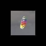
+Wander Lost Posted June 28, 2002 Share Posted June 28, 2002 quote:Originally posted by Firefishe: quote:Originally posted by bigredmed: I downloaded Cetus from freepalmware.com and have had good success running the Magellan Companion on my Visor Pro. I have not had a chance to run it on my wife's VDX yet. Cetus is up to 1.1 in beta and 1.0 stable. 1.1's first beta version didn't work well on the VPro, but a newer beta version is working fine. I especially like the 4 digit seconds and the compass features. I tried to find http://www.freepalmware.com, palmware.com, etc., but couldn't load the page. Is the spelling correct? I think that link should be freepalmware.net. I download my copy of Cetus from Palmgear.com. I also just got something real cool in the mail today for my visor/magellan combo. It's a rubber protective cover that is designed to accommodate springboard modules. The company is called Active Armor. Here is a picture of how it looks with the GPS module. Quote Link to comment
+Dan_Edwards Posted June 28, 2002 Share Posted June 28, 2002 quote:Originally posted by Wander Lost: I also just got something real cool in the mail today for my visor/magellan combo. It's a rubber protective cover that is designed to accommodate springboard modules. The company is called http://www.activearmor.com Here is a picture of how it looks with the GPS module. http://www.activearmor.com/index.2.gif Cool, I had wrote about it, but have not ordered one yet. Now that I have decided not to get a stand alone unit I think I will get one. So does it still allow easy access to the visor buttons and touchscreen? Dan A = A Quote Link to comment
+M-D-M Explorations Posted June 29, 2002 Share Posted June 29, 2002 Does the cover provide any security to holding the GPS module in place. The biggest problem I have had with mine when out caching was if I tried to set it somewhere, or place it in a pack or a box, and the module sometimes would work loose, causing a need to reset everything. ALso, is there a connection for a lanyard so it can be carried around the neck? M-D-M Explorations MrSki and DogMa 40º 07.874'N 88º 11.647'W Quote Link to comment
+Dan_Edwards Posted June 29, 2002 Share Posted June 29, 2002 I just read some updated info on Visor Central that shows the new add ons that include a lanyard and carabineer clip. They also have a link to the previous review. Dan A = A Quote Link to comment
+Wander Lost Posted June 29, 2002 Share Posted June 29, 2002 The buttons are all covered by the armor but the Visor slips right into place and the buttons on the cover all line up perfectly with the ones on my visor. You have to remove it from the case to hotsync in the regular cradle. But there is an opening for the travel hotsynk cable. It has openings for the IR and spots to hold two stylus. (what is the plural of stylus???) There isn't anything extra to hold the gps module in. But there are two loops in the bottom for a lanyard or the carabineer clips Dan mentioned. You could certainly use those to adapt something to hold the gps module in. I've never had trouble with mine though. It's odd yours is so loose. Anyway, Day Two here and I'm still happy with it. Quote Link to comment
+Wander Lost Posted June 29, 2002 Share Posted June 29, 2002 The buttons are all covered by the armor but the Visor slips right into place and the buttons on the cover all line up perfectly with the ones on my visor. You have to remove it from the case to hotsync in the regular cradle. But there is an opening for the travel hotsynk cable. It has openings for the IR and spots to hold two stylus. (what is the plural of stylus???) There isn't anything extra to hold the gps module in. But there are two loops in the bottom for a lanyard or the carabineer clips Dan mentioned. You could certainly use those to adapt something to hold the gps module in. I've never had trouble with mine though. It's odd yours is so loose. Anyway, Day Two here and I'm still happy with it. Quote Link to comment
+RayDar_ Posted July 1, 2002 Share Posted July 1, 2002 Warm Fuzzies - Fuzzy wrote: quote:I shouldn't have to memorize the coords to transfer them to my nav software. No, you can't cut-and-paste. The people who wrote the nav sofware are too smart for that; GeoNiche allows you to cut and paste. Coordinates pasted into GeoNiche may be in many different formats - to be compatible with whatever format is used by your other software. quote:Every navigation tool I've tried for the Palm thinks it's smarter than you, so it switches from feet to miles at some arbitrary, unconfigurable distance. One of the reasons I wrote GeoNiche was that "Tracker" for the Palm didn't switch to feet [bOLD]AT ALL[/bOLD]. GeoNiche is extremely configurable. You can even configure the distance at which it switches into feet (or even yards). -RayDar Quote Link to comment
Scabbers Posted July 8, 2002 Share Posted July 8, 2002 I know I chiming in late here, but I'm a newbie to geocaching.com. I ONLY have experience with a Palm Vx + Magellan GPS Companion (which I got for $79. at Amazon). I have to say that I have very few complaints. I had the yellow eTrex, but returned it when I realized it would not do street-level mapping. The Magellan gives me both street mapping/tracking (MapComp) and the NavComp software for geocaching. NavComp (version 1.0) has gotten me to 5/5 caches and typically gives accuracy to about 15', even under very heavy treecover. This past weekend it read 0.0 ft. at a cache site. It seems to swithch form x.x miles to x.x feet at about 400 ft. range. This seems reasonable to me considering that 0.1 miles = 528 ft. GPS Battery life is ~10 hrs (I carry spares) and the Palm Vx internal rechargeable batteries always go longer than 10 hrs. All that said, now I want to upgrade to a GPS V for a more rugged/water resistant handheld and turn-by-turn driving directions. I'll try to post a comparison in a few weeks, but the Magellan GPS Companion was a great and cheap way for me to start. Quote Link to comment
+parkrrrr Posted July 11, 2002 Share Posted July 11, 2002 A semi-interesting note for all you PalmOS GPS users: the author of Cetus GPS posted this to the Cetus mailing list this morning: quote:I have listened to the may requests and I am now spending quite a few of my holiday evenings and nights working on a great waypoint database feature :-) Maybe if we're lucky he'll have it done before 1.1 is released. (Where's that smiley of a fuzzy crossing his fingers....) Quote Link to comment

Recommended Posts
Join the conversation
You can post now and register later. If you have an account, sign in now to post with your account.
Note: Your post will require moderator approval before it will be visible.