+BigLinc16 Posted June 25, 2015 Share Posted June 25, 2015 Well, Heres my dilemma. I am hiding a cache up in the mountains over fourth of July weekend that requires a steep 5.5 mile hike 1 way. Also at one point goes along a steep cliff with about a 60-70 foot drop that several people have actually died falling down before. The cache is hidden near a pretty remote lake in the Rockies called Beaver Lake. It is a beautiful body of water completely unpolluted that has great trout fishing. My question is what would you call the terrain based on the description of the hike there? I used the terrain rating system already and it said 4 but just wanted to double check that rating here so the finders don't get "cheated" out of their T5 or are upset about it being overrated. Thanks for your time. BigLinc16 Quote Link to comment
+wmpastor Posted June 25, 2015 Share Posted June 25, 2015 4 or 4.5 Agreed. You apparently don't need climbing ropes, so it's not T 5.0. Quote Link to comment
+cerberus1 Posted June 25, 2015 Share Posted June 25, 2015 Mountain lake trout....float tube and a 10' 5wt... Oh, sorry. Sounds like a 4 to me. Quote Link to comment
+Touchstone Posted June 25, 2015 Share Posted June 25, 2015 4 or 4.5 Agreed. You apparently don't need climbing ropes, so it's not T 5.0. +2 Not to be a party pooper, but just make sure the location you place the cache is not inside a designated Wilderness Area. I'm not terribly familiar with CO, but the first reference to a Beaver Lake I found was inside the Holy Cross Wilderness area. Good luck with the cache! Sounds like a great hike. Quote Link to comment
+BigLinc16 Posted June 25, 2015 Author Share Posted June 25, 2015 4 or 4.5 Agreed. You apparently don't need climbing ropes, so it's not T 5.0. +2 Not to be a party pooper, but just make sure the location you place the cache is not inside a designated Wilderness Area. I'm not terribly familiar with CO, but the first reference to a Beaver Lake I found was inside the Holy Cross Wilderness area. Good luck with the cache! Sounds like a great hike. Ok, I just took a look and beaver lake is about 1/2 mile into the wilderness area... No big deal though, I can hide it on the trail coming up right before it crosses over into the wilderness area. Huh. Thats too bad, it really is a picturesque location. However I will not violate the guidelines. People placing caches in designated No-Geo zones just cause the rangers to crack down even harder. Quote Link to comment
+jellis Posted June 26, 2015 Share Posted June 26, 2015 4 or 4.5 Agreed. You apparently don't need climbing ropes, so it's not T 5.0. +2 Not to be a party pooper, but just make sure the location you place the cache is not inside a designated Wilderness Area. I'm not terribly familiar with CO, but the first reference to a Beaver Lake I found was inside the Holy Cross Wilderness area. Good luck with the cache! Sounds like a great hike. Ok, I just took a look and beaver lake is about 1/2 mile into the wilderness area... No big deal though, I can hide it on the trail coming up right before it crosses over into the wilderness area. Huh. Thats too bad, it really is a picturesque location. However I will not violate the guidelines. People placing caches in designated No-Geo zones just cause the rangers to crack down even harder. You can make it a multi or Wherigo and have the final be outside the park. As long as you don't have a physical cache or stage in the park you are good to go. Quote Link to comment
+BigLinc16 Posted June 27, 2015 Author Share Posted June 27, 2015 Ok, Im going to try to figure out how to do this multi. Im wanting to kind of copy the format and design of this one in Yosemite: GCKNBG. So after reading the cache page and stuff he did a Virtual multi. Im going to want to modify this a little and have a final container that is outside of the park. The Idea is to have people stet from the trail head at floods ponds and have them take down their starting coordinates. They are then going to hike the 5 miles to the top and get to beaver lake. There there will be some numbers gleaning from the surroundings to complete the coordinates for the final which will be just outside the wilderness area down the trail so they can pick it up on the way back. Do you guys see a problem with this setup? Quote Link to comment
+GeoTrekker26 Posted June 27, 2015 Share Posted June 27, 2015 Ok, Im going to try to figure out how to do this multi. Im wanting to kind of copy the format and design of this one in Yosemite: GCKNBG. So after reading the cache page and stuff he did a Virtual multi. Im going to want to modify this a little and have a final container that is outside of the park. The Idea is to have people stet from the trail head at floods ponds and have them take down their starting coordinates. They are then going to hike the 5 miles to the top and get to beaver lake. There there will be some numbers gleaning from the surroundings to complete the coordinates for the final which will be just outside the wilderness area down the trail so they can pick it up on the way back. Do you guys see a problem with this setup? That would be an excellent use of a multi, but you need to mention in the description the approximate length of the hike, and that the final will be near the starting point. It may be difficult to find something natural that is unambiguous and will not change over time as a number source. You don't want someone to make the trek and then be confused by what should be counted. All you really need is one number which can be manipulated for use in the coordinates. As to your original question, from All Trails: "Beaver Lake is a 5 mile out and back trail located near Avon, Colorado and is rated as moderate. The trail is primarily used for hiking and is accessible from May until October." In reading the reviews, it seems that the only issues are the altitude and a few steep segments so maybe a 3.5? Being a ski area the hike itself gets mixed reviews but that is from hikers not geocachers. Quote Link to comment
+BigLinc16 Posted June 27, 2015 Author Share Posted June 27, 2015 (edited) Ok, Im going to try to figure out how to do this multi. Im wanting to kind of copy the format and design of this one in Yosemite: GCKNBG. So after reading the cache page and stuff he did a Virtual multi. Im going to want to modify this a little and have a final container that is outside of the park. The Idea is to have people stet from the trail head at floods ponds and have them take down their starting coordinates. They are then going to hike the 5 miles to the top and get to beaver lake. There there will be some numbers gleaning from the surroundings to complete the coordinates for the final which will be just outside the wilderness area down the trail so they can pick it up on the way back. Do you guys see a problem with this setup? That would be an excellent use of a multi, but you need to mention in the description the approximate length of the hike, and that the final will be near the starting point. It may be difficult to find something natural that is unambiguous and will not change over time as a number source. You don't want someone to make the trek and then be confused by what should be counted. All you really need is one number which can be manipulated for use in the coordinates. As to your original question, from All Trails: "Beaver Lake is a 5 mile out and back trail located near Avon, Colorado and is rated as moderate. The trail is primarily used for hiking and is accessible from May until October." In reading the reviews, it seems that the only issues are the altitude and a few steep segments so maybe a 3.5? Being a ski area the hike itself gets mixed reviews but that is from hikers not geocachers. Ok, thanks. I wouldn't want to overrate it. The only reason I would give it a 4 for terrain is a steep cliff that goes for about a quarter mile near the end of the hike. It is a fall that has claimed several lives over the years and I want people to know what they are getting themselves into. Thanks for your help and I'll probably have some more questions I need answered! Thanks for everyones help and I'll report back when it is placed! Edit: It just struck me that there are large wooden poles set in the ground at the top at the lake for horses to tie off on. I can use these for my numbers! Edited June 27, 2015 by BigLinc16 Quote Link to comment
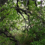
+BigLinc16 Posted June 27, 2015 Author Share Posted June 27, 2015 (edited) Here is a Pic of the Lake. Beautiful place. If your fairly lucky you'll see a Bear here and catch some nice brown, speckled, or Rainbow trout. Edited June 27, 2015 by BigLinc16 Quote Link to comment
+GeoTrekker26 Posted June 27, 2015 Share Posted June 27, 2015 Ok, Im going to try to figure out how to do this multi. Im wanting to kind of copy the format and design of this one in Yosemite: GCKNBG. So after reading the cache page and stuff he did a Virtual multi. Im going to want to modify this a little and have a final container that is outside of the park. The Idea is to have people stet from the trail head at floods ponds and have them take down their starting coordinates. They are then going to hike the 5 miles to the top and get to beaver lake. There there will be some numbers gleaning from the surroundings to complete the coordinates for the final which will be just outside the wilderness area down the trail so they can pick it up on the way back. Do you guys see a problem with this setup? That would be an excellent use of a multi, but you need to mention in the description the approximate length of the hike, and that the final will be near the starting point. It may be difficult to find something natural that is unambiguous and will not change over time as a number source. You don't want someone to make the trek and then be confused by what should be counted. All you really need is one number which can be manipulated for use in the coordinates. As to your original question, from All Trails: "Beaver Lake is a 5 mile out and back trail located near Avon, Colorado and is rated as moderate. The trail is primarily used for hiking and is accessible from May until October." In reading the reviews, it seems that the only issues are the altitude and a few steep segments so maybe a 3.5? Being a ski area the hike itself gets mixed reviews but that is from hikers not geocachers. Ok, thanks. I wouldn't want to overrate it. The only reason I would give it a 4 for terrain is a steep cliff that goes for about a quarter mile near the end of the hike. It is a fall that has claimed several lives over the years and I want people to know what they are getting themselves into. Thanks for your help and I'll probably have some more questions I need answered! Thanks for everyones help and I'll report back when it is placed! Edit: It just struck me that there are large wooden poles set in the ground at the top at the lake for horses to tie off on. I can use these for my numbers! Just to be sure we are talking the same lake, the prior info I cited relates to the lake at N 39 33.844 W 106° 32.132 on the trail that is south out of Beaver Creek. This All Trails log entry makes makes me wonder if were are talking about the same place: "Took my 4 year old on this hike it was a bit much for him between the elevation gain and sheer distance he rode the final half of the hike in my shoulders but it's amazing!!..." It doesn't seem like he would carry his kid on the type of terrain you are describing. Quote Link to comment
+BigLinc16 Posted June 27, 2015 Author Share Posted June 27, 2015 (edited) The trail that you are referring to is to floods ponds. It is a little trail that leads to two little fishing ponds. Beaver Lake trail head is right next to floods ponds. There is no way that a person could carry a four year old for the last half of the hike, far to steep. Edited June 27, 2015 by BigLinc16 Quote Link to comment
+KatnissRue Posted June 27, 2015 Share Posted June 27, 2015 Holy crap. That place is something else. I love out of the way places and being outdoors. Can you send me the cache page link when you've got it published? If I'm ever out that way, I want to find it! Quote Link to comment
+BigLinc16 Posted June 27, 2015 Author Share Posted June 27, 2015 Holy crap. That place is something else. I love out of the way places and being outdoors. Can you send me the cache page link when you've got it published? If I'm ever out that way, I want to find it! Haha, no problem. I love the outdoors as well. Its the whole reason I play the game! Quote Link to comment
+GeoTrekker26 Posted June 27, 2015 Share Posted June 27, 2015 The trail that you are referring to is to floods ponds. It is a little trail that leads to two little fishing ponds. Beaver Lake trail head is right next to floods ponds. There is no way that a person could carry a four year old for the last half of the hike, far to steep. Have you been to the All Trails site to read the description and reviews (logs)? Did you see the coordinates I posted? I'm talking about a trail 5 miles long with a 1545 foot gain in elevation. Is that not the same trail? Quote Link to comment
+BigLinc16 Posted July 8, 2015 Author Share Posted July 8, 2015 HI guys! Because of a foot injury I wasn't able to make the hike to beaver lake so I hid the cache in another manner. It takes people all over the beaver creek village to glean cords and eventually has the cacher travel to the floods ponds where the cache is about 300 yards from in the woods where the cache is tethered to an aspen. The GC code is GC5YR9D if you want to check it out. Quote Link to comment
+NYPaddleCacher Posted July 8, 2015 Share Posted July 8, 2015 HI guys! Because of a foot injury I wasn't able to make the hike to beaver lake so I hid the cache in another manner. It takes people all over the beaver creek village to glean cords and eventually has the cacher travel to the floods ponds where the cache is about 300 yards from in the woods where the cache is tethered to an aspen. The GC code is GC5YR9D if you want to check it out. Looks like a good one, but I did notice this? "Take this number and subtract 17 and add 1 in order to get a two digit number that will be represented as BC" Why not make it easier and subtract 16 from the number? Quote Link to comment

Recommended Posts
Join the conversation
You can post now and register later. If you have an account, sign in now to post with your account.
Note: Your post will require moderator approval before it will be visible.