I! Posted August 31, 2014 Share Posted August 31, 2014 For September's photo competition, I've hidden a cache in Midgård: You must guess where the cache is. To be valid, your entry (max 3 per player) must contain: A Midgård map reference, as precise as you can make it (e.g. "base of the tree above the M of ROMRIKE"), stating where you think the Midgård cache is hidden. A photo taken at that cache site (just pretending, okay? - so make it visually plausible if you can). So like this for example: taken at GC11WFB, on the rolling hills of Poutakummut; the cache is in the little yellow house on the map In judging the entries, I will short-list the three nearest guesses then pick a winner based on: Plausibility of the Midgård connection. (Photos of urban micros are unlikely to do well ...) Photographic merit insofar as I am able to tell. That's all. Go for it! Commit code ----...////001333344555677888999999:aabbbcccccccddeeeefgggghhhiimmnnnoopptt (please ignore this, it's just for me and is not any sort of hint) Quote Link to comment
+Yorkshire Yellow Posted September 2, 2014 Share Posted September 2, 2014 Up in the mountains to the north east corner of Sami, overlooking the sea. Quote Link to comment
I! Posted September 2, 2014 Author Share Posted September 2, 2014 (edited) Nice photo! - thanks for getting us started. I should've said: please also give the GC code of the (real) geocache where your photo was taken. (shouty red letters only to give others a chance to spot the update) Cheers. PS: (edit) - in your case no need to reply - I can see it's GC3018. Edited September 2, 2014 by I! Quote Link to comment
+Gackt Posted September 2, 2014 Share Posted September 2, 2014 (edited) My first guess... Link to the full size photo Taken at GC4ZD7V about a half hour before dusk this evening, along a narrow stream just as it joins the River Rykinjoki from the east on the edge of the woods. The cache is wedged tightly in a head height nook of a moss covered tree, the one closest to the building labelled Kilpi on the map. If you are interested to see what the impressively trimmed hedge that surrounds Kilpi looks like, a photo of that can be seen via GC4ZD7V. I couldn't post that one as xJ had the camera at that point. Edited September 2, 2014 by Gackt Quote Link to comment
+CaveBadgerMan Posted September 3, 2014 Share Posted September 3, 2014 My first guess is the sulpher pits around the volcano's in YLAMAAT. (Real cache - Nisyros GC1CZFF) My Second guess is the walls of the castle in Kilpi the other side of the island. (Real cache - Bozukkale Castle GC4PD0K) Quote Link to comment
+Clue-72 Posted September 3, 2014 Share Posted September 3, 2014 I have three entries for this month's competition... The first is of the terrible beasties that live in the woods to the east of Vargtungen (real cache GC1M56T) The second is the view of the sunset from the little hut on the west coast, just underneath the Viking ship (real cache GCK09Z) The third was taken on the shores of the lake just east of the white stag at Heinmork (real cache GC2N2NP) Great idea for a topic! Quote Link to comment
I! Posted September 3, 2014 Author Share Posted September 3, 2014 Fab entries ... I want to go on holiday to Midgard! Spots picked so far: Quote Link to comment
+The Blorenges Posted September 3, 2014 Share Posted September 3, 2014 The cache is hidden under the floorboards of the small hut on the headland at Keihaan-Karki. This is the view from the cache site looking roughly east towards the city of Karlaberg. It's low tide and you can just make out some of the white-walled city buildings on the far side of the bay. MrsB Quote Link to comment
+milvus-milvus Posted September 4, 2014 Share Posted September 4, 2014 The impressive looking building at Karlaberg is not in fact a castle at all but a rather quaint little pub - where on most nights of the year you can sit and sup your pint of Karlsberg in peace, while admiring the view of the distant Keihann-Karki penninsula. Don't be tempted to venture there in late October however. The locals are rather odd, and at Halloween they indulge in some very strange and unusual rituals: Real cache: GC4ZEVH With a couple of bonus caches: GC4Q1K8 and GC4Q1K7 thrown in for good measure... Quote Link to comment
+Gackt Posted September 8, 2014 Share Posted September 8, 2014 My second guess. You'll have to use a lil bit of imagination for this one... Link to full size photo The long YLÄMAAT Canal Tunnel opened for business on 20th April 1789 after 5 years of construction and provided a much easier method of transporting goods between POHJOISET MANNUT and HEINMÖRK than trekking with horse and cart over the almost impassable mountain ranges that separated them previously. It is now disused, the last commercial passage being in 1911. The tunnel is falling into disrepair and has been impassable by any floating craft for many years as a number of collapses block the way. The tunnel stretches from the river alongside the mountain range named HUKANSELKA, just north of the mountain range TRAAKINHARJA, and follows an almost straight path under the mountains surrounding YLÄMAAT to emerge into the north-east most fork of the river in HEINMÖRK. It is just inside this southern portal that this picture was taken on Saturday, about 50 metres from GCGNBE. Knowing a few of the CO's caches, I do not believe the cache to be hidden in this dangerous tunnel. However it's not far from this portal. On the map between the name HEINMÖRK and the mountain range there are four trees. In the centre of those trees are the remains of an old cottage, not much more than the stone wall foundations which rise to about a few feet high at most are left. Tucked into one corner under a couple of the fallen stones is a solid built 50cal ammo can. Quote Link to comment
+Yetidave and Elyz Posted September 11, 2014 Share Posted September 11, 2014 Cool idea for a photo competition. As frequent visitors to Midgard, here are our locations of the missing cache... 1. In the tiny settlement in the snowy wasteland of Norrsken with the mountain peaks in the background, the locals use the bell tower to warn of possible attacks on their community. (Real cache GC3FFHD Haglebu mountain church) 2. Above the region of Phjoiset Mannut lays a sheltered inlet that only freezes during the harshest winters allowing access to the northern mountains of Sami, where the cache is hidden in the treeline around the edge of the water. (Real cache GC3E8EJ at Lake Haglebu) Quote Link to comment
I! Posted September 11, 2014 Author Share Posted September 11, 2014 (edited) Legend speaks of the mysterious "geøcåcher" and his moveable cache, tempting adventurers to a fruitless mission for hidden treasure, ultimately slaying the unwitting saps as they searched, leaving nothing but a pile of bones and a smashed GPSr ... Keep trying! Edited September 11, 2014 by I! Quote Link to comment
BOBBLES WORLD TOUR Posted September 12, 2014 Share Posted September 12, 2014 It was with much angst that my journey East was to pass through Lukinsola. A place renowned for it's legions of giant venomous Arachnids. I travelled with haste and was lucky indeed. I only came upon this one scout which I disemboweled with my trusty sword. Then it was a few hours uneventful walking to the lake at Sysi-laakso, where I met my fellow companions. GC code GC3PM7Q Quote Link to comment
+Gackt Posted September 14, 2014 Share Posted September 14, 2014 Third and final guess. Photo taken at GC1NNHH. Link to full size photo It was a clear day at Appeldal today. The photo was taken near on a bit of high ground at the most impressive building of the settlement with good views over a couple of other settlements to the north-east, with even SAMI to be seen across the waters in the far distance. My final guess id that it is a small container under the skirt of the flag pole at Appeldal next to this building. Quote Link to comment
I! Posted September 14, 2014 Author Share Posted September 14, 2014 I *still* haven't visited Appeldal Castle, er I mean Rodborough Hill Fort, and your photo has just reminded me that I am missing out! Nice pic. Quote Link to comment
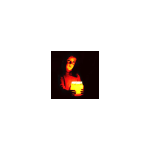
+Wild-Skye Posted September 14, 2014 Share Posted September 14, 2014 (edited) http://imgcdn.geocaching.com/cache/log/large/35e76ff7-88f4-478e-907b-e6a4ee534129.jpg Link to photo The cache is in the hands of the little gnome creature on the decking. The houses are situated above the P in Appeldal. Real cache - start of multi bread a porter GC57XYF Edited September 15, 2014 by Wild-Skye Quote Link to comment
I! Posted September 20, 2014 Author Share Posted September 20, 2014 Wild-Skye's photo didn't appear in his post, so here it is ... ... and here are everyone's guesses so far: Quote Link to comment
+milvus-milvus Posted September 23, 2014 Share Posted September 23, 2014 I'll have another go: The lake to the south of Appeldal is man made - it was dammed to supply water to the village. It was used for bombing practice during the war. The cache is hidden high on the southern side offering fine views over the dam. Photo taken during bombing practice: Real cache: Derwent Dam Fine View Quote Link to comment
I! Posted September 30, 2014 Author Share Posted September 30, 2014 A couple of hours to go, then I'll decide on the winner this evening. Quote Link to comment
I! Posted September 30, 2014 Author Share Posted September 30, 2014 The cache was in the mountains of Isgrind: There were good guesses from milvus-milvus, Gackt and Clue-72 ... ... but the closest, and by virtue of the photo my winning pick, was from Yetidave and Elyz: :) Well done :) Thanks to everyone for playing. Now over to the winners to set next month's competition ... Quote Link to comment
+milvus-milvus Posted September 30, 2014 Share Posted September 30, 2014 Thanks for a very different and interesting theme! Quote Link to comment
+Yetidave and Elyz Posted October 1, 2014 Share Posted October 1, 2014 Wow, never expected to win. Many thanks for a fun competition. October's competition is on its way.... Quote Link to comment
+Bear and Ragged Posted October 1, 2014 Share Posted October 1, 2014 Thanks for a very different and interesting theme! Seconded! Quote Link to comment
+Wild-Skye Posted October 6, 2014 Share Posted October 6, 2014 Fun competition with some great photos - thanks - Looking forward to next theme! Quote Link to comment

Recommended Posts
Join the conversation
You can post now and register later. If you have an account, sign in now to post with your account.
Note: Your post will require moderator approval before it will be visible.