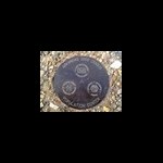
+secondgunman Posted March 1, 2011 Share Posted March 1, 2011 I have several questions that all seem to be connected (at least geographically) and thought I'd start a single new thread for all of them instead of several new threads. Let's begin by looking at the datasheet for Station FORT FH0805. I know that link goes to the sheet at GC.com and if you look at the current data sheet you'll see that the most recent note for it is a not found log by a local surveyor in 2002. The mark is present and I have photos to prove it. I need to do a recovery report for it, I just haven't gotten around to it. Now, on to the questions. Part 1 I understand that the box score shows the distance and azimuth FROM this station TO the points listed in the box. My question in this case specifically revolves around FH1009. This station was marked as destroyed in 1959, and I can confirm that the stone sitting at that location is not the original stone. The original stone currently sits in the nearby museum. FH1009 shows that it was placed in 1919 and was present in good condition in 1935, which is when FH0805 was placed. Am I correct in assuming that the box score for FH0805 tells me that all of the stations listed there were observed FROM FH0805 when it was placed? Anything else seems silly, but I haven't seen that mentioned anywhere else. Part 2 If you look at a topo map of this area you see a few benchmarks and a few things that I'm not sure how to interpret. FH0805 doesn't actually appear on that map that I can see. It would be located about where the "N" is in "Nat Hist Site". BM408 and BM42X are FH0806 and FH0149, respectively. At the center of the map, BM462 is FH0804. At the SE corner of the map, BM468 is FH0803. My second question is this..... Just south of the "National Cem" is a small X with number 429 next to it. Looking at the legend for USGS topo maps, I can't tell if it's supposed to be a "vertical control point, third order or better elevation, recoverable mark, no tablet" or simply a "spot elevation". 429 feet isn't out of line for the elevation above sea level in this area. If it's a recoverable mark, what does "recoverable mark, no tablet" mean? Part 3 On the same topo map as Part 2, you can see two things crossing the river in this area. One is the large red/white striped line representing the highway. Just south of that is a thin black line with several black squares along its length. You'll notice that the south-eastern-most point of that line is a white square. I accidentally cut off the map to the west or you'd see that there's a similar white square on the west side of the river, though in the middle of the line not at a terminus of the line. I can't figure out what that square is supposed to represent. I've talked with the folks at the nearby historic site regarding changes to the AR-OK state boundry over the years, and they told me that there's an old boundry stone in that area. I found the stone, and the coordinates line up pretty well with what I'm able to get from the map, but I see no reason for a small stone (roughly 1 foot cubed) to show up on the topo attached to a line like that. What I'm seeing on the map looks more like a powerline, and there have been several different powerlines crossing the river in this area over the years. But it makes no sense to show a powerline on a map and have it end suddenly like that. I suppose what I'm asking is this: What do you make of the white square on the map? If it is supposed to be a marker of some sort, what would you expect to find there? Bearing in mind that it's possible that there IS a marker there of some sort and that what appears on the map is unrelated. Here's a picture of the stone that I can't figure out: And a shot looking down from above. Note the chiseled cross just left of center in this shot: I'm looking forward to your thoughts! Quote Link to comment
mloser Posted March 1, 2011 Share Posted March 1, 2011 Part 3 (because I am pretty sure of my answer)-The two squares are, I am fairly certain, just large towers. The one on the east side of the river is obvious on Google Earth. You can see the tower itself, the large square base, and the long shadow pointing to one o'clock. The one on the west side is less obvious but I can see it. It is an elongated white triangle pointing at 4 o'clock and the shadow is much shorter (about half the length of the tower) and points to about 10 o'clock. Part 1 I can't be totally sure but I will say that I have found destroyed marks on the box score on numerous occasions. They are just part of the text description of a mark so they will not be updated relationally at all. Part 2 Not all marks appear on topo maps. Some are there just as control for the making of the map. By setting known locations and elevations the map makers can put contour lines on the map and align it to the aerial photos it is created from. The X with 429 beside it may be that sort of control mark and may simply be the elevation of the center of the street. It may be listed on the USGS marker sheet for your map. You can call the USGS and get the descriptions of the markers for your quad (they will fax a single set so you can get instant gratification!). Quote Link to comment
+billwallace Posted March 2, 2011 Share Posted March 2, 2011 Part 2: On the USGS topo map symbol pdf, it looks like a spot elevation has the elevation written in italics where the Third-order or better elevation, recoverable mark, no tablet is not in italics. To me the X you are questioning has its elevation in italics. Part 3: Looks like it matches the Power transmission line; pole; tower symbol/line. All the boundary line symbols look like they are not solid lines or are red or in the case of National Forest System land status, Forest Service lands line it is a solid line with pink shading on one side - so none of those. Part 1: That is always what i have assumed but ......... Quote Link to comment
Bill93 Posted March 2, 2011 Share Posted March 2, 2011 >Part 1: the box score for FH0805 tells me that all of the stations listed there were observed FROM FH0805 Yes. All these stations were observed from there. But the list does not necessarily include all such stations. DaveD once told us that they selected stations for the box score that would most likely be observable by practicing surveyors from the ground (no Bilby tower). I asked because I ran across a reproduction of an old paper data sheet from before they were computerized, and was surprised that it listed more stations than the the box score. >observed when it was placed? I wouldn't assume that. If for some reason there was re-observation done later then NGS might have used some of those stations in the box score. Quote Link to comment

Recommended Posts
Join the conversation
You can post now and register later. If you have an account, sign in now to post with your account.
Note: Your post will require moderator approval before it will be visible.