+CacheHord(e) Posted July 22, 2002 Share Posted July 22, 2002 When I was in California last year (near Sacramento) I noticed big white plus signs painted on the ground all over town. Some were on highways; some were on grassy fields. I guessed they were for aerial surveys, but does anyone on here know for sure? I wish I had a picture to show you. They're about 2 feet wide and 2 feet high. Maybe a little more. Sometimes there's marker nailed in the center of the plus. Team Hord Quote Link to comment
iryshe Posted July 22, 2002 Share Posted July 22, 2002 Surveyors create them and sell them to imagery companies so they can match up their photos with the physical environment. They use these white x's (which have a bolt in the center), as well as street corners or any other highly visible structure that can be seen from the air. If you want to be a full-time geocacher, this is one way to go I hear it pays pretty well too. Jeremy Irish Groundspeak - The Language of Location Quote Link to comment
iryshe Posted July 22, 2002 Share Posted July 22, 2002 Surveyors create them and sell them to imagery companies so they can match up their photos with the physical environment. They use these white x's (which have a bolt in the center), as well as street corners or any other highly visible structure that can be seen from the air. If you want to be a full-time geocacher, this is one way to go I hear it pays pretty well too. Jeremy Irish Groundspeak - The Language of Location Quote Link to comment
+ca_surveyor Posted July 25, 2002 Share Posted July 25, 2002 The crosses are placed, as Jeremy says above, to provide ground control for aerial photography. The crosses are placed, typically along some rough gridwork that the photogrammetry company defines based on the area to be mapped, the desired scale, and the altitude the plane will fly. Given that, the surveyors will try to reach a point within about 50 feet of the target, establish a point, or use an existing monument, and then place a cross on the ground. In the streets these are pretty simple. A can of cheap paint (so it doesn't last too long and blight the area and worse) and a brush. It gets more creative on a hillside or (my worst case, in a cow pasture..the cows kept eating the cross material). I have heard of once case where the plane was early and the last cross was not done. The surveyor and his assistant lay on the ground and each pointed at the survey point.. it actually worked (but they had to keep doing it each time the plane went by because they never knew if they were in the grid line being currently photographed). gil ca_surveyor (you got questions.. we got answers.. but do they match - grin) Quote Link to comment
+CacheHord(e) Posted August 1, 2002 Author Share Posted August 1, 2002 Thanks for the authoritative reply. Are there any examples of these aerial photos I can see online? (Just curious) Team Hord Quote Link to comment
survey tech Posted August 1, 2002 Share Posted August 1, 2002 Landnetusa is a good source of various types of mapping including aerial photos. Quote Link to comment
+n8aho Posted August 1, 2002 Share Posted August 1, 2002 Is there a technical name for this type of mark so I can search around on the web to find more information? Jim massillon ohio stark county skywarn packet radio, aprs long haul 802.11b, warchalking linux, os x geocaching geodashing gps art recumbent bikes extreme kites Quote Link to comment
+n8aho Posted August 2, 2002 Share Posted August 2, 2002 I found these this morning, could this be the same or similar to what the white plusses are for? Jim http://www.photolib.noaa.gov/historic/c&gs/thind8.htm http://www.photolib.noaa.gov/historic/c&gs/theb0976.htm http://www.photolib.noaa.gov/historic/c&gs/theb0977.htm massillon ohio stark county skywarn packet radio, aprs long haul 802.11b, warchalking linux, os x geocaching geodashing gps art recumbent bikes extreme kites Quote Link to comment
+infosponge Posted August 2, 2002 Share Posted August 2, 2002 Yes, that's what they are. quote:Originally posted by n8aho:I found these this morning, could this be the same or similar to what the white plusses are for? Jim Quote Link to comment
+makaio Posted August 9, 2002 Share Posted August 9, 2002 Like this one ? The benchmark is beneath the plate at the center of the cross. The Data Sheet for this benchmark shows it's a HORIZONTAL marker which coincides with the aerial survey descriptions above. - Quote Link to comment
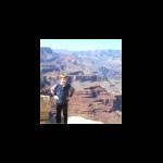
+EraSeek Posted August 9, 2002 Share Posted August 9, 2002 Here's one that is part of my ''Havesting The Tides'' cache: http://img.Groundspeak.com/cache/6596_200.jpg a very cool spot! Quote Link to comment

Recommended Posts
Join the conversation
You can post now and register later. If you have an account, sign in now to post with your account.
Note: Your post will require moderator approval before it will be visible.