Glenn W Posted July 31, 2007 Share Posted July 31, 2007 I noticed that the roads in my area are located with far less accuracy on TOPO 2008 as compared to Topo USA. It's so bad, my home plots on the wrong block. It seems Garmin gave with one hand (named roads and shading), but took away with the other (less accurate roads). Quote Link to comment
+Redwoods Mtn Biker Posted July 31, 2007 Share Posted July 31, 2007 Ok, I purchased Topo 2008 this weekend and it is far better than the base map. Let me ask this - I loaded about 900 maps to my GPS60CSX and on the map set-up page, under map name, it seems to list the names of all the tiles I loaded? How in the world would I ever turn these maps off if I later install City Nav? when you are on the map setup page and have map setup - Information highlighted(where it shows map name) press the menu button. this will bring up a much easier to use show/hide map screen, where you can show/hide the entire mapsets. To me it doesn't even make any sense why garmin has the screen that allows you to hide map segments individually, then it just requires more button presses to achieve my goal. Great tip!!!!!!! Quote Link to comment
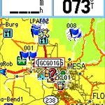
+GeekBoy.from.Illinois Posted July 31, 2007 Share Posted July 31, 2007 I noticed that the roads in my area are located with far less accuracy on TOPO 2008 as compared to Topo USA. It's so bad, my home plots on the wrong block. It seems Garmin gave with one hand (named roads and shading), but took away with the other (less accurate roads). I am seeing the same issue with my maps. Many of the roads I use regularly are 50-300 feet off the driving track that my GPS shows. It makes it difficult when I am trying to determine which road to turn on and the road I wan t is really 100 feet behind me already but still ahead of my on the GPSr screen. Quote Link to comment
+mo_town_man Posted July 31, 2007 Share Posted July 31, 2007 I noticed that the roads in my area are located with far less accuracy on TOPO 2008 as compared to Topo USA. It's so bad, my home plots on the wrong block. It seems Garmin gave with one hand (named roads and shading), but took away with the other (less accurate roads). I am seeing the same issue with my maps. Many of the roads I use regularly are 50-300 feet off the driving track that my GPS shows. It makes it difficult when I am trying to determine which road to turn on and the road I wan t is really 100 feet behind me already but still ahead of my on the GPSr screen. sounds like you need the road map instead of or in addition to the topo map. Quote Link to comment
+GeekBoy.from.Illinois Posted July 31, 2007 Share Posted July 31, 2007 (edited) I am seeing the same issue with my maps. Many of the roads I use regularly are 50-300 feet off the driving track that my GPS shows. It makes it difficult when I am trying to determine which road to turn on and the road I wan t is really 100 feet behind me already but still ahead of my on the GPSr screen. sounds like you need the road map instead of or in addition to the topo map. Why should I have to spend another couple hundred dollars to buy another set of maps to load on my GPSr when the maps already have roads (with names) on them? Based on the accuracy (or lack there of) with the current Topo maps, why should I assume that the street routing maps are any more accurate? I don't want my GPS to tell me how to get there, I just want the maps it displays to be accurate... Edited July 31, 2007 by GeekBoy.from.Illinois Quote Link to comment
+mo_town_man Posted July 31, 2007 Share Posted July 31, 2007 I am seeing the same issue with my maps. Many of the roads I use regularly are 50-300 feet off the driving track that my GPS shows. It makes it difficult when I am trying to determine which road to turn on and the road I wan t is really 100 feet behind me already but still ahead of my on the GPSr screen. sounds like you need the road map instead of or in addition to the topo map. Why should I have to spend another couple hundred dollars to buy another set of maps to load on my GPSr when the maps already have roads (with names) on them? Based on the accuracy (or lack there of) with the current Topo maps, why should I assume that the street routing maps are any more accurate? I don't want my GPS to tell me how to get there, I just want the maps it displays to be accurate... I think thats the whole idea on why it can't do auto-routeing and don't cover roads as good. I don't think they intend for one map to take the place of another. They finally gave topo 2008 street names, so now u want to use it as a road map. Not sure about more accurate, but it can "lock on the road", where i doubt u can do that with topo2008. And no, u are right, its not perfect. Sometimes the cache here in WV is listed on wrong side of bike trail. Sometimes when I jetski, and look over the tracks, and i'm jetsking on land close to lake. Or sometimes i'm walking on water. But, i still feel i got my 100 dollars worth. Its a pretty map, but as u know, not 100% perfect. --danny Quote Link to comment
+GeekBoy.from.Illinois Posted August 1, 2007 Share Posted August 1, 2007 ... But, i still feel i got my 100 dollars worth. Its a pretty map, but as u know, not 100% perfect. Our complaint is that it is less accurate than the last version which we had also paid $100 for. Most folks expect the newer versions to be better than the older version, not worse... Quote Link to comment
+mo_town_man Posted August 1, 2007 Share Posted August 1, 2007 ... But, i still feel i got my 100 dollars worth. Its a pretty map, but as u know, not 100% perfect. Our complaint is that it is less accurate than the last version which we had also paid $100 for. Most folks expect the newer versions to be better than the older version, not worse... I'm new to GPS's.. or fairly new. So topo 2008 was my only gps topo map. And it beats the heck out of the base map. Course anything would beat the heck out of it. But since u had a earlier topo, i can see where you are comming from. Least you got street names if you don't have the road map. (still don't begin to take place of the street map). And you got shadeing. On downside, it takes up a LOT more room on the card (so they tell me) and it may be less accurate. Guess take the good with the bad and there u got the Facts of Life. Now if they would only release City NT 2008. I want it BAD. Quote Link to comment
+geobernd Posted August 5, 2007 Share Posted August 5, 2007 $48.87 at Amazon after rebate, and free shipping too. I just checked the details of that rebate, and it's only good if you are upgrading from an old version of Mapsource US Topo. http://ec1.images-amazon.com/images/G/01/0..._V31778602_.pdf I think the price is 109.98 minus the $30 rebate. The $78.87 seems to be the OLD mapsource topo. The first sale date was Jan, 2007 way before the 2008 product was available and the old picture is shown as well. Just got mine from Amazon - and it is Topo 2008 (they also fixed the picture) for $78.87 - $30 upgrade rebate... Good deal... It's installing as I write this..... Quote Link to comment
Oregon*Trail Posted August 6, 2007 Share Posted August 6, 2007 So I'm ready to buy topo 2008. Do I need to look for NT version? I only see the North America 2008 DVD. Is that the one that I need for my Vista HCX? I also am looking for dash mount. It's a toss up between Garmin and RAM. Looks like the RAM needs to be screwed in. Which would you recommend? Thanks! Quote Link to comment
GeoBobC Posted August 6, 2007 Share Posted August 6, 2007 There is only one version of Topo 2008. Quote Link to comment
+tallenwa Posted August 13, 2007 Share Posted August 13, 2007 I just ordered this from AMAZON for $59.10 BEFORE mail in upgrade rebate. List Price: $116.65 Price: $59.10 You Save: $57.55 (49%) Rebate: $30.00 Price After Rebate: $29.10 Check it out. Link Quote Link to comment
roktoys84 Posted August 28, 2007 Share Posted August 28, 2007 I just installed TOPO 2008 and I'm not seeing any terrain shading. When I switch between maps it looks similar to TOPO USA but with more detail, but no shading. Anyone seen this? Quote Link to comment
CenTexDodger Posted August 28, 2007 Share Posted August 28, 2007 I just installed TOPO 2008 and I'm not seeing any terrain shading. When I switch between maps it looks similar to TOPO USA but with more detail, but no shading. Anyone seen this? Try Edit-->preference-->Terrain Shading-->on. Quote Link to comment
+TeamCatalpa Posted August 28, 2007 Share Posted August 28, 2007 The link from tallenwa to the Amazon site, is that the actual topo dvd? Not an upgrade, or old version, but the actual topo 2008 that everyone had pre-ordered and just got? I'm new to GPS and geocaching, I just got a Garmin 60 csx, and was unpleasantly surprised at the base map. It doesn't even show any of the roads in my county! So I'm thinking about getting the topo for work, and the city navigator for exploring and geocaching, so I have routable road maps. From what I've read here, I'm trying to understand, is it possible to load and use both maps? Do I have to switch back and forth between them depending on what I'm doing, or do I have to always re-load each one before use? This newbie appreciates all helpful answers! Quote Link to comment
CenTexDodger Posted August 28, 2007 Share Posted August 28, 2007 The link from tallenwa to the Amazon site, is that the actual topo dvd? Not an upgrade, or old version, but the actual topo 2008 that everyone had pre-ordered and just got? There is not an upgrade for this one. The one at Amazon is the correct software. I'm new to GPS and geocaching, I just got a Garmin 60 csx, and was unpleasantly surprised at the base map. It doesn't even show any of the roads in my county! Yes they are not very good. So I'm thinking about getting the topo for work, and the city navigator for exploring and geocaching, so I have routable road maps. That works. Many users here do the same thing. From what I've read here, I'm trying to understand, is it possible to load and use both maps? Do I have to switch back and forth between them depending on what I'm doing, or do I have to always re-load each one before use? This newbie appreciates all helpful answers! You can load them on your GPS at the the same time, and just switch back and forth between them. They do not display simultaneously, you have to swith back and forth. Quote Link to comment
roktoys84 Posted August 28, 2007 Share Posted August 28, 2007 Try Edit-->preference-->Terrain Shading-->on. Thanks, looks much better Quote Link to comment
GPS 06 Posted September 23, 2007 Share Posted September 23, 2007 Two questions here: 1) I recently purchased the Garmin Topo 2008 DVD, and I am wondering if anybody has figured out how to make the Topo2008 image files transparent so I can overlay them in my GPS with the CN2008 map? I have tried the Trans_2A program, which seems to work with the old Topo map image files, but it doesn't seem to work with the new Topo 2008 files. 2) I am wondering if there is a way to find out which image file name is associated with what map segment in Mapsource. The name in Mapsource (e.g. Moab,UT-CO East) does not provide the image file name (e.g. 00162774.img) that you see in the Windows Explorer. Is there any way to find out the association so I know what file name goes with what Mapsource segment? Thanks Quote Link to comment

Recommended Posts
Join the conversation
You can post now and register later. If you have an account, sign in now to post with your account.
Note: Your post will require moderator approval before it will be visible.