+flipflopnick Posted June 22, 2006 Share Posted June 22, 2006 (edited) This is a thread to discuss Cream of Galloway meet 2006 event cache GCWNH1. Bring mountain bike, walking gear and conviviality. One of many events this weekend. Edited June 22, 2006 by flipflopnick Quote Link to comment
+Haggis Hunter Posted June 23, 2006 Share Posted June 23, 2006 That's a bad weekend for me, so I won't be able to make it. Which is a pity as it looks as though it will be great. Look out for the elephant Mimetolith when you go over to Hestan Island. I hope the event goes well for you? Quote Link to comment
+perth pathfinders Posted June 23, 2006 Share Posted June 23, 2006 Sorry, won't be able to attend, as this clashes with the 5th Scottish Cache Bash - Gathering in the Glens. Wish you every success with your event! Quote Link to comment
+Simply Paul Posted June 23, 2006 Share Posted June 23, 2006 A link, like a zip, is for ease of access! Quote Link to comment
The Toughs Posted June 23, 2006 Share Posted June 23, 2006 Sadly its too far for us for a weekend, can vouch for the area tho, we were up there for a camping trip at the end of May Ice Cream is superb Lovely beach at this cache site if you venture a bit further afield Rigg Bay Fancied Hestan Island hop, but decided against as nippers in tow Quote Link to comment
+The Forester Posted June 23, 2006 Share Posted June 23, 2006 For those who are planning to walk to Hestan that weekend, I'd urge a note of caution. I've computed some bespoke tide tables and the resultant data is not encouraging. On Friday the 8th of September Low Water (29cm) is predicted to be at 19:21BST. Sunset that evening will be at 19:47BST, ie just 26 minutes after low tide. That really doesn't give you a lot of time to get back to safety before dusk. Remember that the deepest water is at the inshore end of the walk, ie at the end of your escape route from the island. Saturday the 9th is even worse. Although the lower tide (15cm) will buy you an extra 66 minutes of 'dry' time compared with the Friday, you still have the problem that Low Water will be 21 minutes after sunset. Planning to find yourself trapped by a rising tide in the gathering gloom of dusk is, at best, unwise. Plenty of people have died as a result of underestimating how rapidly the flood tide cuts off an escape from Hestan. As for Sunday, forget it. Low water will be an hour and five minutes after sunset. Of course there are two tides per day, but the fundamental problem is that Spring tides near the equinox have been chosen. It's a coincidence, but not happenstance, that low tide just happens to be near dawn and dusk. Think about the mechanism of what causes tides, especially Spring tides. These Springs are caused by a full moon. The full moon is a result of the Sun, the Earth and the Moon being strung out in a straight line. No surprise then that the moon rises just as the sun is setting and no surprise that low tide is around that time of day. I suppose if you're really determined, you could catch the dawn tide, but you really would have to get up at the crack of sparrow's fart in the morning to explore the island and do its cache and yet get back ashore safely before the tide starts to rip. Low water on the morning of Saturday the 9th will be at 07:47 and will be spectacularly low -- one of the lowest tides of the entire 18½ year tidal cycle -- but that is a classic beartrap because it will be followed by one of the highest tides, which means that the tide will come in at a hell of rate. It's a classic killer tide which is just waiting to lure the unwary into deep doodoo. Remember that the tidal curve in this estuarine environment is lop-sided. The tide comes in faster than it goes out. Remember also that meteorological effects can adversely affect tidal flow. If there is a low pressure area in the vicinity, a situation which is extremely common in September, or if there is a SouWesterly wind, another very common occurrence at that time of year, the water tends to be piled up at the top end of the Solway and the low water slack period can simply vanish, with an early onset of a very fast young flood tide. It's a very well known and well understood phenomenon called a 'surge' and it's not at all rare. The fundamental problem with planning to do a low tide walk like this so close to the autumnal equinox is that it fails to take into account the mechanism of what makes the tidal clock tick. I personally would love to do the Hestan island cache and Spring tides are the right time to do it, but as a Hydrographer who is well into his second quarter century of practical experience, I think that September is a really good time of year NOT to venture into the jaws of such an easily predictable trap. I'd like to think that somebody somewhere had learned some lessons from the cocklers' tragedy last year, which happened just down the coast from this location, but I do sometimes wonder. Good luck! Quote Link to comment
+flipflopnick Posted June 23, 2006 Author Share Posted June 23, 2006 Thanx to The Forester, sobering thoughts. Wish you were coming along. I consider all those criteria The Forester mentioned to find the biggest tides to surf the tidal bores that occur in the estuaries round the UK. So looking at the opposite criteria will hopefully prove successful for this journey. Can always turn round before leaving mainland. Always ready for a DNF. So ideally what we need is high pressure, NE Force 3 wind, cloudless sky. Thanx also for the tidal predictions and sunset times. Realise time is potentially tight, but only need to get back onto mainland before absolute dark, (bring torch) which should not be for at least half an hour after sunset. Plenty of time to cross the RACK. Walking back on landrover tracks across the headland in the twilight will be comparatively easier. BTW the cache owner set the cache at this time of year, under these conditions. And they got back to create the cache. [Just been told off by my elder sister, for kayaking out to Hestan Island solo.] Wonder what The Forester's opinion is of walking out on Thursday evening? As with all these adventures, its a mental thing. Keeping your head together. That's not to say false bravado, more considered action, re-evaluating your position as you go along. Which is why we do it. If people don't want the challenge .... Quote Link to comment
+Seasider Posted June 24, 2006 Share Posted June 24, 2006 I'm interested in this and have noted the comments by Forester. Just one question - do you have local knowledge of this part of the coast? I live on the west coast but further south and often follow the Ribble channel across the estuary and along the line of perches to the sea - sometimes getting 3.5 miles out from shore and sometimes in the dark. Indeed, the furthest perch (Mussel Point we call it) is only reachable at neap tides and in winter can only be done in the dark. On paper it looks dangerous - being 3.5 miles away from shore in the dark with the tide coming in on 3 sides. However, with local knowledge it isn't and infact I'm going to take a cryptozoologist out there in the dark later in the year to show him where I trod on a patch of glow-worms (unknown to this coast) last December . If you have experience of walking to the Island then put me down on the list. P.S I'm not that much of a camper and definitely not a biker so will pass on the rest of the activities! Cheers! Seasider Quote Link to comment
+The Forester Posted June 24, 2006 Share Posted June 24, 2006 If you are seriously considering organising a gagglecache out to that island in those tides, I strongly recommend that you take rather more safety precautions than merely carrying a torch. As an absolute minimum, you should: Inform the Coastguard in advance of what you are contemplating. They will be extremely busy that weekend as so many other people will wander out onto the flats to admire the sunset and explore the rarely exposed seabed. The RNLI and the SAR helicopters will have a very busy evening rescuing foolish people and you may have to join a queue. As any IRB cox'n will readily attest, nighttime searches are the most difficult and most often have unsatisfactory outcomes. Do not rely on cellphones. Most are not waterproof and saltwater does them no good at all. Keep a very strict headcount of everyone who goes out to the island and count them all back in again. One of the common characteristics of those predictable tragedies is confusion as to how many bodies to search for. Keep a very close eye on the difference between predicted and actual tides. Predicting the astronomical component of tidal height is trivially simple because it's just a matter of summing the phase angle and amplitude of four harmonic constituents, but forecasting the weather beyond about five days is practically impossible because it's a non-linear system in which chaos prevails. Wonder what The Forester's opinion is of walking out on Thursday evening? Low Water that evening will not be especially low. My own tables show a tidal height of 0.64m at 18:37BST. Sunset will be at 19:49BST, by which time the tide will have risen to 1.29 metres. Quote Link to comment
+The Forester Posted June 24, 2006 Share Posted June 24, 2006 do you have local knowledge of this part of the coast? No. I rely on the hypsography and hydrography published by the Admiralty. Is there any local knowledge which suggests that the Admiralty is wrong? If so, a submission ought to be made to Taunton to have corrections made. Quote Link to comment
+The Forester Posted June 24, 2006 Share Posted June 24, 2006 By an odd coincidence, the BBC has today published this news report. Quote Link to comment
+The Forester Posted June 24, 2006 Share Posted June 24, 2006 the furthest perch (Mussel Point we call it) is only reachable at neap tides I'm puzzled. What is the reason why it's only reachable during neaps? Quote Link to comment
+Haggis Hunter Posted June 24, 2006 Share Posted June 24, 2006 By an odd coincidence, the BBC has today published this news report. People get trapped by the tides on a daily basis. Cramond Island for instance has several rescues every Saturday & Sunday. Would it not be cheaper to put a member of the coatsguard on patrol on those days to get the people off? Probably but rather impractical. I have noted from your link that the coastguard recommends this - .....the coastguard urged people to check tide times before embarking on a walk close to the sea. Which is the most advice I have ever seen the coastguard give on such a situation. Although I would agree that your advice is rather sound and good, I do feel however as though you may be over inflating the situation. Could this possibly be because it falls on the same weekend as another Scottish event, that has been organised by the admin/mods & members of a forum that you are a moderator on? Flipflopnick, going by your posts, you sound as though you have a good experience of such things. If you have done your homework then go ahead with it. But I suppose it wouldn't hurt to call the coastguard and get their expert opinion of your plans. Quote Link to comment
+Seasider Posted June 24, 2006 Share Posted June 24, 2006 do you have local knowledge of this part of the coast? No. I rely on the hypsography and hydrography published by the Admiralty. Is there any local knowledge which suggests that the Admiralty is wrong? If so, a submission ought to be made to Taunton to have corrections made. Err... the question was aimed at Flipflopnick. But it's interesting that you are making (slightly ridiculous) comments about a part of the coast you know nothing about. The key issue is how long will the beach around the Island be clear of water. Can your charts tell us that? Spouting technical details about harmonics etc. is all very well but is a poor substitute for actual knowledge of the area. Lets wait to hear from Flipflopnick whether he has made this journey before. Cheers! Seasider Quote Link to comment
+Seasider Posted June 24, 2006 Share Posted June 24, 2006 By an odd coincidence, the BBC has today published this news report. This just proves how important knowledge of an area is. Even with an in depth knowledge of tide tables and how they are calculated I would be wary about walking an estuary which I had never visited before. I would always make sure I went with a local. Cheers! Seasider Quote Link to comment
+The Forester Posted June 24, 2006 Share Posted June 24, 2006 you may be over inflating the situation Not at all. Quite the opposite, in fact. I'm deflating a potential hazard by arming people with information. The cachpage lists the times of High Water but it doesn't show the times of Low Water or sunset times. I've highlighted the potential hazard that faces people trying to go out to the island at low tide, especially on the Sunday. Part of the problem is that the Hydrographic Office no longer gives freebie tidal predictions for more than a week ahead. Chancellor Gorm Broon wants to fill his war chest to pay for another four boatloads of buckets of sunshine and he'll have to sack a helluva lot of nurses to pay for that lot. Government policy nowadays is to make organisations such as the Hydrographic Office and the OS pay their way. This has led to anomalies such as vital safety information becoming a profit-making commodity to be sold for whatever the market can stand. I think that stinks and I'm very happy to provide anyone who needs tidal data with whatever they want. I had a chufti at Google to see if I could find a link to give to people who want to do their own tidal calcs, but I see that the Crown has sent notices to several outfits which had offered freeware programs demanding that they withdraw any information which was derived from Admiralty data. That really stinks. The Cramond Island example you mention is a good case in point. It's the people who don't check the tide tables who get stuck on the island. I don't think the date chosen for the island gig is particularly good. Given that there are a couple of dozen Spring tides a year, choosing an equinoxial Spring when the tide is high during the day does not seem to me to be an optimum use of tide tables. While I accept Seasider's point that he's quite happy to walk long distances over tidal flats at night in an area of which he has local knowledge, I think you have to also take into account the fact that these gigs attract families and that many parents would be very wary of taking children out onto the tidal flats at dusk when ferocious tides are to be expected. The fact that of 52 weekends in the year, this event has been chosen in a clash with the 5th Scottish Cache Bash - Gathering in the Glens event is unfortunate, especially for someone like me who lives pretty well midway between the two venues, but that clash is much less important than the safety issue. Remember that there are two sets of Spring tides every month, which means that every second weekend is within three days of a Spring tide. I agree that the event organiser would be wise to consult the coastguard. They have an immense amount of highly detailed local knowledge and will be able to give some useful advice. For example, they will probably be able to advise at what tidal height the route becomes passable. The coastguard tracks actual tide data in realtime and they will be able to advise whether the actual tide is leading or lagging the predicted curve on the day. The last camping event I attended had well over a hundred cachers and caching teams. If this event attracts even a fraction of that number and if a significant proportion of the attendees join in the gagglecaching expedition to the island, it would be a good idea to let the coastguard know and to phone them again at the end of the day when everybody has safely returned from the island and is accounted for. I'm often amazed that so many members of the public don't consult the coastguard when planning unusual coastal trips. The coastguard provide an immensely valuable (and free!) service. Anyway, they always like to know what's happening on 'their' patch and an organised event such as this is just the sort of thing they like to know about. Quote Link to comment
+Seasider Posted June 24, 2006 Share Posted June 24, 2006 the furthest perch (Mussel Point we call it) is only reachable at neap tides I'm puzzled. What is the reason why it's only reachable during neaps? Sorry - brain not engaged this morning - I obviously meant spring tide. Cheers! Seasider Quote Link to comment
+The Forester Posted June 24, 2006 Share Posted June 24, 2006 The key issue is how long will the beach around the Island be clear of water. No. The key issue is that on the chosen weekend Low Water will be at dusk. That's the key issue. I think a better plan would be to choose a weekend when low tide happens during daytime. There are plenty to choose from. Quote Link to comment
+Seasider Posted June 24, 2006 Share Posted June 24, 2006 No, you said low water was 26 minutes before sunset plus the causeway is just 1/2 mile long and takes 10 minutes to cross so no problems there. Indeed, no doubt the journey can commence before the low tide mark and can conclude with the sun still in the sky Since no-one can give me any information on how long the causeway would be water free I have contacted the Scottish Ramblers in the area to give their opinion of the proposed journey (maybe they might join us on the day) and will report back with conclusions in due course. Cheers! Seasider Quote Link to comment
+Team Ballibeg Posted June 24, 2006 Share Posted June 24, 2006 Sunset and the time its too dark to see enough are not the same. Dave Quote Link to comment
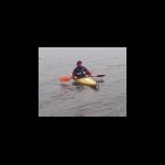
+flipflopnick Posted June 24, 2006 Author Share Posted June 24, 2006 No, you said low water was 26 minutes before sunset plus the causeway is just 1/2 mile long and takes 10 minutes to cross so no problems there. Indeed, no doubt the journey can commence before the low tide mark and can conclude with the sun still in the sky Since no-one can give me any information on how long the causeway would be water free I have contacted the Scottish Ramblers in the area to give their opinion of the proposed journey (maybe they might join us on the day) and will report back with conclusions in due course. Cheers! Seasider Look forward to meeting Seasider. Which day, date? Usually on these forum threads about events, people discuss BBQs and electric hookups, this one seams to have gone off on tangent. It really good to get some corroborating info about tide and sunset. Good to compare info. May not even make it to Hestan Island, as could get swept away by Seacat wash on cliffs near Kirkholm earlier in week. If survive that, then probably die of exhaustion cycling into 'theres gold in them hills'. Once recovered from that, almost certainly get swallowed by a bog on the way to Merrick. So chances of being alive by end of week are slim. Hestan will be a relief, less than 1 km on level terrain. My only visits to Hestan Island are last week, when I kayaked solo across to it, and last November walked out to headland, but was thwarted by tide not being low enough, so could not cross to island. Hence choice of spring tides. Walk across headland is straight forward, tricky bit is waiting to set off across causeway. Like Seasider I've explored my local estuaries (Morecambe Bay, Ravenglass, Leven and further away Severn) and intend to apply my knowledge gained to this adventure. (see co-ords in sig) I doubt there will be any families as schools will have returned in England. Choice of date was determined by the tides and sunset. Been planning this week since December 2005, but had to wait until finished recce of camp-sites, last week. Date is unfortunate as there are two other events on. Event will appeal to the few adventurous (not foolhardy) cachers that are out there, that don't want to run with the crowd, and want to find caches above 2/2. If there are 10 people during the whole week, in total, it'll be amazing. More likely one, myself. Merrick will be more of a challenge. Would The Forester consider being our base contact, when we walk out to Hestan? If not I have backup people. Re. Coastguard, have a tale to tell. Was night surfing the Morecambe Bay tidal bore in WW kayaks with friends. Had told Coastguard what we were doing. MRSC Liverpool is our centre. They did not know where we were talking about, and did not want to know about every little boat journey on the sea, as far as they were concerned. We thought it was best to tell them, which we'd done. Didn't tell the police and everyone in Grange-o-sands. Someone in Grange-o-sands saw lights out in estuary at night, called police. Who then proceeded to blind us with their search light as we tried to surf in, now blinded. That was the first time, nearly covered all the bases. Next times did not tell anyone. And did not use lights. Older, wiser now. All adds to life's rich tapestry. 'The Sector base of the Solway is located in Dee Walk, Kirkcudbright with the Maritime Rescue Coordinating Sub Centre at Liverpool. Tel no (24hrs): 0151 931 3341' are responsible for Solway, including Hestan inlet. http://www.mcga.gov.uk/c4mca/mcga-dops-reg...lway_sector.htm This is just one adventure during the week which people are welcome to share. Maybe someone else has some ideas for adventures in south west Scotland, with or without caches. Quote Link to comment
+flipflopnick Posted June 24, 2006 Author Share Posted June 24, 2006 That's a bad weekend for me, so I won't be able to make it. Which is a pity as it looks as though it will be great. Look out for the elephant Mimetolith when you go over to Hestan Island. I hope the event goes well for you? Thanx for adding to bookmark list. Have you seen photos on Hestan Hop page of elephant?. Event is also during week running up to date. Take some more time off, join us. Quote Link to comment
+The Forester Posted June 24, 2006 Share Posted June 24, 2006 I've emailed a former shipmate who now works for the coastguard, asking him if he can look up the height above Chart Datum of the lowest point on the route. He's a desk warrior nowadays so I don't suppose he'll be able to answer until Monday. With that dimension I can plot a time series showing the window of opportunity for each of the tides over the weekend in question. I'll upload the graphs and tabulations to the cachepage to assist people in planning a trip to the islet. I'll include one for the early morning tide on the 9th, which is a humdinger of a low tide which will probably go as much as 4.46m (almost 15 feet) below local mean sea level, just in case any earlybirds want to take advantage of that opportunity to make the crossing. Of course there's still the uncertainty of what the weather effects will be, but that's always going to be a problem and shouldn't worry us at this stage. Here's an example of actual tidal data plotted on top of predicted. Note what happened on the 21st. The low tide didn't go quite as low as predicted and the high tide was a wee bit higher. Air pressure that day was 1000mB which is just slightly on the low side. Quote Link to comment
+The Forester Posted June 24, 2006 Share Posted June 24, 2006 It looks like they've got some serious currents in that part of the world. Take a look at this BBC News story. Quote Link to comment
+Haggis Hunter Posted June 25, 2006 Share Posted June 25, 2006 That's a bad weekend for me, so I won't be able to make it. Which is a pity as it looks as though it will be great. Look out for the elephant Mimetolith when you go over to Hestan Island. I hope the event goes well for you? Thanx for adding to bookmark list. Have you seen photos on Hestan Hop page of elephant?. Event is also during week running up to date. Take some more time off, join us. I really wish I could join you, but I have already made arrangements to get away the week before to climb Schiehallion & Ben Vrackie. Getting my leave pass to extend to another week at the other side of Scotland just won't work I am afraid. I hadn't seen the photos and my link on the Gey Man of Merrick page had expired for the second time. So I hope you don't mind but I have now linked to your photo? When you do any of your walks in the area, remember to submit a route card for your walk, and also follow the advice on that link. I sincerely wish I could be there for the Hestan trip and the Merrick walk. To be able to see peoples faces as they turn the corner and see the mimetolith would make my journey out there even more worth it. With that said it has already been worth it, as it has had a few visits. If you have good weather for the walk, you should consider having a wee dip in Loch Enoch. Not many people can boast of swimming in the highest loch in Scotland. Quote Link to comment
+The Forester Posted June 25, 2006 Share Posted June 25, 2006 I've done a wee bit of elementary detective work to try to estimate the tidal height at which the islet is accessible. I started with this picture from the islet's cachepage: I've concluded that the photograph was taken an hour and a half before Low Water on Monday the 19th of September last year. I've computed a hindcast of the tidal height at that time (18:22BST) and it suggests that the astronomical component of the tidal height would have been 1.14m. To adjust for actual height, I've examined the tidal records for the nearby port of Workington. At that location and at that time, the actual tide was 10cm higher than predicted. It is reasonable to presume that the same correction should be applied to the predicted tide height at Hestan, so we have a corrected tide height of 1.24m at the time of this photograph. A second photograph shows a view from the island, looking North: I calculate an actual tidal height of 0.91m for this photograph, which I believe to have been taken an hour and 7 minutes before Low Water. We just need to check with the cache creators whether they recall if the deep part of the route to the North of the Rack was clear of tidewater when they walked out to the islet. If so, then we can presume that the tide window commences when the tide falls to that level. By adopting a maximum tide height of 1.2m as acceptable for accessing the route, I can recompute the start and end of the accessible time periods. I shall construct a graph and tabulation on that basis if the presumption is confirmed. I'll do it in such a way that the actual tide on the day can be used to make any necessary adjustment to the predicted tide curve. The Proudman Lab's website gives access to realtime tidal data for the Solway via the tide gauge at Workington so such an adjustment will be very easy and people can adjust their gameplan accordingly. Of course, if I'm wrong about the date and times of the photographs then my calculations are completely invalidated, but there's a reason why I have some confidence that I might be right. A little over an hour elapsed between the photograph on the beach at White Port Bay and the picture on the Rack, which is only a kilometre or so away. This suggests to me that there were loitering, waiting for the tide to to ebb sufficiently for a dry passsage out to the rack. If so, the figure of 1.2m as a drying height looks quite sound and can form part of a well calculated plan. Quote Link to comment
+Simply Paul Posted June 25, 2006 Share Posted June 25, 2006 Won't air pressure and wind strength and direction also have a marked effect on tidal height? He said, splashing smart-arse petrol on the BBQ of discussion and running away. Quote Link to comment
+The Forester Posted June 26, 2006 Share Posted June 26, 2006 Won't air pressure and wind strength and direction also have a marked effect on tidal height? Yes. It most certainly does. That's why my backcaclculation of the tidal height at the moment of the two photographs I show in the above post takes into account the 10 centimetres that the actual tidal height at Workington was above the predicted heights for those times. Such 'surges' are extremely common and it's vital to take them into account, especially when considering something as potentially foolhardy as venturing onto the tidal flats of somewhere like the Solway Firth with encroaching darkness. Foolhardiness becomes recklessness when safety margins are knowingly and deliberately sacrificed and the safety margins for this risky venture are already quite slender enough. If my estimate of the sands' height above Chart Datum of 1.2m is correct, the access window on the Saturday will be an hour and 25 minutes long before sunset. An example of a quite typical surge occurred just 9 days after the islet's cache was created. That surge, of 57.5cm, if it were to occur on the Saturday of the proposed event, would reduce the duration of the daytime access window to just 42 minutes. That surge wasn't even a biggie. In 2005 there were plenty of surges greater than the 1.05m which would cause the sands not to become uncovered at all on the evening of the 9th of September. I propose that the actual tidal height of the Solway be monitored on the day of the event to adjust the prediction of when the access window at Heston will occur. There's a bubbler gauge at Workington on the other side of the Solway which broadcasts its near realtime data. I shall provide the event organiser with predictions for the gauge and a ready-reckoner table to convert that gauge's actual data into a forecast of the timing of the access window at Hestan. Quote Link to comment
+Jango & Boba Fett Posted June 30, 2006 Share Posted June 30, 2006 Having seen the effects of a southwesterly gale on the flood tide while battling my way to Funny Faces on 20 June. The tide was forcing its way up the Rough Firth an hour early and a couple of yachts which were sitting abeam the sea with their kedges stuck in the mud very nearly were ripped from their moorings. So took shelter in the Chandlers at Kippford with some worried looking yacht owners and bought myself a tide table. Perused the tide table that night and made plans for a Galloway version of HighlandNick's Summit to Sea (LowlandJango's Merrick to Mare maybe ). Low tide at Liverpool was predicted at 13:43 on Wednesday 21 June so add 1:00 for BST and 0:25 for the delay in the tidal wave reaching Heston Islet and low tide should have occurred at 15:08. Summited the Merrick at 11 am, reached the Grey Man at 12:00 and then yomped down the Rigg of Loch Enoch to return to the by the Bruce Stone by 2 ish. Observed all the rules of the road and parked at the end of the public road at Almorness at 3 pm. A third of the way to the end of the point I found I'd left my GPSr in its cradle on the dash so having doubled back I eventually reached the end of Almorness Point by the path along the west side half an hour after low water. The wind was forcing the water into Auchencairn Bay on the west side of the rack and there was a small channel between the landward beach and the end of the Rack with water running down into the Rough Firth. It only took 25 minutes to get to Heston Island, log in and return to the landward end of the Rack but in that time the whole beach had been covered (this was still less than 1 hour after low water) so knowing from the way in where the deepest water was I waded in knee deep water the couple of hundred metres back to the shore. Bounced up the rocks and found that there was a foot/atv path all the way from the Moyl back to the public road on the western side (its a bit like a highland track, sometimes it appears to be well constructed and 1 metre wide, sometimes its a muddy rut and at other times its just a change in the colour of the grass but it does have a big stile over the southernmost fence). So my suggestion would be plan to follow Shep & Seren's advice and arrive at Almorness point about 1 hour before predicted low water (on Spring Tides). Do this by adding 25 minutes onto the predicted Low Water for Liverpool that you'll find in the Newspaper. And to find the Elephant rock look on the shore to the east of the cottage. If you are not back on the mainland by 40 minutes after Low Tide then plan to wait another 12 hours as only idiotic Scotsmen are stupid to wade ashore on an incoming tide. Outstanding cache though, and there is now a TB in the box which was kindly upgraded by FlipFlopNick. The next big spring tide is on Tuesday 11 July at 07:03 and 19:21, although low waters on Friday to Sunday (14-16th) are lower and would give you more time (09:22, 10:06 & 10:50). So we'll be keeping an eye out for more Heston Hoppers in a fortnights time - Oh yes the old virgin cache list now stands at 9, for although Heston Hop and Buchan's Retreat have been found three new virgins have arrived. Quote Link to comment
+The Forester Posted July 1, 2006 Share Posted July 1, 2006 J & B's report is interesting. We can do some number crunching with it! When he was wading knee deep in the surf, there was a surge of around 34cm. That was in addition to the tide height. If he went out half an hour after LW then that would have been at 15:45BST, when the predicted tidal height above datum would have been 1.64m. Tide gauge records on the other side of the estuary show that there was a positive surge of 33cm at that time. Adding the surge to the predicted gives us a pretty accurate measure of the actual height of the tide. So, the tide's height when he crossed the sands outbound was 1.97m. Returning half an hour later, at 16:15BST, the predicted height was 1.87m and the surge had increased marginally to 34cm, so the actual tide height was a trouser-wetting 2.21m. Assuming the description of "knee deep" can be quantified as a water depth of 55cm, we can deduce that the sand bar is now at a height of 1.66m above Chart Datum if that depth refers only to the return walk, and 1.42m if the water was knee-deep on the outbound walk. That's good news because it suggests that the islet is more accessible this year than it was last autumn when the cache was originally placed. For that time my calcs suggest that the flooded channel J & B mentions was at 1.24m above datum. As for using Liverpuddle as a Standard Port, no need. Pusser's freebie tide tables include Hestan Islet and can give you free predictions for up to six days ahead. Just change the last digit of the URL to 7 to get the full extent of the free forward predictions. If you are not back on the mainland by 40 minutes after Low Tide then plan to wait another 12 hours I would caution against making any presumption that a tidal access window will be open for as long as 40 minutes. The duration of an access window entirely depends on how low that particular Low Water is going to be. It's wise to check the predicted height of any particular LW in order to assess how long the access window will be. It's shown in the lower box on the tide tables For the planned event, and in particular consideration of the serious safety implications which arise from the low tide including the hours of darkness that weekend, I shall be providing the event organiser with a simple ready reckoner which will enable the actual duration of the access window to be calculated on the day. I shall do so for the Saturday, but not for the Sunday because I think it's sheer madness to encourage people to go wandering around the seabed of the Solway, ten feet below mean sea level with an incoming equinoxial Spring tide in darkness, especially in a gaggle. J&B's paddling sounds like fun, but that was at least five hours before sunset. Planning to wade in the sea at night during unusually severe tides suggests a lack of respect for the power of the sea. Neptune has a track record of killing people who fail to show him some respect. Quote Link to comment
+flipflopnick Posted August 20, 2006 Author Share Posted August 20, 2006 Let's hope weather improves from current rain and low pressure. Don't want to camp in rain :-( Not really inviting. Quote Link to comment
+flipflopnick Posted November 4, 2006 Author Share Posted November 4, 2006 Let's hope weather improves from current rain and low pressure. Don't want to camp in rain :-( Not really inviting. We came, we saw, we visited Hestan Island. See logs. We had a 'window of opportunity' of over four hours long. Due to exceptionally low spring tide, 'Rack' was exposed 2 hours before high water. Got back to the cars at sunset. Everything went as planned, right down to the mud being softest nearest the shore, firmest nearest the stream. 'Don't you just love it when a plan comes together' Colonel Hannibal, The A Team Quote Link to comment

Recommended Posts
Join the conversation
You can post now and register later. If you have an account, sign in now to post with your account.
Note: Your post will require moderator approval before it will be visible.