+bdhoun Posted March 21, 2006 Share Posted March 21, 2006 (edited) I have been caching since Christmas of 2005 and have found 13 or so caches. So definitely a newbie. I have been using the map screen of my Garmin Legend. Is this what everybody uses or do they use the bearing screen? I always seem to turn the wrong way while I'm watching the bearing. Edited March 21, 2006 by bdhoun Quote Link to comment
+BlueDeuce Posted March 21, 2006 Share Posted March 21, 2006 I use the arrow. You just have to remember to walk in a steady pace. Stopping or slowing down too much will make the GPS unsure where you are in relation to the cache. Quote Link to comment
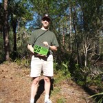
+the hermit crabs Posted March 21, 2006 Share Posted March 21, 2006 Why settle for just one or the other? This is definitely a case where you can have your cake and eat it, too. This is the setup that I found most handy with the Legend: Use the map screen. In the Map option menu, select "show data fields". Two data boxes will be displayed at the bottom. Click on one of them and set it to "Pointer". Click on the other and set it to "Final distance". This way you know you direction and remaining distance, like you'd get from the compass page, but you also get to see things like roads and lakes, not to mention your own breadcumb trail, as you're walking along. (The picture below shows a Vista, but it works the same way as the Legend.) Quote Link to comment
rynd Posted March 21, 2006 Share Posted March 21, 2006 (edited) I use the arrow. You just have to remember to walk in a steady pace. Stopping or slowing down too much will make the GPS unsure where you are in relation to the cache. I think the GPSr knows were you are in relationship to the cache it just doesn't know which direction you are facing or moving. I recommend that you carry a magnetic compass with you. Use the GPSr to get a bearing and distance to the cache, then use the compass to show you the direction to that bearing. Edited to: clarify my thoughts. Edited March 21, 2006 by rynd Quote Link to comment
+BlueDeuce Posted March 21, 2006 Share Posted March 21, 2006 I use the arrow. You just have to remember to walk in a steady pace. Stopping or slowing down too much will make the GPS unsure where you are in relation to the cache. I think the GPSr knows were you are in relationship to the cache it just dosn't know which direction you are facing. The GPSr can still be used to get a bearing to the cache. I recomend that you carry a magnetic compass with you. Use the bearing from the GPSr to find the direction, and use the compass to lead you to it. Well if you want to get all technical about it. Quote Link to comment
rynd Posted March 21, 2006 Share Posted March 21, 2006 I use the arrow. You just have to remember to walk in a steady pace. Stopping or slowing down too much will make the GPS unsure where you are in relation to the cache. I think the GPSr knows were you are in relationship to the cache it just dosn't know which direction you are facing. The GPSr can still be used to get a bearing to the cache. I recomend that you carry a magnetic compass with you. Use the bearing from the GPSr to find the direction, and use the compass to lead you to it. Well if you want to get all technical about it. BlueDeuce I hope that that didn't come off as me beeing a smart a__. I just think that it helps alot to carry the compass. Quote Link to comment
+BlueDeuce Posted March 21, 2006 Share Posted March 21, 2006 No, no. You are correct. Nothing wrong with that! happy posting! Quote Link to comment
+JohnnyVegas Posted March 21, 2006 Share Posted March 21, 2006 I start with the map screen to get to the general area of the cache, then I switch to the arrow to find the cache. Quote Link to comment
+Jhwk Posted March 21, 2006 Share Posted March 21, 2006 I usually: 1. Use the compass screen versus the map screen. Tells you where to go and how far left to go. 2. Rather than trying to get to the 0 point on your GPSr (basically standing on top of the cache) stop about 50 feet from the expected location. Then stop looking at your GPS and start looking at your location. Look for the obvious clues to the cache location. Piles of sticks, rocks, dead hollow tree, or stump in plain view. Don't forget to look at the size of the cache you are looking for. Nothing like thinking you are hunting a regular sized cache, when it is actually a micro-cache. 3. Start out with the easiest dificulty caches (D/T). So go for the 1/1 to 2/2 caches first. Quote Link to comment
+the hermit crabs Posted March 21, 2006 Share Posted March 21, 2006 I start with the map screen to get to the general area of the cache, then I switch to the arrow to find the cache. I usually:1. Use the compass screen versus the map screen. Tells you where to go and how far left to go. Assuming that your GPSr models have the functionality, which maybe they don't -- is there a reason that you guys don't configure it as in my post above, so that you get to use both at the same time, having the map plus the direction arrow together on the same screen? Quote Link to comment
+briansnat Posted March 21, 2006 Share Posted March 21, 2006 I use the bearing arrow 90 percent of the time. I'll flip to the map page ocassionally to make sure I'm approaching it from the best possible route. Quote Link to comment
+wandererrob Posted March 21, 2006 Share Posted March 21, 2006 Assuming that your GPSr models have the functionality, which maybe they don't -- is there a reason that you guys don't configure it as in my post above, so that you get to use both at the same time, having the map plus the direction arrow together on the same screen? I too have done the same with my Vista, but I found that it's hard to keep the unit "level" as it keeps telling me to "keep level" but never tells me what the hell level is. I found that slight tilts could throw the compass off a fair amount so I just used the compass screen close to the cache to keep a better eye on things. I haven't tested out how testy the 76CSx is yet, but I tend to do the same... use the setup you showed, then switch to compass only as I get close. Quote Link to comment
rynd Posted March 22, 2006 Share Posted March 22, 2006 (edited) Assuming that your GPSr models have the functionality, which maybe they don't -- is there a reason that you guys don't configure it as in my post above, so that you get to use both at the same time, having the map plus the direction arrow together on the same screen? I just hadn't thougt about it. Edited March 22, 2006 by rynd Quote Link to comment
+Sputnik 57 Posted March 22, 2006 Share Posted March 22, 2006 I used to follow the arrow. I would keep following it, no matter which way it pointed. I wanted it to lead me straight to the cache, so all I had to do was bend down and open it. Sadly, that practice led me into doing the Drunken Bee Dance. What followed was a life of dark days and darker nights--quests for pollen at odd hours; frenzied activity near flowers, and repeatedly slamming into people who got too near to my house. Finally, I found myself alone in the gutter with a near-empty bottle of Sue Bee. Well, that was the bottom for me. Since then I've cleaned up my act. I've gotten my caching life back together again. I still follow the arrow, but when I get to within 20 or 30 feet of the cache, I stop looking at the GPSr and ask myself, "Now where would I hide this cache?" Or sometimes I say to myself, "What Would Briansnat Do?" The fields on my compass screen include distance and bearing, so even if the arrow isn't pointing properly (because I've stopped moving), I still know about where to go. Quote Link to comment
+briansnat Posted March 22, 2006 Share Posted March 22, 2006 I start with the map screen to get to the general area of the cache, then I switch to the arrow to find the cache. I usually:1. Use the compass screen versus the map screen. Tells you where to go and how far left to go. Assuming that your GPSr models have the functionality, which maybe they don't -- is there a reason that you guys don't configure it as in my post above, so that you get to use both at the same time, having the map plus the direction arrow together on the same screen? Because I never knew my Vista had that capability. Thanks for the heads up! Quote Link to comment
+Skidamarink Posted March 23, 2006 Share Posted March 23, 2006 Thanks Hermit Crabs! I've got the Legend and never realized that I could change those 2 fields. I'm going to try this mode next time out! Quote Link to comment
+alexrudd Posted March 23, 2006 Share Posted March 23, 2006 I don't bother with the maps, at high zoom they haven't been very reliable for me. "OK, turn here there's a bridge over the river!" Nope, no bridge. The last few caches I hunted all showed up as underwater on my map. I thought there was a problem with the coordinates, until I saw the arrow indicating my position also in the middle of a lake. Quote Link to comment
+the hermit crabs Posted March 23, 2006 Share Posted March 23, 2006 Because I never knew my Vista had that capability. Thanks for the heads up! Thanks Hermit Crabs!I've got the Legend and never realized that I could change those 2 fields. I'm going to try this mode next time out! You're both welcome! Quote Link to comment
+bdhoun Posted March 27, 2006 Author Share Posted March 27, 2006 Why settle for just one or the other? This is definitely a case where you can have your cake and eat it, too. This is the setup that I found most handy with the Legend: Use the map screen. In the Map option menu, select "show data fields". Two data boxes will be displayed at the bottom. Click on one of them and set it to "Pointer". Click on the other and set it to "Final distance". This way you know you direction and remaining distance, like you'd get from the compass page, but you also get to see things like roads and lakes, not to mention your own breadcumb trail, as you're walking along. (The picture below shows a Vista, but it works the same way as the Legend.) Thanks for the advice. Found 4 for 4 on the weekend. The one suggestion I have for you is instead of one the data screens being final distance, which is already shown on the top of the screen when using a goto, I suggest using GPS accuracy. This way once you have reached the destination you know how big of a search area you need. Quote Link to comment
+otterbob Posted March 27, 2006 Share Posted March 27, 2006 I use the arrow. You just have to remember to walk in a steady pace. Stopping or slowing down too much will make the GPS unsure where you are in relation to the cache. I think the GPSr knows were you are in relationship to the cache it just dosn't know which direction you are facing. The GPSr can still be used to get a bearing to the cache. I recomend that you carry a magnetic compass with you. Use the bearing from the GPSr to find the direction, and use the compass to lead you to it. Well if you want to get all technical about it. thats what i love about the digital compass feature. Quote Link to comment

Recommended Posts
Join the conversation
You can post now and register later. If you have an account, sign in now to post with your account.
Note: Your post will require moderator approval before it will be visible.