

ZoomZoom
-
Posts
287 -
Joined
-
Last visited
Posts posted by ZoomZoom
-
-
How much of the money from each coin goes to support troops?
So...what's the answer I also wonder.
-
This looks like a computer cpu, maybe AMD? Maybe it's the Matrix.

-
Assuming these PDF versions will follow the same trend I say *great* I'd rather get something digital that I can work with and print out if need be, than some stupid paper map that I have to go to the trouble of buying and scanning if I have to use it.
Only an idiot would rely on electronics for his well being...enough said.
Care to elaborate on that?
Sure can.
I think too many people rely on thier gpsr and don't bring one form of paper map with them when venturing far. Once your gpsr bites the dust then it isn't much good other than being a paper wieght and there's no breadcrumbs to follow to get you back from where you came from.
Hope that helps.
-
Assuming its what it sounds like, I'm actually in favour. Sounds to me like they will discontinue the paper maps, and allow you to download a High Res PDF for free instead. I'm all for it.
As far as the canadian government not offering enough free mapping services, bull carp. They offer tons, you just don't know where to look. You can get free DEMs of all of Canada, free landsat data, free road data, all high res, all digital. The only thing I haven't found a source for is free rivers lakes streams etc. (you can get them in raster format, low resolution though off the toporama site). And to top it off, its pretty much all unrestricted license agreement.
Assuming these PDF versions will follow the same trend I say *great* I'd rather get something digital that I can work with and print out if need be, than some stupid paper map that I have to go to the trouble of buying and scanning if I have to use it.
Only an idiot would rely on electronics for his well being...enough said.
-
Well like many others i"ve come to accept electronic mapping software like many have, I love my Fugawi also for what it does at the moment.
At least if I get lost with a paper map...I can at least start a fire.
-
Well like many others if come to accept electronic mapping software like many have, I love my Fugawi also for what it does at the moment.
At least if I get lost with a paper map...I can at least start a fire.
-
Buddy and I were doing a contest not publish on this site cause it was against thier guidelines...whatever.
Heading back home late some evening and it was dark...
Befofore I continue from there, we were hauling a trailer with a quad on it, anyway along the trail, we manage to bend the trailer axle. Well we got a flat and changed it only to get another a few miles down the highway. Went to pull over, remember it's pitch black dark by now, hit the shoulder and the whole truck felt like it was gonna flip over. Hit a spot where there was a ditch, about a four foot drop or so, only thing saving us was the quad ond the trailer which was wishbone behind us. Nothing we could possisbly do to get out of it.
Buddy finaly hitch a ride to the nearest town which wasn't so near and had a tow truck pull me out...that's when we saw the bent axle on the trailer. Fixed it the next morning and life has been good since then.

-
Doesn't matter much for me. I have the Fugawi Topo software. That's the way to go now. You can print any section you want.
Wait till the time your electronic frulala goes on the fritz and see what happens. paper will always be better than any electronic crap cause it's printed...then if you get lost...then you suck.
-
Stupid goverment...when will they start thinking?
-
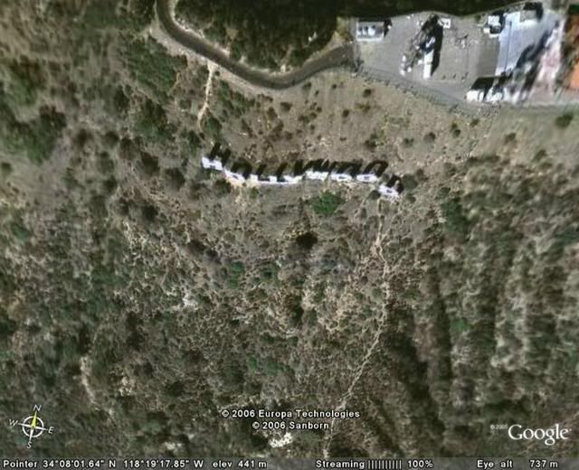
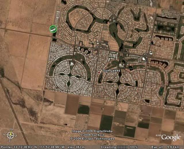
Hey I found Hollywood.

-
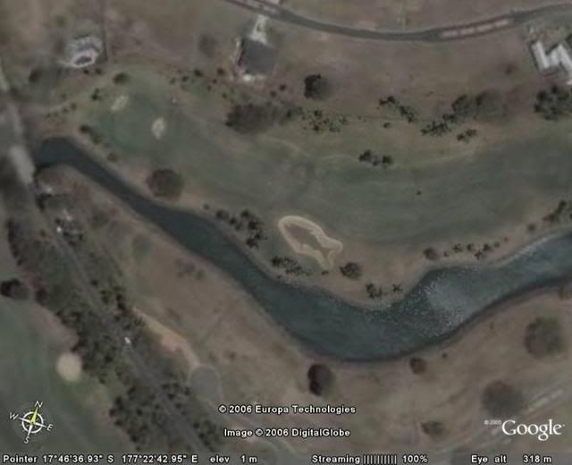
Fiji Island seems to have these creatures laid out around a golf course, this is only one of them.
-
You think that is bizarre...We have a fella around here who just goes for numbers by the look of it. One of his log, eventhough the cache was no longer there was something like this, "Pretty sure I was in the right area so I claiming it as a find". He's done it more than once so go figure!
Had one fella who claimed he found one of mine and even if I deleted his log, he would come back and relog on GC.
Some are just born losers.

-
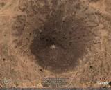
This is kind of cool.
-
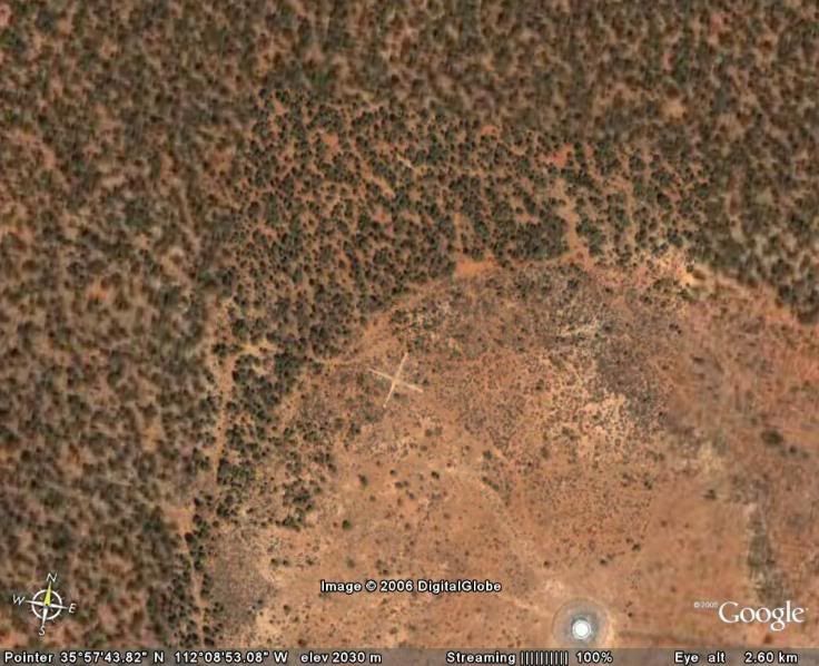
I wonder if anything is buried at these spots?
-
I wonder when THE people will wake up and see what our so call goverment really do to us and our money and lives.

-
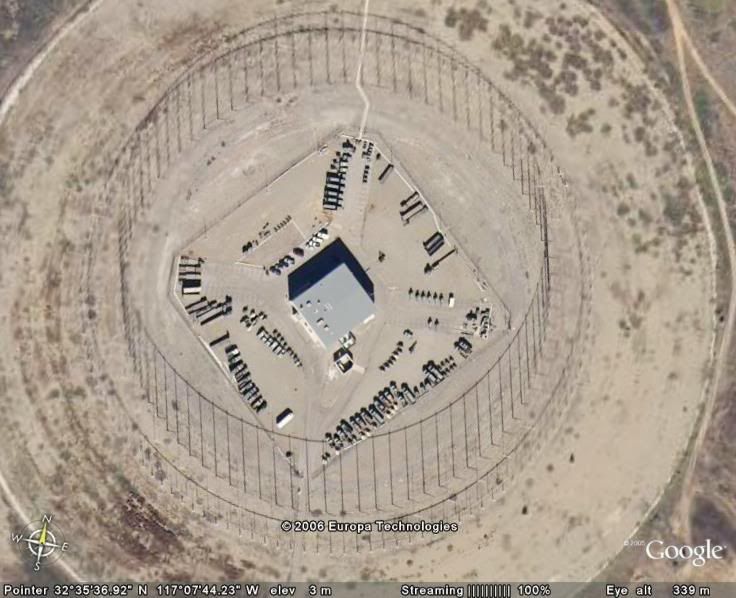
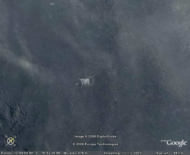
Just a question - How do people just happen to find these unusual images? Without knowing where to look for it I would have never spotted that.
Finding this one was just that, just happen to find it while cruising over Peru. Peru really has an alien like landscape when viewed from above, lots of wierd stuff and strange layouts.
-
I'm not sure if it really is manmade or a goggle map joke.
-
My Precious by me of course.
-
I'm tempted to sell my bike also. It's a Marin Palisade Trail with front suspension that was added on when purchased. Maybe if I had a decent offer for it I might let it go, very nice bike.
-
Keep your hints to yourself if it's not your cache. If I place a cache and make it a challenge, I did so purposely...who are you to give out hints on a cache that doesn't belong to you? That's why there's a rating system in place.
-
I won't name names right now but what is your problem??? I know your history and you are ( Cache -Advance, etc...) <...moderator edit...> for as long as I know. Now if someone would please reactivate my caches...Thanks!
-
Here's a heads up to all you imposter, haters and troublemakers. I'm quitting soon and just want to let the rest of the world know that I won't be playing your mental games any longer. You guys can post all the fake post, continue threatening me all you want, log in using my name, etc... but I'm cutting your game short, right here right now. I will no longer answer emails or threads related to me. You're all on your own from now on and feel free to make an a** of yourselfs.
<Removed by moderator>.
Everybody else I apologize for the wrong my enemies have tried to stir up.
Merry christmas and happy new year to you all.
-
Anyone have one of these available for trade?
I have one up for trade if you still want one.
-
Happiness is a full tank of gas.


Support our troops GeoCoin
in Canada
Posted
Well it's all cool then since you all put it that way. Thanks for clearing that up. I still don't understand what business we or others have in another country or wherever and make war or fight a war that's not ours to begin with. ???
...but then I don't understand a lot of things.