

GrizzFlyer
-
Posts
234 -
Joined
-
Last visited
Everything posted by GrizzFlyer
-
People forget to use stealth, chased away by secruity.
GrizzFlyer replied to Coldgears's topic in General geocaching topics
I see a lot of cachers pretty much ignore the "stealth" on these usually-lame caches. I don't do stealth. Find them and grab them up, sign log, put 'em back, let lots of people look on if its in that public a location. If it gets muggled after I leave, too bad. -
Proper procedure on logging requirements is whatever you want it to be as long as it complies with the guidelines, you own the cache. He didn't sign, you can delete the log. Personally, if I'm convinced the cacher was there and found the container, and there are extenuating circumstances, I'd be inclined to let it pass. Not wanting to re-roll the log doesn't fit as an extenuating circumstance in my view. I'm just wondering how he/she knows about rolling up the log if he/she didn't unroll it. Email them and ask them to return and sign the log, or you will have to delete their find.
-
After getting 100 FTF's, I slowed down on them because I didn't want to become known as an FTF Hog. Think I have 107 now, 2900+ finds. If you count benchmarks, I have over 700 FTF's in almost 1100 recoveries (finds).
-
I linked this thread on the local NWOGEO (NorthWest Ohio GEOcachers) webpage. Maybe somebody there can help.
-
That's pretty neat, using gc photos for official records. Haven't checked to see if you've used any of mine, but feel free to do so. Photos are important in this pastime of ours. On tri-station recoveries, do you also use photos of reference marks and azimuths if they do not have their own PID? I did MC1496 yesterday, and wound up with 12 photos. Usually I only post 3, one close-up, one close-up with the GPS, and an area view.
-
Some of the oldest caches in Ohio are in the Cinci area. Look at GC1F4TH, the Ohio History Challenge cache, and it has a bookmark listed that gives the oldest 45-50 caches in Ohio. The Shawnee Lookout cache is on my to-do list for that area, the oldest cache in Ohio, and is just SW of Cinci. I'm sure there are more, newer, caches available that are great too. Maybe somebody else from that area can chime in with some ideas.
-
George, I sent a PM to you for 2 T-shirts if any are still available. XXL is a little large for me, but the wife is real good at shrinking stuff. . Let me know how to pay you and get my address to you. Grizz
-
One of my benchmarking quests is to locate every original granite monument that still exists along the Ohio-Michigan border. Some are listed in the NGS database, some are not. Many thanks to CallawayMT for steering me to a reprint of the original survey when these monuments were placed. I purchased that book, and it is invaluable if you're looking for the monuments that are not in the NGS database. The link to it is Michigan-Ohio Boundary. I assumed that every monument would be about a mile apart, and while that is true in many cases, some are much farther and/or much shorter than a mile. I still have a lot of work to do on this project, but the book is heading me in the right direction. This book also has information on the rest of the southern border as well as the western border of Michigan. Lots of interesting info on the Ohio-Michigan boundary dispute, and how that was resolved. (Michigan won, Toledo was given to Ohio.....) .
-
That feature works fine. On the main page, just place your cursor in the block that auto-fills with coordinates, that will highlight those coords, type in your zip code which will make the coords go away, and hit GO.
-
That looks like just what I need. I checked our local library system, they don't have it. They did a nationwide library search for it, only 3 libraries in the nation have this book. 2 libraries at the Univ of Michigan and 1 in Alabama, none of which will lend it. I'll be ordering it tomorrow from the Michigan Land Surveyors. Thanks for the info. Grizz ====
-
It was glacially slow all weekend for me. Read this thread, deleted all my geocaching.com cookies, re-logged in, runs great now. Never had to do that before.
-
That was some determined searching! Bet that felt good when the disk was finally uncovered and you realized your success.
-
I recorded the coords for the Post 54 as N41 43.488 W083 43.482. In messing around with the photo I took of the remon mark, I was able to enhance the numbers a very little bit. It has been uploaded to Photobucket, link is Remon Mark. Loading the photo here loses some of the detail in the upload, maybe the Photobucket image will be a bit better if loaded into a photo editor and resized, but the marks will still be faint. Also, it looks like there might be a 4 in front of the 1913, so the 1913 may not be a date, but actually 41913. CallawayMT: That monument line is very interesting, and you found a damaged one that I missed. I went back and got that one! The tough ones will be Posts 4, 15, and 22, if they still exist. No PID's, all on private property way back in fields, and all a ways from any access.
-
One of my goals this year is to finish recovering all the existing original granite boundary posts on the Ohio-Michigan border. A little over half of them have PID's and are listed in the NGS database, the others are not. (Why? -that's another subject some day). Anyhow, after locating Post 54 (an unlisted mark) in somebody's back yard, I also discovered another mark about 9 meters north. It is a modern style mark, but dated 1913, and labeled as part of a "remon program". Its the first photo below. The second photo shows the original granite boundary post, looking north to the remon mark at the witness post. Is the purpose of the remon program to re-establish some original point? If it is a township or section corner, why would it be so far from what is known to be the state line? The lightly stamped data on the remon looks like E 2 T 9 S R 6 E, with 1913 under it.
-
Foxtrot_Xray.... Thanks for all your hard work, it is much appreciated.
-
I've often thought about how a committee could be established by Groundspeak to oversee these types of bogus or grossly-in-error logs. Consisting of established benchmarkers, the committee would have the ability to inspect and investigate any logs brought to their attention and request the logger to provide more details or proof of their recovery, or ask them to delete or modify their log, and also have the ability to delete benchmark logs if need be. Similar to what a "cache owner" can do with any geocache they "own". Such a committee could be fraught with problems however, so certain logging guidelines would need to be established and the committee would need to consist of well known and respected benchmarkers. Lots of those here on this section of the forum. As most of us here, I've seen many logs in error, almost always by geocachers that thought they found the correct benchmark. Several times I've sent a gentle private note to the logger and suggested how they might want to re-visit their log, and offered my assistance. Only once was there even a reply, and the local geocacher removed his log and then logged the correct benchmark 30 feet away. I don't do it any more.
-
I looked at your photos and the satellite view of the area, and am wondering why this was left unfound for about 18 months? Looks like a beautiful area, nice mountains and forest. Here in NW Ohio, if we want to climb a mountain, we have to stand on a speed bump. Congrats on the 600 FTF.
-
Couple of different choices: 1: Go back, look again with the CO's hint in mind, if you're still convinced the cache is gone, use the Needs Maintenance log and see what happens. If nothing in a week or so, log a Should Be Archived log. That brings it to the attention of the local reviewer. 2: Forget the additional look-see and the Needs Maintenance log, and just go for the SBA if you're certain the cache is gone. 3: LIG. That's -Let It Go-. Forgetaboutit.
-
There are some caches right off the NT, easy to get to. Some are mere feet away from boundary markers. The list by usyoopers above is a great start, we did some of those last year. The virtual, GCCEA5, is in a very nice area, and is a major stopover for the hummingbirds when they are in migration in March and September.
-
Several years ago, a local cacher died suddenly. Members of the local caching community adopted his caches as a sort of memorial to him. We kept the original cache names, as well as the owner name followed by "adopted by GrizzFlyer" or whoever, and also maintained his original wording by quoting it in a modified cache description. Here is one of them: GCKZ3Z No need to delete your own find if you found it before you adopted it.
-
The only caches that I've ever had to delete any finds is one of my 2 EarthCaches. It requires answers to 3 very easy questions, if the cacher has been there. In each case (there's been 4 of them out of the 29 who have logged a find), I wait a week and if no email with the answers, I email them and remind them of the cache requirements. I wait another week, if no response, I email them again and advise that I will delete their "find" if answers aren't forthcoming, and offering assistance if they ask for it. A week later, the log gets deleted. So far, I've not received even one response of any kind to the emails I sent these 4 loggers. If they won't even acknowledge my emails to them, tough stuff.
-
Yep, that worked. Found an old copy of MS Photo Editor, loaded it, and did the transparency. An extra couple of steps, but it works. Now you guys have me thinking of new ways to present recoveries visually, here's one I just did of a tri-station and its 2 RM's from a satellite view, MC1516
-
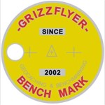
Here's one I just did using the freeware program Photoscape. It crops roundly, but saves the crop in a square blank background. So far, anyway, haven't figured out how to save only the cropped portion (although it says it does). Kind of a neat idea, but it does take more time. Probably good for those special benchmarks we want to show off now and then. This is just one a picked at random, MC0161
-
My first find would also qualify as my "plainest disc" recovery. Just a 2.5" disc with FULTON 5 on it, nothing else. But I was off and running on benchmarks from then on, doing 9 of them that day. It was MC1746, a county boundary in NW Ohio.
-
Price has been adjusted down 10% to $135 for the lot, plus USPS shipping. That comes out to an average of $7.10 per coin. Anybody interested? Thanks for looking.