

happycycler
-
Posts
296 -
Joined
-
Last visited
Posts posted by happycycler
-
-
I have been searching for a while and haven't found the answer yet ... I have a Palm Pilot Tungsten E series and was wondering if there was a way to download caches into it? It's an older palm I have had lying around and thought I would try and put it to use. Currently I am able to cut and paste information into the address book but still looking for an easier way. I have looked at GSAK forums and was not able to find anything there either.
I am able to load my caches onto my Garmin e-trex legend HCx but don't know how to load my finds back onto the computer.
Still Learning ... Thanks
CHDdad
Older Palm you had lying around? That thing's not old at all!! It will work just fine for Geocaching. And the "Palm Pilot" was a specific model that was introduced in 1997, and is ancient history. Don't worry though, they're never going to shake that Palm Pilot moniker.

Yes, Cachemate as suggested. Personally, I never tried it, I just go with Plucker. this is not Geocaching specific by any means, but allows you to view web pages on the Palm. Works great with Geocaching.com pages, or any webpage, for that matter.
-
Only the software on the CO, OR, & DK will recognize mapsets with non gmapsupp.img files. There is something that some models of NUVIs can do, but I keep forgeting what it was.
Thank you for the information!! very helpful!!
-
I am a bit comfused also as map overlays and satellite imagery are two different data types.
Oz was probably refering to the ability of the CO, OR & DK units to rename the gmapsupp.img file which MapSource creates to anyname.img (.img is the critical part). Then you can later have MapSource create another gmapsupp.img from another mapset (or more than one as SamSpade47 replied) and rename it. Do this as many times as you like. By this method, you can also remove a mapset without the need to have MapSource rebuild from all the other mapsets.
Might the above trick also work on the eTrex Legend HCx? Or am I generally limited to only one map? (I do have Missouri & Midwest FREE topos loaded on one micro SD card - without doing any renaming. But now I would like to load several different states on another different micro SD card - either from the FREE site or from Garmin's USA topo 1:100K DVD. That way I hope to change cards depending on where I plan to travel.)
Thank you
-
Thank you all for the helpful suggestions. I appreciate your help!
-
I had been using http://www.lostoutdoors.com to get USGS aerial photos and Topographic map coverage over Benchmarks (& othere things where I had GPS coordinates). I am no longer able to use it. Does anyone know anything about this? What other options might I be able to use to get aerial photo & Topographic map coverage over a point with known geographic coordinates?

-
I prefer Benchmarks but do some GeoCaches with my wife or when the Cache is a micro and within walking (or short bicycling) distance of home. (My wife prefers the larger Caches with "treasures" to trade!)
I log Benchmarks with GC and only occasionally log with NGS -- generally if I find a mark that "needs work" or if someone has logged a DNF with NGS.
-
Thanks CallawayMT for directing me to this thread. I looked thru my finds and have come up with a partial list of MORC and other survey marks near St. Louis, MO.
Some MORC survey marks:
-------------------------------
JC1008 pipe cap, monumented = UNK, in Chamois, MO, GOOD
JC0585 bolt, monumented = UNK, in Washington, MO, GOOD
JD0439 pipe cap, monumented = UNK, in Boonville, MO, Cap gone--pipe OK
JC0512 pipe cap, monumented = UNK, in Chesterfield, MO, GOOD
?Mississippi River Commission OR Missouri River Commission?
----------------------------------------------------------------------
JD2637 pipe cap, monumented =1949, in Boonville, MO, FAIR--triangle missing
(pipe cap says Missouri, description says Mississippi)
Illinois River Survey:
-----------------------
* >KC0554 3 CAP 39 02 47. /090 33 31. D* NOT in GeoCaching database--only in NGS database--NO description
JC0574 pipe cap, monumented =1903, near Pere Marquett S.P., IL, GOOD
KC0146 pipe cap, monumented =1903, Eldred, IL -- GOOD
USE pipe cap:
----------------
HB1790 pipe cap, monumented =1931, Ft. Kaskaskia S.P., IL, GOOD
-
THANK YOU CallawayMT!! That is precisely what I wished to know! I am grateful for the help that I get in this Forum, also a bit embarrased that I did not find these "all by myself".
 Great info. & great links! Thank you!
 -
Thank you BDT -- you are a better searcher than I am!!
And you are always a good source of answers! (I had tried an internet search, earlier -- apparently my bad spelling hurt me here.) THANK YOU! -
I have found a few River Commision / Survey pipe caps here in the midwest (St. Louis, MO) area. Some have dates on the marker but many are Monumented UNK. Would anyone have an idea of the date range for these?
Last weekend I found: PID=JC1008
An earlier find that does have a date: PID=JC0574
Thankyou!
-
THAK YOU Geo*Trailblazer!! This should help a bunch!
-
Thanks folks for the helpful links. I just got interested in finding out about the old Timberlake placer mining operation in Moffat county, Colorado. Wife's ancestor ws involved with it "after 1892". We have an old photo which may be of that area. Next summer I would like to try to find it. So any other ideas on finding out old mine claims?
Thanks!!
-
No, eight letters is not too long. I have seen several with more than eight letters -- often a town name though....
-
I don't find your mystery disk in either GeoCaching or the NGS databases. I suspect that you have already done a radial search from your coords but here is what I got:
from GeoCaching:
---------------
NK0586 0mi NW BLACK IA survey disk
NK0580 1.1mi SE REBAR 1202 IA metal rod
NK0115 2.4mi NW G 11 IA bench mark disk
from NGS: http://www.ngs.noaa.gov/cgi-bin/datasheet.prl
|Dist|PID...|H V|Vert_Source|Approx.|Approx..|Stab|Designation
|----|------|- -|-----------|-------|--------|----|-----------
| 0.0|NK0586|2 .|29/VERT ANG|N421941|W0923052|....|BLACK
| 2.4|NK0115|. 1|88/ADJUSTED|N422103|W0923258|C...|G 11
| 1.1|NK0580|2 .|29/VERT ANG|N421916|W0922941|D...|REBAR 1202
I do notice however that the disk that you seek is subsurface.
REFERENCE MARK 1 AND REFERENCE MARK 2 ARE SET FLUSH WITH THE GROUND.THE STATION MARK IS BURIED APPROX. 20 IN. BELOW THE SURFACE.
Maybe you woudl want to try to locate the reference marks first to get some idea where to start digging? Good Luck!
-
I would like to add the link to dustyjacket's site which has a very nice selection of photos of different survey markers, witness posts, etc. Would that be OK to include here?
-
Welcome aboard!!
Some earlier thoughts: 100/100 club from this forum.
So I guess numbers don't matter much, I do just love going out and finding things with my gpsr, whether caches or benches...PSST -- please don't tell anyone but I like numbers!
I wish that my numbers were more impressive.  But I also enjoy getting out for a search. The history involved, and the changes that have happened since some marks were set also intrigue me.
It is a hobby! I think that we each define our own rules and I would hope that we each find enjoyment in this pursuit.
-
GREAT ONE! WaldenRun! Are both in GeoCaching by any chance?
-
There is also DIXON in Colorado (which might be named after a town in Wyoming). NEXT summer I may do some searching in that area during wife's family reunion....
-
Yeah! CONGRATS.!! (It would be a real honor to get to sit in the truck after a find like that!)
-
TERRIFIC beatnik!!
-
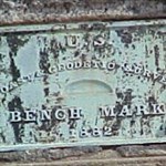
Nice One embra!! None of my chisled squares have been as nicely labeled or as old! I wonder if the hole could have been due to a later bolt or disk?

-
JC1171 was one of my earlier finds. It is a scaled mark and I was still religiously following my GPS at the time. I had not started trying to read the descriptions yet and had not leared about the inaccuracy of many scaled locations. On this one, I leaned my bicycle against the flood wall and followed my GPS around for a while. I expanded my search area and looked again. After I had given up and returned to the bicycle -- I noticed a vertically mounted benchmark about 3 feet from my handlebars. Needless to report it was the mark that I had been searching for.
-
Congrats seventhings for passing me up!! Great Job!!

First two finds on 10/23/02
My first search was a few days earlier, I did not take the description along and could not use the GPS yet. (And the survey stations did have ADJUSTED coordinates.)
All Found Logs = 756
All Logs = 1298 (includes Found, NOT Found and Notes)
Approx. 58% find rate -- and remember that I only search for the easy ones, I increasingly become more of a *drive by* specialist.

-
Approximately 1% of my benchmark finds have been near a cemetery. But thus far no benchmarks have been listed near a cemetery where we were doing geneological research. We rarely find anyone around the small rural cemeteries where I benchmark or where we do geneology. Not sure how many ghosts were there however....


Can I load caches onto my Tungsten E palm pilot?
in GPS technology and devices
Posted
Is Plucker (www.plkr.org) still around? I am not being able to download it. The website times out.