

CallawayMT
-
Posts
379 -
Joined
-
Last visited
Everything posted by CallawayMT
-
For folks that are really looking into getting one of these - and don't want live readings to use it to FIND a station, instead of simply getting readings off of a station - check your local government surplus. My town's selling a Leicia for $50. That's why I was asking my questions. I may get it from them, I may not. Still deciding. Mike, If all you would be out is $50; I would definitely go for it. I'm not sure what software Jerry has shown you to use, but all you would need to do is get the rinex files out of the Leica unit and then you can submit them to OPUS and get some great information. It would be fun for you to verify horizontal control stations against the NGS record, you can check leveled bench marks against the geoid(in most cases you should be within a foot of the record), you can also have a better chance at finding unfound horizontal stations by setting a temporary point(nail) and getting an OPUS position and then going back with your inverse to pull over and probe or dig. I was incorrect about the GeoXH not having L1/L2, but it still does not give an accurate vertical component and this Leica unit does have that capability. Sounds like a good buy to me. For $50 you can defintely part it out and get your money back if you find out you don't have all the parts needed. Good luck.
-
Leica makes great equipment; we started with Leica static GPS units around 1990, but moved to Trimble around 1995 for all of our GPS units. I still prefer Leica Total Stations over Trimble's conventional units. That being said, the Leica 300's are good equipment. Are you buying a set with radio; or are you simply going to use it for static processing to CORS or OPUS; or do you have some sort of reference station that can be used in your area? Do you get the Leica software and license? I do not like the Leica processing software which you would need for most data processing or transfers. Kurt
-
The survey-grade receiver's that are dual frequency and can hook into the virtual reference networks run in the $20,000-25,000 range per unit. These units have repeatable horizontal and vertical accuracies down to the 1-2 cm range. The Trimble Geo units are single phase units with no vertical component. Ask for a Trimble R8 for Christmas, that is when you know that your family truly loves you! Kurt
-
A few more chimney's. Salt Lake SE Base Salt Lake NW Base These were each designed to set up over the top and site a bolt in the bottom. Kurt
-
Not always! Kurt
-
Be careful for what you wish for. If you go to this story:MORC - WARD We were probing for the better part of an hour and pushing through 3-4 feet of earth will wear you out! Rocky ground does not work well for the probes. Have fun and be careful for what you are probing for and what you can possibly probe. Many bench marks fall near areas where you could possibly probe through power, phone and irrigation lines. Kurt
-
Student Camper, Any of us can get one of these types of marks wrong. Without doing as was mentioned, getting right on the position to see what you see. I did definitely call out a few of these while on our cruise this year. I had to have NOT get too carried away with the legitmacy of these nav lights and even towers, gables and peaks due to the fact that their usefullness has basically expired as a surveying aid. I appreciate the vote of confidence from all due to my profession, but hey I was on vacation and I can guarantee I had a few Alaskan Amber's and Summer Ales while out on the deck. Kurt
-
Foxtrot, Thanks for the reply. I knew somebody here would find it for me. Kurt
-
It's a nice dreery cold Saturday and I am sitting at my desk trying to process some GPS data from October. Yes I am only about 1 month behind on my work! The main NGS server is down and I have had luck getting some CORS data that I needed, but I am having no luck getting a data sheet for PLS5 - Polson 5 CORS station. Can anybody find me a datasheet for the station or especially the ARP datasheet DK4101. Any help today would be greatly appreciated. Thanks, Kurt
-
Thanks Holo, Here I thought I knew maps well and did not even know that my trip to Tununak was further west than my recoveries in Kauai. I did this recovery at the request of Northwes to get one of the Alaskan Burough's colored in. You learn something new every day. Kurt
-
Northwes - Bethel and points west from there are much more remote and rustic. My wife and I came through Anchorage in May after cruising to Whittier from Vancouver. Went up to Denali for 3 days and spent a day in Fairbanks. I have spent time on projects on the islands around Juneau, but this year has been my first visits past Juneau. FoxTrot - Don't worry, the village will be lucky to see anything past either boardwalks for the 4-wheelers or some rock fill. LatahGPS - Thanks for the heads up, I will check if we get that much clearing. The horizon just opened up and the sun is glowing brightly above the sea. Only 11:30 and still another half hour or so of sunlight. Az - When the wind is blowing the mosquitoes aren't too bad. A few times today and they came out in full force. Thank goodness it is cool enough for long sleeves and rain gear. Kurt
-
I am currently working on my most remote project that I have ever completed over my previous 20+ years of surveying. I came up to Tununak, Alaska yesterday with my survey crew to perform a mapping project for the Federal Highways Administration. We left home at 5 AM Mountain time and got to Bethel, Alaska at 8 PM Alaskan time and spent the night. Today we chartered a flight due to the amount of equipment and supplies to work for the next 2 weeks, and arrived in Tununak this afternoon. We were able to procure a 4-wheeler and trailer as our transportation for the project. We are staying in the school building and have internet and phone lines. My cell does not work up here and I can say that it was the first day in a long time that I did not have any calls all day! An air mattress in the Kindergarten will be my home for the next 4 days; I get to leave, while my crew will be staying until the project is complete. I have a view overlooking the Bering Sea and I can just imagine the storms that roll into this place! Tununak, Alaska The crew checking out the Bering Sea coastline. There are approximately 300 Yup'ik Eskimo natives in this village and all of them get around on their 4-wheelers in town during the summer and can commute to the other villages on Nelson Island by dog sled and snow mobile during the harsh winters. All are friendly and the kids are hard to shake while trying to get the work accomplished. I saw my first muskox while taking the trail up to Tri-station TABLE Just thought I would share a little. Kurt
-
Guys, The CORS stations do NOT need to be plumb, they simply need to be very solid into the ground. The deep earth monitoring stations, like this station below, that I have seen are generally not very plumb, or perpendicular. They are intended for movement monitoring and so they do not have any real vertical measuring point, just the phase center, a very ambiguous position in the antenna head. These stations are monitored for a time period before they go online to establish a base position and then they are continuously monitored while running. The position on CORS stations even get a velocity due to the fact that all stations are continuously moving. So the antenna really does not need to be perfect Kurt
-
Jerry is using the Black Hills National Forest Recreation and Travel Map. They are available and very useful for all National Forests. I scanned this one which I had purchased a few years back while tracking down the Black Hills Initial Point. I sent the full map scan to Jerry for us to plan for our trip together coming up in the fall. Jerry is a little closer to the Hills than I and has been doing some preliminary search using the Forest Map. Kurt
-
Mike, SQ0363 is a Benchmark which was leveled and has scaled coordinates. This would tend to place the highest percentage of probable error on the location not the elevation. There could be a problem with the elevation, but not likely and not on more than one benchmark in an area. We are working on a project at Rock Creek and I am heading to Medora the week after next, I might make a quick run through there, let me know where you might be. The Corps elevation for the pool is based on NGVD29 elevations which is only about 2 feet lower in that area, so you should not be seeing much difference from that causing you any problems. My money is on the L/L values being incorrect over the elevation values. Kurt
-
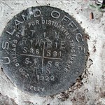
Mike, The SC stands for "Standard Corner" and the five Notches indicates that this is the Standard Section Corner between sections 31 & 32 in North Dakota. The line was run with reference to the PLSS in North Dakota and monuments generally, but not always, placed on the 1/4 and section corners for North Dakota. The 1/4 corners were appropriately marked "1/4", rather than notches. The notches start at the range lines with 6 notches and run west with one notch between sections 35 & 36, two notches between sections 34 & 35, etc. You really need to get "The Quartzite Boundary", you would really appreciate the historical perspective of the line after finding a couple. If you get over to the Montana Line, you can check out the terminal Monument. Boundary Mon 360M 45.35Ch
-
LOLzer Is there an index to the USGS Bulletins like those that you found on Google Books? The USGS Bulletins are sometimes tough to find, but you can do a search on most University Library searches and then go to Google Books and try to find an electronic version. Very hit and miss at times. Kurt
-
The state and international boundaries are my favorites. Here are a few others that I have found and followed: Idaho - Washington Boundary USGS Bulletin 466 North Dakota - South Dakota Boundary Quartzite Border Idaho - Montana Boundary USGS Bulletin 170 Canadian Boundary from Washington to Minnesota Joint report upon the survey and demarcation of the boundary between the United States and Canada from the Gulf of Georgia to the northwesternmost point of Lake of the Woods Just a few others that I have read and used for searching out historical boundary monuments. Kurt
-
I like seeing these older ceramic on steel signs. I have seen a few of these landscape style ceramic on steel as Mike shows above, but most of the older styles in this area that are still standing are these portrait style. I would guess that the older are the landscape and then the portrait evolved into the steel and aluminum portrait style signs that we see in Z15's post. Here is RX0366 from 1956 Kurt
-
I have had an HTC Droid Eris for a month or two and have been trying to get it usable for impromptu benchmark searching. Has anybody in here come up with a good system? I have checked the other forums, but they are too preoccupied with geocache applications. I have loaded both GeoBeagle and Cachemate and have tried them both. I loaded a gpx file with all of the Montana marks which is over 16,000 marks. This is kind of taxing for the droid, but does load. My questions are: Do any of these apps search to the closest marks near your location? Has anybody come up with an efficient method to search and have their data sheets available for easy access? Cachemate does have the data sheet information, which is very nice, but I have struggled so far trying to search the closest or nearby marks and get at their datasheets. I must admit that I haven't spent a lot of time trying to come up with a system, but these phones have everything needed for searching. 4 megapixel camera, good GPS, database retention and recovery and even direct link to NGS or Geocaching while in phone service. I have been impressed. I was down in Alameda, California last week on business and did not have time to do any research; especially after having my laptop along with 2 other laptops of my co-worker stolen out of the rental car in daylight at an Applebee's in San Ramon before we could check into our hotel. Yes, I do know, NOW, don't leave things in view because people have hammers and rocks and windows don't hold up to either. Whoa!! Got off subject. I was able to pick up just one benchmark due to having my droid and download some data on the fly. I found a bunch of tidal marks which never made it into the NGS database while I was on the Coast Guard base while visiting my nephew, but did not know until after the fact that they were unloggable. I thought I might have some good restricted marks, but it was not to be. Sorry I did not have time to give you a shout Patty. So is anybody else using a Droid? Kurt
-
Grizz, Do you have a copy of the 1916 MI-OH Boundary Report? There is a reprint on the Michigan Land Surveyors website:1996 Reprint of 1916 Boundary Report I bought a copy and it is very well done and great to read while you are retracing. Kurt
-
Grizz, I would love to follow that whole line, but I don't usually have enough time when I go back to NE Indiana for family visits. I did visit a few of those stateline monuments a couple years back. I can't see your cap monument, but based on what I can see, I believe that you probably found a reference monument to the milepost 54 marker. This monument could be part of the 1993 PLSO recovery program and the surveyors could have placed some reference monuments at that time. The stamping fits for the Township and Range for the Michigan Meridian, but would be between sections 4 & 5; so I'm not sure what the E2 would represent. One other possibility is that it could have been a closing corner to the state line for sections 4 & 5. Kurt
-
Anyone using the HTC Hero to geocache?
CallawayMT replied to JimChristiansen's topic in GPS technology and devices
Madman, I loaded a gpx file and got GeoBeagle to sync it. It does load the benchmarks onto the map, but I don't get the data sheets and the Web Page link only goes to geocaches and not the benchmark page. How do you view the full NGS datasheets? As you can tell, I would really like to see this work with the points and especially the data sheets. Thanks -
Anyone using the HTC Hero to geocache?
CallawayMT replied to JimChristiansen's topic in GPS technology and devices
Madman, I have all of the benchmark files and gpx files, but how are you viewing the datasheets on your phone? What format are you loading them and viewing them with? I have always loaded them on my Dell Axim using the gpx2html program which worked great, but haven't come up with a good way to load them on the phone yet, or maybe I need to try loading the html and see if they work. Thanks -
Anyone using the HTC Hero to geocache?
CallawayMT replied to JimChristiansen's topic in GPS technology and devices
Madman, What process do you use to load the benchmarks and have the datasheets as well. Thanks