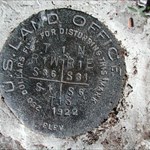
I have seen so many recent posts by people in regards to NGS markers being out, lost or destroyed along with the belief that local surveyors will reset these markers. Elcamino is right on the mark as far as his comment about not notifying a local surveyor. We do use the NGS control for varying projects and do rely upon them for large and small control projects, but very few if any private surveyors and even the depleted NGS ranks do not have the resources to replace these monuments. Most when lost, destroyed or disturbed are just that "lost for our use". If we can't find one benchmark we will move on to find a different one.
As far as horizontal control goes; we will generally only use "A and B" order horizontal control for our GPS projects. Most 1st and 2nd order stations have been created using conventional methods and were built on NAD 27, which have been converted to NAD 83. This value is going to be too far from the 1-2cm accuracy we are looking for in most projects. And so old flagpoles, buildings, radio masts and even old triangulation stations are generally not used with todays equipment and standards.
That being said for the benefit of some who do not understand how these monuments are being used; I want to say that there is nothing better than finding the old triangulation stations that were set in years past with a great deal of sweat and pain. We do appreciate all of the work that was accomplished during vast hardships by the old time surveyors.
Regards