

CallawayMT
-
Posts
379 -
Joined
-
Last visited
Everything posted by CallawayMT
-
Jerry Penry has been working on this subject: http://www.penryfamily.com/geographicalcenters/main.html
-
How do I find benchmarks on old USGS Topo map?
CallawayMT replied to mcsew2k's topic in Benchmarking
That is absolutely the BM X on the historical quad map. The early 1900's monuments that were attached to boulders were many times Aluminum. That is a great find and the fun is trying to these older monuments from the historical quad maps. The elevation stamped is from the original datum and almost always changed with closing loops and changing datums. That is the reason that elevations were not stamped on the monuments over time to alleviate a different elevation on the monument than what was found in the records. Here is a good place to understand how to search and what to search for: http://www.penryfamily.com/surveying/usgsfindmaps.html Nice job! -
About 8 years ago there was someone who kept statistics of all of the Benchmark finders. Furthest North, South, East and West; most finds, highest finds, etc. He did make it fun to try and outdo others. I don't know if he is still around or his website still available.
-
Here is your conversion complements of NGS. The upper Lat Lon Numbers are in Degrees and the lower Lat Lon numbers are in DMS.SS. Assumptions based on your location are WV state plane US Feet due to state unit statute and zone based on your location. If it hits where you expected, we guessed right.

-
Those appear to be state plane coordinates. They can be converted, but I would need to know a general location for your monument which would help with the state and zone needed to convert them. CallawayMT
-
Hey foxtrot I use your Google Earth plugin daily, but it has not been working lately. It appears you changed your server and I can't even find your information anymore. Are you keeping the GE plugin operational? Thanks for your work over the years!
-
Michaelcycle, You didn't make it easy by your description of where you were located, but here are the original GLO notes describing your corner including the placing of the stone with the X on the west side of the corner. Nice find! Kurt


-
Found a mark in the woods - trouble finding it on here
CallawayMT replied to clay_wells's topic in Benchmarking
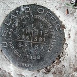
Clay as Kayak indicated, you found a land ownership corner. 99% of these are not in the NGS database and cannot be logged in this arena. You specifically found the South 1/16 corner for Section 7 and is a part of the Public Lands Survey System (PLSS). This is the base system for the majority of the land ownership system in the majority of the western U.S. This is a unique location that can be very easily identified as I am showing in the aerial and quad images: Happy hunting! -
Is anyone going benchmark hunting this month?
CallawayMT replied to eephillipswsj's topic in Benchmarking
I'm a skeptic of the post, too, given the date. Would the Wall Street Journal really have a reporter assigned to cover a non-business topic like benchmark hunting, The funny thing is the Wall Street Journal actually interviewed my friend Jerry Penry just this past week in regards to his many monument searches and stories. -
It is a sickness that has no remedy! Our wives just learn to deal with it.
-
Mike do you have a photo looking at the bank with the stone exposed? Nice work, as always. I'm glad to see you are still at it. Kurt
-
Is it Possible to Garner Location from PLSS Marker Stamping?
CallawayMT replied to Ernmark's topic in Benchmarking
The best available information for the most probable location of the PLSS corner monuments was derived from the GLO record information which was then adjusted to good and not so good controlling corners. This information was then least squares adjusted using Geographic Measurement Management software and generally by the BLM or a private contractor for the BLM. This information can be retrieved as shapefiles from GeoCommunicator.gov. I downloaded the shapefile and queried that corner and here are the NAD83 DMS geographic coordinates: 35°39'53.79"N 93°15'15.35"W. Another way you can do it is to go to:PLSSGE and you can search corners by TRS or other searches and zoom into Google Earth to get the value. This GE plugin is using the shapefiles created by the GCDB to generate the PLSS linework onto Google Earth. Kurt -
Missouri River Commission Triangulation Stations
CallawayMT replied to pixerit's topic in Benchmarking
The place to find the Missouri River Commission Information is in the old Report of the Chief of Engineers, U.S. Army, Appendix AAA Report of Missouri River Commission, December 9, 1884 covers a few states and Triangulation Station Descriptions. You will probably have to go to a good library to find these reports from various years in the 1880's. Here is a link to the maps created by the Commission and you will see triangles indicating the Horizontal Control Stations. MORC Maps Jerry's book is very well written with a lot of good MORC information. You might consider purchasing it here: MORC book by Jerry Penry Good Luck, Kurt -
I don't know about others, but we have only found 3 or 4 of the wooden towers in the almost 1400 recoveries we have done. We are always excited to find such things. John Here is the tallest standing tower that I have seen, probably 25-30 feet tall:Ambrose Kurt
-
USGS is interested in getting recovery reports
CallawayMT replied to Black Dog Trackers's topic in Benchmarking
If anyone is interested, here is another great article by Jerry Penry on the USGS Deadwood Datum. USGS Deadwood Datum -
Thanks for the history Mike! We haven't talked in awhile, have you had a chance to stop at the Headwater's to see if North Base went downstream since last year? I'm sure it did, based on my last view of it and how high the rivers were last spring. Talk to you sometime soon. Kurt
-
jxavierf, If you have a question then you should call the surveyor and ask him how he created the certificate. You need to be using the correct datum to begin with; NGVD29 or NAVD88. Those two datums are approximately 2-4 feet different in many parts of the country. Without running a level circuit or a very precise GPS elevation to your house; you are just guessing what your elevation really is. More than likely you do not have that type of equipment or expertise to perform an elevation survey on your own, so you would need to contact somebody who does. The techniques that you used are probably in the neighborhood of 20+ feet in accuracy and are very unreliable. Give him a call and he should be able to answer your questions. Kurt
-
Edrik, The PLSS data that you are getting from the Geocommunicator website is created using Geographic Coordinate Data Base (GCDB) software. This software uses the historical GLO and BLM record information and coordinate geometry for creating a least squares estimate for all of the PLSS data across the country. When you download the shapefile you are getting all of the 1/16, 1/4, section, meander, mineral and other special survey corner locations along with line intersections; so you are getting a lot of extraneous corner locations which were never monumented, but they still have a corner location. The thing to remember in surveying, is that a corner (a record or calculated position) is created upon survey, but a monument(which is a physical object) was not necessarily placed at every corner location. Some state BLM offices supply the GCDB flat files which can be manipulated using WinGMM and other softwares to clean out all of the extraneous (un-monumented) PLSS positions. Here is a good place to look for software if you want to experiment with PLSS data: Kurt Wurm GCDB Software In Montana I use his LX2GPSX software all the time to create a quick search file for handheld or even survey data collectors by township and I can run the raw data through GMM to clean out all the extra corners I don't want to load. If I want to visually see the PLSS grid on the Garmin receiver, I have also downloaded the shapefile as you have been doing and convert that to a track or route to load on the units. When I have been out across the country for work and pleasure, locating the PLSS initial points has been a hobby of mine and last week I went to my 17th initial point at the Fairbanks Intial Point in Alaska. I visited the Michigan marks back in 2006 and they have been fanciest remonumentation of any I have been to, unfortunately they remain difficult to get to. You can see my post and photos for them here: Michigan Intial Points I haven't looked at Michigan, but many states and counties across the US do have websites where the PLSS corner monument Corner Perpetuation or Certification Records created by Professional Land Surveyors are stored and available to view which would tell you what the monument is and information to find it. You are correct in the fact that there are many publicly accessible monuments located throughout the US to find, always remember to leave them as you find them for the publics best interest. Kurt
-
My guess is that these were mis-quoted as being Missouri River Commission versus Mississippi. They even call the stone as being US Geodetic Survey versus what should have been Geological Survey. Kurt
-
You are welcome Mike, for the photo! I wish I could have found more MRC monuments. How are things, I have been very busy and have not made it into the forums lately. Kurt
-
When you go you should find the Michigan Meridian. Looks like it is in the woods. Check this website: http://www.pmproject.org/MIPM.htm The coordinates I have for that is: 42°25'28.00"N 84°21'53.00"W If you get better coordinates please share them here. Thanks Hey I've been there! I have been busy and away from the posts for awhile and missing these good conversations. Kurt
-
You found PID HV2004 GATE 2 Kurt
-
TillaMurphs, If you are using the USGS Leveling book, then at the beginning of the section for that particular bench mark, there should be a lead in section which shows which quad they were leveling on. You can go to this website and possibly download the correct historic quad: Oregon Historic Quads These originals are very helpful to see where the roads, junctions and various features were compared to now. You can take the image and reference it onto google earth and usually get yourself in the correct area. If you find the quad from around 1900, it will clearly show the BM X positions for the leveling book bench marks. Kurt
-
AZ, If you are talking about making recoveries through the OPUS DB site; you have to be submitting dual frequency survey measurements to use this avenue. Here is one of my recoveries from National Surveyor's Week: OPUS DB Recovery Kurt
-
"How the States Got Their Shapes" goes to series
CallawayMT replied to Wintertime's topic in Benchmarking
LSU, For those of us without cable; thanks for the heads up and link! Kurt


