


barefootjeff
-
Posts
6801 -
Joined
-
Last visited
Everything posted by barefootjeff
-
Here's an example of what I mean. This cache, a small in a tree stump, was placed by lee737 nearly four years ago. It's rather out of the way for him, as it's only accessible by train, but it's not far from me and on the way to one of my own caches so I'm happy to poke my head in and take a look whenever I go past. It's a sturdy container within a container and has had no maintenance since the day he placed it, yet everything is still in pristine condition. Much like my cache further along the trail, which I placed in 2017. It's a stainless steel cookpot with a waterproof stone-paper logbook hidden inside a small cave at the top of the ridge, and has also needed no maintenance in the time it's been there. As I said, this isn't rocket science, it's just good design and all about making a cache fit for purpose to start with.


-
Actually I think a better solution would be to encourage caches that are designed to be long-lasting so they don't need constant maintenance either by the CO or, in their absence, the community. It's not rocket science, good quality containers and logbooks are readily available and, while they might cost a few more dollars more than a throw-away mint tin or pill bottle, they'll soon pay for themselves in reduced maintenance visits and better caching experiences. Perhaps there needs to be more emphasis on creating quality experiences rather than quantity. Just last week a new cache was published locally, the first one (apart from mine) since last July. It's an Eclipse mint tin placed next to a large body of salt water. That's where the problem is, right there at the beginning of that cache's life cycle, and the way to fix it isn't to insist that all caches get frequent maintenance visits from their owners, get auto-archived after X years, have code numbers and geofencing instead of logbooks, or any of the other sledgehammer "solutions" that have been proposed. Start with a good fit-for-purpose container and log and most of the problems will disappear.
-
Maybe it's because many of the suggested "improvements" also have some pretty serious drawbacks. I like improvements that actually make things better, for example the new logging flow (apart from a few issues like not being able to edit reviewer notes on unsubmitted caches), but most of the suggestions I've seen for "fixing" the proliferation of poor quality caches would end up wiping out the really good quality ones instead.
-
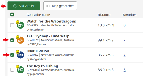
If you go to your list of finds in your Profile, there's a checkbox next to each one and a button up the top to add checked caches to a list. If the caches are well spread out amongst your finds, you can add filters to limit the ones displayed, such as cache type or "Geocache name contains".
-
An easier way is to put the geoart caches in a list, create a PQ from that list, then preview the PQ and map its caches. This includes archived caches. You can also go directly to the PQ map in the Browse map by clicking on Pocket Queries in the top left corner.
-
The note posted by the reviewer will cause the warning to remain for 30 days after that note.
-
I don't know, but I think something that focuses on memorable experiences rather than quantities would be good, except for the pure numbers hounds I guess. You can have great experiences even in places where there are few caches and cachers.
-
New concept feature-random geocache
barefootjeff replied to LaNoRy's topic in Official Geocaching® apps
I've often travelled that distance for just one cache, most recently for GCA8WQY at Sandy Hollow in the upper Hunter Valley (150km in a straight line but 220km by road). I also own a cache (GC9ZM7G) that's a similar distance from home. Almost all my caching now is more than 40km from home (straight line) as new caches closer than that are a rare treat these days. I'll use public transport (trains, buses and ferries) if I can but often that's not an option. Before retiring, my daily commute to the office was over 40km each way (5km bike ride, 37km train trip and 1.4km walk). Distances don't mean much here because everything is a long way away.- 9 replies
-
- 1
-

-
- random cache
- distance
- (and 1 more)
-
Hmm, I attended 8 Community Celebration events, all in the last few months of 2022 and mostly in the Newcastle region (including one hosted by our reviewer) as well as two on the Central Coast and one in northern Sydney. None had 25+ attendees, the highest was 24 at my one at Umina Beach and the average was about 15. About the only events I've been to (apart from megas) that have had 25+ attendees were ones hosted by Geocaching NSW that attracted people from across the state. We have plenty of events around here, but they just don't attract large numbers because we don't have large numbers of active cachers to attract. It felt like Community Celebration events were overdone last time, although part of that might have been the disruption caused by COVID that saw them all happen in late 2022. Maybe something a bit different this time around.
-
Could stickers count as stamps for Letterbox Hybrid?
barefootjeff replied to CrayfishYAY's topic in General geocaching topics
As arisoft said, the Guidelines specifically say "stamp". I'm not a letterbox stamp imprint collector but those that do keep a book of LBH imprints might not like stickers because of the extra thickness it would add to the page. Also stamp or sticker, anything having the logo of your business on it could also be seen as a breach of the commercial content guideline. -
I was wondering the same thing. The guidelines aren't specific either way and I've noticed one of the new ones in the USA already has 41 FPs from 89 finds, with most of those from visits prior to publication. On my own one (GCAJHJV), I've specifically said that photos from prior visits aren't acceptable, basing that on similar wording I saw on a 2.0 Reward, but realistically I wouldn't be able to tell the difference as the location looks the same now as it did decades or more ago. In any case, I have questions as well that would likely require a fresh visit to answer. I noticed a newly published one in Queensland where the only requirement is a photo of the view from a lookout. I visited there a decade ago and have a photo of that view, but I'm not about to claim a find. If I get the chance to revisit I'll take a new photo and claim it then. If I'm going to log a find, I'd want to be doing more than just sitting at my desk going back through old photos.
-
Yes. A 2006 cache I adopted in 2018 was originally a small, but it had gone missing at the time of the adoption and I replaced it in a slightly different spot with a regular. That hide proved a bit problematic, though, with the container lid cracking under the weight of its covering rock, so I changed it to a lower profile version, making it a small again. There have been other occasions when I've had to change the container as my original choice didn't work as well as I'd hoped, and those might also have involved switching between small and regular or vice versa. Smalls and regulars are the most common container sizes around here, outnumbering micros by a good margin, so hopefully those changes didn't mess with anyone's challenge qualifications.
-
Are GPS's more accurate than phones?
barefootjeff replied to majordude's topic in General geocaching topics
Exactly, and what the official geocaching app really, desperately needs is similar functionality built into it so it can be properly used by prospective COs to obtain half-decent coordinates. The cludge of taking a single reading by creating a waypoint on an existing cache, which is likely using the coordinates it recorded when you were five or ten metres away and it thought you'd stopped moving, I'm sure is the root cause of so many new caches having poor coordinates. Make it easy to get good coordinates, not hard. -
Unable to click from cache page to trackables listed
barefootjeff replied to CCFwasG's topic in Website
I see you don't include maintaining the geocaching.com website in your list. I guess for most phone-only cachers these days, the website is irrelevant. In any case, I doubt the technical staff would be involved in managing reviewers, promotion, policy and paying the bills. Even in the small company I worked for with just 5 employees, we had separate staff doing the technical, administrative and marketing jobs. -
Are GPS's more accurate than phones?
barefootjeff replied to majordude's topic in General geocaching topics
I rarely use my phone (an Android) to take coordinates, but on the odd occasion I have (using the create a waypoint function in the official app), I've observed the opposite. I don't know whether this is happening in the phone itself or in the app, but if it thinks I've stopped moving it'll stop updating its reading and the coordinates don't change even if I slowly move five or ten metres away. Then suddenly it'll decide 'hey, he's moved!" and update. I know of one cacher locally who exclusively uses a phone and this has been a constant battle for him when placing caches and he really has a hard time reliably getting a reading within 10 metres of his hides. I suspect it was a similar scenario with the one I recently did where the initial coordinates were ten metres out and confirmed by the other cacher searching with me and where the icon appeared on the map, in that case the CO quickly rechecked and updated his coordinates. -
PQs only appear as lists in the official app, not on the website, where they remain for 7 days regardless of whether the original PQ is deleted or not.
-
Are GPS's more accurate than phones?
barefootjeff replied to majordude's topic in General geocaching topics
Not everyone, WAAS only covers the USA. The cache creation page doesn't make this easy for the creator to pick up. The initial map where you're entering your coordinates can't be zoomed in and covers a fairly wide area. There's no scale on the map, but it looks to be about 7km wide so you're not going to be able to tell from that which side of the road you're on: The one on the edit page at least has zoom buttons (but again no scale), but it's only the OSM Trails map with no option for other map sources or satellite images. On one of my recent caches, the trails shown on the map are nothing like what's actually on the ground. The signposted track junction, where I placed my trailhead waypoint, is several hundred metres from where the map has it:

-
Are GPS's more accurate than phones?
barefootjeff replied to majordude's topic in General geocaching topics
I bought a GPSMAP 67 last March and have only charged it four times since then, and most of those times the remaining charge was still well above 50%. On one recent outing, I forgot to turn it off before putting it into my backpack after finding the cache and didn't discover that until the next day. No problem, stiill heaps of charge left. With the Oregon 700 I'd often have to swap AA Eneloops mid hike but the 67, talk about running on the smell of an oily rag! -
Are GPS's more accurate than phones?
barefootjeff replied to majordude's topic in General geocaching topics
Yesterday I went caching around Sydney harbour, targetting specific D/T combinations I need for one of lee737's challenge caches. It was a public transport jaunt (my aversion to Sydney traffic and the $2.50 seniors day cap makes it a no-brainer), using a mixture of trains, ferries and buses to get around. First up was an AL in Hyde Park, then once I'd finished that and got the bonus's coordinates from Certitude, I loaded those onto the Garmin and used that pretty much exclusively for the rest of the day. It was particularly handy when on the bus to the first of the Cremorne caches, when I could watch it to see where I was in relation to the cache to pick where to get off. I've done something similar on buses using my phone, but having to constantly keep the screen awake is bothersome. Maybe I'm old-fashioned (some would just say old), but for the sort of caching I do, I prefer the Garmin, mainly for its small size, ruggedness and constantly viewable screen combining the map (with a scale!), the compass and basic cache details.
-
400 new virtuals have now been published, a tenth of the allocation, so we can now get some idea of their geographical distribution: Bahamas, Ireland, Boznia and Herzegovina, South Korea, Latvia, China, Croatia, Luxembourg, Curacao, Taiwan, Nepal, Estonia, Faroe Islands, Pakistan, Aland Islands, Romania and Singapore each have one to date.

-
So here I am, balanced precariously up in this cave on the cache Monkey Magic I found last week: Putting aside any malware concerns about connecting a device I found in a cache to my phone, I connect the little cube while managing not to drop either it or the phone off the edge or down a crevice. Assuming I manage, I open the app and get *beep* No Signal or *beep* Something went wrong. Now what? Even if I do get a signal, what sort of log am I likely to compose? Maybe "FTF fun cache TFTC" or something similar. Certainly not this log that I wrote after returning home, going for a swim and sitting back in my armchair to compose my thoughts: One of the great things about caching is that it doesn't rely on any one piece of technology, except perhaps GPS but even then there are a variety of navigation satellites to use these days (or even just maps, satellite images and a good old-fashioned compass). As long as I have a means of getting myself to GZ, can find the cache, open it and extract the log, all I need is something to write with, be it a pen, pencil or even a thumbnail dipped in tar. I don't need a phone, a specific app or anything like that, and what this allows is a great variety of caches that go way beyond what could be accommodated with any particular phone/app combination. The reason ALs have died here is because there's just too much sameness about them and the requirements/limitations of the app rule out so many interesting adventures.


-
More specifically, in the Help Centre under 7.4 Maintenance Expectations is this: The "inappropriate logs" link lands here: The "cache type" link then goes to this: So, in a bit of a roundabout fashion, it's the CO's responsibility to delete online logs if the logger hasn't visited the coordinates and signed the logbook.


-
There are still some of us who put a fair bit of effort into our logbooks (yes books, not strips of paper), like this one by lee737 and his sons: Or this one of mine: Then there's the great satisfaction of making it to GZ, opening the container and finding an empty logbook to sign: Or, if you're not the first, looking back at the signatures before yours and what they've written. There's a whole different world of caching if you go beyond just urban micros, where ammo cans are the container of choice, the logbooks are big and thick and the caches don't need constant maintenance to keep them in good nick for decades or more. With your suggestion, you wouldn't even need a container, just laminate the code word as MNTA suggested and stick it somewhere. Change the code word to a QR code and it becomes, well, much the same as some other game I guess. Huh? The last new AL to appear around here was my Dangar Island one in October 2022. There was another in June 2022, one before that in January 2022 and just my 5 Lands Walk in 2021. ALs died here once the novelty wore off. Edit to add: Logbooks aren't an anachronism, they're an integral part of the game, at least in this part of the world. Here's a logbook photo posted on my most recent physical hide: BTW, there's no phone coverage at or anywhere near that cache, so any sort of online digital logging (or an AL for that matter) would be problematic.


-
This is pretty severe on one I just looked at. It's a 5-stage AL set around the Sydney CBD but the map on the home page covers the entire Sydney metropolitan area: The map doesn't have a scale (why not???) but it's roughly 40km by 40km. This thread probably needs to be moved to the Playing Adventures forum.

-
Adopted caches add an extra complexity. I'm not sure if the system keeps a record of who the original owner was or when the adoption took place.


.png)
.png)


