

ddnutzy
-
Posts
153 -
Joined
-
Last visited
Everything posted by ddnutzy
-
John, We had to hike in about two miles for each of the stations. There was also about a 150 meter elevation gain for each one. For High Ridge I tried to drive in but there was a lot of permafrost on the woods road and some deep water so we ended packing in most of the way. The whole trip took us a little over three hours. We were not sure if we could drive out after we went down a steep hill with permafrost most of the way. When I get a good picture of the dime I'll send it to you via regular email. Dave
-
Rob, The rm's were established by the geodetic method. All of the dimensions and bearings were right on. We found the station first then use the bearings and distances to find the rm's. It took us about fifteen minutes to get everything done. Dave
-
Today myself and Wildbird found 1832 and 1837 benchmarks on a couple of mountains in MA. The 1832 (MZ1702) was not a FTF but we did find all three of the rm's. The 1837 (MZ1700) has not been recorded since 1901. In 1934 the MASSACHUSETTS GEODETIC SURVEY tried to find it (MZ1700) with no luck. The coords were not to far off but without a metal detector I don't think we would have found it. While looking for it we also found a 1853 half dime that seems to be in fine condition.
-
I live in Sturbridge, Ma. and most of the BM's were set a long time ago. The bm's off of the beaten path have mulch,dirt, and leaves covering them. I find a metal detector invaluble on my searches. In N.Y. you'll probably run into the same problem. Dave
-
My find to not find ratio is about 94% with 263 finds, 16 not found, 11 destroyed and 16 notes. I will go back numerous times to find a bm that I didn't find which accounts for the high ratio. Most of my finds are FTF because I don't go after any that have been found by another benchmarker. Exception to that rule is up on mountains that I spend a lot of effort to get to. That means that I now have to drive quite a way to look for bm's.
-
I have found quite a few bm's through the snow with my metal detector. The disks on my white are waterproof so the snow has never bothered the unit. Ice has not been a problem either. It has worked at seven below zero with no trouble.
-
I just explain to people that I'm a civilian volunteer for the NGS and show them the NGS datasheets that I print off of the NGS site. So far no one has given me any trouble. In fact quite a few of them have come with me to show me where the mark is. I then give them the datasheet and the topomap that I usually have with me.
-
If you think the newer discriptions are vague and the bearings are off check out the ones that we have to put up with in this area. I found five bm's yesterday and had to drive 143 miles to get them. I didn't get these yesterday but a lot of the discriptions we work off of are similar. MY3675, MZ1593, MZ1509 and MY3840.
-
Thanks to all of you for your help on this subject. I had no idea what was going on when I ran into these rm's that were reversed. Now that I know, it will make the searchs a little easier if this problem comes up again. Dave
-
MZ1481 was another bm with reversed azimuths. That was the first one that I found like that. There are two more but I don't remember the pid's
-
I finally recovered the station and all four of the reference marks for MZ1557. All of the RM's were a mirror image of the aizmuths in the discription. RM1 was 189 instead of 09 degrees, RM2 286 instead 106, RM3 41 instead of 221 and RM4 131 instead of 311 degrees. Mins and secs not included . THe station and rm's 1,2 and three were easy to find but I had to scratch around for RM4. Four had not been recovered since 1901 I think.
-
Yesterday I went up the hill and shot aizmuths from MZ1557 station marker to the three RM's. Rm1 was 185 degrees, RM 2 was 286 degrees and RM 3 was 45 degrees. The 15 degree declination is built into these bearings. I may be off a few degrees but its close. The aizmuths in the discription are RM1 is 09 degrees 35 min 07 sec., RM2 is 106 degrees 07 min 49 sec and RM3 is 221 degrees 28 min 11 sec. These are the back aizmuths or mirror image of the ones that I took.
-
John, The discription said that it was on the pinnacle of the moutain. Ten feet east puts it almost 4' below the pinnacle. I have looked in that area some with no luck. The trustees don't want us disturbing the soil to much if possible. As you know, sometimes the discriptions are a little bit off. This one is confusing. Dave
-
I never go benchmarking without a metal detector. I have a Whites and a small one that they use in prisons that I carry in my pack on the long walks. I have found many bm's that I wouldn't have found without it. Two of them were at least 15" down. I'm not to far from Tubeman so I cover a lot of the same area. There is a benchmark on Colonels Mt. that I've looked for with a metal detector a few times without any luck. I think that it might be a drillhole so the detector is no help.
-
In 1885 Peaked Mt.(MZ1556) was documented as a drill hole in a triangle on the pinacle of Peaked Mt. In 1896 Peaked Mt.2 (MZ1557) was documented as a drillhole in a triangle and a circle. A disk was later placed in that drillhole. There is another drillhole 10'10" west of the MZ1557 disk but it is about 6" below the disk. I've spent a bit of time looking for MZ1556 and since a drillhole in granite is hard to destroy I'm sure that it is still there. I think that MZ1556 and MZ1557 are both the same. I would like some other opinions on this subject.
-
I have owned five different gps's over the years Garmin V, Legend, 60cs and a couple of Magellens. THe one that I think is the best all around is the Garmin 60c. I still have the gps v but the one I use most of the time is the 60cs.
-
If the measurements from the six listed references meet at the centerof the monument I think that if should be considered a find. That is measured not paced off. In the picture I couldn't see if the stem was there or not so no comment on that.
-
The bound mark was nowhere to be found. I spent some time looking for the bolt and the bound mark just to make sure that the hole was the mark. There is another unrecorded 1862 mark about a mile from this one but the area is covered with grass and it's a seven inch deep hole in ledge. Wildbird and myself are going back to get it when he has time.
-
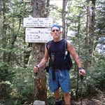
I'd post the pictures but I'm such a computer idiot I don't know how. If someone would let me know how to do it in real basic layman's terms I'd upload some.
-
Found a BM today(MZ2040) that was placed in 1862 with no recovery listed until today. The iron bolt had rusted out but the I found the drill hole The coords were off a bit. The altitude was right on. Got BM's in three different states today but I had to hike 13 miles to do it. Every one was on a mountain over 2100 ft above sea level.
-
Geo*Trailblazer1 Thanks for the information on the height of light question. Now it all makes sense. On all the discriptions with height of light I always wondered what it meant , now I know.
-
In the following discriptions there in no mention of a tower but the hight of light is in all three. MZ2042 HOL 4.8m, MZ2045 HOL 1.4m and MZ2085 HOL 3m. The hight of light is not very high so I don't think that it describes any kind of tower. MZ2040 gives no HOL but mentions a 27 foot signal. Other discriptions mention towers but no HOL's. As it is I still don't know what the hight of light means. I have asked a couple of survey engineers about this before and they had no answers for me.
-
Beatnik, I'm jealous, the highest peak we have in New England is a little over 6000 ft so we can't come close to a find like you got. I'm now going after bm's on the high peaks in N.E But none will compare to your find. Congratulations
-
If I ever go to Arizona to visit my brother in law I'll consider going after those benchmarks. Those are the kind I like to search for. It looks like they are more difficult to get to then any I've found up to now though.
-
Getting a 1902 copper bolt benchmark is a great find. I don't understand what the 1934 discription means about the station being a disk though. It's obvious that you found the 1902 bm with the coords on your gps. I'd try to find the rest of the disks at a later date.