

cliff_hanger
-
Posts
338 -
Joined
-
Last visited
Everything posted by cliff_hanger
-
I've seen locked caches with keys hidden close by (for ease of replacement) in micro containers. Under Lock and Key Determination The Pit In most cases, there are several keys but only ONE works. The only problem I see with a multi is getting your keys replaced
-
Since you've been "introduced" to geocaching, did you go with somebody? If so, did you ask them about their GPSr? Are there any local caching clubs or groups where you could tag along and see some of the strengths and weaknesses of other folks GPSrs? This gets asked in the forums pretty often. A quick perusal through the forums will find a lot of recommendations. Did you do that? A lot will depend on your price range. I have a Garmin Vista HCx that I like a lot. Here are some previous threads where other folks have asked your question: First GPS Beginner GPS options GPS for new geocacher Cheapest "good" GPS unit
-
YW. I was just going to tell you to check out this thread, too.
-
Check that your PQ is set to download .gpx format instead of .loc The option is down on the bottom of the PQ setup page just above the submit button. Also, see this FAQ. Scroll down to the "output to email" section
-
Oh, and reading the logs, it appears that this cache was found by the Clay County Sheriff's department on Feb 10, 2007. They investigated it because it was reported as a suspicious object but there is no indication (unless in the note they left in the cache) that it was dangerous and had to be removed. Huh? If it was so dangerous maybe the finder and his attorney friend should ask the Sheriff's dept why they didn't remove it?
-
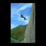
First, I have to say that even at 54 years old, I especially enjoy caches where I have to rappel down the side of a cliff and dangle from the rope while signing the log. Look at my avatar. So, you may not think my comments especially helpful And here are some caches that I placed which don't require rappelling. But they are close to unguarded cliffs in a forest where hunting is allowed! OMG! Whatever will we do? Two Towers: Barad-Dûr Two Towers: Rivendell Second, it's not usually considered wise to use your real name in a public newsgroup. I have to tell you, I laughed out loud when I read this part. Oh, HE "will use this correspondence during litigation" Bwahahahahahaha!!! As what? An expert witness? Bwahahahahaha!!!! "Excuse me, your Honor. I know I have nothing to do with this case and it's none of my business but I have these emails and posts from a public newsgroup that your Honor might find relevant. Let me just weed out some of this spam. Oh, and did I mention the 'plaster tire tracks, foot prints, dog smelling prints, and twenty seven 8x10 color glossy photographs with circles and arrows and a paragraph on the back of each one explaining what each one is?' We also took pictures of the approach, the getaway, the northwest corner the southwest corner and that's not to mention the aerial photography." - apologies to Arlo Guthrie Bwahahahahaha!!!! I'd ignore him. He and his lawyer friend are not worth you getting upset or changing your son's cache (Which, BTW, sounds like a cache I would like to find) Lastly, where's Vinny & Sue when you need them?
-
HCx inaccuracy after upgrade to 2.60/2.60
cliff_hanger replied to mikser's topic in GPS technology and devices
I was thinking the same thing over this weekend. I have a Vista HCx purchased in February 2008. Software versions 2.60/2.60 that were upgraded via web updater. I don't remember the versions it came with. Installed maps are Topo 2008 and MetroGuide NA v7 "hacked" with Metro Gold. I have a 1gB micro SD card and use Powerex rechargeable batteries. The map segments installed are only the CT, NY, MA tri-state area because that's where I do my caching. I aways use the electronic compass. Caches are always loaded as POIs. On Saturday, I went for a 7.12 mile hike in Harriman SP, NY on part of the AT and a loop around Island Pond. When I got back to the car, my track log showed a 15 foot discrepancy. On Sunday, I went for a 4.92 mile hike in the same park, but a different section. On returning to my car, my track log showed a 5 foot discrepancy. Both of those are well within the stated accuracy of the GPSr. I'll be happy to post track logs or any other information that might be helpful but I'm just not seeing the type of track error that some of you folks are talking about. This really makes me wonder if it is the software or a bad batch as coggins suggested. -
Use a pocket query http://ctcachers.com/wiki/index.php?title=Pocket_Queries Cachemate by smittyware should work there Yes, I use GSAK. Others use EasyGPS or the Mapsource software that came with your Legend. Did you install that software on your PC and look at it?
-
Either combine city "A" database with city "B" database using GSAK > Database > Move/Copy waypoints or Copy city "A" database and city "B" database to a new "C" database using GSAK > Database > Move/Copy waypoints
-
Yes. http://forums.Groundspeak.com/GC/index.php?showtopic=140085 Scroll to "Paperless Caching" This is one that I was involved with. Might be TMI but read the "Overview" and "Two Schools of Thought" http://ctcachers.com/wiki/index.php?title=Paperless_Caching
-
Aargh! Pirates of Harriman V Event: The Kraken's Calling
cliff_hanger replied to avroair's topic in Northeast
"Directions From the North: From the NY Thruway (route 87) take route 106 east going into the park, take the third right at Kanawauke circle going South on Seven Lakes Drive. On Seven Lakes look for the Sebago Beach exit." Be aware that Route 106 is listed as CLOSED between Little Long Pond and Lake Kanawauke. If so, you won't make it to Kanawauke Circle. (visit link) "Route 106 Closed: Between Little Long Pond and Kanawauke Lake until end of summer due to bridge closing. Trailhead parking areas are accessible only from the west (Route 17/17A)" Be good to check as the event gets closer -
Yes and yes
-
etrex vista hcx bike mount suggestions
cliff_hanger replied to bubnme's topic in GPS technology and devices
What do you mean by Garmin only supplying the large mount by itself? Yeah, I'm unclear on that, too. Seem like this is the large one and this is the standard one Or cheaper large one and cheaper standard one As far as which one you need? I'm assuming large one (1" to 1-1/4" diameter) for mountain bike handlebars and the "standard" for road bike handle bars. Or get the large one and add another layer of sheet rubber for more shock absorption if necessary? -
etrex vista hcx bike mount suggestions
cliff_hanger replied to bubnme's topic in GPS technology and devices
I believe they sell a replacement battery cover as part of the bike mount package. Unfortunately, it's for a different model in the e-trex series and does not have a "relief" for the SD card - so does not fit properly. The OP needs to look at this thread and this thread The bracket that came with my Vista HCx is the one shown in that thread. Surprisingly, it snaps right into the bike handlebar mount I had bought for my old Magellan Merigold. edit: added 2nd link -
Some people do not know that the Profile Badge is a clickable link, I like that tiny bit of reduandancy. I was suggesting removing the "Profile Badge" since 1) some do not know it is clickable link - so why bother with it? 2) it simply duplicates the info under My Account at the top of the RH column: Caches Found/Caches Hidden. And it's clear that the link "view profile" IS clickable. <facetious> Too bad the "My Account" page isn't user customizable like a Yahoo page or similar. Then everybody could be happy, eh? </facetious>
-
Agreed! I know who I am and my caching handle does not have to be a hyperlink or in that list at all. I would be more satisfied to see 'myname' replaced with "you" (no hyperlink) Also, on "My Account" it's a bit redundant to have the "view profile" and the "Profile Badge" right next to one another, no?
-
POIs vs. waypoints? csv vs. gpx? HELP!
cliff_hanger replied to reynog's topic in GPS technology and devices
Don't know what GPSr you're using. But, this zoom level is customizable on my Vista HCx. I usually have it set to 800' -
Geocaching with the Vista HCX
cliff_hanger replied to TopherAC's topic in GPS technology and devices
Did you try the compass before downgrading to 2.30? I'm using Vista HCx with 2.60 and I have the compass set to switch from satellite compass to magnetic compass after 15 seconds of speed lower than 3 mph. It works very well for me. -
HCx inaccuracy after upgrade to 2.60/2.60
cliff_hanger replied to mikser's topic in GPS technology and devices
You sent a well written and concise email and THAT"S the response you get? And they send you to gpsinformation.net instead of garmin.com? Pathetic. Looks like Garmin is becoming the new Magellan. -
I think this was discussed in depth over in the hiking and backpacking forum http://forums.Groundspeak.com/GC/index.php?showtopic=187037
-
Paperless WIKI with step by step and lots of options
-
double tap (sigh)
-
That's actually very good. Expect that your GPSr will get you to within "about" 30 feet of the cache on a "good" day. After that, you have to use your eyes and geosense. Think "where would I hide it?" Venture HC does not have a magnetic flux compass. The compass relies on satellite information. Thus, you have to be moving for it to function. Other units like the Legend HCx and Vista HCx have magnetic compasses that kick in when you stop moving below a certain speed and switch from satellite compass to magnetic compass. No, caches are not supposed to be buried in the sense of digging a hole. However, they may be covered over with sticks, rocks, leaves or other debris. Don't give up. To start with, look for caches that are large containers. It's the hunt, not the find.
-
adding more waypoints with bigger sd card?
cliff_hanger replied to mind_virus's topic in GPS technology and devices
This one is listed in the FAQ at the top of this forum page Look for the Garmin POI loader -
GSAK is not free, is that correct? That was my understanding and why I've been using GPX Spinner with my Palm T|X. Step by step http://ctcachers.com/wiki/index.php?title=Paperless_Caching