

kevin917z
-
Posts
170 -
Joined
-
Last visited
Everything posted by kevin917z
-
Tracking With Laptop And Garmin Nroute
kevin917z replied to kevin917z's topic in GPS technology and devices
so i just have to just look over at the laptop where the route is highlighted and try to stay on it myself? -
Tracking With Laptop And Garmin Nroute
kevin917z replied to kevin917z's topic in GPS technology and devices
Can you tell me what im doing wrong, i can create routes just fine in both mapsource and nRoute, but how do i start it navigating so i can get turn for turn directions and have the computer speak to me? Im just not seeing how to start telling it i want to go somewhere -
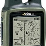
ok, now that garmin stopped allowing tracking in the mapsource program and created nRoute, I am lost! I have created a route in nRoute but how do i get the real time tracking and having it tell me which way to go when i am in the car? This is really frustrating, ive been playing around with this for a couple hours now and cant figure it out!!!! I am leaving sunday morning for a trip out of state and using my laptop to navigate with the GPS would be greatly benifitial! I think im going to be looking for the old updates and reinstall all my garmin software but i really dont want to do this! I am using mapsource metroguide version 5 and a rino 130
-
I have a set of KS and a set of MO national geographic topo programs. These are like new. I used these when i lived in these areas for a short time but havent used them since. I want to sell each set for 55 each (includes shipping) buy both for 100 shipped. the CD's are in excellent condition. The topo maps are the most detailed you will be able to get. they are also seamless. I am selling these at a great price, look around and you will see that. intersted? if so please EMAIL me as i check my email more than this forum. kevin917z at hotmail.com
-
Just wondered if anyone is or has used the garmin iQue (3600) and what their thoughts are on it. I am looking at this unit specifically for mapping purposes in the field and the feature i see that with using 3rd party software you can put in any type of digital map, ie jpg, bmp etc that you can calibrate with a gps lat/long coords. I see also that i would be able to use my Natl. Geographic Topo. with their Pocket TOPO program. I would really like to hear something about people using this unit. I am wondering also if you can zoom in without getting really fuzzy images.
-
i have a Kansas and Missouri (two separate sets) of National Geographic topo that i have only used a few times, it is like new and i am offering it for 60 dollars shipped per set, or both for 110 shipped, look online at the prices on amazon and other places and you will see what a good deal this is if interested please EMAIL me through the website
-
well i calibrated it today and used it to mark 12 points, when i got home i loaded them into the computer and found that i was within 1 meter on about 8 of the 12 points, the other 4was 1-3 m accuracy which is pretty good since i wasnt standing on the contour line at each point so it looks like im getting 1-2 meter accuracy, im still not sure what the auto calibrate on my rino 130 means, i am assuming that it is adjusting the satellite determined elevation by using the barometric altimeter the elevation on the satelite page is usually 10 meters off what the other pages say as the satellite page only shows satellite determined elevation
-
ok, i think im understanding this then, so adjusted is super accurate but scaled is an estimate and not very accurate, from what i read im not sure about vertcon though, im thinking its fairly accurate but not very good?
-
i am just wondering is the benchmark elevation very accurate like to a few centimeters or so? i just want to know if i can calibrate my barometric altimeter in my gps, i have been getting 2-5 meters higher than the benchmarks say, they are all scaled at least the ones ive seen
-
Handspring Visor Neo 8mb Blue Fs
kevin917z replied to kevin917z's topic in GPS technology and devices
SOLD -
Natl Geographic Topo Kansas And Missouri Sets Fs
kevin917z replied to kevin917z's topic in GPS technology and devices
both are still for sale, im asking 65 shipped for each state, i think this is fair as they go new for 85-99 dollars, and i only used these a couple times -
Natl Geographic Topo Kansas And Missouri Sets Fs
kevin917z replied to kevin917z's topic in GPS technology and devices
"possible" deal in the works but if your interested let me know, right now only one person has shown a possible* interest in the Missouri set -
Handspring Visor Neo 8mb Blue Fs
kevin917z replied to kevin917z's topic in GPS technology and devices
sent an email back but no response, so whoever says "ill take it" gets it (or if i get another response from you soon you can still have it) -
Handspring Visor Neo 8mb Blue Fs
kevin917z replied to kevin917z's topic in GPS technology and devices
here is a link to the item on amazon,http://www.amazon.com/exec/obidos/tg/detail/-/B00005OCWX/qid=1124638001/sr=8-4/ref=sr_8_xs_ap_i4_xgl147/002-2655349-5745611?v=glance&s=pc&n=507846 its just the same and in great working order with no scratches on the screen or anything, mine comes in the original box with all documentation the box still looks new, does 35 shipped sound fair? if not please make a lower offer -
i have a lightly used visor neo in the blue color with a USB and another Serial port cradle included, comes in original box with all software and documentation i used this on one trip with my pocket querys but havent had time for caching the last year if interested please email me or post below, im not sure what this is worth now but reasonable offers accepted thanks for looking
-
i have the complete kansas and missouri Natl Geographic topos for sale, i havent been doing hardly any geocaching anymore so i dont need these anymore, if interested please email me through the website or post below thanks
-
any offers?????i started it at 200 hoping someone would make an offer, the things i've sold on here usually sell when people make an offer, often less than what i asked
-
would anyone be interested in buying the rino120 for $199 ???? i can also accept paypal if your interested
-
i have a rino 120 for sale, it has been used for finding i believe 7 caches in just two days,, since this is a 2nd unit and i no longer have any use for it i am wanting to sell it. this comes with all original documentation and packaging, as well as the data cable This unit is i believe 3 months old, i can check later to find the actual date i purchased it this unit has no problems, please make an offer on here or email me if interested, thanks i plan to ship the package insured with tracking and signature confirmation (i have sold a gps on here before as well as other things, you can check what others have said about me by viewing my older forums posts, i can also give you references of people on here that have bought gps related stuff from me) ( im looking into seeing if it would be allowed to also upload maps to the unit from mapsource metroguide v 4.01 or v5.00 for the buyer if they dont have it and want more detailed maps for their region in the gps) NOTE: I WILL POST A NOTE IF AND WHEN A DEAL IS GOING ON, SO IF THERE IS NO NOTE ABOUT A DEAL IN PROGRESS ASSUME THE RINO120 IS STILL FOR SALE
-
Fs Rino110/120 Data Cable (original Garmin)
kevin917z replied to kevin917z's topic in GPS technology and devices
sold and shipped -
Fs Rino110/120 Data Cable (original Garmin)
kevin917z replied to kevin917z's topic in GPS technology and devices
i forgot to mention, i can take paypal too (just not credit cards) -
i prefer my craftsman metal engraver with a stencil or letter template, much cheaper too!
-
Fs Rino110/120 Data Cable (original Garmin)
kevin917z replied to kevin917z's topic in GPS technology and devices
any offers????? -
i have both and prefer v4 because it takes up less memory, and shows rivers lakes, etc. V5 doesnt show hardly any water features and has really dumb POI's like dry cleaners, day cares, home businesses etc. i have noticed very few updates to the v5 for caching i prefer v4 but if im just doing a trip and no caching i will use v5
-
SOLD!