


sjkimmel99
-
Posts
11 -
Joined
-
Last visited
Posts posted by sjkimmel99
-
-
As others here have noted in other threads Corps of Engineering disks are often located along waterways or other Corps engineering projects which would explain it's location next to the bridge and river. This section of the FAQ gives reasons why a mark would not be in the Geocaching.com database: http://www.geocaching.com/mark/#whynotin
By the way, looked at your photostream on Flickr and noticed the graveyard photos. What's the story behind it? Kind of unusual monuments, almost pre-historic looking.

-
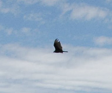
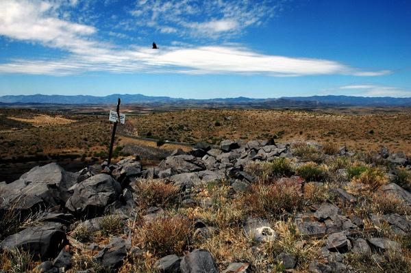
Armistice bird?
Not sure what kind. At the time I thought it was a carrion type, maybe because of the shape of the wings but I'm no bird expert. Here's a slightly closer pic of the shape.
-
-
I found a similar situation today and was just rummaging through the forums before posting to ask how I should log this mark: AA6969. Adjusted coordinates indicate that the disc is still within a foot or two of where it should be, but clearly it is not flush with the ground, and more mysteriously, there is no hole! I have no agenda to have marks declared destroyed, quite the opposite, but what else is this?
Send an email to Deb with the pictures as attachments and any other relevant evidence as described on the NGS site. She makes the updates for destroyed anyway so she'll make the judgement & mail you back with what it is - sometimes, like the OP's situation she might say for you to log on the NGS site in poor condition otherwise she'll say she's going to mark it destroyed.
On GC.com update the visit log with the pics in the form of a note which you've done. Then when you get an answer from Deb you can go back and update the gc.com log. Bill93 said it, describe what's there (although I have not always done so) first since usability isn't really our call.
-
deleted. misunderstood the question.

-
I searched but didn't find other references to this so hopefully it's not a repost.
Here is a book people might enjoy. The tale of one of the participants in the 1870's Geological Surveys of the western territories (Colorado, Wyoming, etc..) There are occasional references to making topographical surveys but most of the prose is about the journey, companions, events, landscape, weather, animals, etc.. They don't appear to be making actual geodesic readings as he doesn't mention measuring the leg distances so don't know if it's just for map making or what and the triangulation is aimed only at the tops of mountains, not at lights or other man-made signals. In any case it gives a good picture of the circumstances, hardships & challenges of early day survey parties. This is a quote from the beginning of the third section of the book which is available in it's entirety on Google Books in on-line form and as a pdf.
XVII
Time was when a traveller must begin his tale by an account at the very least of the parting with his lachrymose relatives at the farmhouse and then continue through several chapters with the small incidents of his journey however long or well travelled. Readers now won't stand such dallying. Behold me, therefore, at Rawlins, Wyoming, a station on the Union Pacific Railway half way between the terrors of Cheyenne and the horrors of Ogden. This was in 1877, when I was attached to the division of the United States Geological Survey for Primary Triangulation, in charge of Mr AD Wilson - may the fates be kind to him.
Rawlins stands upon the edge of the infamous Bitter Root country -- a spot without a rival for miserableness until you come to Death Valley or the Sand Hills of Idaho. Nevertheless here is where we rendezvoused for an excursion up into the almost wholly unknown region lying south of the Sweetwater river. The less said concerning Rawlins the better. I need not describe the outfit of a camping party, with a pack train of mules; and so we are quickly ready to mount and be off to where (we hope) sage brush will be less abundant and rattlesnakes farther between.
http://books.google.com/books?id=5-QUAAAAY...wn9zCDA#PPP1,M1
-
Assistant son making sure he got a picture when we stopped to ask the locals about Scrabble / ES0987 (and yes, there is a Hard / ES1166 nearby although we didn't get it that day.)
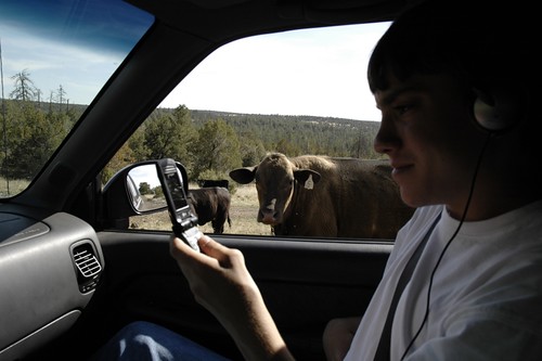
That's him in the background with one of the RM's in the foreground.
Ok, couple more.
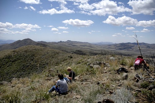
GreatKate85053, Eric and Robert on the way to Rover / ES0997 and BOUNDARY MON 26 MARICOPA YAVAPAI / ES0998
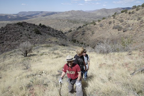
resting at the top.
-
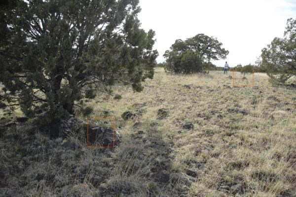
Perhaps if you pivoted the boulder with the suspected drill hole around it's far end it would line up with the boulder under the carin (where the red arrow is) as if the rock split right at the drill hole (an obvious place for water to enter & expand.) That would put the suspected drill hole close to the base of the carin where it's supposed to be. Someone could have heaved it around to get the disk out once it became obvious the rock had split.
-
NGS Surveyor said:
8 tribrach plates, aluminum (4 pairs) --- used to mount the theodolite atop the inner tower, they were clamped in place with common C-clamps (see photo of “Y” shaped plate at: http://www.flickr.com/photos/12262796@N06/2152057769/ )Here's another picture from the same Flickr site (NGS Surveyor?) showing a triangle of floor boards intended to keep the surveyors from shaking the stand.
http://www.flickr.com/photos/12262796@N06/...in/photostream/
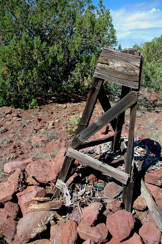
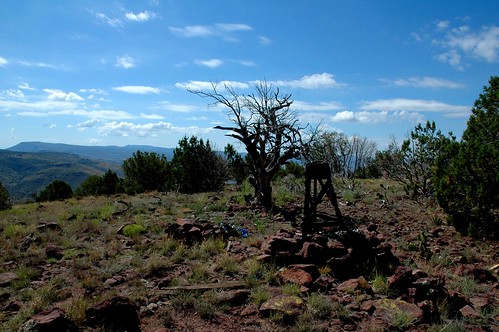
I found a wooden tower similar to the one pictured in the links above at ES1006. The recovery log for 1946 says that a "6-FT Instrument stand was erected over the mark and the floor boards supported by a triangular wall of rock about 2 feet high." The floor boards have either rotted or the survey party removed them but the stand looks to be in good shape after 52 years in the weather.
Just so this isn't completely off-topic I didn't see a walking stick in anyone's list. Since climbing hills is a typical experience a walking stick helps on the way up and is critical on the way down.
-
Still getting the error of "your request received an error" after clicking on "log this benchmark"
database index error?
parameter truncation between the "log this benchmark" and whatever fetches the next screen?
Looking at the page source of the error screen it shows this possible error code:
ctl00_SiteContent_lblSubmitErrorInfo
test were tested with IE6 and Firefox 3
marks for which others have posted a recovery log and "log this benchmark" behaves correctly and goes to the "post a new log" page:
DU2194
DU2223
ES1001
DU2224
marks which both I and others have recovered for which "log this benchmark" gets the "your request received an error."
DU2221
marks which only I've posted a recovery report and which behave correctly on "log this benchmark"
ES0997
ES0998
marks which nobody has logged a recovery report and which receive the "your request received and error" message after clicking on "log this benchmark"
ES0999
ES0994 - still get the error with IE 7
DU2196 - still get the error with IE 7 (didn't try any of the others)
DU2195
ES1164
Marks which nobody has logged and which behave correctly - getting to the "post a new log" page.
ES1180
ES0980
ES0992
ES0993


Groundspeak is removing Benchmarking and the logs/photos
in Benchmarking
Posted
This is the 2nd time something I put time into on the Internet has been nuked. The first was Panoramio, the photo layer on Google Earth. I spent a lot of time and uploaded many of my photos, photos of things that don't exist any more. Then Google nuked it. At least they gave everyone warning and the option to download their own pics. It was still a gut punch. I haven't logged any benchmarks for several years, work got in the way. Good times then, sorry to see this happen.