

JetSkier
-
Posts
431 -
Joined
-
Last visited
Everything posted by JetSkier
-
What prompted this post? Everyone here knows they are testing a beta version and we're pretty happy to do so. JetSkier
-
I noticed this once as well. I hadn't used the GPS for a couple of days and I went to do a cache that I had DNF'd. I'm pretty sure my battery meter was reading 3 bars the last time I had used it, but the unit wouldn't power on. I tried again and saw the "Low Battery" message just before it turned back off. I replaced the batteries and all was well. JetSkier
-
#1 & 2) - The Field notes with the Oregon are easy to use and they don't automatically log your finds/dnfs. First thing you do is access the "Field Notes" option from your profile page. Then select the Oregon, point the browser to the txt file on the oregon and upload. This will only upload to your Field Notes Manager. From there, you can choose to log any of the caches in that list. When you select "Post Log" you will have the opportunity to change/edit your field note before it submits the log. Basically, it takes you to the "Log your visit" page and enters the type of log, the date and pre-fills the log with any field note you create. It's up to you to press the "Submit button. #3) - This is where you set your starting found count that appears on the geocaching dashboard. It gets incremented each time you log a cache as found using the Oregon. #4) - No way that I know of. JetSkier
-
I also noticed that my "Custom POIs" are now called "Extras". JetSkier
-
Almost ... if you select a point on the map to get the push pin and the button at the top and then scroll into that button, it still has the bug. JetSkier
-
Oregon 300 and Zagg Screen Protector
JetSkier replied to JetSkier's topic in GPS technology and devices
Neithter my cell phone nor camera are touchscreen. I guess that's why I like it for those devices. The other problem I had with my Oregon is that the friction sometimes caused a "pick" instead of a "drag" on the map screen which then put the pushpin icon which then cluttered up my screen! I'm much happier without it. JetSkier -
I bought a Zagg screen protector about a month ago and installed it on my Oregon 300. It generated serious friction when panning my map or scrolling cache descriptions. I tried to get used to it but I finally gave up on it and removed it. It un-installs pretty easily. I just peeled up a corner with a pocket knife and then peeled it off like a sticker. So, who likes it and who doesn't. Just curious. Btw, I have the Zagg on my cell phone and digital camera and love it for those devices. JetSkier
-
I didn't check my WAAS very often, but I did have it half the time I did check. Also, the trails in the ONF are dirt trails so our vehicle speed was no more than 20 mph. Even when we did hike to a cache, I did not see any "spikes". Two of my friends with the 60cx both said they get "spikes" in their tracklogs sometimes. So I guess the Oregon is doing what the 60 would do here in Florida. JetSkier
-
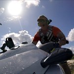
I tested the tracklog with my Oregon 300 in the Ocala National Forest and I didn't see the huge "spikes" that have been reported. The biggest error I got was travelling south down a dirt road, finding a cache and then travelling back up north on that same road. The distance between the North and South track at it's widest point was only 18'. Here are some pics... Widest point on the next one is only 18' or .003 minutes: JetSkier
-
Need new upgade to Oregon series!
JetSkier replied to Inkahoots's topic in GPS technology and devices
What do you mean by "deleting them individually by cache number"? If I remove the GPX file that I used to select a cache as found, then those caches are no longer on my found list. Are you using the "Send to GPS" button to load your caches? If you are, you need to stop doing that and use pocket queries. Then all the caches can be removed from your found list by removing (or replacing with a new PQ) that GPX file. JetSkier -
Weird GPX file on Oregon 400t . . .
JetSkier replied to GerIRL's topic in GPS technology and devices
Did you try to rename it first to something normal? JetSkier -
The only Magellan software that will recognize the CrossoverGPS is the Magellan Tools. Vantage Point is not compatible with the CrossoverGPS. The only thing the Magellan Tools will do for you is upload Enhanced POIs, pictures and mp3 files. None of which will allow you to geocache. To upload waypoints to the unit, you need to convert either a gpx file or loc file to UPT format. The Magellan Mapsend Lite program will do this for you or you can download gpsbabel and use the "SD card as for eXplorist" option. Once you have a .upt file, you just copy it directly to your SD card (which you'll need an SD card reader/writer), plug the card back into the unit, go into outdoor mode, then Options, then Import Data, then Waypoints. The only problem with geocaching with this unit is it gives you a message saying "You are near your destination" when you get within 100' of the waypoint and then stops navigating to it. You have to constantly re-enter the goto. I hope this is helpful. JetSkier
-
Lets try this again... New Oregon Owner
JetSkier replied to ark_fireman's topic in GPS technology and devices
If you are not relying on your tracklog for back-tracking, then 2.86 is fine. I'm not so sure that any of the previous firmware versions have accurate tracklogs. The coordinates with 2.86 are fine and stable, meaning they don't change when the unit is stationary. At least that what mine does with 2.86. JetSkier -
Where did you get the answer? Your post was on the 15th. When I checked the web site on the 16th, it said the answer would be made available at the end of the day. Also, it's not clear from your post what they saw after they threw the unit down the stairs and started picking up the pieces. JetSkier
-
What happened to the latest puzzler? It's showing 2/2 as the current puzzler. What has the answer to this puzzle? JetSkier
-
I'm doing some caching in the Ocala National Forest on Monday. Doesn't get any more "real world" than that. I'll make sure my friends send me their track logs so I can compare. I'll post my results next week. JetSkier
-
Remember to unzip the PQ before copying it directly to your Colorado or using it in GSAK. Both use the gpx files, not the zip file. JetSkier
-
I've used 2.8, 2.85 and 2.86 for geocaching and have had no problems finding caches. From what I'm reading here in the forums, it appears that the problem seems to be with the tracklogs which then people are assuming that the accuracy is in question. If I turn my 300 on and let it sit, it will read the same coordinates +/- .001 (which is only about 6'). I have not tested with the tracklog yet, but I'll give that a shot on my outing this coming Monday. JetSkier
-
I reported two bugs to OregonBeta@Garmin.com on 2/4/09 and just got this response: Thanks for helping us test this beta release. These two issues will be fixed in the next release. -------------------------------------------------------------------------------- From: <Deleted> Sent: Wednesday, February 04, 2009 7:36 PM To: Oregon Beta Subject: Oregon 300 2.86 Beta Bug Two bugs to report: 1) Map Scrolling: If you scroll the map and release your finger over top of the +, - or the button at the top (describing the pin location), then the map only pans what was previously visible. It does not fill in what was scrolled from off the screen. 2) Custom POI: If you have two gpx files in the same folder and use the poiloader, then when you press Where To? -> Custom POIs, you'll have three buttons. Pressing the top button labeled "All Databases" will show the busy cursor for a second and then return no results. The other two buttons that correspond to your two gpx files work fine. I wonder how soon the next Beta will be released ... JetSkier
-
It's pretty easy to change the coordinates of a Geocache downloaded through a gpx file. All you have to do is bring up the description page for that cache and press the button at the bottom of a flag overtop of an X. That will create a waypoint using those coordinates. Then you can easily modify it from the Waypoints manager. Granted it's a few extra steps, but with touchscreen, it doesn't take long. JetSkier
-
Make sure you're using the USB cable that came with the unit. There are two types of cables, 1 type will only give it a charge, the other will do both. JetSkier
-
I use GSAK for EVERYTHING. - Keeping a record of solved puzzles for when I get around to finding them. - Maintaining an offline data base for when the PQ's don't show up. AND they often don't show up. - Maintaining a list of found caches with descriptions of where the cache is hidden or how I solved the puzzle so when friends ask for help I can give it. - Selecting a list of caches for a trip. Less important with my OR and its ability to hold 2000. - Sending 2000 caches to my OR with the child waypoints as POI's so they don't clutter up or exceed the 1000 limit waypoint list. AND so that child waypoints have a meaningful name instead of A34BPK etc. - Analyzing my Found stats - Planning a caching trip with a friend and identifying which caches neither of us has found. - ETC ETC ETC. I am sure I will get a response that says none of the above is important to someone. Good for them. But I still say GSAK is the icing on the geocaching cake. Actually, none of those are important to me, but that's ok. I was just responding to the quote made by hallycat. You may not be able to play golf with a baseball bat, but you can certainly geocache without GSAK! I personally don't need to massage my PQ data before I put it on my Oregon, so GSAK is not a good fit for me ... that's all I'm saying. JetSkier But you COULD play golf with a baseball bat. It just isn't the best tool. Groundspeak does a great job and lots of folks make do without GSAK. We all play the game the way we want and if it's ok with you then it's fine with me too. I just think it was a bad analogy. I think it would almost impossible to complete a round of golf with a baseball bat, not to mention that you certainly wouldn't beat anyone, but you would have not problem completing a day of geocaching without GSAK. AND, your changes of winning (if that makes sense in this game) would be just as good as the persion using GSAK. JetSkier
-
I use GSAK for EVERYTHING. - Keeping a record of solved puzzles for when I get around to finding them. - Maintaining an offline data base for when the PQ's don't show up. AND they often don't show up. - Maintaining a list of found caches with descriptions of where the cache is hidden or how I solved the puzzle so when friends ask for help I can give it. - Selecting a list of caches for a trip. Less important with my OR and its ability to hold 2000. - Sending 2000 caches to my OR with the child waypoints as POI's so they don't clutter up or exceed the 1000 limit waypoint list. AND so that child waypoints have a meaningful name instead of A34BPK etc. - Analyzing my Found stats - Planning a caching trip with a friend and identifying which caches neither of us has found. - ETC ETC ETC. I am sure I will get a response that says none of the above is important to someone. Good for them. But I still say GSAK is the icing on the geocaching cake. Actually, none of those are important to me, but that's ok. I was just responding to the quote made by hallycat. You may not be able to play golf with a baseball bat, but you can certainly geocache without GSAK! I personally don't need to massage my PQ data before I put it on my Oregon, so GSAK is not a good fit for me ... that's all I'm saying. JetSkier
-
Besides, there is no Colorado/Oregon 500 ... unless you have an Oregon 200 AND an Oregon 300, then I guess you could claim to have an Oregon 500. JetSkier
-
Now that would be possible indeed.. but only if I wanted to get rid of more hard earned money to get GSAK.... GSAK is the best investment you will ever make. It does everything but find the cache for you. Not having GSAK to complement your caching device is like trying to play golf with a baseball bat. (was that a good analogy? ) Hmmm ... don't quite understand that! I don't use GSAK and I really don't see a need for it. I load my GPX files directly to my Oregon 300 and away I go. I downloaded GSAK a few years back but it was very confusing to use. Not sure why I would need it anyway. JetSkier