

Guitar4Him
-
Posts
132 -
Joined
-
Last visited
Everything posted by Guitar4Him
-
Explorist Li-ion Battery Not Charging
Guitar4Him replied to geognerd's topic in GPS technology and devices
I'll bet it got knocked sideways by the truck tire. If it had been actually run over...that is....the entire distributed weight on one of the truck's tires on it, the GPS would look significantly different. The cases for these things cannot withstand that much force on them...we're talking several thousand pounds. It would be totaled and would probably be less than 1/2" thick. -
I got my $50 rebate check in the mail yesterday! It took about 3 months.
-
Explorist Li-ion Battery Not Charging
Guitar4Him replied to geognerd's topic in GPS technology and devices
It does not charge quicker, it saves you the aggrevation of attaching the cable. OK...I have the RAM cradle which includes the capability of attaching the data/power cable to the back, just like the cradle you're referring to. Then, to charge, all I have to do is to pop the eXplorist into the RAM cradle and it will charge and I can do data transfer without actually having to screw the cable to the back of the unit. This is very convenient. Thanks for the idea....I never thought about using it this way. -
Explorist Li-ion Battery Not Charging
Guitar4Him replied to geognerd's topic in GPS technology and devices
What cradle are you referring to and where can I get one? -
That's not a travel bug.....it's a bad-luck charm....
-
Explorist Li-ion Battery Not Charging
Guitar4Him replied to geognerd's topic in GPS technology and devices
I would suspect a flaky cable. -
Ditto on the $10 SwissGear hiking poles sold at Wal-Mart. We use them and they are great.
-
How do you go about that?.....NEVER MIND....I FIGURED IT OUT.
-
I went back and re-edited my profile. Voila!....now my location's appearing. Thanks for the help!
-
I can't get my location to appear in the area below my avatar when I post in the forum. I have a home location in my profile. Any suggestions?
-
Do a search on GSAK and Pocket Queries. These are the tools which will make life wonderful for you, as far as, getting coordinates into your eXplorist 500.
-
Is cache saturation really a bad thing? We have a 480-acre park in our area that has 31 caches. There are ammo cans, lok-n-loks, micros, multi's....a little of everything. The local caching community considers it "caching paradise". It will take a good cacher the better part of 2 days to find all the caches in the park, except maybe one of the multi's and it has been known to take whole groups an entire day to finish (if they're lucky). I occasionally get private messages from out-of-town folks who want to come to our area just to cache this park. Our local reviewer is a stickler about maintaining the 0.1 minimum rule. One cache I wanted to place was 510 feet from the nearest, separated by a stream that can't be crossed without using a bridge which would have required more than a 0.5 mile hike to get from one to the other. Still the reviewer wouldn't approve it. I moved it about 50 feet and he approved it. I guess it's just his pet peeve. Some would argue that this is way too many caches, but our local folks don't think so.
-
Collapsible Walking Stick Online.
Guitar4Him replied to Team JSAM's topic in General geocaching topics
I can add another praise for the $10 SwissGear sticks from Wal-Mart. My wife and I have them and they work great. Why spend any more money? -
Us Topo Not Entirely Street Friendly
Guitar4Him replied to mustangSally!'s topic in GPS technology and devices
I don't know if the Garmin Topo maps are the same as the Magellan Topo maps. However, if they are, you can't do street routing on them....only point-to-point. This would explain it taking you down paths instead of streets. -
There's an ammo can cache in our area that has stumped many folks,myself included. It's not painted...just your good 'ole army green, 30 cal ammo can. The owner found a depression in the ground in the woods and layed the ammo can flat in the depression. He then covered it with some "woods debris" and layed a couple of sticks over it. Almost 50% of the logs are DNF's. My wife and I hunted for an hour looking for it the first time and ended up with a DNF. Later, we went back and found it pretty quickly, thanks to a little "friendly advice". The hiding methodology is deceptively simple, but very effective. I had actually walked right over it several times. I think the "randomly placed" sticks, approximately arm-sized, was the key. Subconsciously, you would step over the cache not wanting to step on the sticks. The area looked totally normal....there wasn't anything about the hide that looked out of place. All the successful finders have apparently been very good about putting everything back just like they found it. It still remains one of the more difficult caches to find in this park.
-
Inventory Time> What GPS Units Do You Own ?
Guitar4Him replied to GOT GPS?'s topic in GPS technology and devices
Search the forums...there are lots of posts about the eXplorist series. I have an eXplorist 500 and love it. Color is definitely good. Battery life is good for me and extra batteries can be obtained for relatively cheap. -
Oh goodee!!!......my favorite type of cache......an underwater micro!!!
-
To prevent losing stuff as has been described in the many posts to this thread, I always do the following: - Carry a backpack when I'm geocaching - Put my cell phone in a zipped compartment in the backpack - Carry my GPS with a lanyard around my neck - Hide my "massive" car key chain in my vehicle, lock the vehicle and carry a single key in a secure pocket Now, if I could just remember where I put that cache......
-
How Do You Make A Log For Nano's?
Guitar4Him replied to Kemo_Sabe's topic in General geocaching topics
I never thought I would hear myself brag like this, but mine is smaller than yours. Not that size really matters, though. Dude.....I don't think I would admit that............at least, publicly. -
It seems to me that putting caches out in public areas where there is a good chance of being observed is just asking for trouble.
-
How Do You Make A Log For Nano's?
Guitar4Him replied to Kemo_Sabe's topic in General geocaching topics
Here's one of my "nano-caches"..... For a log sheet, I use one column from the logsheet linked below and trim it a little so it will fit. Here's the logsheet..... Cache Logsheet -
There's a 480-acre park in our area with 31 caches in it. Many refer to it as "Caching Paradise". For a good cacher, it will take the better part of 2 days to find all but one and that one will take you (and a couple more folks) most of a day to find it. So, the park represents roughly 3 days of caching. What you're talking about is nowhere near "Cache Saturation".
-
Inventory Time> What GPS Units Do You Own ?
Guitar4Him replied to GOT GPS?'s topic in GPS technology and devices
Currently own Garmin 2610 (Road use only) Magellan eXplorist 500 (Primarily geocaching, but occasional road use) Fortuna GPSmart (Bluetooth unit...used it with Mapopolist on a Palm Tungsten T) -
Explorist Bug/enhancement List Firmware-5.2.03
Guitar4Him replied to D0T-C0M's topic in GPS technology and devices
I've done the firmware upgrade to my eXplorist 500 and I'm seeing great battery life. Most of the time, I have the backlight on bright and I'm seeing 6-7 hours easily. In fact, I haven't run the battery all the way down yet. I love the use of the Lithium-Ion rechargeable battery instead of AA cells. For those of you that deplore the use of the Lithium-Ion rechargeable battery in the eXplorists.......get an extra battery. I got one from this ebay store: GSM Ebay Store The cost with shipping was $12.25. It's the high capacity battery for the Motorola T720 Cell Phone Now, I have at least 12-14 hours with the backlight on bright and I don't have to be concerned with buying new batteries for a good long time. -
Which Software? Direct Send Or Topo
Guitar4Him replied to ram1000's topic in GPS technology and devices
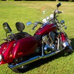
T3D and DirectRoute use the same map database...the roads are identical (if using the same NavTeq issue date). I have both. They're each useful for a particular situation....DR for driving directions and POI's and Topo for geocaching. If you could do street routing with Topo, it would pretty much eliminate the need for DR. However, the POI database in Topo isn't as extensive as the one in DR. I focuses primarily on lodging, fuel and auto repair. One interesting thing about Topo vs DR....in Topo, the POI icons are visible at pretty much any reasonable zoom. In DR, they are only visibile at 100 ft zoom....go figure.... I also have a Garmin 2610, which I use in my SUV and on my motorcyle. I'm used to being able to setup exact routes where I choose the roads. This doesn't work in DR. It takes the start and end points and calculates a route, apparently the fastest route, between the start and end points. You cannot set up custom routes where you choose the roads.