

StephenTravels
-
Posts
142 -
Joined
-
Last visited
Everything posted by StephenTravels
-
I live on an island. Lot's of caches here!
-
Or on Google Earth, just look for Christopher McCandless. It's considered a landmark now. huh, how about that. However, it appears typing in his name takes you to a spot 10 miles east of the actual location.
-
That's funny, I've tried tracking down the location of the bus myself after reading the book. Looks like google just recently updated the maps because before the site was blocked by the clouds. Someone should definitely put a cache out there! After a quick look on Google Earth, the exact coords of the bus are at N63 52.104 W149 46.157.
-
That reminds me of a fairly new cache that I found here in Seattle. In one of our local parks, someone put out a huge ammo can with 500 film canisters inside. It was easy finding the can, but the real hunt was for the logbook, somewhere inside one of the film canisters. And you couldn't do the "shake and listen" method (the owner made the logbook big enough to where it doesn't jumble around inside), you had to physically open every canister to check. It took me about 20 minutes to find the logbook, but I think I got lucky compared to some of the other finders!
-
They aren't fainting goats, are they? I think they're sheep actually
-
Well, I made a trip up to Vancouver yesterday with the family and decided on "Leviathan Lurking" for my milestone. And it was the perfect cache for it! Thanks for all the tips and replies. I'll have to come back sometime during the year to explore those Othello Tunnels
-
What do I need to know to climb Mount Saint Helens?
StephenTravels replied to PastorDIC's topic in Northwest
A few friends and I are climbing the mountain this summer as well. We just registered and we're booked for July 19 -
Not too bad for a freebie. Thanks for sharing!
-
You can sneak around in that. Hmmmm I saw this van today as well driving northbound on Aurora Avenue in Shoreline. Hard to miss!
-
Darn...
-
Depends on the weather the next few weeks - right now you're probably safe as most of the snow on the ground has metled - however apprently they are calling for a few flurries this weekend.. If you follow this link: http://www.bcgeocaching.com/index.php?name...ewforum&f=4 It will take you to the bcgeocaching forum where people can reccomend caches you may find a few more in there Thanks for all the hints! I'll check out the BC forums.
-
Thanks for all the ideas, keep 'em coming! I think I might drive up anytime as soon as two weeks (end of January) till the beginning of March. Is there snow in Hope throughout the winter? I've only been there during the summer, and I have no idea what winter is like up there.
-
Howdy! I'm a cacher from Washington State who's looking into exploring some neat places north of the border as well as finding my 900th cache. I was wondering if any of you living in SW BC might have some suggestions for some really cool caches in your area (anywhere from Vancouver to Hope). Any hints or tips would be greatly appreciated. Thanks!
-
BOOKMARKS OF YOUR STATE'S FAVORITE GEOCACHES
StephenTravels replied to pafarmboy's topic in General geocaching topics
Darn double post... =P -
BOOKMARKS OF YOUR STATE'S FAVORITE GEOCACHES
StephenTravels replied to pafarmboy's topic in General geocaching topics
Washington (State). This is a great bookmark that highlights a few of Washington's best rated caches. Most of these are within a few hours drive from Seattle, but there are other awesome and amazing caches out and beyond. If you're really feeling adventurous and want to see some epic scenery, I'd recommend heading up into the mountains. Enjoy! -
Impromptu Run-ins with other geocachers
StephenTravels replied to end13's topic in General geocaching topics
I've had my fair share of run-ins with other cachers, especially when I'm going after FTF on a newly published cache. I'm pretty sure about 50% of the cachers I've met while geocaching have been in pursuit of FTF. In Seattle, it's not uncommon to find at least 3 or four other cachers at GZ of a new cache. When this happens, we call it a "FTF Party" -
I wouldn't really call these "resolutions", but I've recently put together a bookmark of caches I'd like to find over the year. I'm pretty sure I won't find all of them since most are in the mountains and are only accessible during the summer. But I'm excited to see how much I can get done Along with that, I'll keep working on the Fizzy Challenge.
-
Share Your Greatest Caching View
StephenTravels replied to The 2 Dogs's topic in General geocaching topics
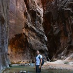
Pics from Washington and surrounding areas continued... View from the famous Ebey Bluffs cache by Eraseek on Whidbey Island (GC13DC) View from White Wolf cache near Hell's Canyon in North-Central Idaho (GCMZ0C Salmon Glacier at the Alaskan/Canadian Border (GCMRXT) -
Share Your Greatest Caching View
StephenTravels replied to The 2 Dogs's topic in General geocaching topics
Here's a few I've taken in around my home state of WASHINGTON Views from the top of Sauk Mountain (GCGJQQ) View from cache at Lake Ann (GC1725) Mt. Shuksan from Picture Lake Earthcache (GC1EHB4) View from my own Earthcache at Deception Pass on Whidbey Island (GC1E057) Snoqualmie Pass near the APE Cache (GC1169) -
That would be awesome! Thanks!
-
I didn't know PNWAdmin was leaving, this is new news to me! I'd like to thank you sacrificing your own time so that others can enjoy this addictive hobby and I appreciate everything you've done for the geocaching communities across the PNW. Enjoy all the free time you'll have now!
-
Enchantment Basin Geocache
StephenTravels replied to footsore311's topic in General geocaching topics
I think this post actually belongs in the regional (Northwest) forums...but your story is interesting! I don't know anything about it, but what are the chances of finding a little 35mm film canister out in the middle of the Cascades? -
Correct, and this one is no different. The start point (GC16RZF So easy a caveman can do it!) is about 200 yards from the dinner location. This allows anyone who wants to carpool for the day to meet up close to the end point, and not have to catch a ride 10 miles to get back to their car after dinner. Three parallel routes? Getting one right is tough enough, and the central start location should work for just about everyone. Of course, you're not obligated to follow the route -- it's merely my best suggestion. Due to time constraints, I'm not even including the south half of the island on the route. The way the route's set up, though, you could start at stop #8, at the Deception Pass bridge, get #7 between #13 and #14, and catch #1-#6 at the end of the route. Oh, yeah, the route. Here's my first draft (667KB PDF). Please take a look and let me know if y'all see anything that isn't quite right. Except for the four Ebey Bluff caches, stops should take an average of seven minutes, meaning no more than a 0.25 mile hike from car to cache. I only included one multi that appeared to be a quickie (GC1A5K8 Grumman Ironworks). The rest I couldn't tell how fast they were. As always, there's more caches on the route than there is time to do them, just in case. Having done all of these, I already know which caches can be easily accessed in the given guidelines (.25 mile hike, ~7 minutes). Here's a few that I thought might take a little more effort than some of the others: - Goose Rock (GCC7BF) is about a .4 mile hike and would most likely take more than 7 minutes to get to from the car. However, it's one of Whidbey's classics so I don't know if you would want to skip that one or not. -Although Roy's 94 (GCG4YE) might appear to be close to a road, I believe it's actually a private drive that cannot be accessed. It is located in Kettles Park, which is a pretty complex trail system and depending on which paths you take, it could take a while to walk to. -The Grampa Tree (GCGCX9) is another cache that would take more than 7 minutes to walk to, due to the complex trail system that it is located in. There's my three cents!
-
No, Charles Porter Ave is on military property therefore restricted to civilians (well, at least those who don't have military ID . Your best bet would be just to take SR-20 all the way around the base (if your coming from the north) and turn right onto Ault Field Road.
-
Glad to see an event right on my own home turf! Will try to make it!