


Accordiongal
-
Posts
233 -
Joined
-
Last visited
Posts posted by Accordiongal
-
-
What do you like most about challenge caches?
Reminiscing about finding a specific cache. Caching with friends and the stories that stand the test of time. Remember, when...
Hey I like bragging about my finds....
I really like the cache pages that have GSAK macros built to determine qualifications.
What do you not like about challenge caches?
Reviewers inconsistent in cache publication based on their interpretation of guidelines. Friends have attempted to publish caches, exact copy of a published cache, in home state after completing a challenge in another state.
Some caches require so much data mining, takes so much time.
Caches that you require you to drastically change caching style such as x streak of no finds. With that though I can ignore that cache.
Also some challenges are poorly worded and difficult to understand.
Establishing the difficulty level of a challenge cache is subjective. Discussion points: What are the guidelines for each difficulty level? Cache density varies from area to area, finding 100 caches in a day is no issue in geographic areas with power trails, but placing a challenge cache is a cache barren area stating you need 100 finds, plus this cache is not always practical.
Distance traveled, number of qualifying finds, certain stats of previous finds?
Most challenge cache placements are a typical cache placement, so why over rate the cache placement?
Ground speak not providing prior notice that challenge cache publication will be suspended.
What would you like to see changed about challenge caches?
Separate icon.
Volunteer reviewers applying same guidelines.
Clear appeal guidelines by CO when publication denied.
If you could describe your favorite challenge cache type, what would it be?
Some challenge caches are really cache placement generators, which benefits and can hinder all cachers.
What types of challenge caches do you avoid?
Locally-oriented challenges like "find 100 caches in this city/county", or even worse: "find 50% of the active caches in this or that county"
Caching is a voluntary activity, each person can choose what, when, where, and how they cache. I do not have to find all the caches.
I also like that challenge caches allow me to set goals and accomplish the goal.
-
MtnHermit,
Thanks for the link, explaining the DVD contains maps, and no viewer, which I had not anticipated.
What is the differnece between MapSource and BaseMap?
Hate to say this, but I need detailed step by step to understand how to VIEW the maps.
Accordiongal
-
Greetings,
I am attempting to install Garmin TOPO US 100k to laptop, with intentions to copy to 4 GB Micro SD card to use in 60CSX.
Placed DVD into drive, automatically ran installation.
Suspect I do not know how to use product correctly.
In all programs noticed Garmin Basemap
In collection shows TOPO
Something seems wrong, but have no idea what.
Should Basemap really be there?
Accordiongal
-
I had the luck to view this display last fall while doing caches in Moose Lake State Park. Oh, the rocks are so pretty.
-
IMO, the next level of earthcaches needs to be related to public service. So far the levels are based upon seeing and creating. Racking up the numbers of visited and created.
Public service is an aspect that gives back to society and geocaching. Earthcaching public service: geological cito,
teaching/hosting an earthcache event with emphasis on geology, creating processes, etc. Hey doesn't mean you have to be the expert, but coordinated the content
What other public service earthcache ideas can be generated?
-
Hi Everyone,
I'm planning on creating an Earthcache at a river crossing where the flow of the river has lessened due to water disappearing down "swallow holes" into the underlying chalk in the area, I have some interesting geological and historical information on this phenomenom to put on the cache page to educate visiting cachers.
There are no information boards at the feature itself, I was thinking of having the following logging requirements:
1) Take a photo that includes yourself or your GPSr at the cache site with the river in the background.
2) Estimate or measure the width of the river at this point, noting the method you used to get this measurement.
3) Measure the depth of the river at it's centre.
The crossing of the river is made of "stepping stones" which would enable cachers to access the centre section of the river to measure the width and depth.
The swallow holes are known as "sinking streams" in SE Minnesota. My thought would be to include q and a about the sinking stream process. What creates differences in the seasons? Spring, Summer, Fall, Winter.
The questions you list are related to measuring the stream in general, not about the "Swallow holes". I think the logging requirements should be related to the swallow holes. Consult with the local county geologist, they are full of information and can give you ideas on how to approach the logging requirements.
Good luck.
Would these requirements, along with the geological and historical information on "swallow holes" I supply on the cache page be enough to create an earthcache?
Any suggestions would be welcomed, thanks.

Dave
-
Ready to travel to beautiful Colorado!!!! Any date, any time.
Publish it, and they will come.
Long drive, which I have done many times to Colorado Springs.
Would be great having a face to face with geoaware, unique event, geologic content from experts face to face.
Possability of traveling to Canadian Rockies, oh, they are beatiful and want to return there some day. Another very long drive, but will come.
Out of US sites, possibility with enough time to plan, seems that would have to be off in the future.
Gee now you are going to be a travel service for earthcaches.
-
Umm, why don't you make them yourself.
I have not skill or leads.
-
Have the finder post a picture, if there are signs, answer question based on signs making sure the same info is not available online, measure water temp, tree size.
If you can provide additional information about the unique site, then maybe forum community can provide additional assistance. Ask again at the site for educational idea, what is the message the site wants visitors to take home?
Don't make it so hard, like easy, that is the hardest task.
-
Educational based questions:
First review published EC for methods to validate a visit.
Describe any humps, water sediments from iron, organic acid, high in the mountains-take an elevation reading, differences in plant life in various zones,
Do many animals walk in the area, if there is an animal track, is the water depth changed?
Fen and bogs have different sources of water and drainage, where is the source and drainage point
What is the affect on ben/bog in wet years, dry years
For assistance contact the area geologist or state water expert. They are walking books of knowledge and should be glad to assist in developing content and appropriate learning activities. Check your states DNR pages, under wetlands.
Good luck
-
Content is developed prior to publication. Upon publication the content can be changed. I wonder if a cache owner adds some of the logging requirements post publication?
Without understanding the owners reason for including the statements about negative comments, I don't want to pass total judgment. I would probably say very little about the cache site: answers sent.
Feels like a sensorship, say what I want, not what you think.
-
I’d love to see a LIDAR image on this one…
What is LIDAR image?
-
I appreciate an earthcache owners reply about visiting a site to correct answers/typos or just a "thanks for visiting"
I don't always reply based upon mood, other stuff pending. If I do reply, there is a simple response, thanks for visiting or correct answers. I am not a wordy person, hate to write.
Accordiongal
-
All cachers are invited to create earthcaches. From my experience, the degreed experts are very willing to share their knowledge, provide explanations, offer resources, correct mistakes, and one even took part of a day to provide a personal tour of a wetlands.
Many resources are availiable: geological county maps, links on wikipedia, libraries, local county geologists, publications, earthscience teachers in public schools, university staff, TerryDad2, and local earthcache developers
I have visited well developed earthcaches and "lame" earthcaches. To me what makes the difference is the writing abilities of the creater. Content included, signifance, and method to increase the cachers knowledge of the unique area, tasks. The earthcaches I have developed include a lot of content about the formations because that is what I enjoy reading. Creative writing is a very weak skill, so use a lot of the content from publications.
My opinion, I like visiting springs, but have measured temp and pH so much that they are now lame caches. Enjoy visiting the spots because now I understand the unique features of springs and enjoy the scenery, and historical aspects of the sites.
Thanks to earthcaches, I now tour Minnesota and recognize the various types of features and am amazed how truely wonderful and the power of Mother Nature.
-
If you see this Jeep say hello. My platinum sticker is hard to read but you can see it.
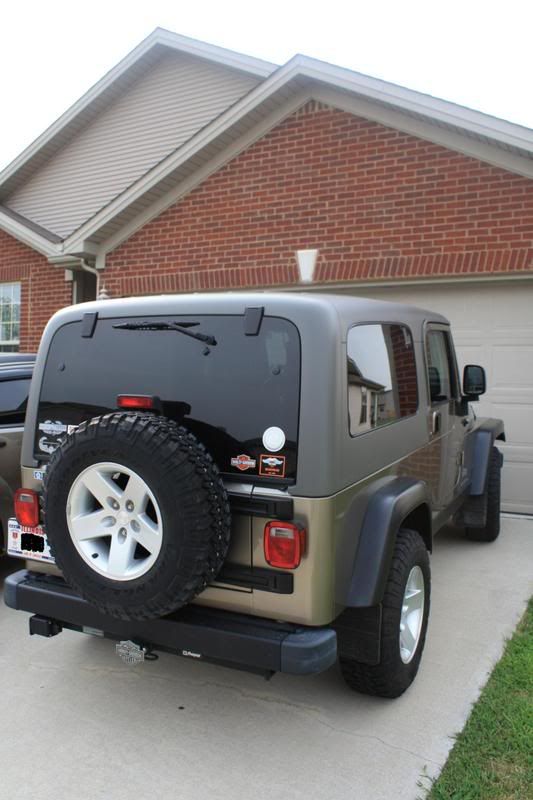
Forget the Jeep, lets see the Harley with a sticker!
-
Greetings,
Timing of receiving a geocoin angel mystery coin must be dejavue. For many months I have not dared be involved in the coin forums due to credit card self control issues. Finally decided this week to return because I missed the efamily. Then today in the mail there is a wonderful gift of the geoangel coin. In the past I have been very fortunate to send a few gift packages to some in the coin family. Sending mystery packages is a great feeling, even better then purchasing the hottest coin. Well, very nice to receive the geocoin angel today. Truely appreciate the gift, hoping the geocoin angel continues to spread joy and most importantly the gift of sharing.
THANKS!!!!
-
Have to admit thought about makeing an earthcahe memebers only. In the long run felt that members only would be inappropriate because feel that earthcaches are a unique geology learning tool. Why limit the options?
Members only should not occur.
-
There are three that have been my favorite:
GC13END Soda Lake in California because the research station is beautiful. I wanted to stay there, just think of the location and go into a zenn state and feel relaxed.
GCZ9C7 Petrified Dunes in Snow Canyon in Utah. Talk about the moki marbles a lot with my main caching partner. Even found something like them in Minnesota.
GC1054V Get Down & Dirty in Indiana because you have to make mud and play in the dirt. Another earthcache that I like discussing because of the lessons learned about soil and dirt.
-
Very nice, would be interested in pre-oreder for all versions.
-
My opinion, see what ever you want to think is in the coin. Intent is not to be offensive to "your eyes". Heck, if this coin seems offensive, how about Christmas Holiday coins, Easter coins, those can be offensive to those who are not Christian.
Then what about the sextant coin. Which contains the word sex. Should that be renamed because it's not family friendly. Not to mention doesn't follow the shape rules suggested.
My thought, get over it. Don't purchase the coin, go find a cache, better yet, place a cache.
-
Depends upon a number of possabilities:
If you own the cache you can archive the listing.
If you don't own the cache and its not active from lack of maintence, the cacher is not active, work with your local reviewer to have the cache archived.
If you are unable to provide routine maintance, inquire of the local caching comminity if someone would like to adopt the cache.
Should provide a basic answer, let others provide some options also. Depending upon the situation you may want to provide some additional details.
-
I for one am tired of measuring water temp and pH levels, after a few its basically the same answer in karst country in SE Minnesota. Has tought me fresh water springs are the same temp year around and pH varies due to percipitation. The same "learning" requirement leads to lame caches.
Personally I could care less if some one anwers questions, I just want the cacher to read the content and learn. Sets a peson up for armchair earthcaches.
The last earchace developed is a fen, heavy content, answers are in the content, main point is for cacher to experience the setting and take with them understanding of wetland importance.
-
The idea of additional approval levels to verify content sound great. The issue will be finding volunteer reviewers, determinging minimum level of criteria for explanation, tasks. THen not to mention needing english/writting majors for content formation.
So if additional levels of review are to be added, what would be the minimun level of professional preparation be required? High school earthscience teacher, DRN geologists, PhD prepared, very knowledgable non-geology professional, platinum level earthcache masters, list can go on and on.
There are enough issues with state by state geocache reviews and consistency, then to add additional layers will create issues for placers and reviewers.
How many reviewers make up geoaware?
Looking at the numbers of published ec, there has to be more than one person involved in the review process.
My two cents for now.
-
I will mail some coins tomorrow.

gc.com timeout on Mac using Parrellels and windows
in Website
Posted
Greetings,
New Mac user. I have parallels and Windows 10 installed to use GSAK.
Today while in the Windows platform, received error message that gc.com access timed out. Yet, I can access gc.com in the Mac platform. Prior to today do not recall issues accessing gc.com in the windows platform.
Is there some little checkbox that needs to be changed, why is this inconsistency happening in the windows platform and not in the Mac today.
Thanks for your information and suggestions.
Accordiongal