


FollowMeChaps
-
Posts
620 -
Joined
-
Last visited
Posts posted by FollowMeChaps
-
-
You'll probably find that a 9 year old has a better gift for operating the more complex unit than you do. Give him the fancy one and choose the cheap one to suit you - IMHO you can't go wrong with an Etrex H as a second.
-
Shaun - you don't say what screen you prefer to use - map, compass, etc.
Let's assume you use the map - to add info' to the map try Setup>Map>Data Fields> then choose one you prefer - if you've updated your software then you might find you like Dashboard>Geocaching - Active but play around and try the one you prefer.
If you use the compass then just hit the icon in the botto, right corner and try the different choices.
Have fun!
-
If it's the same as the 550, and I guess it is, you need to have first chosen to navigate to the cache before you can see the hint - select a cache first THEN hit the geocaching button. You can't see the hints on caches you are just browsing.
-
I use the one on the front of the unit - it works a treat for me!

-
To build on Bruce's original question I have been using this great little utility for a while and it's really great - brilliant work Madproforg many thanks.
Does anyone know how many of these tiles you can upload onto an Oregon? I've managed over 50 so far, by loading them onto a micro card, but I understand there's a limit. GarminOregonWiki says it's 100 jpg files, but as I understand it each of Mapfrog's kmz files are made up of 16 jpegs so how come I can save >50?
Confused

-
Hello everyone,
I also just bought a Oregon 450 and so far I love it. I am trying to figure out how to download bunches of caches at once. I like to do a search on the area I am going to go to and then download all those at once. So far all I have been able to do is download them one at a time. Is there some addtional software I need to put on my unit to get this to work (download all waypoint option). Thanks for any help. I am pretty new to this so hopefully this is not to stupid of a question.

Jim
Jim - the Garmin Oregon Wiki has all the answers - you'll need a Premium account see this page for how to.
-
You'll enjoy it Josh, the Oregon's a great tool/toy!

-
 I hope I'm not speaking too soon but I have upgraded to the new 3.1 software and the magenta line is now showing with transparent maps - I use talkytoaster's excellent UK OSM maps. I had to uninstall the version 3 upgrade and revert to the previous version to get the magic direction line back - I'll be keeping my fingers crossed for the next few days!
 I didn't experience the breaking up problems others have reported so cannot give any feedbak on that issue I'm afraid.
-
Sorry, but I can't make head nor tail of the 'Contract' page! Is this a free download or is there a charge to using it?
-
Have you also tried this - http://www.bikehike.co.uk/mapview.php?
That said talkytoaster's OSM maps, which you already seem to have, should do the trick on their own.
-
ohh another one... same event...
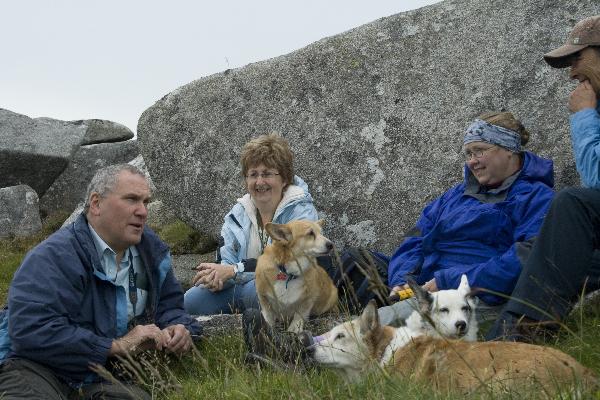
Three of the Caching Corgis.. but don't be taken in, sweet, innocent, cute and fluffy they may look.... but I'd be sure they're eyeing up MrsB for dinner...
and here's another one at a different event..

The cogis are fine - it's the wheelybarrows you have to watch out for!


-
Wendy - Mrs FMC and I would like to add our condolences for your loss. Caesar was a truly wonderful companion and help to you. I can only echo MartyBartfast's words that you contributed as much to his enjoyment of life as he did to yours - that photo you added just proves it.
Our love.
-
.....I was wondering if it would be possible to add an option to remove any posts from someone in your ignore list.
I have been working on this for a few days now and am not making any headway........
Did you, or anyone else, make any progess with this GeoBain?
-
Martin - many thanks.
-
U lot spent to long at skool - easy answer!
-
jester2005 - sounds like you've got a dickie unit that you may have to send back and have replaced. I get several hours (sorry I've not measured but easily lasts over 6, my longest trip with it so far) on the supplied batteries or Energizer rechargables (2000 mAh), and that's with the light on max with 30 second auto off and taking the occasional pic. I also get no freeze ups
Like you I also used the Gramin website last week to ask a question about the version 3.00 software upgrade (navigation line not showing when using transparent maps like OSM) and got no response - not even a 'thanks we are looking into it' - nice gps unit but crap service I'm afraid.
-
Just copy the ???.kmz file that the Bing-map gizmo generates into the Garmi/Custom Maps folder of your Oregon - alternatively create a Garmi/Custom Maps folder on your memory card in the unit. The unit will look in both.
Edited to add:- you also have to enable the map on your Oregon - Setup>Map>Map Information Select a Map>Custom Maps>Enable
-
REQUEST TO MODERATORS:
Can you PLEASE open a new thread along the lines of "Is OSM any good?" and move these recent ramblings to that thread so that those that choose to can ignore them. There are many of us who DO like OSM and are watching this thread for updates - after all it is a Latest OpenStreeMap UK Garmin Mapsets... thread that talkytoaster was using very effectively.
This way one sado who clearly has clearly lost his/her dolly from from the pram doesn't have to ruin it for the rest of us?
-
Having done a system restore it made no difference so I left it outside to learn the satellites. This exhausted the batteries. Once changed I have got the magenta line back in only one of my profiles where it shows as a direct line (off road mode) - if I 'recalculate on road' it disappears in the same profile!
Help!
-
Has any of you tried to call Garmin about this?
I've emailed and awaiting a reply. Tried a hard reset and it made no difference.
-
I've lost the magenta line as well on 550. Tried disabling the base map and all others but this made no difference.

-
Thanks snowfleurys. I'm curious to know how one finds this out?
-
Nice find jeepdelfuego.


Before After
It's a large klm file. I'm therefore not sure how that will effect the Oregon performance. The garminoregon.wikispaces.com says "The limitation on the amount of map data which can be loaded on the Garmin is related to the total number of JPEG images supported across all KMZ files. Currently the unit is limited to 100 files." I'm not sure how many jpegs go into this klm file, does anyone know?
-
For the benefit of others watching this thread qichina has not made a fair comparison his/her post. The zoom level chosen for the 2 pictures I would not use when out caching. I'd zoom in much more - at which level you'd loose the 1:50K map shown.
If you want a great solution yet stay stay with free maps then I'd recommend using OSM for the general layer but add OS 1:25K tiles using Madproforg's excellent utility - here.
However, I agree with Marty - qichina, you obviously don't like OSM yourself so why keep posting on an OSM thread?


Latest OpenStreeMap UK Garmin Mapsets...
in United Kingdom and Ireland
Posted
ditto - Martin, you de man!