

phlatlander
-
Posts
199 -
Joined
-
Last visited
Posts posted by phlatlander
-
-
Interesting about the "gold chests". On my Nuvi 1350 seeing the gold chests is as a result of a specific macro. I have the latest software update and depending upon which macro I use, I either get the (usual) little green boxes or the "gold chests". In fact I can get both if I run both macros. The "gold chest" .gpx file becomes my favourites which I periodically erase as I get tired of the cluttered screen.
-
Took my grandkids to check on one my geocaches and found this.

-
Well, I have an assortment of gpx files and csv files (55 files in all) for my Nuvi 1350. While I create and maintain both formats, unless I want to add additional data such as descriptions and jpgs, csv is simpler and much more compact format.
-
If you are comfortable with a pc and your gps, these custom maps will work. My Nuvi 1350 only allows 2 maps to be active, so I have North America (which came with the unit) and a 2nd map of about 1/3 of Europe. I created/obtained the 2nd map from the site below which, by the way, is free.
-
I am considering replacing my old Etrex Legend with an Etrex 20. I know you can download .gpx geocache files, how about downloading .csv files?
Thanks in advance.
-
Hard to say how many geocaches are on the my Nuvi 1350 micro sd card. GSAK says 2001 but as I don't download Multis or WhereIgos or Virtuals, there's likely about 1800-1900. Seeing as I am more of an occasional geocacher, I just like figuring out what I can do with a 1350 rather than storing several thousand GCs. I also do have many, many files of interesting eating places and the like - great devices this GPSr!
I haven't yet found a GSAK macro that lets me add pictures to a geocache (not spoiler pictures) so I also create my own geocache.gpx file which includes a GoogleEarth image of where the geocache might be or just general layout. I only do that for about 30 GCs.
I also have a map of much of Europe on the sd card too for trip planning references. I like the Nuvi because of the larger screen and general ease of use but I plan to purchase an Etrex 20 in 2012 because of the much better battery life and AA batteries (I carry several sets of Eneloop NiMH for my Canon S51s and my Etrex Legend).
-
The macro on this page does not work correctly on my 1350. I knew that before I tried but I was interested to see what did get processed/displayed. I do get all of the geocache icons but no descriptions, notes or lat/long information.
This is not a complaint towards the macro whatsoever, quite the opposite. I just wish Garmin would have consistent data parameters across their model line.
-
Thanks for the link. I shall try that on my 1350 this weekend. My old Legend does not do papterless so it will likely get replaced by an Etrex 20 in 2012.
-
Skyk, do you happen to have the name of that macro?
-
I use a Nuvi 1350 for geocaching and with the exception of a compass rose and distance to cache it works every bit as well and as accurately as my old Etrex Legend. As I am quite comfortable with Lat/Long I don't need the compass rose.
All that to say that I'm fairly sure that unless you set up your geocache file as a TourGuide gpx file, you will not see geocaches unless they are within the normal alert distance on your route, and certainly not far left or right of your course. TourGuide gpx files are interpreted to show these positions within a radius distance from the point (maximum radius is around 30 miles or so). I use GSAK and set the radius distance for 250 meters (Canada) for geocaches. On a slightly different note, I set rest area TourGuides for 2 kilometers. I currently store 1150 geocaches and numerous other .gpx files so I have no idea how many geocaches a Nuvi 1350 can store. I use a micro sd card and I do not let the unit copy the files to its internal memory.
GSAK is a good and very complete program that allows you access to your own user log where I add "WINTER FRIENDLY" and similar attributes as well as select "hints" gleaned from geocache logs. Then the macro I use copies my logs faithfully to the gpx file for Garmin's Poiloader V27 (using v27, don't forget to rename your .poi file to .gpi). What I like about GSAK is that when I download a newer pocket query, it does not overwrite my own user log file.
Original macro: GPX_by_Cache_Type_TourGuide.gsk (available from the GSAK forum). This macro outputs separate TourGuide.gpx files for various kinds of geocaches, an audible warning .wav file (which I have since replaced with a silent .wav file") and various geocache .bmp icon.
I'm a senior so I have modified this macro to display different coloured text and larger fonts - anything to help older eyes. Regarding the attached photos, in #2 and #3, the original font size for all the text description are the lines "Last found" and "Poi Created". Hope I didn't stray to far from the original question.


-
When you say attributes, are you meaning "Winter Friendly" or "Winter Friendly" and similar attributes?
-
Regarding maps - in particular for Garmin GPSrs.
You might want to try a few maps from http://garmin.openstreetmap.nl/ Took me a while to figure out to use the website but the results are OK and the maps are free.
I have installed a modified map of Europe (Germany, Austria, Czeck Rep, Hungary) onto my Nuvi 1350 and it is likely most Garmin products will read/use a .img map file. I have been advised by an Etrex 20 user that it can read/display the .img map.
-
You might want to try a few maps from http://garmin.openstreetmap.nl/ Took me a while to figure out to use it but the results are OK and the maps are free.
I have installed a modified map of Europe (Germany, Austria, Czeck Rep, Hungary) onto my Nuvi 1350 and it is likely most Garmin products will read/use a .img map file
-
Excellent, thanks very much. We will be going on a Danube river cruise next fall and I wanted to take along a gps with applicable maps. Looks like the Etrex 20 will do just nicely.
Cheers from Winnipeg MB CA
-
We probably get 50-100 ticks every year between my pooch and me. I just pull 'em off both of us and then burn 'em. If it seems to be a particularly year bad I will get a anti tick collar - for the dog...
Here on the beginning of the Canadian Prairies tick season starts in April but is usually over by late June. I do check for deer ticks and our dog gets regular check-ups.
-
I am looking to replace my aging Garmin Legend and the Etrex 20 looks like a good choice. I also have a Nuvi 1350 and I have successfully loaded and displayed Europe maps from openstreetmap.org in .img format. On the Nuvi you have to ensure the map name is gmapsupp.img and you can only have the installed map and one more .img map running at a time.
My question is, has anybody downloaded and displayed a .img map from openstreetmap.org on an Etrex 20?
-
Well, I am able to use GSAK and and my Nuvi 1350 does a very credible job of paperless geocaching. Matter of fact, except for the rather limiting battery life, it does a better job of urban geocaching than my older Legend. Lest someone jump up, caps ready, the Nuvi can display geocache info in larger print and as I am quite comfortable with Lat/Long navigating, I do not need a heading or distance. Check out this post:
I'm not sayin', I'm just sayin' is all...
-
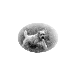
Here is my geocaching buddy, Toby the terror terrier. Good company when we head out to geocache or check on my caches.

-
In order to place Geocaches I have checked my (old) Garmin Legend to a known geopoint and the unit if off 1m N and 1yd W. I now have 15 or so hides and before submitting them I verify the location with GoogleEarth just to see if everything is reasonable. I have found two instances where the Google "patches" do not align properly so if you were to use only GoogleEarth in these instances you would be off 30-60 feet.
I like to use GoogleEarth to scope the general geocache area for approach and parking.
-
Gary Sinise ... with beard...
Gets my vote

-
Not to muddy the waters but my Nuvi 1350 works very well for paperless geocaching. There is a learning curve required to figure out how to do it but not only can I display the complete description and 3-5 logs, I add attributes too - thanks to GSAK.
I also create my own gpx files with pictures or maps of the area. The scren on my old Etrex Legend is becoming problematic so I will likely replace it with an Etrex 20. I like the extended battery life which the Nuvi does not have.
-
Spotted while geocaching near Kenora Ontairo Canada

-
I just surfed in (I own an older Garmin Legend, not a Nuvi) and as I am interested in a Nuvi, I found this utube video. Will this helps.
http://video.google.com/videoplay?docid=-7407432798720049061
Lost "Gold Treasurer Chests" Nuvi
in GPS technology and devices
Posted
I am seeking to understand the Nuvi 1350 and poi displays and I am in no way trying to be argumentative, however... Here are the "gold boxes" I see on my Nuvi. If these are not the same as are the topic of this post, then I stand corrected before I start.
- E: Nuvi 1350LMT running 5.70 software
- G: 4gb micro sd card where ALL of my poi, gpx and img (map files) are stored and I do not allow the Nuvi to copy any files on unit startup.
- GSAK Beta 8
- Garmin Poiloader 2.7
- macros I use (as I am a senior, I prefer larger text as well as different colored text on the Nuvi so I have modified both 1 and 2 for my personal preferences).
#1. Attrib_to_UserNoteLog.gsk An excellent macro that allows you to display text geocache attributes and user notes. (modified text and color display).
#2. GPX_by_Cache_Type_TourGuide.gsk, by jjred (and others). This is a great macro which outputs tourguide gpx files which work correctly on the Nuvi 1350 (modified text and color display).
#3. GarminExport.gsk which writes a gpx files to E: which I move to G:
#1 is only used when I start a new database.
#2 is used quite often but I only use the Traditional and Mystery output files. I have replaced the "dinging" wav file with a silent wav file and if I am not geocaching then I delete the word "TourGuide" from the filename.
#3 outputs a file called GarminCaches.gpx to E:/garmin/gpx/ and creates 2 subdirectories /POI and /POI Stash. I move the file GarminCaches.gpx to G:/garmin/gpx this way the geocaches end up as favourites (same as before) and I delete the subdirectories which makes reading the Nuvi Extras much easier. And as these geocaches do not contain data, they are only used to show the "gold boxes". So occasionally I must delete the entries in the Favorites file if I do not want to see these geocaches.
All of this to say if I do not do #3 I never see "gold boxes" so I am of the opinion these are present as a result of the macro, regardless whether I am running 5.7 or not. May I reiterate that I am seeking to understand the Nuvi 1350 and geocache displays and I am in no way trying to be argumentative