


BiT
-
Posts
248 -
Joined
-
Last visited
Posts posted by BiT
-
-
To reposition a waypoint.
Move to the new location, WhereTo?->Waypoints->[select waypoint]->Options->Edit Waypoint->Reposition Here.
GO$Rs
Question or maybe I'm having a moment. When I reposition a waypoint, it brings that waypoint to my current location. I was thinking that you could select a waypoint you "jump" to that waypoint then pan around that location instead of panning all they way to that waypoint from your current location.
Why would you want to do this?
-
Do you still have it? I'm interested.
-
Well is has been over 7 weeks and still no mounts for the Colorado. I emailed the "Third-Party" vendor that Ram farmed the order out to and they had no idea when it would ship. The original date was March 26. I then emailed Ram Mounts and they don't seem very keen on customer support of emails. Hurry up and wait I guess. I may have to go with the Garmin mount but that isn't quite what I wanted.
-
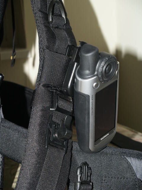
I don't attach my CO to my belt, I attach it to the shoulder straps of the backpack, just above the clip to my mouth piece of the water line for the hydration pack.
-
Mine did the same, just turn the magnetic compass off.
-
Sure, I just drilled out a small hole and screwed the button into it. I then used a lot of JB Weld Epoxy.
-
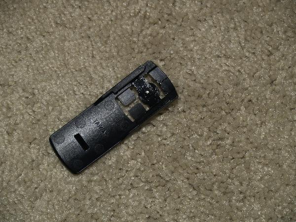
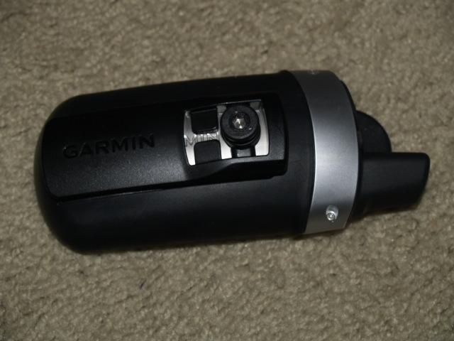
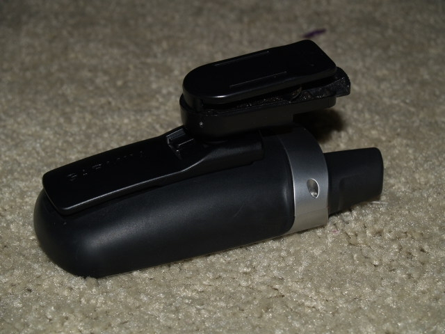
Check this out, I engineered a belt clip for my Colorado from parts left over from my 60 series.
-
Did you take any screen shots with the 3D views? I would love to see them.
-
....but it is advertised to have all functions of a gpsmap (also with the games if you need them)...
Go and find an advertisment from GARMIN and THEN we will believe you........
there was an advertisement on garmin.de
the OFFICIAL HOMEPAGE
but i did not make any screenshot and now they removed it.
In summary, what did that advertisement say?
-
Hi, I'm looking for a part for the Garmin 60 series. I don't know what it is called but it is the the screw piece that attaches the belt clip to the GPSr (see picture below).
If anyone has one that they are not using and would be willing to give or sell, please let me know.

-
I used Navigator NT on the 400t for the first time yesterday and noticed that the beep tones when approacing a turn is not very loud. With the radio on it was barely audible. Is the loudness a user definition or is it a software issue. I needs to be louder.
Anniebananie
Amen, brother or is it sister! I've been wanting that for a few years now. It is/was like that on the 60CSx however you could change the alert sounds on the 60CSx. I like to "jam out" sometimes in the car and hate that I cannot hear the turn alerts.
-
What if that relatively small amount is over 5 to 7 miles?
-
I like to run with my GPSr in my hand, how much do you thing the arm swing affects the distance traveled? Do you think it may be negated because of the back and forth motion?
What are your thoughts?
-
Double Post.
-
Just create a waypoint where the cache is. Go to your map and click on the waypoint. Then Options>Project Waypoint>Enter Bearing in Degrees>Done>Select Projection Distance Units>Enter Distance>Done>Yes.
-
I love mine. I have many uses for it. I like the fitness feature because I regularly run and do trail runs. I'm looking into the biking features in the future. I use it to hike, auto navigate, and geocache. I like having all the cache info in one machine. I use to have a PDA but didn't carry it or left in the car a lot. Now I'm forced to carry the info with me if I'm geocaching. I like the bigger screen and I like the ergonomic fit in my hand. I like the picture viewer because I can load other map resources (as .jpg files) into the machine and also have them with me.
-
Also you can get a screen shot to show us any future issues you may have.
All you have to do is press and hold the right soft key for about two seconds. Then connect your CO to you computer and the screen shot should be in [drive]:\Garmin\scrn\<unique_id>.bmp .
-
IMHO, when you have the CO outside, the screen doen't seen dim at all.
-
Perhaps I do not understand the question, so please forgive me if this does not apply. But I can click on a cache on the map using the RnR button and am able to view info on the cache and am given the option to "go" to the cache. If I am in auti mode, city navigator will even give me directions to it. This comes in handy for those caches that are tucked away in those hard to find parks.
I think the OP was asking about this?
-
2. Is there a way to add a owned by tag on the startup screen as with GPSmap 60Cx.
What I did is make an .jpg image of my info and loaded it into the image viewer.
-
Yep, you learn something new all the time. I never have tried CN and Topo at the same time.
-
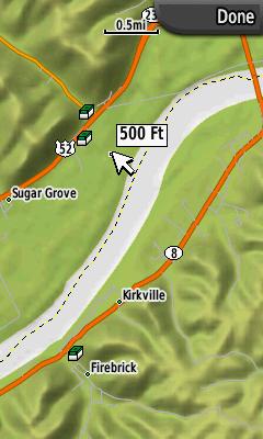
On the CO, would not it be cool to if you could turn off the topographic lines and just have the DEM shading?
For a sample, zoom in or out one level, there will be a short delay where the DEM shading is present and no topographic lines are yet drawn. Is that cool or what?
Buy City Nav! I guess it isn't quite the same but you do just see the road information and DEM and it looks very similar.
GO$Rs
I have CN how do you get the DEM on it?
-
On the CO, would not it be cool to if you could turn off the topographic lines and just have the DEM shading?
For a sample, zoom in or out one level, there will be a short delay where the DEM shading is present and no topographic lines are yet drawn. Is that cool or what?
-
There is something in the settings which shows labels at a given height.
Setup
Map
Options (Soft Key)
Advanced
Zoom Levels
then select what type of label, then the level you want the label to appear at.
Hope this is the answer to your question
Regards
LakelandFox, UK
I played around with those setting and still no difference when you hover over a lake or a bigger river.
Beta Update for Colorado ver 2.51
in GPS technology and devices
Posted
Why not just create a new waypoint there since you are standing at that location.