

david&diana
-
Posts
82 -
Joined
-
Last visited
Posts posted by david&diana
-
-
You'd have to actually install Mapsource on the other computer. You can save your unlock codes to a flash drive and then use them on the other computer. Note that I think this may technically violate the software license if you don't own both computers.
You can fit a lot of the eastern US on a 1Gb memory card. Using both CN7 and Topo, you could fit FL, MS, AL, GA, SC, TN, NC, KY, WV, VA, MD, DE, IL, IN, OH, PA and NJ. That would take 964.8 Mb.
If you have a specific list of states in mind, post the list and I can tell you how much space it would take.
-
If I loaded City Navigator, 24K, US Topo, and Worldmap, and I was in the area covered by 24K, what would be the hierarchy?
If I loaded City Navigator, US Topo, Blue Chart, and Worldmap, and I was in the vicinity covered by all 4 maps, what would be the heirarchy?
It's not quite the same set of maps that you list, but I have City Select, Topo 24K, Roads & Recreation, and Topo maps loaded into our 76C and they're displayed with that hierarchy. City Select first, Topo 24K if City Select is hidden, Roads & Recreation if the first two are hidden, and Topo if everything else is hidden.
I think you can determine the hierarchy by the order that the maps are listed on the GPSr menu where you can hide or show them.
-
Pennsylvania is divided into only 4 segments in CN 7. The Southeastern quarter takes 25.7Mb. New Jersey is divided into only 2 segments. The Southern half takes 13.6Mb.
-
We've logged the WJTB's Davian and Diantha.
-
The City Select maps for New England take 71 MB. You can reduce that to 67.9 MB if you don't include the SW corner of Connecticut since those map segments are mostly New York. A 76CS should be able to hold both City Select and Topo for New England with 7-10 MB to spare.
-
We use a digital camera to make a picture of the GPSr screen with the GC number of the cache just before starting our search. We also make pictures of mult-stage clues along the way. When we find the cache, we make pictures of any travel bugs (including tag numbers) we leave or take, a spoiler photo of the cache hiding place, and the signed log book. When we get home, we upload the pictures to our computer and save them in a folder labeled with the date. We also upload the track log from the GPSr. The log book photo helps when doing the on-line log because we can see what we originally wrote. If we need to refer back to a particular hunt, it's easy to look up the date we logged the cache on GC.com and find the corresponding folder.
-
The 3 closest caches to Pinnacle, NC are:
NÚMERO DOS: Mount Pilot Cache (GCHZCM)
-
There were 467 travel bugs logged into (GCHAZV) Second Annual Geo-Woodstock.
-
Our 76c is very readable in sunlight.
-
What's interesting is that I just pulled out my old GPS III and tried it with Mapsource 6.3 and they worked fine together.
-
It's discontinued now and the maps are getting out of date but U.S. Roads & Recreation (http://www.garmin.com/cartography/mapSource/RnR.jsp) will show you the county boundaries since it selects maps to load to your GPSr by county. I still use this sometimes even with my 76C since it has most roads and better lake/river/creek mapping than Metro Guide or City Select. You may be able to still find it in a store somewhere or on Ebay.
-
I have recently put both City Select and the Garmin Topo on there but am wondering if there is a way to *see* both at the same time.
You can't see both maps at the same time. You can use the map setup menu to quickly switch between any maps you have loaded but that's the best you can do.
While I'm sure this is true, at the moment I can't find where it's documented even though I'm pretty sure I remember reading it somewhere.
-
I would like to know what you think of the Metroguide and City Select. Which software is better? What are the good/bad points of each? I will be using this with a Garmin eTrex Vista.
For an Etrex Vista, you definitely should get Metroguide. The maps are the same. As far as I know, the only differences are the City Select supports auto-routing GPSr's and must be unlocked for each GPSr you use. It costs extra to unlock more than 2 GPSr's. In fact, I don't think that City Select will even work with the Etrex series.
-
I think you are mostly correct. I bet the hardware is the same and the firmware only has minor differences.
I downloaded the 3.30 firmware upgrades for the 60C, 60CS, 76C, and 76CS and they're all identical once you uncompress the files.
-
In the last 2 years we've made 3 trips to the Transylvania County area for a honeymoon and Geocaching. We stayed at The Yellow House in Waynesville just across the mountain in Haywood County. They have a cottage for families. We found a lot of caches along US 276 and the Blue Ridge Parkway between Waynesville and Brevard.
-
I cannot figure this out from the manual, so am hoping for help from other Garmin GPSMap 76S users ...
How do I retrieve the gps satellite elevations for trackpoints and waypoints? By the default, the barometric elevations are downloaded. Is there a way to access the corresponding satellite elevations?
Related to this, is there a way to force the unit to rely on satellite elevations (simply switching off the barometer results in NO elevations on the mapping page)?
Thanks for any help that you might give me!
You should be able to do this if you update the firmware in your GPSr. Garmin added the ability to virtually turn off the altimeter in version 3.40.
-
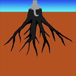
Our avatar is the Carolina Red Clay logo, our cat Rocky sitting on a stump with its roots in Carolina Red Clay.
-
A Sunday afternoon would be a great time for a meeting. We can drive down from Winston-Salem and not have to take time off from work.
-
Hawk-eye and El Diablo are no longer competing to place the most devious cache. Now it's WE4NCS and his Bison tubes. In fact WE4NCS wasn't even caching yet. Back then you had to get up pretty early to beat Hawk-eye to a FTF.
-
Isn't Asheville a little close to Pigman's territory?

A weekend without Geocaching is like a Monday.
-
We also celebrated our 400th find with an FTF.
A weekend without Geocaching is like a Monday.
-
When we decided to do “Where’s In A Name?”, we calculated a latitude from our name and plotted it across the US looking for population centers along the way. We checked for nearby caches at various coordinates along the line. The goal was to find a geocacher who had found and placed caches in the area and did locationless caches. Going all the way across the country, we found someone that not only fit all our requirements but had assisted in logging “Where’s In A Name?” for another cacher. We sent him an email and received several pictures including a very cool shot showing a GPSr with an aircraft carrier in the background.
A weekend without Geocaching is like a Monday.
-
We've been to this location several times. Based on the track log from our last visit, the cache is probably about 0.15 miles from the nearest non-handicapped parking. Yes, I'm a geek. We've had the pleasure to meet rldill several times and we've enjoyed several of his caches. We plan to try this one Saturday.
A weekend without Geocaching is like a Monday.
-
Even with binoculars we had to make two trips to see the clue for Hawk 12.
A weekend without Geocaching is like a Monday.
Map Source
in GPS technology and devices
Posted
As near as I can tell, those 8 states require 442.2Mb for CN7 and Topo.