


Viajero Perdido
-
Posts
4374 -
Joined
-
Last visited
Posts posted by Viajero Perdido
-
-
Why can't Groundspeak interject here and tell us, because emergency, what the old search URLs are, the ones that still work, and work properly?
I'm outside enjoying a sunbeam, and don't have the URLs handy. I'm not paid for this kind of support; in fact I'm paying for someone else to provide it.
EDIT: try these:
https://www.geocaching.com/seek/nearest.aspx?u=username
https://www.geocaching.com/seek/nearest.aspx?ul=username
-
.png) 3
3
-
-
I think this should be top priority, a work-all-weekend style emergency. Very prominent, high impact.
-
4
-
.png) 1
1
-
-
How could anybody know, given the likelihood most people use the website for creating the listings? They would get those coordinates from ... unknown, unspecified.
We can only guess, and that's probably all Groundspeak can do too ... unless they did a survey.
-
1
-
-
On 4/11/2024 at 4:59 AM, arm-chair said:
It was the best caching app for me because it allowed OS maps
For other reasons, I just bought/downloaded a section of Ordnance Survey maps for the first time, into the app I use. Utterly unimpressed, far inferior to OpenStreetMap IMHO. Less detail, and you only get blurriness when you zoom in. I won't use it. A total waste of a few dollars. No better than the gov't maps from my own country, same quality.
Suggestion to OS fans with a dead caching app: Check out 3rd-party (but official partner) apps that support OSM (there are a good number). You might be pleasantly surprised.
-
I rarely see events disabled. The simple fact of them passing past the concept of "today" into the past is enough for most people.
Then a month later, archived by robot, thank you for that convenience.
No changes needed, IMHO. Could you please fix favorite % and search instead? Thanks.
-
3
-
-
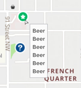
I think events are great, but that map above is ridiculous. (Is there some local challenge involving events?) Most geo-maps, I expect, would be less of an issue.
To easily find just future events, see the calendar part of https://www.geocaching.com/account/dashboard (Not shown at some layouts.)
PS, I'm not saying ridiculous is bad, just uncommon. I'm responsible for this, and nobody's complained yet:
-
.png) 2
2
-
-
You might be better served with a 3rd-party caching app that works well offline - there are a handful that support this and do it well - and pre-load caches by PQ (+ maps) before setting out.
I do this, and often put the phone in airplane mode to save battery. Everything I need is already in the phone.
I'm pretty sure the URL parameters you used on the website are not coming back. [:(]
-
1
-
-
3 hours ago, 2Abendsegler said:
All pages that moved to the more modern tech stack will no longer display the message indicator.
Possibly related, and the timing is roughly the same... On my high-res big tablet with Brave in desktop mode, and oddly portrait only, the big green band at the top stops well short of my user icon; there's just white space in between. The Message clickable belongs in there, but it's missing too. But if there's a new message, there's a telltale yellow dot in that white space, and I've learned to know what it means.
And if I want the message center, a blind click on the missing icon's likely location usually works. So does typing "mess" in the address bar, and accepting the first suggestion.
No biggie; I know you've got some bigger fish to fry...
-
14 hours ago, SpiritGuide said:
Geooh GO has a setting to use OS tile servers.
So does Locus Map. Official OS maps (£££), also OSM offline maps (£ or free) with an OS-like theme.
The OS-like theme can be found at https://forum.locusmap.eu/index.php?topic=7000.0 (link in first post) for users of Locus or other apps that use MapsForge format. It applies a visual style to OSM data that should be familiar to fans of OS maps. And, the OS maps themselves are available in the store within the app. So, a choice of two different data sets, similar visually.
-
 1
1
-
-
In polite society, we say thank you.
Someone placed those caches out there for you to find, and in general, they appreciate the feedback.
-
6
-
3
-
-
Uruguay's been on my list for so long ... but it's such a long flight. (I just like to say Montevideo. Montevideo Montevideo Monte-vi-DAY-O! Daylight come...)
In the so long department, I've been stuck at 19 geo-countries for an eternity, because I keep returning to my favorites within that 19. But this summer, finally, I return to Europe for the first time since punts, pounds, and francs, yep three new countries. (It can't have gotten more expensive, can it? Rhetorical, I know the answer.)
-
That's still vague.
-
1
-
-
Aside from the unusual situation above, moving coords even a small amount tends to wake up the reviewer to do another proximity check. I've seen many no-you-can't messages over the years.
-
1
-
-
Groundspeak seems reluctant to make changes to their map style. In the years it's existed, I recall only one intentional change ever (adding county boundaries for the stats crowd), and one perhaps inadvertent change (one mid-range zoom level shows trails only if they have a name ... wot?!?). Energy seems to be directed elsewhere.
Useful stuff like parking and indication of prohibited areas, details of which are available in the underlying OSM data, have been suggested long ago but haven't happened.
Your best bet is to find a better map for your own use. Some great ones are available... What's your main use case: web, Android, iOS? Which app, and are you willing to change?
Some beautiful maps are available if you know where to look.
-
Changes made to OSM will show up on the Geocaching maps after a few months. If you use some of the other OSM-based maps (there are many), they often show up sooner. The OSM Default map shows changes almost instantly because that one exists to support mappers.
May I recommend, you upload your GPX tracks using OSM's "GPS Traces" feature. This places them into a "holding area" of sorts, where they're visible to mappers, and one of those mappers (could be you) eventually uses those traces, maybe in combination with satellite view, to update or create the version people see on the map.
I don't recommend uploading GPX tracks directly into the map, because 1. it may duplicate a trail someone else mapped yesterday, and 2. they usually need smoothing and editing-out of caching stops, etc. But multiple copies of a trail in the "GPS Traces" feature is good; the more tracks you see, the better you can draw a path through the average of them all.
-
1
-
-
12 hours ago, colleda said:
Booked a trip to Sth Korea for late September
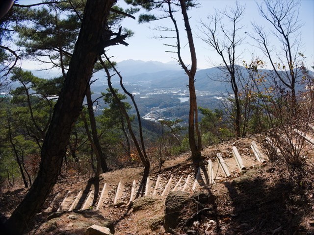
I love love love caching in Korea! I'll happy settle into a cool neighborhood in Seoul (Insadong so far) for a couple+ weeks at a time, then take the brilliant metro to a new trailhead every day. Hiking is the national pastime, so the trails are excellent, and well-studded with caches.
Keep an eye out for the monthly meet-and-greet event at a geocaching-themed pub. It's the de-facto hangout.
")
-
1
-
 1
1
-
2
-
-
I'd like to respectfully suggest that Groundspeak keep us in the loop with a post-mortem explanation of:
- What went wrong technically.
- How it managed to happen.
- What might be done to prevent this in future.
Thank you.
-
8
-
Problem here too, on current FIrefox on current Linux Mint. Even with scripts all enabled (don't ask me to do this), still problem.
Notably, NoScript shows more scripts loaded than I've ever seen on a GC page, too many to screenshot because scrollbar. Ad-related stuff, from the sounds of it. (Hey, I'm paying yearly, and still getting ad cruft?!?)
I get the impression they quietly threw in some scripts, thinking nobody would notice. We noticed. Staging server? Beta testers? Release notes?!?
EDIT: also fails on Brave on Android, completely different software stack.
EDIT: the map is also gone from the page.
-
1
-
-
26 minutes ago, The_Jumping_Pig said:
I've always found this cache hilarious, GCAEK8T
Agree. One-touch linky here: https://coord.info/GCAEK8T
-
1
-
1
-
-
Some one-liners are funny for the wrong reason.

-
1
-
1
-
1
-
-
Can we assume USA for this question?
-
1
-
1
-
-
It could be argued that, for walk-to-the-geocache purposes, more precision isn't needed. The app I use does roughly the same thing, and it's never bothered me.
But for times when you really do need that accuracy (puzzles come to mind), there are various tools available to measure distance between two sets of coords, and do it accurately.
-
Scrolling text should be for emergencies only.
-
2
-
-
This is always good.
My owner dashboard, in the last few entries toward the bottom, shows entries deep into the past: a couple of 2019, then 2012. A wee glitch.
(But somehow, magically, that 2012 log was one I really enjoyed re-reading. How did you know?!?)
-
1
-
1
-
.png)
.png)
.png)

")

Archived geocaches not showing.
in General geocaching topics
Posted
While you're waiting, try this:
https://www.geocaching.com/seek/nearest.aspx?u=username
Replace u with ul for found caches.
It's old code that someone saw the wisdom in keeping active.