


lmcgisme
-
Posts
85 -
Joined
-
Last visited
Posts posted by lmcgisme
-
-
I would change the rule for what is a puzzle/unknown cache and break it into two different cache types - the bogus coordinates mystery/unknown cache type and the "start here" mystery/unknown cache type. The bogus coord type would require you do do some pre-work before even getting the starting coordinates. The "start here" type would have valid starting coordinates, but then you need to solve something with information gathered at the site, do an ALR, an unusual cache container, etc.
With two different cache types you can filter better with a PQ, which I would like to be able to do. With the "starts here" type coordinates and the cache page information you can take a shot at finding the cache, which is not true of the bogus coords cache type. The way it is now I exclude a lot of "start here" types because I don't want to load bogus coords into my GPS, and there's no easy way to tell the difference.
-
So, I'd like to run a pocket query on a route that has not been defined as yet. I have created a .mps file of the route in Mapsource. How do I go about translating that to a GPX so I can upload the route?
Download GPS Babel from http://www.gpsbabel.org/. Its free software for GPS data conversion, though they ask for donations to help support the project. After installing the software use GPSBabelGUI.exe, which has a graphical interface that's easier to use than command line input.
You pick the type of input file ( I use DeLorme Street Atlas, but see that it does support Garmin MapSource) and select the file you want to convert. For the output format select GPX XML and under options check 'Target GPX version for output' and put 1.1 for the version number. Give your output file a name and click 'Let's Go'. That will create a .gpx file for you to upload to G.com. Be sure to put the .gpx at the end of your file name - it doesn't do that automatically.
It took some playing around with it to get it to create a valid route that GC.com would accept, but once you have it down its pretty easy. They do have decent help if you need it for the different formats & option.
-
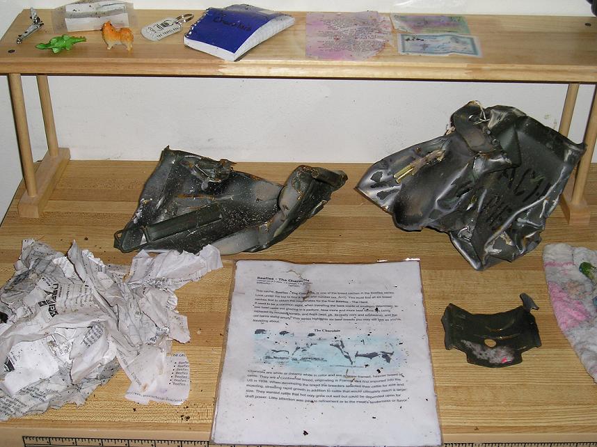
I had one that was sent through a chipper when the DNR cleared smaller trees out a wildlife area. I bet the ammo can made quite a noise when it went through. The finder scoured the area for remnants and posted this pic:
-
The same thing is happening to me. Someone took one of my geocoins on a road trip and dipped it into several caches. I got the "retrieved" email notice every time, but never did get a "placed" email notice. For coins & bugs on my watchlist I get both placed & received notices. Its just the ones I own that I don't get the "placed" email.
-
Now that I have a proper GPX file from the PQ email and have loaded that into Google Earth, I am able to see the GCXXXX name in the list of waypoints associated with this route. Some of the objects displpay o the GE map using GC image kml/2/png but most do not.
Any ideas on why some but not all caches display on the GE map?
In GE, is your "show time" set to never? If not it will only show some caches. I'm not sure what date it uses to see if a cache is shown - those placed within the specified time, maybe? To check your setting open GE and then open a .gpx file. Then in the GE menu, under 'View' is 'Show Time'. Select that and click 'Never' to turn off the tmeline and show all caches.
Hope this helps.
-
As long as the Sportrak comes with a cable to connect it to the PC then you can use the coordinates downloaded from GC.com - you don't need to enter them manually. You will need another piece of software, like EasyGPS (which is free and easy to use) to get the downloaded waypoints into the GPS.
I don't have a Sportrak but my sister does (I have a Magellan Meridian). I've downloaded waypoints into it and we've gone caching together and her accuracy was good with that GPS. It is a discontinued model, so it isn't supported by Magellan (not that their support is good even for current models).
-
As far as geocoin (and even TB) etiquette, is it inconsiderate to NOT pick up coins and TBs that I come across? Is it inconsiderate to not log a "discovery?" I think they're really neat and can't wait to find new ones, but is there a sort of obligation to pick them up and move them along?
 (more silly noobie questions)
Its nice if you pick up a geocoin or TB if you can help it reach its goal, or at least not hurt its goal. If it wants to go south, and you're traveling north its better to leave it for someone else. If you're staying in the same general area then picking it up and dropping it somewhere near doesn't hurt the mission and the owner gets an email to know the traveler is still out there and active. Its also nice to discover a TB or geocoin if you can't help it, since the owner gets an email and knows its still ok. You're certainly under no obligation to do either.
-
Hi,
Sounds like you found "Rusty" in the Storr Lake wildlife area near Milton. Been there, found that - it was a nice cache with lots of goodies when I found it. There are quite a few caches in Milton, and even more in Janesville, so you're in a good spot to start geocaching.
Instead of posting below in the Midwest forum you'll have better luck getting local info from the Wisconsin Geocaching Association forums: WGA
Welcome to the addiction!
-
8566.5 miles, LX4 (GCMRTH) off the island of Koh Chang, Thailand
-
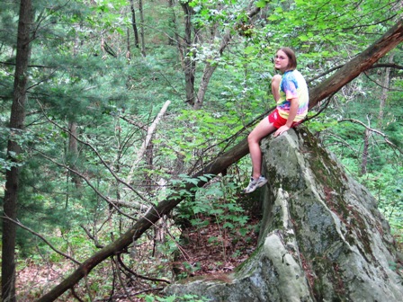
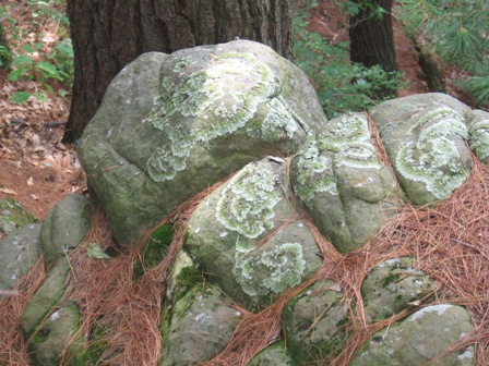
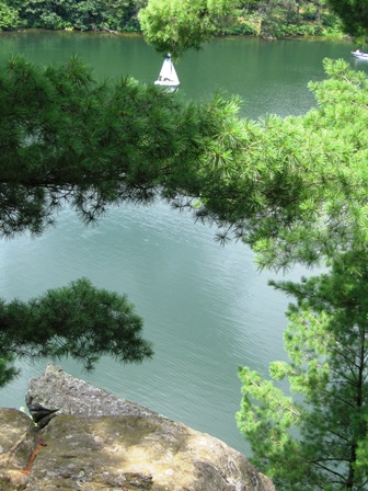
Wisconsin scenery
-
I log every time I have a DNF. I was reading some other topics that noted they looked for the cache a few times before they logged a DNF.
I thought that by not finding the cache and logging a DNF that you are actually helping the owner of the cache. If I have 2 DNF's on my cache I will make sure the cache didn't somehow grow legs.
After I log a DNF, I put a watch on that cache. As soon as I see someone has found the cache I am back out looking.
How do you handle DNF's?
I handle them basically the same as you do - if I looked for the cache and didn't find it I'll log a DNF to help the owner. Sometimes I put a watch on the cache if its local, but if I'm just traveling through I don't bother to watch it.
-
I noticed I have what seems to be a REALLY high cache-to-cache distance when running the FindStats GSAK macro over my 396 finds -- 24,044 miles! That's an average of 60.7 miles between caches! Has anyone got a higher average (divide the total miles by total finds)?
Just curious....
Rich
My average is 73.75, using 49,044 miles over 665 caches. It was much higher a couple years ago, just after returning from Thailand, but has been steadily going down ever since.
-
Hi - we are very new to this. Just added our first cache yesterday. Question: why is the cache displayed on the map of caches in the same area with a yellow star? Also, what about those caches with smiley faces instead of the usual green box format? Is there a guide to these icons? Do we have any control over how our cache's are presented in the map format?
Thanks.
When looking at the map, the caches you hid will be a yellow star to you, but will look like a regular green box (assuming its a traditional) to others. And all those caches with a smiley face are caches you've already found
 . Makes it much easier to tell at a glance what caches are there for you to find, and which you've hid or already found.
 -
You don't get a smiley, why would anybody want to visit all these places, many of which are unique, fascinating or beautiful, unless they can get a smiley?
If you got a smiley for visiting them you'd see how fast it would become a visitors game.
I think if it were easier to know how to get credit for a visit it would become a visitor's game. Right now I can download a .loc file and get the waypoint on my GPS, but no additional info that I can load into my PDA like the .gpx from gc.com. I've visited more waymarks than I've logged because I don't have the logging requirements with me, and I don't get the correct picture/info to log the visit even if I was there.
If Waymarking starts to have PQs with additional info to load to a PDA then I think visits will go up, but right now its frustrating to actually visit but not be able to log the visit.
-
I think you should move the TB. Even if its only .10 mile to the next cache the owner will get an email and know their TB is still in the game and not missing. The only time I wouldn't want to move a bug is if I'm going in the opposite direction than the way the TB wants to travel.
-
The test was interesting - I'm an ISTP:
Introverted (I) 89% Extraverted (E) 11%
Sensing (S) 55% Intuitive (N) 45%
Thinking (T) 70% Feeling (F) 30%
Perceiving (P) 59% Judging (J) 41%
Caching especially appeals to my Introverted side - I'd rather be off on my own instead of having to deal with a bunch of people (you may note the lack of events attended on my profile).
I never considered myself to be a big risk taker and was surprised to see that my type are considered the risk takers. Then I saw what they called risky behavior and thought back on life & what I like to do, and I guess I'd have to agree with the test. Maybe I just considered the behavior/activity as 'normal', not risky.
-
Another thing that confused me at first - the limit of five per day are PQs that are processed and an email is sent.
When setting up a PQ, as long as you don't check the day you want it to run, you can submit the PQ, preview the results, edit the PQ, submit & preview, edit, submit & preview, etc. It won't count against your five per day limit until you check the day you want it to run and do the final submit. When it runs the 'last run date' in your PQ list is bold - then it counts against your daily limit.
-
I agree that it's more about the time and uncertainty, and less about the smilie count. I seldom take a day or an afternoon for caching; usually I have to go from point A to point B and will add extra time to the trip to grab some caches along the way. It also seems like lots of logs I see on my caches are "was traveling through the area and..." Given that, if I have a choice of using up all my extra time getting one multi in one area, or getting one traditional, drive for a while until I want another break and find another traditional, then drive and another break etc, I'll opt for breaking my drive up in several spots, not just get one multi then drive, drive, drive.
The experiment with four traditional caches with a bonus vs one five part multi would be interesting, not only to see how many get all five vs. the one multi, but also to see how many times only one or two of the traditionals were hunted. That would show that its more about the time than the smilie count - if they didn't have enough time to get all four traditionals plus the bonus they wouldn't have had time for the one multi, regardless of the smilies. Additionally, you often don't know how many stages or if they're in the same park or spread across the county, so if you're just traveling through chances are you're going to skip the multi.
-
Oh my . . . that sure looks like a lot of work. To load my Garmin GPSr, there are fewer steps.
- Request new 500-cache PQ/PQs
- Receive the PQ/PQs and open them in GSAK
- Filter the GSAK database to fit my destination for the day
- Turn on the GPSr connected to the computer and click the "Send to GPS" option in GSAK
- Disconnect the GPSr from the computer and go caching
My daughter has an eXplorist 500 and really likes it. When loading her GPSr I basically do the same steps as you (Jhwk went into greater detail - their steps 2-6 was basically the same as your step #2). The steps I take are:
- Request new 500-cache PQ/PQs (she is a premium member - not loading one of my PQ's)
- Receive the PQ/PQs and open them in GSAK
- Filter the GSAK database to fit our destination for the day
- Put GPSr SD card in the computer slot and click the "Export to Magellan eXplorist" button, save on card with meaningful name. Repeat last two steps for multiple geocache files
- Insert the SD card into the GPSr and go caching
How do you save multiple geocache files on your GPSr? Or are you limited to whatever your unit can hold in memory and need to reconnect to the computer to load caches for a different area?
- Request new 500-cache PQ/PQs
-
I find the "dogs allowed' attribute very helpful. Since I usually cache with my dog I'll check to see if the Dogs Allowed (or prohibited) attribute is set, and avoid those that I know prohibit dogs if she's with me. I dislike driving out to a cache on a hot summer day only to find that dogs aren't allowed and I have to give up on the hunt, wasting the gas and time it took to get there. I set attributes for all of my caches to help out other cachers who may do the same.
-
I can't become a member because I live in MN........but I'll take a peek around anyway.
You can join as a "Friend of WGA" and read/post to the forums - everything but vote for the board of directors. There a cachers there from Minnesota, Michigan, & Illinois who post frequently to the forums, and are quite welcome there.
-
You can also check out the Wisconsin Geocaching Association. Lots of friendly cachers on their forum.
-
When I set up my night cache I used reflective tacks I got at Walmart in the sporting goods dept. Much cheaper than fire tacks, and people don't seem to be having a problem seeing them. The cache is in your area, GURU4HIRE, you can check it out and see if you like those reflectors: Hoot Owl Hike
-
I have a Magellan Meridian Color, my daughter has a Magellan eXplorist 500 and my niece also has a Magellan eXplorist 500. We all like our Meridians and have never had any problems, so we've had no need to contact tech support. They are all very accurate and keep a lock even under heavy leaf cover. When I lose GPS lock in a tunnel or something mine beeps at me, so its not just pretending to have a lock using the averaging.
IMO, for the money an eXplorist 500LE is a better value than a Garmin.
 . Makes it much easier to tell at a glance what caches are there for you to find, and which you've hid or already found.
What Fascinates You About Geocaching?
in General geocaching topics
Posted
What fascinates me about geocaching?
The thrill of the hunt
The 'Ah Ha' of the find
The discovery of places
The learning of facts
The knowing of secrets
The sharing of sites
The meeting of people
and the feeling of community