

PhntmArcher
-
Posts
146 -
Joined
-
Last visited
Posts posted by PhntmArcher
-
-
Ok, I'm sure that I am missing something here, but when I click on the ICON in the lower corner of this page, my options are: TRACK, SUBSCRIBE and DOWNLOAD/PRINT.
I guess that I want to UN-Subscribe... I don't see how.
Sorry for the density !!
-
I was Tracking a Topic, by clicking on "Track This Topic" button. How do I STOP Tracking a Topic? I have looked, but I can't seem to find the right spot.
Thanks in advance.
-
The first map is from MetroGuide 4 (a couple of years old). There is a newer version that might be more up to date, but because it did not autoroute I haven't "upgraded" to that version. I have both MetroGuide 4 and City Select 6, and for my off road excursions I use MetroGuide 99% of the time. Also, because it doesn't require any unlock codes (Version 4) you should be able to find a copy pretty inexpensively.
Check this out: Ebay Auction NO. 5792452050. Currently at $17.47
http://cgi.ebay.com/ws/eBayISAPI.dll?ViewI...gory=58049&rd=1
-
Depending on whether or not you plan on using your unit for Geocaching Only, or also in a vehicle you might want to look at one of the autorouting applications. I have both MetroGuide 4 (only version that autoroutes) or City Select 7. I personally like MetroGuide 4. It seems to have better detail for remote areas. Check it out.


-
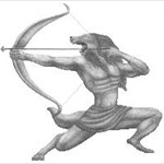
Hello, I have been using this avatar because it was the closest I could find. I do like this one, but I think that it could be improved. I am open for suggestions... revamp existing, add color?, or brand new?
Thanks in advance, PhntmArcher.

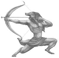
how is this

Hey kimmyroo, I do like it. How would it look it the text was just black... would it stand out better or look goofy? Thanks for you work.
-
Hello, I have been using this avatar because it was the closest I could find. I do like this one, but I think that it could be improved. Completely lacking any artistic skills, and having been totally impressed with some of the creations I have seen here, I am open for suggestions... revamp existing, add color?, or brand new?
Thanks in advance, PhntmArcher.
-
Hey tabulator32, I like your attitude. I just don't want people to get frustrated, I really want to make it challenging. And being new to this, I guess that I am trying to find the tenacity of the group. Thanks for the responses.
-
I am fairly new to Geocaching, but I have been doing a lot of reading and research over the last couple of weeks. I have been doing some research regarding hiding a cache, and have come up with a couple of ideas that I think that I want to use. However, I have been looking at various websites, and ebay for containers for the cache. I have been seeing many, many “micro” and even “nano” cache containers. I have also seen items like hollowed out bolts, and fake sprinkler heads.
It seems to me, that if I wanted to hide something that could not be found, that I could probably accomplish this, much to the frustration of my fellow Geocachers. I thought that the idea was to make it interesting and adventuresome, not impossible. Or am I missing here?
-
-
Garmin GPSMap 76CS Plus from West Marine
GARMIN
76CS Plus Handheld GPS
--------------------------------------------------------------------------------
West Marine worked with Garmin to make one of the world's most popular handheld graphic navigators even better! Specifically, we developed dedicated custom displays to show information tailored to whether you're sailing, power boating, highway driving or navigating off-road.
Easy route editing "on the fly" enables you to move, add or delete waypoints right on the screen's chart display. Its unique Heading Line gives you instant information on distance or time to any point ahead of your vessel. A unique logbook function records your position automatically at intervals of 30 minutes to 8 hours so you can analyze average speed, travel time and more. These unique features, along with the unit's built-in barometric altimeter and electronic compass provide everything you need to plan your trip on land or sea.
In addition to the built-in basemap, it can accept detailed BlueChart or MapSource cartography for streets, lakes and mountain trails. It will store 1000 named waypoints and up to 50 separate routes. The rugged case is highly water-resistant and unsinkable if dropped overboard. With its small overall size, and feature-laden functionality, this is the top value in handheld GPS on the market today.
Display Type: Brilliant 256-Color TFT
Screen Size: 1.5"W x 2.2"H
Screen Resolution: 160 x 240
Display Mode: Select from 24 custom pages, map, altimeter, electronic compass, marine timer
Data Input: 8 buttons, rocker pad
Antenna: WAAS-enabled quad helix with external connector
Battery Type: AA batteries
Battery Life: 20 hours
Dimensions: 2.7"W x 6.2"H x 1.2"D
Weight: 7.6oz.
Waterproof: Waterproof (IPX-7); floats
Waypoints: 1000/50
Interface Inputs/Outputs: PC (USB/Serial), NMEA, DGPS
Included Equipment: PC/USB interface cable, MapSource Trip & Waypoint Manager CD, wrist strap
Link: http://www.westmarine.com/webapp/wcs/store...=&storeNum=4600
Unit is New with latest FirmWare installed.
Asking $389.00 + Shipping (PayPal Payment Only)
-
Well of course, it was in the VERY Last Place you looked... why would you keep looking once you found it??
-
Just to add a note for MrLost, the Garmin 76C/S do float. According to the Garmin website:
Water resistant to IEC 60529 IPX7 standards (can be submerged in one meter of water for 30 minutes); rugged and waterproof housing that floats.
-
In my opinion, then just go with the Garmin GPSMap 76C or CS. Nice clean design (no awkward antenna sticking out of the top like the GPSMap 60C/S), Autorouting, Nice color screen, lots of memory (115mb) for downloading maps & waypoints etc, it floats, great battery life, lots of accessories- car mounts, handlebar mounts etc...
Needless to say I like mine.
Good luck... and have fun.
-
Peter, you are absolutely right about the smaller roads. While I was in NC last week, it was showing me dirt roads accessing private hunting clubs, and fishing ponds. As you pointed out this can be both good and bad. So, maybe I will have to pick and choose from both MG4 and CS6 for specific quests... ie geocaching vs cross country trips, since I have already purchased CS6.
-
Thanks for all of the great insight. I am fairly new to this and I thought that maybe I was missing something. I am still trying to figure out why Garmin wouldn't just keep building on the foundation of MetroGuide. Prior to purchasing City Select v6, I called Garmin and they told me that MetroGuide v6 and City Select v6 used the exact same maps. But as Webscouter pointed out they don't show the same detail at the same levels. When creating routes I have to zoom waaayyy in on City Select v6 to get the smaller roads (to mark Waypoints), and then zoom back out to move around.
Again, thanks for the information and insight.
-
I had an older version of MetroGuide (v4.01) which from my conversations with Garmin is the only version that will do AutoRouting installed on my Garmin GPSMap 76C. It works beautifully. However, I was looking for updated information... new roads, exits, etc, and Garmin directed me to City Select 6. Ok, I paid the $115.00 for the new software and installed it. Maybe it's just me, and I am not up to speed on City Select, but the maps in MetroGuide v4.01 were much more detailed, and accurate (especially in remote areas) than City Select v6.0. Maybe other info is more current... restaurants, shopping etc, but the maps seemed better in MetroGuide.
Has anyone else experienced this?? Or am I missing something?
Thanks.
-
-
No, GPS 300.

-
I have a Magellan GPS 300 that is in excellent condition. Includes Original Box, Manual, and Wrist Strap. $40.00 + shipping from Illinois.
Tracking Topics
in Website
Posted
Thank You !! I couldn't see the forest for the trees!