

gulo
-
Posts
144 -
Joined
-
Last visited
Everything posted by gulo
-
I use .gpx file exported from GSAk. Save it to /download folder in root directory of your SD card and then click on Offline list in geobeagle
-
The latest version of GeoBeagle on the Android Marketplace now supports logging via field notes, check it out and let me know what you think. Steve yeah I already used that feature, works great, thanks !
-
wow ! Google earth link is gone ? I am definitely one of those 200, I used this every single time when looking for caches outside of my home area (I use PQ for those). There is really no replacement for this and I am really pissed off because I am going on 2500 mile road trip in just one month and I wonder how will I plan for it now. I know there is the google map, but it's very slow, cumbersome to navigate and it just takes 5x as much time as it did in Google earth... Very dissapointed in this decision
-
Question about saving Track Log on GPSmap 60CSx
gulo replied to bbbullock's topic in GPS technology and devices
There is an option to constantly record your track directly to SD card. You can retrieve those by attaching GPS to your PC and accessing it as a external USB drive. Those track files will not have the 500 points limitation. -
Custom Garmin Map - drawing trails over roads
gulo replied to gulo's topic in GPS technology and devices
Yeah my custom trails are set to show on all zoom levels. Most of the other custom objects (like trail heads, waterfalls, overlooks,etc..) only show up when you zoom much closer so they don't clutter the map. -
Custom Garmin Map - drawing trails over roads
gulo replied to gulo's topic in GPS technology and devices
Thanks I went with the first option and changed my trails to Major Highway type which automatically puts them on top. But since I also have one interstate on my map I changed that one to 0x03 (not used by anything else on my map) and created custom TYP to make 0x01 a nice red line for my trails and 0x03 thick orange line just like the original major highway. -
Hello I am working on a custom garmin map. It includes road information (using TIGER data) and my own trail tracks. The problem is that in areas where my trail follows a road Mapsource draws the road over my trail. I would like the trail to be on top. I am already using a custom TYP for my trails and I wonder if there is a way to increase my trail tracks draw priority ? thanks
-
thanks so much for adding this
-
you can actually literally drop them in there. You just click and drag your gpx track file icon into Google Earth application and it will automatically display it there.
-
now this is completely off topic but I wish that county maps used more colors (maybe green or yellow) instead of 4 shades of blue. That often makes it difficult to say what number you're looking at, especially for smaller counties
-
Convincing a Park Manager to allow caches
gulo replied to benh57's topic in General geocaching topics
http://parks.state.co.us/Parks/CheyenneMou...ies/Geocaching/ -
This actually does not remove anything from current design. You do NOT have to download extra software, it would still work the same for you. But if you do download it, you can enjoy full screen images and easy slideshows. For example http://www.summitpost.org/ added this recently and you wouldn't notice any change unless you have the plugin installed
-
I was wondering if geocaching.com could add PicLens support for its images. All that really needs to be done is for the server to generate media RSS files any time it shows an image gallery site.
-
Are there other cities that support GPS
gulo replied to dew cache's topic in General geocaching topics
The new Cheyenne Mountain State Park in Colorado has GPS waypoint signs posted along all trails. There is over 100 of them I believe. -
thanks for the link ! I just bought invisible shield for my 60csx for just $5 with free shipping
-
you can download GPS tracks (usually in GPX format) from various sources and then display them in GPS unit on top of the map. some places may just provide waypoints which will just show up as points on the map. I run a small website that contains gpx tracks for hikes in Colorado Springs area, you can try to download those and see how it shows up address cospringstrails.com
-
sorry, double post
-
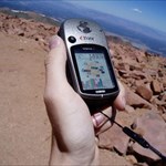
Some pictures from my hiking/geocaching trips in Colorado Springs area
-
I have garmin streetpilot and I load waypoints using their POI Loader software. It can automatically read gpx files and add them into the unit. It would be nice if I could punch those in directly but this still works fine.
-
Hi I have Pharos iGPS 360 with Bluetooth dock for sale: Sale includes the removable GPS unit that can also be connected via USB or Compactflash using additional adapters plus the bluetooth dock for it. Can be used for car navigation, geocaching or any other gps activity when connected to PC or PDA wirelessly through bluetooth. Unit has built in rechargeable battery. It has been used but it's in excellent condition. Also included is cord that will charge GPS and optional Pocket pc at the same time via USB and a belt pouch. Asking price: $80 Photos
-
ok Well I did a full reset and left the unit sitting for about 10 minutes while it was getting lock and it works much better now. I also turned off lock to road feature (I wonder though if that actually changes the track log or does it only DISPLAY your current position on the road) and I changed track log interval to Most often. At least it seems to be working much better now I have some google earth tracklogs here if anyone cares
-
I always load my pocket query into google earth before I go out geocaching. It helps me figuring out where to park and how to best approach the cache (I guess it's a bit of cheating I even found few caches without GPS, just by using GE. I also like to display my gps track in Google earth, i am posting some of them on my website
-
but I wasnt using them at the same time. I just added 2 different logs.. I will try reset today and go out to see if it helped
-
I got this earlier today...looks pretty good to me. Will getting bad fix after cold reset screw up all the data until another reset, or should the unit fix itself as I use it ?
-
thanks for reply I know what WAAS is and I had it on. I even had some "D" satelites, though not all the time. I actually selected "GPS accuracy" as default text entry so I can monitor it and usually it's pretty good (it should definately put me on the road at least) I think it might have been bad fix, I will try again tommorow. I wonder about the whole cold reset thing though. I never had to leave my Pharos GPS on for 30 min to get good fix. How often should I do a cold reset and how do I actually do it ? I found a way to do reset online, while pressing 3 different buttons at the same time Is changing the location in satelite menu gonna do the same thing ? I hope I don't have to wait 30 minutes everytime I wanna go out caching