

3fros
-
Posts
185 -
Joined
-
Last visited
Never
Everything posted by 3fros
-
I have seen many of the problems posted previously with caches that were placed by local users. My point is that it is not a local vs tourist problem. I do agree that if you are going to place a tourist cache you do need to take all the extra precautions to make it a little to no maintenance cache. In some ways I think we are arguing the same point, but disagree on the severity of the problem. I believe that this entire thread should be about having tourist's raise the quality level of their caches, not about not placing any at all. One person said that they should check the distance on approval of the cache. I know of at least one approver that has caches all over the country. I welcome those caches and am glad that they are there.
-
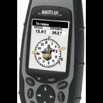
I have the Platinum and a 315. They both are equally fine when driving or walking to the cache site, but I like the compass feature of the Platinum when wandering around back and forth near the cache site. It makes it more stable as to the direction of the cache. For example, if I turn around while using the 315 it doesn't update its direction until I move. The platinum compass doesn't have to be held level with the ground either so it works real well. My only complaint of the Platinum compass is that I can't just push the menu button when on the compass screen and change it. I have to click menu, scroll down to setup, hit enter, scroll way down to compass orient, hit enter, select GPS Course or Magnetic North (which can be Magnetic or True depending on a different setting), hit enter, and finally hit escape. Hopefully they'll make this easier in a future firmware revision.
-
quote:Originally posted by skydiver:Yes, we all should _help_ maintin the caches we visit, but the ultimate responsibility still falls on the cache placer. To assume or expect others to do the work for you is rude and inconsiderate. Who am I placing the cache for, me the placer or you the geocacher? It was dry when I put it out there, it was full of nice goodies when I placed it, there's no reason it shouldn't remain so except for other carelessness of other geocachers. If it turns up missing I'm just going to write it off and close it. Those who got there before it turned up missing lucked out. At least they will have got some fun out of it. Just be happy that I'm placing something for you to find. Besides, how much maintanance does a cache really need? If I pack it in an ammo box, stuff it with nice goodies with each in separate ziplock baggies what else could possibly be required. Even if it's a local cache it's a lot more efficient for someone who is going there anyway to dry it out than for me to make a special trip. Don't get me wrong, I do maintain my local caches. At first I was running out and checking up on them constantly, but I soon figured out that I was wasting my time and it was better to leave it alone and let the people who are looking for it to semi-maintain it. I've also since tried to keep other caches up when I find them. It's a lot more efficient that way. Don't think I'm not using common sense though, if I hide a cache that I don't live by I'm not going make it a multi-cache because they take too much maintenance. If someone writes and say's that they couldn't find it and through our discussion I figure out that they were looking in the right spot, then it's toast and it's closed. How can you possibly say it's rude that I buy a ammo box, paint it camo, spend $20 on goodies, place them in ziplock baggies, find a place to hide it, and log it on the web for you to find. I get NOTHING for my trouble. I'll tell you what skydiver, next time I'm in Montana and I place a cache in the Mission valley, you can just ignore it. I'm not placing it for you.
-
Some places don't have many caches. Many small towns in the Western part of the US are miles from any other towns. Some of these towns are tourist traps. Say you lived in a small town and want to geocache. I'm sure you are not going to find a lot of caches if you're the only one hiding them. Here come the tourists placing caches, suddenly you can have fun geocaching too. Not everyone that wants to geocache lives near 100 other caches. How many of you protesting tourist caches live a long ways from the nearest cache? To the person living in the small town, I bet tourist caches are very welcome. Another thing, I grew up in Montana about an hour North of where Renegade Knight is from. Last I looked, there were not a lot of caches in the area. I know the area well where I grew up and placing a cache while visiting would probably be welcome by Renegade Knight or the others that live there. Even if I haven't been to an area before I think I'm smart enough to figure out what a public park is. Now I'm not excusing people who don't use common sense, but that common sense is not limited to locals. So who is going to maintain it? We all should maintain it. If you are going to a cache and the last person posted that it was wet, bring something to dry it out. If the last person posted that there wasn't much in it, bring some geotoys. If the last person posted that the log book was soaking, bring a new one. Better yet, if you feel so inclined, be proactive and pack stuff along with you to spruce it up in case it's a dud. Some of the most dedicated geocachers that I know of have geocaches all over the United States. I doubt they can maintain them all, but depend on other geocachers to help maintain them when finding them. If we all just hid geocaches in our local area the amount of geocaches to find would dry up in a hurry. My one tourist experience was hiding a geocache in Leavenworth, WA. This town is miles from others, and is a big tourist trap for the people from the Seattle area. I thought if I lived there I would want a few caches to find so I hid one in a local park which is a river Island. It was evident to me from the signs that I read that I couldn't hide it down low because sometimes the river floods the area. That eliminated all the good hiding spots, but I still found a place to hide it that I thought would last for a little while. Seven different groups found it before someone stole it. I figured it was a write off and I was just glad to provide some fun to those who did find it. Well, a local geocacher that found it missing decided to create another in the same area that has been found by quite a few people. Next time I go there I plan on finding the cache they hid.
-
Wow, that's' one every half hour. Truly amazing.
-
Posted pictures of camouflage and unusual cache containers.
3fros replied to GarminArmin's topic in General geocaching topics
I'd show you a picture of my camo ammo box, but you couldn't see it anyway. -
Geocaching Classes $50.00.......Per Person!
3fros replied to Poindexter's topic in General geocaching topics
If you really need Geocaching classes why not take a free class from REI. Here's an upcoming one for the Seattle store, but they probably have them at a lot of stores. -
HSPEIA High School Pregnancy Ends In Abortion Here's Some Puke, Eat It Again
-
Maybe you could vacuum bag and seal it so it will fit. I can imagine a lot of air in a teddy bear. Hopefully no one is foolish enough to open it up.
-
Angry at Garmin - Their false advertising will ruin your unit!
3fros replied to IEFBR14's topic in GPS technology and devices
I'm with you Grandmaster Cache. If it says 3 meters for 30 minutes it had better be able to do that. The margin of safety is on the manufacturers back. If the guarantee it at 3 meters for 30 minutes they should test it for more. Speaking of watches. I had a casio that was rated to 100 meters. It had an altimeter/depth gauge on it. I took it scuba diving to 100 feet. I know it wasn't 100 meters, but it's a lot more than the swimming standard I was reading about. The watch held up with no problems. Too bad I lost that watch. My point is that if they make the claim, then they should back it up. -
Here in the Seattle area, it's not too cold in the Winter (not a flake of snow yet this year), not too hot in the Summer, and it doesn't rain as much as people say. Oops, I forgot I wasn't supposed to let you all know our little secret.
-
What's the hardest cache you have found?
3fros replied to The_Brownies's topic in General geocaching topics
http://www.geocaching.com/seek/cache_details.aspx?ID=25123 This one's in the Everett, WA area. It kicked my behind for a while, but I finally finished it. It seems to take an average of about 5 different trips to finish it, if at all. -
To find out you need to be able to collect data. Good luck getting people to cooperate. I posted This poll, because I wonder what others are using. For example, on this cache the original coordinates were off by 64 feet if I remember right from the location I came up with using my Platinum. Evergreenhiker had the original coordinates at 14' away, what was he using? What did Granny1918 use to come up with the original coordinates? Moun10bike's coordinates were around 50' from the original coordinates and he is using a Garmin V I believe. Was the owner using a V or a Platinum, or something completely different? Was VPlaMar, who had the same problems I originally had, using the same GPSr as me or something different? Was my Platinum consistently wrong at this cache location or was Granny1918's wrong. My point is that without the data no one knows.
-
Nice low price, but 2 things I don't like about the gecko's. 1. Patch antenna. 2. Buttons above the screen instead of below it. The users hands are in the way of the screen when pushing the buttons.
-
Made my own logo stamp, really easy... how to.
3fros replied to poksal's topic in General geocaching topics
I was thinking of having a stamp made, but didn't even think of making my own. I would think you could cut out a handle from a block of wood and glue the rubber onto it using contact cement (the smelly kind). I glue closed-cell foam onto fiberglass to make kayak seats so I would think it would work on rubber too. -
Child care centers/childrens private schools. We actually have a couple of these in my area. I've driven by 2 of them and I just kept on going. Both had a fenced in yard. Am I really supposed to go through the gate and wander around in the back. Oh yeah, I can just see myself in the back of a squad car after that. While it might be a great class project, I'm not going to participate.
-
Something's just not right here.......
3fros replied to Geo-Johnson's's topic in General geocaching topics
Either Bob faked his find, or he did find it by searching the entire hill and his remarks that the coordinates are right on is not true. I can't say which, but I'd go find it right away and see if he logged the find in the logbook. If he didn't find it, expose him. If he did find it, then it's an unfortunate mistake by the owner of the cache. I have a similar pet peave. A couple of times I've went out and found a cache first. When I get home someone else has written comments about how they been to the location before, or they love that area, or whatever. They just blather on about nothing because they want to post a note on the cache web site first whether they've earned it or not. Why can't they just hold their comments until the first finder has logged. If someone beats me to the log book, I'm going to give them a while to log it before I do, it's only fair. If anyone posts a note on any of my caches before the first finder posts, I'm going to delete their comments. But, now I'm getting way off topic. -
Position changes after systen upgrade
3fros replied to ProDocJazz's topic in GPS technology and devices
I hadn't taken my GPS out for a test run after its upgrade until today. I went out to the truck to go geocaching and noticed that it showed me right at my home waypoint location. As I started driving toward the cache locations I noticed that every time I passed a cross street my GPS would show the map at about 1 - 1.5 blocks from where I was. I know mapsend products aren't perfect, but it was never this far off before. I just kept on going, got on the freeway, went about 8 miles down the freeway and exited. When I got near the cache locations I looked at the map again and it was right on the money for the rest of the day. I think it just needed to get some almanac data into it. -
Request for owners of both Garmin and Magellan
3fros replied to Searching_ut's topic in GPS technology and devices
Here's a link that compares the 76S to the sporTrak. It's not a comparison with the legend, but it shows information on the accuracy of the SporTrak which is very enlightening. http://www.gpsinformation.net/mgoldreview/sportrak-pro-trees.html Here's the article that it comes from. http://www.gpsinformation.net/mgoldreview/sportrak-pro-rev.html -
Things that make you go hmmmmmm.....?
3fros replied to Clown Knife's topic in GPS technology and devices
quote:Originally posted by niskibum:If you get into a deep narrow valley (where a patch shines) your 315 had better come with a corkscrew so that it isn't completly useless. Huh, I've been between buildings and in narrow valleys and never had a problem with my 315. Yes, my comparison is with the Etrex, and not all Garmin units, but the Etrex is probably their most popular unit by far. It is also made for the same market as the 315 so it is not a car vs truck argument. It is not Ford Mustang vs Chevy truck, it's more like having a Chevy 2WD V6 with a real nice stereo (Garmin Etrex), vs a Dodge 4WD V8 (Mag 315). I know which one I'm using off road. If I'm lost in the woods I don't want the GPS to be lost too. It's Garmins fault they put in a patch antenna in what is probably their most popular unit, nobody elses, so don't take it personally. It's also the reason I didn't buy one. My point is that it's sad that a bare bones 315 kicks the snot out of a high dollar GPSr like the Vista when it comes to reception. Have you actually ever tried both units in the woods? Most users haven't and only like the unit they got used to first. Remember I was a big Garmin fan before I tried the Etrex. -
quote:Originally posted by Cracker7M:My unit has a date code of 4302. This would be the 43rd week of 2002. Mine too has a date of 4302 and has no problems except one spec about the size of one pixel. I'm not going to worry about it.
-
Things that make you go hmmmmmm.....?
3fros replied to Clown Knife's topic in GPS technology and devices
Before I bought my first GPSr I REALLY wanted an Etrex Vista and would have eventually bought one when I saved enough money. They are small, good looking, and waterproof. The Magellan 300 series has that ugly antenna and aren't waterproof. Most people don't get a chance to use one before buying, but I did. I borrowed a friends Etrex Yellow and went out in the woods looking for a cache. The thing was constantly losing lock. There I am holding the GPSr above my head looking for spot between the trees that it could pick up a lock. I was disgusted with how crappy it was in the woods. My sister told me she wanted to sell the Mag 315 they had because they never used it. I ended up buying it for $80. WOW, what a difference in the woods. I used it for a while and recently upgraded to the Meriplat. I hid one cache in the heavy woods to mess with the Etrex users. I recently hid another cache in the woods using my Meriplat and didn't even think about the fact that it was in the woods because I never had any reception problems. To my suprise people were writing that they could hardly get reception. Oops, I wasn't even trying and I bet I got another Etrex user. Some of the Garmin software might be better, but where I live (Western Washington) reception is a must. -
Just an idea. I don't know if anyone else has thought of this yet or not. Are any of you going to hide any of your presents in the woods or wherever and then wrap the coordinates up and put them under the tree so the receiver of the present has to go out and find it?
-
Magellan Meridian Firmware v4.02 Now Online
3fros replied to alexm's topic in GPS technology and devices
I E-mailed off the wish list from this thread "Meridian Platinum wish list"to Magellan 10 days ago and it looks like some of the things have been incorporated. My E-mail probably had absolutely nothing to do with it since their changes had to take a while to program and incorporate into the change, so here is the updated list of what is left to change. I'm glad they keep updating the firmware so we can continue to have a better product. Still needed to revise Done STARTUP SCREEN: 1. Personalize setting to add our name, phone number, reward information, or whatever to one of the many startup screens. I know there are programs on the internet to edit my hex file to do this, but I'm not sure I dare do this yet, and I would rather just have the option to do this without uploading files like I can do on my 315. MAP SCREEN: 2. Option to use "Rubber band" goto lines. Rubber band goto lines describe the line that's laid on the map when you mash goto. Magellan's behavior is to draw that line from where you were to where you wanted to be and not where you ARE to where you want to be. I understand this is useful to boaters and pilots but it's quite unhelpful when biking or driving. 3. Allow us to turn off the basemap. COMPASS SCREEN: 4.a. The option to have the electronic compass turn on/off based on speed & satellite locks. I hate caching with electronic compass on (< 5 mph), getting in the car [> 5mph) and having the darn thing point at the engine. 4.b. Or, it would be nice to have a hot-key option for turning the compass on and off so we do not have to go through the menus to do this. For example, on the compass page, just hold down a button (enter button) for a second and it will toggle the compass on and off. By the way, the Garmin Vista has this feature. 4.c. Another way to adjust the compass could be to push the menu button when on the compass screen and have a compass orient button option just like the Map Setup button for the map screen. 5. The letter T (True), M (Magnetic), or C (Course) should be displayed on the compass screen so the compass mode being used will easily be known. When I click on North Reference it changes all of the compasses to True, but when I click on Setup - Compass Orient it only has the options of "GPS Course" and "Magnetic North" which is confusing and made me believe that the compass screen was the only one still on Magnetic. It should say "Mag/True North" instead of "Magnetic North". I now know how it works, but it could be less confusing. 6. Put 4 custom fields in the compass screen (as in all other Magellan units). WAYPOINTS: 7. More waypoint icons. Geacaching Treasure box icon, Car icon (where did it go, the 315 has it), trailhead icon, Dock icon. Or better yet, let us users create them by allowing them to be easily uploadable to our firmware or a file on our SD card. We could trade them, and share them with Magellan so they could add them to future models or firmware revisions. Let us also delete the ones we know we'll never use. I know there are programs on the internet to edit my hex file to do this, but I'm not sure I dare do this yet, and I would rather use a program from Magellan to do this. 8. Page up/page down in the waypoint list like the 315 does. Maybe left/right keys or in/out keys or could do this. (I can see why Magellan does not have this for POI's). 9. A way to search for a user waypoint (keyboard or scroll and type (?)) 10. When I delete a waypoint the platinum starts over at the top of the list. On my 315 it goes to the very next waypoint which makes it a lot easier to delete multiple waypoints. I don't have to keep scrolling down to get to the next one to delete. PROJECTIONS: 11. The ability to do projections in feet. 12. Fix/finish waypoint projection. Waypoint projection is known broken in all but WGS84. If you enter, say, .01 miles it will convert that to 52.8 feet but when you go to edtit it it converts that to 52.8 miles. It's related to the issue you raise. ROUTES: 13. ETA/ETE to the end of route (not just the next waypoint in the route). TRACKS: 14. Automatic save track to route. This would save the track to the card every so often (500 track points) and would keep doing this going until you no longer need it (I hate it when I have my tracks deleted). This would be easy to do a track back option because it could recall the track from the card when it reaches the 400th to 500th point. But save track to route would be incredibly tricky. You would also need a program that could read the cards data, because it would be difficult to transfer all that trough the GPSr. 15. Have an option to set the track resolution to one second. Every 52.8 feet is fine for driving, but to me it is a little lacking when I walk (sometime I like to out line a perimeter of something). MISC: 16. Tide tables for given locations like the Garmin 76S has. 17. Temperature & air pressure on a Nav Screen and not the hidden screens. 18. Total Elevation Gain/Loss (I would like to know my total vertical feet skied). 19a. More stats like Max Speed, Avg Speed since the trip was reset, Max vertical rate of change, etc. 20. A light Icon. I turned my light on in the daylight and couldn't tell whether I had turned it off or not without covering the screen. We need a light icon to come on when the light is on, just like the 315 has. 21. Better MapSend This is probably more of a MapSend upgrade, but I would like to see the option of copying waypoint/route files directly to the card. Currently, the only way to create a waypoint file is by uploading the waypoints to my Meridian through the serial port and then saving them to the disk. I have several different waypoint files and managing them is a nightmare with the way it works now. I would like to be able to save them through MapSend and then just copy them directly to the card. I would also like the see the MapSend product upgraded considerably, both in accuracy and features. 22. Support for those newfangled rechargeable batteries on the guage. 23. The odometer was kind of neat to have (along with the trip). But I can live with out this one, I could never bring myself to use the simulator because it would give false readings, and it reset with every update, and I found myself using the simulator to get it back to where I had it (it still takes a long time to put 10,000 to 15,000+(that’s just with a car) miles on it at 999 mph). 24. One screen that lets me have 12 or more custom fields. 25. A way to shut of just the screen, this would allow me to continue to track satellites, but would increase my battery power (I also use it with a PDA and a laptop, so displaying stuff is not critical-yes I have a cig cable, but the cable for the PDA does not have this option). -
My opinion is to buy a meridian series (any level should do depending on how much you want to spend), then buy a 128MB SD chip from costco.com for about $57, and Mapsend Topo (covers all of the US) from amazon.com for $70 (or better prices if you can find them). Note: Mapsend Topo has streets on it so you don't have to buy Streets and destinations too if you don't want to, like I unfortunately did. While garmin does make many good GPSr's I would avoid the etrex series if you are going to be using it in heavy trees