

Butano
-
Posts
161 -
Joined
-
Last visited
Everything posted by Butano
-
I do see the problem too, bit in IE 6 and IE 7.
-
I tried it using my Vista machine and didn't have any problems (other than having to read the directions ). It seemed to work well. The only thought that I have is that when I imported the GPX file into GSAK, the icons were not benchmark icons.
-
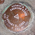
I found AH5765 at the Onizuka Air Force Station in Sunnyvale, CA. It is a reset of the original (which is still marked as there, though obviously it was destroyed). It was fun finding one that very few people would have access too, though trying to grab an image of it was a little difficult -- no cameras allowed.
-
I'm iving it a try. We'll see what happens. I do subscribe to GeoWorld which sounds like a similar kind of deal. They probably aren't too picky if it means that they can get some advetising out to you.
-
That is one cool coin and some great history behind it. Put me down for a black nickel.
-
A while back I went looking for this one, but it had been reset with another one. Both are still in the database as active, with the same exact coordinates. But this one has a similar condition to the one that you found. Well, the whole bridge was destroyed and not replaced.
-
I have been playing with the tool some and have run across an error. To create the error I chose to upload a file. On the next screen I chose to cancel the upload. I then browsed for another file. I chose a file created with GE. I repeatedly got the error when I retried. I did not try recycling the browser window first. When I clicked the upload button, I got the following Server Error in '/' Application. -------------------------------------------------------------------------------- Object reference not set to an instance of an object. Description: An unhandled exception occurred during the execution of the current web request. Please review the stack trace for more information about the error and where it originated in the code. Exception Details: System.NullReferenceException: Object reference not set to an instance of an object. Source Error: An unhandled exception was generated during the execution of the current web request. Information regarding the origin and location of the exception can be identified using the exception stack trace below. Stack Trace: [NullReferenceException: Object reference not set to an instance of an object.] Geocaching.UI.UserRoutes.cmdUploadGPX_Click(Object sender, EventArgs e) +8324 System.Web.UI.WebControls.Button.OnClick(EventArgs e) +108 System.Web.UI.WebControls.Button.System.Web.UI.IPostBackEventHandler.RaisePostBackEvent(String eventArgument) +57 System.Web.UI.Page.RaisePostBackEvent(IPostBackEventHandler sourceControl, String eventArgument) +18 System.Web.UI.Page.RaisePostBackEvent(NameValueCollection postData) +33 System.Web.UI.Page.ProcessRequestMain() +1292
-
So the place where we drag our files to might be called the RaineDrop? And maybe the feature we use to get caches along a route will be called Driving Raine? To make sure the caches are within a certain distace from the trip, does it do a Raine Check? I know those of us that have been looking forward to this feature, and are happy about it, are now doing a Raine Dance! Just be sure to give a big bonus to Raine man! ... and I'm done.
-
I have gotten my today though.
-
Ever Find A Pipecap/benchmark That Only You Are Able To Log?
Butano replied to Mystery Ink's topic in Benchmarking
Well, this one - AH5765 is not restricted to those who are invited in to your house, but it is in a restricted and guarded area. I didn't even take my camera because I am sure I would have lost it in the process, but did get a crayon tracing of it. It was fun getting one that is of such limited access. -
But this just brings up the question, can you log your own event? And if not, does that mean no one could ever attend?
-
Hey, that cement still looks wet!
-
I guess you do have the coordinates, so you should be able to find that pennisula. But by tank, do they mean one that holds water, or one that roams around and has detachable pieces measured in millimeters? I did look at the Google Maps image of the area and didn't see anthing that I could tell was a water tank. Searching for the nearest benchmarkFX0091 indicates that there is one at the base of a water tower (which the USPS could not find). The coordinates are not exactly the same, but they are very close. Maybe even close enough to be the tank sitting on top of the leg of the other one. Maybe it is findable if it is still there. But the challenge of trying to find the information needed was fun for a break at work.
-
This is a pretty cool shot of where two aerial photos were "merged." South San Jose They missed the merge by a bit. As you can see the photo and the map do not line up on the eastern portion of the map. Zoom in a bit and you will see Santa Teresa Blvd make quite an abrupt jump (north west of the pin).
-
Just joined the benchmark club (guess I am waiting for approval). My Yahoo name is ButanoCreek. Think the coins will be neat to have. But personally, I think all this coin collecting has turned into something besides geocaching (unless you find it in a cache, that that is really cool ) I can see for myself picking up selected coins. Quarterly sounds like a good rate to offer them.
-
Should I Just Archive This One And Start Over?
Butano replied to IrondaleDragon's topic in General geocaching topics
I would say that if a cache is moved by more than the GC.com proximity guideline of 528 feet, then it would be a new cache. Maybe that would take some of the guesswork out of the question. But I could see other factors coming into play as well for creating a new cache a shorter distance, or keeping the same for a (short) distance longer. -
Earth magnets are a total scam. I've tried them, and not a single one would stick to earth. Did you try to stick it to the north pole?
-
I have played with it some. Nothing too serious. I hadn't plotted benchmarks with it, but have done a few other things. One disadvantage to it is that it requires an internet connection. If it can't connect, it won't even start. As I understand it, GPSBabel is used as the backend for Google Earth (or maybe I remember wrong and it is Google Maps). GE doesn't seem to support every format that GPSBabel does though. I have downloaded my tracks from the vacation that I just took and put them into GE. Then I flew the path. That was a lot of fun to see the places that I had been. I did cut out the plane trip part though. Even at the maximum fly speed it would have been an hour before to get there. It will be nice as they (hopefully) get higher resolution images. I think the image that is in your post is one of the lower resolution images.
-
I am trying to write a macro that will generate a cachemate database for me and install it on the SD card. After quite a bit of searching around I managed to get QuickInstall installed on my machine (it doesn't come with the Sony Clie desktop). I then found PDAInstall which allows me to specify where I want the database to end up. Now my problem is that I want to use the RUNPGM command in a macro. I need to generate the command RUNPGM pgm="c:\Program Files\Sony Handheld\PDAInstall.exe" Wait=No parms=-u "Louis S" -v1 "C:\Program Files\Sony Handheld\home.PDB" The problem are the parameters to be sent to PDAInstall. The parms argument needs to have quotes around it as well as the parameters to PDAInstall. Therefore I can't (as least I haven't been able to determine how to) include the quotes inside of the quoted string. The -u token indicates the name of the PDA user, and in my case, includes a space. The file name also includes a space and may change so I may not know the short name. I need to be able to pass the quote characters themselves to PDAInstall. Any suggestions? GSAK is a great program. Guess I should have started using it sooner. Thanks!
-
I haven't experienced this problem (I have a Garmin Legend). However, when I transfer data to or from the GPSr and am on my corded phone, I hear the data transferring in my phone. But that only occurs when I have the Garmin cord next to the handset cord. That whine though would bug me though.
-
Garmin Receivers...is The Screen Glass Or Plastic?
Butano replied to Alphawolf's topic in GPS technology and devices
My first Garmin (yellow eTrex) got scratched up really bad. It just doesn't hold up well as a skid plate down a gravel road I went down to Tap Plastics and got some polishing compound and worked it for a while. Most of the scratches came out, but it is a very hard plastic, so it takes some work to get it out. -
I was just adding some corrected waypoints and had a couple of values for one of the puzzles that I am working on. I knew by looking at a map which one would be the right one and which one wouldn't. But I wanted to look at it using ExpertGPS. I found the Custom Export dialog and got it to work like a charm. A hint if you are using this option. You can prefix your command with start "Title" where you can replace Title (IN quotes) with your choice of a name, though you won't see a difference. This will cause your application to run as expected, but will immediately allow GSAK to continue to run. OK, now my request. I would like an option to be able to add the saved export settings to the Export submenu. Even if there were a limited number of settings, it would still be useful. I guess you could create a macro though.
-
How Many Have You Introduced To Caching?
Butano replied to El Diablo's topic in General geocaching topics
Three people (family and friends) that I have introduced to geocaching go out regularly, if not more often than me. My mom goes out occasionally when I go visit her. My brother has found a couple, but I think that is it. I have taken six other friends and coworkers out who really haven't caught the bug at all. -
Accuracy Of Battery Level Indicator-garmin Legend
Butano replied to tholt4's topic in GPS technology and devices
In my Legend I have found the opposite when using the NiMH (with it set co NiMH). The battery indicator goes down pretty quickly to about half, if it even shows it ever full. But then it will go for a while (haven't timed it) before it finally goes dead. But it seems that it takes quite a while to finally die. I hadn't notice any issue when using alkaline, but I don't take the time to reset it when I use them any way. -
Check out this planning software from Trimble. It does exactly what you want to do. It works pretty slick and gives you a lot of flexibility to do different things.