

RogerAg
-
Posts
7 -
Joined
-
Last visited
Everything posted by RogerAg
-
I'm sorry I don't buy the arguement. If well publicized caves get trashed, why isn't Ape Cave destroyed? Because organizations such as “The Cascade Grotto” (Seattle), “The Oregon Grotto” (Vancouver) and “The Willamette Valley Grotto as well as The Boy Scouts and others have all done Ape Cave clean up’s. Some of the trips I was personally on was: 1. Trips to remove pant. We took in 5 Gallon Water fire fighting bladers into the cave to wash off pant. 2. Trips to pick up garbidge. 3. Built 1 1/4 mile of trail from the main entrance to the upper entrance. It took all one summer 4. Removed wood that was thrown down the skylight. 5. Trips to replaced damaged steps in the stairways. So why hasn’t Ape Cave been Trashed? BECAUSE WE KEEP PICKING IT UP!
-
Yes I agree with Davidmac, also I check out the other logs to see what the difficalty is, if you look at one of my logs for GCP5ZC You will see that the cache owner listed the difficulty as 2 1/2 and Terrain as 3 1/2 my log is as follows "June 6, 2006 by RogerAg (64 found) Took a rubber fish left Learning TB, two young ladies who came after us took the TB. This was a masochistic one for us we are both over 60 we started at 9:00 am and got out at 3:00pm. p.s. the hike is not 2 miles! The GPS said 1.86 miles but that is as the crow flies. Though the trail is not swichbacked it does not go directly toward the cache, I would say it is over 3 miles. However that also does not take into consideration a drop of 1,467 feet of elevation, that mean 2,467 feet both ways and that is over 1/2 mile. except after you get to the cache you will not be walking over level ground (start to finish) in some spots the trail is at over 30 degrees also there is almost no shad. Take plenty of water we had 4 bottles each and that was not enough. I would suggest that you take more water and cache them as you go down the trail." Another cache I went for was GCGN30, you might injoy reading my logs and see the photos I went there twice because I did not find the cache the first time the date to look for is:June 13th and 14th, 2006. I also post logs for others to injoy ('
-
Cache owners neglecting their caches
RogerAg replied to Jedi Cacher's topic in General geocaching topics
I have also found caches that needed removing. In two cases GCQRPJ and GCRYHM I took what was left and logged what I did telling the owner that I would mail them what was left. The owner of GCRYHM replaced the old cache however it seems to be muggled again -
Question for those who geocache armed:
RogerAg replied to JockoPablo's topic in General geocaching topics
However I have been advised (by a police chief, not a lawyer) that if you intend to carry at all, it is best to carry all the time. The reason is that if, God forbid, you do have to shoot someone, in the inevitable civil suit brought by the dirt-bag's relatives, they will try to show that you "strapped the gun on your hip and went looking for someone to shoot." The problem: Lawyer: "Why were you carrying your gun that day?" Defendant: "I just KNEW there would be trouble, there always is in that neighbourhood." Lawyer: "So you armed yourself for the specific purpose of going to my client's neighbourhood?" *it goes downhill from here* The better way: Lawyer: "Why were you carrying your gun that day?" Defendant: "I ALWAYS carry a gun if it is legal to do so, sir." *lawyer pursues another line of questioning because he didn't get anywhere with this one* I carry every once in awhile, but have never had the need to draw let alone use my civilian weapon. But I would think that if I ever get in a self-defense situation I would let a lawyer do all the answering for me. You just never know how a prosecuter or a jury views your demeaner, nervous and you over reacted, self confident and you went looking for trouble. I don't carry a gun but I do carry Peper Spray and YES I had to use it after I was attacked by a homeless boy. I felt real bad about it afterwards and I tried to clean him up before the Cops came I was concerend because the Peper Spray was twice the legal strength however the police did'nt seem to mind. If I had a gun instead of the Peper Spray that boy would be dead and I would be living with that. -
About time to invent something decimal based isn't ! That was done a long time ago but us in the good old USA are slow at picking it up. Its called Metric! Lets first look at our system. 1 mile = 1,760. yds = 5,280 ft = 63,360 in. in Metric it would be. 1 km = 1,000. m = 100,000. cm = 1,000,000 mm. 1km = .62 mile or 1 mile =1.61 km. Now comes Universal Transverse Mercator (UTM) The UTM grid is shown on all quadrangle maps prepared by the U.S. Geological Survey (USGS). On 7.5-minute quadrangle maps (1:24,000 and 1:25,000 scale) and 15-minute quadrangle maps (1:50,000, 1:62,500, and standard-edition 1:63,360 scales), the UTM grid lines are indicated at intervals of 1,000 meters, either by blue ticks in the margins of the map or with full grid lines. The 1,000-meter value of the ticks is shown for every tick or grid line. In addition, the actual meter value is shown for ticks nearest the southeast and northwest corners of the map. Provisional maps at 1:63,360 scale show full UTM grids at 5,000-meter intervals. To use the UTM grid, you can place a transparent grid overlay (I call a Romer) on the map to subdivide the grid, or you can draw lines on the map connecting corresponding ticks on opposite edges. The distances can be measured in meters at the map scale between any map point and the nearest grid lines to the south and west. The northing of the point is the value of the nearest grid line south of it plus its distance north of that line; its easting is the value of the nearest grid line west of it plus its distance east of that line (see fig. 2). On maps at 1:100,000 and 1:250,000 scale, a full UTM grid is shown at intervals of 10,000 meters and is numbered and used in the same way So on a map or your GPS a Meter is always a Meter or 3.28 feet that is both northing or easting, however Longitude is different when you go north or south. At the north pole the difference between a second is 0 ft however at the equater it is about 158 ft and were I live it is about 69 ft however a second of Latitude is different, so where I live a second of Latitude is the same as were you live but a second of Longitude will be different. So I always use UTMs on my GPS because I can pinpoint my location on a USGS 7.5 map with end 30ft. However a USCS map uses the Nad 27 Datam. But most you may use the WGS84 Datum and the "Converting waypoints to various formats" does not convert UTMs from the two Datums YET!
-
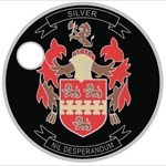
Yes I to have started a collection of Signature items I have seen a lot of wooden nickels that Cachers had made. My Last name is Silver so my screen name is RogerAg (Ag) stands for Silver. I made my own "Wooden Silver Bars" it is made out of cedar and is about 2in long 1 1/8in wide and about 1/8in thick. I made a stamp that said on one side, RogerAg 999 FINE Wooden Silver Bar on the other side the stamp has a picture of a treasure chest and it said under it, WWW.GEOCACHING.COM The very first cache I posted, I placed a note inside for the first person who found it. The note had "Wooden Silver Bar taped to it and the Coordinates to a special prize. The Prize was a Real Silver Bar one Troy ounce. you can visit the logs by going to my cache which is GCXTYT (No Name Park) RogerAg
-
Your "Converting waypoints to various formats" section is a wonderful tool, however there is just one drawback that I see. On the top part of the screen list the "Normal GPS Coordinates (WGS84 Datum) Next list "Older Datum (NAD27) Below that it list "UTM" however that is the UTM for the WGS84 Datum you should also list the UTM for the NAD27 Datum The reason for this is quite simple. All USGS maps (mine anyway) use the NAD27 Datum and there is UTM lines on it so all I have to do is use a roamer to find my location on the map. And since I am in the woods allot my GPS is usually set to the NAD27 Datum. Also your window is a little misleading because the "UTM" is just under the NAD27 Datum. Thanks RogerAG